Podcast
Questions and Answers
What term refers to the water that flows on the surface from highlands to lowlands?
What term refers to the water that flows on the surface from highlands to lowlands?
- River Mouth
- Runoff (correct)
- Tributary
- Transpiration
Which feature is defined as a low area between hills or mountains?
Which feature is defined as a low area between hills or mountains?
- Valley (correct)
- Watershed
- Delta
- Floodplain
What negative impact can rivers have on communities?
What negative impact can rivers have on communities?
- Flooding causing loss of lives and property (correct)
- Irrigation support for farming
- Provision of drinking water
- Source of hydroelectric power
Which term is used to describe a stream or river that joins a main river?
Which term is used to describe a stream or river that joins a main river?
What does a watershed represent in geographic terms?
What does a watershed represent in geographic terms?
What process leads to the formation of meanders in a river?
What process leads to the formation of meanders in a river?
What is a floodplain?
What is a floodplain?
What conditions are necessary for the formation of a delta?
What conditions are necessary for the formation of a delta?
Which feature is represented by closely spaced contours on a topographical map?
Which feature is represented by closely spaced contours on a topographical map?
How are waterfalls represented on topographical maps?
How are waterfalls represented on topographical maps?
What is the primary way rivers positively impact agriculture?
What is the primary way rivers positively impact agriculture?
Which of the following describes a distributary?
Which of the following describes a distributary?
What shape is commonly associated with deltas?
What shape is commonly associated with deltas?
What was the state of the Singapore River in the early 1970s?
What was the state of the Singapore River in the early 1970s?
What percentage of the Earth's surface water is fresh water?
What percentage of the Earth's surface water is fresh water?
Which of the following sources contains the majority of fresh water on Earth?
Which of the following sources contains the majority of fresh water on Earth?
What process changes water from liquid to gas in the hydrologic cycle?
What process changes water from liquid to gas in the hydrologic cycle?
What significant role does the River Nile play for the ancient Egyptians?
What significant role does the River Nile play for the ancient Egyptians?
What are the three states of water in the hydrologic cycle?
What are the three states of water in the hydrologic cycle?
What is the primary source of fresh water used by people?
What is the primary source of fresh water used by people?
During which part of the day does evaporation primarily occur?
During which part of the day does evaporation primarily occur?
What is a primary benefit of rivers for agriculture?
What is a primary benefit of rivers for agriculture?
What is irrigation?
What is irrigation?
Which of the following rivers is known for its historical significance and tourism in Singapore?
Which of the following rivers is known for its historical significance and tourism in Singapore?
What percentage of water drawn by humans is estimated to be used for industrial purposes?
What percentage of water drawn by humans is estimated to be used for industrial purposes?
What significant impact can flooding from rivers have on communities?
What significant impact can flooding from rivers have on communities?
What contributes to a river flooding easily?
What contributes to a river flooding easily?
What recreational activities can take place on rivers?
What recreational activities can take place on rivers?
Why might farmers choose to plant crops along riverbanks?
Why might farmers choose to plant crops along riverbanks?
What is the primary reason towns and cities along the Yellow River are at risk during heavy rains?
What is the primary reason towns and cities along the Yellow River are at risk during heavy rains?
Which Greek word does 'Nile' derive from, and what does it mean?
Which Greek word does 'Nile' derive from, and what does it mean?
What percentage of the African continent does the drainage basin of River Nile cover?
What percentage of the African continent does the drainage basin of River Nile cover?
What natural process occurs annually from June to October along the lower course of River Nile?
What natural process occurs annually from June to October along the lower course of River Nile?
Why is Egypt heavily dependent on River Nile despite its arid climate?
Why is Egypt heavily dependent on River Nile despite its arid climate?
Besides Egypt, which other country heavily relies on River Nile for its fishing industry?
Besides Egypt, which other country heavily relies on River Nile for its fishing industry?
How long is River Nile, making it the world's longest river?
How long is River Nile, making it the world's longest river?
What impact does the sediment build-up at the river mouth of River Nile have?
What impact does the sediment build-up at the river mouth of River Nile have?
What is a direct consequence of the Aswan High Dam on soil quality along the lower course of the River Nile?
What is a direct consequence of the Aswan High Dam on soil quality along the lower course of the River Nile?
How has the Aswan High Dam affected fish populations in the Nile Delta?
How has the Aswan High Dam affected fish populations in the Nile Delta?
What has been one of the impacts of the reduced volume of water in the River Nile due to the dam?
What has been one of the impacts of the reduced volume of water in the River Nile due to the dam?
Which term describes the process where water vapor changes into droplets?
Which term describes the process where water vapor changes into droplets?
What is a delta formed from?
What is a delta formed from?
Which of the following best defines a drainage basin?
Which of the following best defines a drainage basin?
What does evaporation refer to in the water cycle?
What does evaporation refer to in the water cycle?
What is a meander in the context of river geography?
What is a meander in the context of river geography?
Flashcards
Irrigation
Irrigation
The method of supplying water to farms through man-made canals.
Fertile Soil
Fertile Soil
Soil enriched by sediments from river floods, good for farming.
Water Usage in Industry
Water Usage in Industry
Industries draw 23% of all water for cooling and manufacturing.
Recreational Activities
Recreational Activities
Signup and view all the flashcards
Ganges River Flooding
Ganges River Flooding
Signup and view all the flashcards
Sediments
Sediments
Signup and view all the flashcards
Tourist Attraction
Tourist Attraction
Signup and view all the flashcards
Flood Consequences
Flood Consequences
Signup and view all the flashcards
Meanders
Meanders
Signup and view all the flashcards
Floodplain
Floodplain
Signup and view all the flashcards
Delta
Delta
Signup and view all the flashcards
Distributaries
Distributaries
Signup and view all the flashcards
Topographical Map
Topographical Map
Signup and view all the flashcards
Valley
Valley
Signup and view all the flashcards
Water Supply for Farming
Water Supply for Farming
Signup and view all the flashcards
Waterfall Symbol
Waterfall Symbol
Signup and view all the flashcards
River Mouth
River Mouth
Signup and view all the flashcards
River Source
River Source
Signup and view all the flashcards
Runoff
Runoff
Signup and view all the flashcards
Transpiration
Transpiration
Signup and view all the flashcards
Tributary
Tributary
Signup and view all the flashcards
Singapore River clean-up
Singapore River clean-up
Signup and view all the flashcards
Distribution of water
Distribution of water
Signup and view all the flashcards
Freshwater percentage
Freshwater percentage
Signup and view all the flashcards
Hydrologic cycle
Hydrologic cycle
Signup and view all the flashcards
Evaporation
Evaporation
Signup and view all the flashcards
River Nile significance
River Nile significance
Signup and view all the flashcards
Saltwater unpotability
Saltwater unpotability
Signup and view all the flashcards
Yellow River
Yellow River
Signup and view all the flashcards
Nile River
Nile River
Signup and view all the flashcards
Nile Delta
Nile Delta
Signup and view all the flashcards
Farming Fertility
Farming Fertility
Signup and view all the flashcards
Drainage Basin
Drainage Basin
Signup and view all the flashcards
Tributaries of Nile
Tributaries of Nile
Signup and view all the flashcards
Annual Flooding
Annual Flooding
Signup and view all the flashcards
Source of Food
Source of Food
Signup and view all the flashcards
Aswan High Dam
Aswan High Dam
Signup and view all the flashcards
Loss of soil fertility
Loss of soil fertility
Signup and view all the flashcards
Decrease in fish supply
Decrease in fish supply
Signup and view all the flashcards
Condensation
Condensation
Signup and view all the flashcards
Study Notes
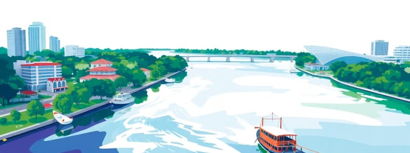
Singapore River Clean-Up
- The Singapore River today is very different from the 1970s
- It was badly polluted and littered with rubbish
- A clean-up campaign from 1977 to 1987 transformed the river
River Features
- River source: The starting point of a river, often in highlands
- River course: The path a river follows
- River mouth: Where a river flows into a lake or sea
- Tributaries: Smaller streams or rivers that join a larger river
- River system: The main river and its tributaries
- Floodplain: The low-lying land surrounding a river which can flood
River Valleys
- A valley is a low area between hills or mountains, shaped by river erosion
- The Grand Canyon in Arizona is a famous example
Waterfalls
- A waterfall is a vertical flow of fast-moving water falling from a height, formed when a river flows over a layer of hard rock overlying soft rock
- The soft rock erodes faster than the hard rock, creating a ledge over which the water falls
Meanders
- Meanders are curves or bends in a river's course, formed from the process of erosion and sediment deposition along the riverbanks.
Floodplains
- The low-lying land surrounding a river often floods when the river overflows its banks
- The soil deposited by floods is often very fertile, making it suitable for agriculture
Deltas
- A delta forms where a river flows into a lake or sea, depositing sediments that build up over time
- The Nile Delta, in Egypt, is a fan-shaped example.
Drainage Basin
- A drainage basin consists of the surrounding land drained by a river and its tributaries
- The boundary of the basin is called a watershed
Identifying River Features on Topographical Maps
- River features like valleys, waterfalls, deltas, floodplains and meanders can be represented, on maps, using contours and symbols
How Do Rivers Affect People?
- Positive impacts:
- Water supply for farming, industry and drinking
- Fertile soil for crops
- Transportation along rivers
- Recreation by providing opportunities for fishing, boating, etc.
- Source of food
- Production of hydroelectric power
- Negative impacts:
- Loss of life and property through flooding
- Damage to crops and property
- Erosion of land along the riverbanks
River Nile Case Study
- The Nile River is the world's longest river. It is essential to the people living in 10 countries in Africa.
- Egyptians depend heavily on the Nile's water supply because they get little rainfall
- The River Nile has been essential for farming, transportation and other human activities
- Projects like the Aswan High Dam have brought both benefits and problems for the people of Egypt
Water Cycle
- Condensation: Water vapor cooling and forming water droplets
- Evaporation: Water turning into water vapor through heat
- Transpiration: Plants releasing water vapor
- Runoff: Water flowing on the surface
- Drainage basin: An area of land drained by a river system.
Studying That Suits You
Use AI to generate personalized quizzes and flashcards to suit your learning preferences.


