Podcast
Questions and Answers
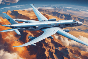
What are some examples of moving platforms used for remote sensing?
What are some examples of moving platforms used for remote sensing?
Aircraft, satellites, Ultra Light Vehicles (ULVs), balloons, Airship, kites
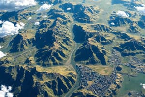
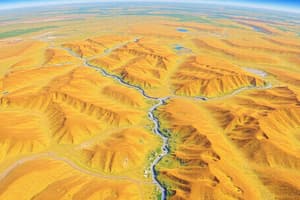
From what height to what height are airborne observations possible?
From what height to what height are airborne observations possible?
From 100 m up to 30–40 km
How are satellites for Earth Observation launched into space?
How are satellites for Earth Observation launched into space?
With rockets
In what range of altitudes are satellites for Earth Observation positioned?
In what range of altitudes are satellites for Earth Observation positioned?
What are some factors that can affect the speed of the aircraft used for airborne remote sensing?
What are some factors that can affect the speed of the aircraft used for airborne remote sensing?
How are the 'measurements' stored in aerial photography?
How are the 'measurements' stored in aerial photography?
Where can the digital data acquired from sensors like a scanner be stored?
Where can the digital data acquired from sensors like a scanner be stored?
What role do the parameters of the satellite’s orbit play in determining the monitoring capabilities of space borne remote sensing sensors?
What role do the parameters of the satellite’s orbit play in determining the monitoring capabilities of space borne remote sensing sensors?
Why are different types of orbits required for space borne remote sensing?
Why are different types of orbits required for space borne remote sensing?
What orbit characteristics are relevant for remote sensing purposes?
What orbit characteristics are relevant for remote sensing purposes?
Flashcards are hidden until you start studying
Study Notes
Moving Platforms for Remote Sensing
- Airborne platforms include aircraft, helicopters, and unmanned aerial vehicles (UAVs)
- Satellite platforms are used for Earth Observation
Airborne Observations
- Airborne observations are possible from a height of about 100-100,000 meters above the Earth's surface
Launching Satellites for Earth Observation
- Satellites are launched into space using rockets
Satellite Altitudes
- Satellites for Earth Observation are positioned at altitudes ranging from 160-36,000 kilometers above the Earth's surface
Factors Affecting Aircraft Speed
- Factors affecting the speed of aircraft used for airborne remote sensing include:
- Air resistance
- Weather conditions
- Aircraft design and type
Storing 'Measurements' in Aerial Photography
- The 'measurements' (i.e., images) are stored on film or digital media in aerial photography
Storing Digital Data from Sensors
- Digital data acquired from sensors like scanners can be stored on:
- Onboard storage devices
- Ground stations
- Cloud-based storage
Satellite Orbit Parameters
- The parameters of a satellite's orbit play a crucial role in determining the monitoring capabilities of space-borne remote sensing sensors
- These parameters include:
- Altitude
- Inclination
- Orbital period
Types of Orbits for Space-Borne Remote Sensing
- Different types of orbits are required for space-borne remote sensing due to varying:
- Sensor requirements
- Spatial resolutions
- Temporal resolutions
- Types of orbits include:
- Low Earth Orbit (LEO)
- Geostationary Orbit (GEO)
- Polar Orbit (PO)
Orbit Characteristics for Remote Sensing
- Relevant orbit characteristics for remote sensing purposes include:
- Altitude
- Inclination
- Orbital period
- Repeat cycle
- Spatial resolution
- Temporal resolution
Studying That Suits You
Use AI to generate personalized quizzes and flashcards to suit your learning preferences.