Podcast
Questions and Answers
Which of the following best describes remote sensing?
Which of the following best describes remote sensing?
- Analyzing physical samples collected from the terrestrial environment.
- Obtaining information about an object through physical sampling.
- Acquiring data about the Earth's surface using direct contact.
- Acquiring information about the Earth's surface without direct contact, using reflected or emitted energy. (correct)
Why is geometric and radiometric calibration essential for remotely sensed data?
Why is geometric and radiometric calibration essential for remotely sensed data?
- To ensure data obtained on different dates can be compared effectively. (correct)
- To reduce the file size of the remotely sensed data.
- To simplify the data processing workflow.
- To enhance the aesthetic appeal of the imagery.
What is the primary purpose of fieldwork in the context of remote sensing?
What is the primary purpose of fieldwork in the context of remote sensing?
- To calibrate remotely sensed data with ground-based biophysical or cultural characteristics. (correct)
- To act as a public relations initiative for remote sensing programs.
- To provide monetary compensation to individuals working in agriculture.
- To visually inspect remote sensing equipment.
What is a key limitation of in situ data collection that remote sensing helps to overcome?
What is a key limitation of in situ data collection that remote sensing helps to overcome?
Which factor can introduce method-produced error in in situ data collection?
Which factor can introduce method-produced error in in situ data collection?
What defines the instantaneous-field-of-view (IFOV) in remote sensing?
What defines the instantaneous-field-of-view (IFOV) in remote sensing?
In the context of Remote Sensing, what is the role of 'modeling' during Data-to-Information conversion?
In the context of Remote Sensing, what is the role of 'modeling' during Data-to-Information conversion?
What is a consequence of increased concentrations of greenhouse gasses (GHGs) in the atmosphere?
What is a consequence of increased concentrations of greenhouse gasses (GHGs) in the atmosphere?
How does the interconnectedness of global, continental, national, and local scales influence environmental monitoring strategies?
How does the interconnectedness of global, continental, national, and local scales influence environmental monitoring strategies?
What is the significance of NASA's Earth Observing System (EOS) program?
What is the significance of NASA's Earth Observing System (EOS) program?
Which of these statements explains the relationship between wavelength and frequency of electromagnetic radiation?
Which of these statements explains the relationship between wavelength and frequency of electromagnetic radiation?
How does the quantum theory describe the propagation of electromagnetic radiation?
How does the quantum theory describe the propagation of electromagnetic radiation?
According to the Stefan-Boltzmann Law, what primarily controls the amount of radiation emitted by an object?
According to the Stefan-Boltzmann Law, what primarily controls the amount of radiation emitted by an object?
Why is it crucial for remote sensors to be designed taking into account Planck's Radiation Law?
Why is it crucial for remote sensors to be designed taking into account Planck's Radiation Law?
What is the main distinction between reflected and emitted infrared (IR) energy in remote sensing?
What is the main distinction between reflected and emitted infrared (IR) energy in remote sensing?
What is the key difference between active and passive sensors in remote sensing?
What is the key difference between active and passive sensors in remote sensing?
Why is it important to account for scattering when computing radiation in remote sensing?
Why is it important to account for scattering when computing radiation in remote sensing?
What circumstances cause Nonselective scattering?
What circumstances cause Nonselective scattering?
What role do atmospheric windows play in remote sensing?
What role do atmospheric windows play in remote sensing?
How does water appear differently based on whether it is viewed with visible or near-infrared wavelengths?
How does water appear differently based on whether it is viewed with visible or near-infrared wavelengths?
What can cause complications when interpreting water-related features in remote sensing?
What can cause complications when interpreting water-related features in remote sensing?
Which factor does not affect a sensors selection?
Which factor does not affect a sensors selection?
What do you call the sensor characteristic that describes how well the sensor can define fine distinctions in energy reflection?
What do you call the sensor characteristic that describes how well the sensor can define fine distinctions in energy reflection?
The 'swath' of a remote sensing instrument refers to:
The 'swath' of a remote sensing instrument refers to:
What is the significance of revisit time for satellite remote sensing?
What is the significance of revisit time for satellite remote sensing?
What causes geometric distortion in remote sensing imagery?
What causes geometric distortion in remote sensing imagery?
What is 'relief displacement' in the context of across-track scanning systems?
What is 'relief displacement' in the context of across-track scanning systems?
The atmospheric condition of aerosols and radiation is best observed by:
The atmospheric condition of aerosols and radiation is best observed by:
What distinguishes the Landsat program from other Earth observation satellite programs?
What distinguishes the Landsat program from other Earth observation satellite programs?
What kind of improvement has the Thematic Mapper (TM) sensor brought to the Landsat program?
What kind of improvement has the Thematic Mapper (TM) sensor brought to the Landsat program?
How does a LiDAR (Light Detection and Ranging) system determine the distance between the sensor and the target?
How does a LiDAR (Light Detection and Ranging) system determine the distance between the sensor and the target?
Radiometric Correction, A Pre-Processing Step, is used in remote sensing imagery to
Radiometric Correction, A Pre-Processing Step, is used in remote sensing imagery to
Which process would you be implementing if you were trying to increase tonal distinction between features of a satellite image?
Which process would you be implementing if you were trying to increase tonal distinction between features of a satellite image?
In pre-processing steps, what is the purpose of resampling?
In pre-processing steps, what is the purpose of resampling?
Which type of spatial filter excels at highlighting linear features such as roads?
Which type of spatial filter excels at highlighting linear features such as roads?
If healthy vegetation is known to reflect strongly in the near-infrared, what results would you expect from dividing the near-infrared band by the red band in a satellite image?
If healthy vegetation is known to reflect strongly in the near-infrared, what results would you expect from dividing the near-infrared band by the red band in a satellite image?
The final result from the ISODATA and other similar unsupervised processing classifications depends directly on numerical calculations in
The final result from the ISODATA and other similar unsupervised processing classifications depends directly on numerical calculations in
How are training areas used in supervised classification?
How are training areas used in supervised classification?
What is a key difference between supervised and unsupervised image classification?
What is a key difference between supervised and unsupervised image classification?
If a pixel's IFOV includes more than one land cover type, how is this best handled in classification?
If a pixel's IFOV includes more than one land cover type, how is this best handled in classification?
The most crucial component of a Multi-resolution segmentation is
The most crucial component of a Multi-resolution segmentation is
How do you access data for free from remote Landsat programs?
How do you access data for free from remote Landsat programs?
Flashcards
Remote Sensing
Remote Sensing
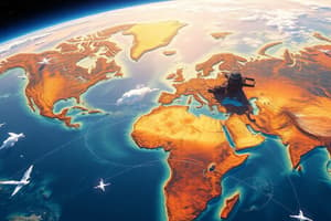
The science of acquiring information about the Earth's surface without direct contact.
Data calibration
Data calibration
Original remotely sensed data calibrated geometrically and radiometrically for comparison across dates.
Method-produced error
Method-produced error
Errors introduced by bias in field data collection.
Instantaneous Field of View (IFOV)
Instantaneous Field of View (IFOV)
Signup and view all the flashcards
Electromagnetic Radiation
Electromagnetic Radiation
Signup and view all the flashcards
Wavelength
Wavelength
Signup and view all the flashcards
Frequency
Frequency
Signup and view all the flashcards
Energy background
Energy background
Signup and view all the flashcards
Photons (quanta)
Photons (quanta)
Signup and view all the flashcards
Stefan-Boltzmann Law
Stefan-Boltzmann Law
Signup and view all the flashcards
Wien's Displacement Law
Wien's Displacement Law
Signup and view all the flashcards
Passive sensors
Passive sensors
Signup and view all the flashcards
Active sensors
Active sensors
Signup and view all the flashcards
Scattering
Scattering
Signup and view all the flashcards
Absorption
Absorption
Signup and view all the flashcards
Refraction
Refraction
Signup and view all the flashcards
Rayleigh scattering
Rayleigh scattering
Signup and view all the flashcards
Mie scattering
Mie scattering
Signup and view all the flashcards
Nonselective scattering
Nonselective scattering
Signup and view all the flashcards
Atmospheric transmission
Atmospheric transmission
Signup and view all the flashcards
Water Visible Wavelengths
Water Visible Wavelengths
Signup and view all the flashcards
Spectral Resolution
Spectral Resolution
Signup and view all the flashcards
Recording Energy
Recording Energy
Signup and view all the flashcards
Orbit
Orbit
Signup and view all the flashcards
Near-polar orbits
Near-polar orbits
Signup and view all the flashcards
Revisits
Revisits
Signup and view all the flashcards
Spatial Resolution
Spatial Resolution
Signup and view all the flashcards
IFOV
IFOV
Signup and view all the flashcards
Radiometric Resolution
Radiometric Resolution
Signup and view all the flashcards
Temporal Resolution
Temporal Resolution
Signup and view all the flashcards
Thermal Imaging
Thermal Imaging
Signup and view all the flashcards
Geometric Distortion
Geometric Distortion
Signup and view all the flashcards
GOES
GOES
Signup and view all the flashcards
AVHRR
AVHRR
Signup and view all the flashcards
Other Sensors
Other Sensors
Signup and view all the flashcards
Image Transformations
Image Transformations
Signup and view all the flashcards
Data Selection
Data Selection
Signup and view all the flashcards
Image Classification And Analysis
Image Classification And Analysis
Signup and view all the flashcards
Pre-processing
Pre-processing
Signup and view all the flashcards
Study Notes
- Remote sensing acquires information about the Earth's surface without direct contact, using reflected or emitted energy.
- This includes sensing, recording, processing, analyzing, and applying the data.
- It's also obtaining reliable information about physical objects and the environment using noncontact sensors.
In Situ Data Collection Calibration
- Remotely sensed data must be geometrically and radiometrically calibrated to compare data from different dates. This includes x,y,z and percent reflectance values.
- Data needs calibrating with ground data via biophysical and cultural characteristics - leaf-area-index, biomass, land use/cover, population density.
Fieldwork and Remote Sensing
- Fieldwork makes meaningful field data collection and remote sensing science usage, more likely.
Problems with In Situ Data Collection
- Method-produced errors and bias can lead to errors
- Errors are caused by improper sampling design, operation of measurement instruments and, uncalibrated instruments.
Remote Sensing Instruments
- They collect data within the instantaneous-field-of-view (IFOV) from suborbital or satellite platforms.
Remote Sensing Process
- Remote Sensing is governed by math, logic, physics, biology, and social sciences.
Global Environmental Problems
- Major problems include global warming, air/water pollution, ecosystem degradation, and ocean productivity decline.
- Air pollution includes energy generation, acid rain, ozone depletion, and airborne contaminants.
- Water issues involve scarcity, depletion, and pollution from metals, contaminants, eutrophication, anoxic waters and solid waste.
- Ecosystem degradation means deforestation, habitat destruction, biodiversity decline, invasive species, and land degradation.
Drivers of Environmental Problems
- These mainly concern overpopulation, economics, consumerism, and diseases.
Greenhouse Gases
- Greenhouse gases (GHGs) have reached a tipping point in the atmosphere, with total CO2e at 455 parts per million.
- Carbon emissions increased at 3.5% per year since 2000 after growing at less than 1% during the 1990s
Climate Change and Disasters
- Disaster numbers are rising; 70% are climate-related, up from 50% two decades prior
- Tenfold increase in climate related disasters affected 2.4 billion people from 1992 to 2008.
Environmental Interconnectedness
- Environmental problems are widespread, and exhibit cumulative effects across scales - so an isolated issue is often symptomatic of bigger underlying problem.
Environmental Monitoring Trends
- Air-photography along with multispectral, hyperspectral imagery are used.
- NASA's Earth Observing System (EOS) uses Terra and Aqua platforms with instruments like MODIS, GLCF GIMMS, and GTOS.
NASA's Earth Observing System (EOS) measurements
- Atmospheric measurements include cloud properties, radiative energy fluxes, precipitation, chemistry, aerosol properties, temperature, humidity, and lightning.
- Land measurements include land cover change, vegetation dynamics, surface temperature, fire/volcanic effects, and surface wetness.
- Ocean measurements include surface temperature, phytoplankton, wind fields, and surface topography.
- Cryosphere measurements include land/sea ice, and snow cover
Electromagnetic Radiation
- Wave properties, electric/magnetic fields travel at the speed of light affected by wavelength/frequency.
- The relationship between wavelength and frequency is expressed as C = λ·ν, where C is the speed of light.
Energy Radiation
- This has both wave and particle models. EM waves that propagate as a sine wave that have velocity C (speed of light).
Physics Background to Remote Sensing
- Changes when propagating through atmospheric strata (not vacuum). From quantum theory EM propagates as photons.
- Emitted radiation laws: Stefan-Boltzmann, Kirchhoff's Law, Wein's Displacement Law and Planck's Law.
Planck's Radiation Law
- Important for selecting wavelengths in remote sensor design and interpretations - pixel reflectances (in digital numbers) can be converted to energy.
Electromagnetic Spectrum
- Visible light ranges from 0.4 to 0.7 µm.
- Infrared (IR) region is 0.7 to 100 µm.
- Reflected IR is approximately 0.7 to 3.0 µm
- Thermal IR is roughly 3.0 µm to 14 μm
Remote Sensing Systems
- In general these are either passive or active. Passive systems detect naturally available energy. Active sensors provide their own energy source.
- Active sensors include microwave radar and laser radar.
Factors Affecting Radiation
- These include scattering, absorption, and refraction. -Scattering affects direction/intensity radiation, wavelength/frequency, spectral distribution radiant energy.
- Rayleigh scatters shorter wavelengths, Mie scattering affects longer wavelengths, and Nonselective scatters all wavelengths equally.
- Absorption turns incident radiation to heat.
Atmospheric Components
- Ozone, carbon dioxide, and water vapour absorb radiation strongly in the infrared - which forms atmospheric windows of observation for remote sensing.
- Refraction means change in angle of radiation, which relates to radiative energy transmission and atmospheric windows.
Water
- Water absorbs near infrared, typically looks blue to blue-green due to stronger reflectance there at shorter wavelengths. Suspended sediment allows for better reflectivity and brighter water appearance.
Generalized Spectral Signature
- Spectral reflectance curves for vegetation, soil, and water allows for a means to classify these surface components based on sensed data.
Models Derived from Remote Sensors
- Are collected from ground, air and via satellites.
- Data can be analog or digital.
- Selection of wavelengths balances sensor suite availability, scheduling, coverage, atmospheric distortion, and costs.
Remote Sensing data and GIS
- GIS has high data variability but a slow processing.
- Remote sensors provide a data capture but low structures.
Incident Energy on Surfaces
- Incident energy is reflected, absorbed or transmitted.
- Remote Sensing works by measuring energy that is reflected. This is spectral reflectance.
Radiation at the Sensor
- Sensor measures mix of: reflected radiation, path radiance, and albedo. This is also affected by attentuation - scatter, absortion, etc
- This can be related to solar constants and zenith angles.
Remote Sensing Data Calculation
- After measurement some common calculation approaches involve determining: atmospheric transmission, digital counts and conversion, and reflectance.
Landsat TM bands
- Soil/vegetation discrimination, bathymetry/coastal mapping, and vegetation mapping.
- Identification of plant/vegetation types, health, biomass content, and soil moisture.
Landsat 8 OLI
- Measures coastal, blue wavelengths; plus shortewave + panchromatic
- OLI captures data with improved radiometric precision over a 12-bit dynamic range, improved signal to noise ratio.
Thermal Infrared Sensors (TIRS)
- Have spectral bands from 10.6-12.51 (µm) and a 100m resolution
Thermal Radiation Principles
- Remote sensing requires understanding kinetic vs radiant energy, electromagnetic radiation and radiant flux.
Thermal Radiation Remote Sensing
- Aircraft use 3-5 um and 8-14 um wavelengths, while spaceborne sensors use 3-4 um and 10.5-12.5 um. Solar reflectance contaminates the smaller numbers more Thermal Image Interpretation is difficult due to: -Material distribution in an IFOV -Angle of thermal insolation -Response dependency of composition, density and texture etc.
- Data should be dependent of the thermal response on composition, density and texture of the materials.
The Thermal Response Number
- It represents how the physiological condition can extracted with thermal infrared data
- It measures surface net at repeat imagery times in situ.
Stress Degree Day
- It measures plant response through with the use of remote temp sensing
- It related canopy temperature with average air temperature
Spot Satellites
- Each SPOT satellite has high resolution imaging systems; each HRV is capable of operating independently/ simultaneously.
- Can sense single-channel panchromatic or coarser spatial resolution three-channel modes.
IKONOS Satellites
- Sensor can is submeter resolution, launched in 1999.
- Capabilities include capturing a 3.2m multispectral, NIR /0.82m resolution, as well as use in coastal monitoring and mapping.
- Launch Data: 24 September 1999 at Vandenberg Air Force Base California. Over/ 7 years
Quickbird Satellite
- It collects to a 0.61m detail for use with land agriculture
Other Sensors for Remote Measurement
- Includes:
- Video Cameras: Timely and cheap data that are annotated for environmental hazard control
- Laser fluorosensor
-
Detects wavelengths for ocean Applications including chlorophyll mapping - LiDAR
-
Light Detection and Ranging -
laser is emitted from the sensor and the returning data determines distance. -
Can measure heights on features. ### Digital Image Processing types - Pre-Processing
- Radiometric Corrections through irregular removal.
- Includes Atmospheric Corrections.
- Target Calibration of Shadows.
- Noise correction
- Correct striping/bending with sensor response times
- Corrected by averaging lines.
- Geometric Registration
- Image Enhancement
- Solely for visual imagery. Improves data by stretching data and removing noise
- Image Transformations
- combines data from multiple spectral bands with arithmetic functions
- Principal components analysis
- efficient way to represent the information in multichannel imagery
- useful for reducing data volumes and dealing with multicollinearity.
- Image Classification
- Aims at classifying the spectral signatures for data.
- Data is termed "Spectral Patterns" and is based upon special program and algorithms -There can be classes of these, which one is trying to identify. For example different crops, rock and or tree -Or spectral classes can classify it with respect to their brightness relative to the color of channels
Classifying Types
- Supervised
- Analyst identifies samples of the surface (Training areas).
- Used as a spectral response tool.
- Unsupervised
- Spectral Classes and data grouped
- Clustering Algorithms that determine structures (This creates a cluster)
- Minimum-Distance-Means -Pixel is with shortest distance in the training sets -Calculates the Euclidean Distance -Pixels can be categorized into one or other based on distances
- Parallelepiped or Box Classifier: -Uses Standard Deviation to determine bounds of pixels when testing the results -Bounds can be determined with training sets -The algorithm tests a pixel to check if it is within the given region.
Maximum Likelihood Classifier
- Tests pixels to see how likely a certain statistic is in a training set. The pixels with the most similar data are used. Most accurate - slowest process to classify.
- Tests pixels to see how likely a certain statistic is in a training set. The pixels with the most similar data are used. Most accurate - slowest process to classify.
Object-Oriented Software types
- Machine learning to do a land over map, etc.
- Cognitive
- IDRISI
- ENVI
Image class accuracy assessment
- Requires random select and determine class through both a database for verification.
Statistical Analysis
- Statistical analysis is required to confirm accuracy of measurements. Common tools are included.
- These can be used to determine rates of accuracy: overall, producer, User.
- Can also use "Error of Omission" - errors from the recorded to database.
Image Classification Al Trends
- Pattern and future recognition in multiple layers of the same category through
- Random forests
- Adding layers using ANNS or SVS (Algorithm methods to calculate the classifications).
- AI improves accuracy and has higher data quality.
Studying That Suits You
Use AI to generate personalized quizzes and flashcards to suit your learning preferences.