Podcast
Questions and Answers
In which Canadian province or territory would you find the city of Calgary?
In which Canadian province or territory would you find the city of Calgary?
- Saskatchewan
- Quebec
- Manitoba
- Alberta (correct)
What is the approximate latitude of Toronto, Canada?
What is the approximate latitude of Toronto, Canada?
- 79°E
- 44°N (correct)
- 79°W
- 44°S
What is the name of the landform region characterized by rocky terrain and rich mineral deposits?
What is the name of the landform region characterized by rocky terrain and rich mineral deposits?
- St. Lawrence Lowlands
- Canadian Shield (correct)
- Interior Plains
- Appalachian Mountains
What is the primary factor that influences the climate of coastal areas?
What is the primary factor that influences the climate of coastal areas?
Which of the following settlement patterns is characterized by small, tightly clustered communities?
Which of the following settlement patterns is characterized by small, tightly clustered communities?
Which geologic era is associated with the formation of the Rocky Mountains?
Which geologic era is associated with the formation of the Rocky Mountains?
Which of the following factors does NOT directly influence the formation of landform regions?
Which of the following factors does NOT directly influence the formation of landform regions?
If it is 10:00 AM in Toronto (Eastern Time), what time is it in Vancouver (Pacific Time)?
If it is 10:00 AM in Toronto (Eastern Time), what time is it in Vancouver (Pacific Time)?
What is the primary reason for the high level of immigration to Canada in the 20th century?
What is the primary reason for the high level of immigration to Canada in the 20th century?
Which of the following are considered pull factors for people migrating to Canada?
Which of the following are considered pull factors for people migrating to Canada?
What is the key difference between a developed and a developing country?
What is the key difference between a developed and a developing country?
Which of the following is a characteristic of a maritime location?
Which of the following is a characteristic of a maritime location?
Which of the following is NOT a factor that contributed to the collapse of the fishing industry in the Atlantic region?
Which of the following is NOT a factor that contributed to the collapse of the fishing industry in the Atlantic region?
Which of the following industries is most likely to be the least employed in Canada?
Which of the following industries is most likely to be the least employed in Canada?
What is the primary role of a Non-Governmental Organization (NGO)?
What is the primary role of a Non-Governmental Organization (NGO)?
Which of the following is a characteristic of a population pyramid with a narrow base?
Which of the following is a characteristic of a population pyramid with a narrow base?
Flashcards
Latitude Lines
Latitude Lines
Lines running parallel to the equator, measuring distance north or south. Example: Toronto is located at 44°N.
Longitude Lines
Longitude Lines
Lines running from pole to pole, measuring distance east or west. Example: Toronto is located at 79°W.
Population Density
Population Density
A formula that calculates the number of people per unit of land area. Example: Canada's density is approximately 4 people per square kilometer.
Linear Population Distribution
Linear Population Distribution
Signup and view all the flashcards
Clustered Population Distribution
Clustered Population Distribution
Signup and view all the flashcards
Dispersed Population Distribution
Dispersed Population Distribution
Signup and view all the flashcards
Precambrian Era
Precambrian Era
Signup and view all the flashcards
Mesozoic Era
Mesozoic Era
Signup and view all the flashcards
Temperature Range
Temperature Range
Signup and view all the flashcards
Total Precipitation
Total Precipitation
Signup and view all the flashcards
Maritime Location
Maritime Location
Signup and view all the flashcards
Continental Location
Continental Location
Signup and view all the flashcards
Ecological Footprint
Ecological Footprint
Signup and view all the flashcards
Stewardship
Stewardship
Signup and view all the flashcards
Environmental Sustainability
Environmental Sustainability
Signup and view all the flashcards
Renewable Resources
Renewable Resources
Signup and view all the flashcards
Study Notes
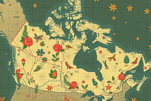
Political Geography of Canada
- Provinces/Territories: Ontario, Quebec, Alberta, British Columbia, Saskatchewan, Manitoba, New Brunswick, Nova Scotia, Prince Edward Island, Newfoundland and Labrador, Yukon, Northwest Territories, Nunavut.
- Major Cities: Toronto, Vancouver, Montreal, Ottawa, Calgary.
- Oceans: Pacific (west), Atlantic (east), Arctic (north).
- Hudson Bay: Located northeast, bordering Manitoba, Ontario, and Quebec.
- Map Elements: Title, scale, compass rose, legend, grid system (latitude/longitude).
- Latitude/Longitude: Latitude lines parallel to the equator; longitude lines run from pole to pole; e.g., Toronto: 44°N, 79°W.
- Time Zones: Pacific, Mountain, Central, Eastern, Atlantic, Newfoundland. Time differences exist between zones.
Physical Environment Interactions
- Population Density: Population divided by land area (e.g., Canada ≈ 4 people/km²).
- Population Distribution: Linear (coasts, transportation routes); Clustered (urban centers); Dispersed (rural areas).
- Rural Settlement Patterns: Linear (along a road/river), Clustered (dense mining/farming areas), Dispersed (spread across farms).
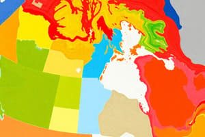
- Landform Regions: Canadian Shield (rocky, minerals), Interior Plains (fertile, flat), Appalachian Mountains (old, eroded).
- Landform Formation: Tectonic activity, glaciation, erosion, sedimentation.
- Geologic Eras: Precambrian (oldest, Canadian Shield), Paleozoic (marine life), Mesozoic (dinosaurs, Rocky Mountains), Cenozoic (ice ages, mammals).
- Plate Tectonics: Earth's plates move, causing earthquakes & mountain ranges (e.g., Pacific Plate vs. North American Plate).
- Climate Factors (LOWERN): Latitude, ocean currents, wind/air masses, elevation, relief, near water.
- Glacier Formation: Shaped valleys, created lakes (e.g., Great Lakes).
- Climate Graph Analysis: Temperature range, total precipitation, average temperature.
- Maritime vs. Continental Climates: Maritime (small range, high precipitation), Continental (large range, low precipitation).
- Ecozones: Boreal Shield, Prairies, Arctic Cordillera.
Resource Management in Canada
- Ecological Footprint & Stewardship: Measures resource use/environmental impact, managing resources responsibly.
- Environmental Sustainability: Using resources to maintain for future generations.
- Natural Resources: Renewable (forests, water), Non-renewable (oil, natural gas, coal).
- Oil in Canada: Alberta (oil sands), Newfoundland (offshore).
- Industries: Primary (resource extraction), Secondary (manufacturing), Tertiary (services).
- Employment: Tertiary sector most employed, primary sector least employed.
- Conservation: Reduce, Reuse, Recycle, Rethink, Refuse, Repair.
- Atlantic Fishing Collapse: Overfishing, improved technology, foreign fleets, poor management.
- NGOs: Non-governmental organizations (Red Cross, World Wildlife Fund), provide aid and promote sustainability.
Changing Populations
- Demographic Formulas: Population Growth Rate (birth + immigration - death - emigration). Natural Increase Rate (birth - death).
- Population Trend: Urbanization, aging population influenced by immigration and life expectancy.
- Urbanization Drivers: Job opportunities, better services.
- Immigration to Canada (20th Century): Economic opportunities, escaping global conflicts.
- Push/Pull Factors: Push (war, poverty, lack of jobs); Pull (safety, better lives, employment).
- Immigration Factors (today): Peace, strong economy, high standard of living.
- Canada's Desirability: Political stability, economic opportunity, multiculturalism.
- Human Development Index (HDI): Measures development using life expectancy, education, income.
- Population Pyramid Types: Expanding (high birth rates, developing countries), Stable (balanced), Negative (aging population, developed countries).
- Urban Land Uses: Residential, commercial, industrial, recreational, transportation.
- Native Peoples: First Nations, Métis, Inuit; Challenges: land rights, cultural preservation.
- Developed vs. Developing Countries: Developed (high HDI, strong economies); Developing (low HDI, reliance on agriculture).
Studying That Suits You
Use AI to generate personalized quizzes and flashcards to suit your learning preferences.