Podcast
Questions and Answers
What is formed approximately 200 kilometers behind a trench at convergent boundaries?
What is formed approximately 200 kilometers behind a trench at convergent boundaries?
- Volcanic arcs (correct)
- Oceanic ridges
- Subduction zones
- Fracture zones
What type of plate boundary is characterized by compressional stresses?
What type of plate boundary is characterized by compressional stresses?
- Passive boundary
- Convergent boundary (correct)
- Divergent boundary
- Transform boundary
Where do the majority of earthquakes tend to occur in relation to trenches?
Where do the majority of earthquakes tend to occur in relation to trenches?
- At the surface level
- In oceanic ridges
- At some depth below the surface (correct)
- On the ocean floor
What term is used for volcanic islands formed parallel to a trench in oceanic/oceanic subduction?
What term is used for volcanic islands formed parallel to a trench in oceanic/oceanic subduction?
What is the characteristic height of the ridge compared to the surrounding sea floor?
What is the characteristic height of the ridge compared to the surrounding sea floor?
How does the age of the ocean floor change relative to the divergent boundary?
How does the age of the ocean floor change relative to the divergent boundary?
What feature is formed as the continental crust thins and breaks apart?
What feature is formed as the continental crust thins and breaks apart?
Which ocean's formation is associated with the break-up of the supercontinent Pangaea?
Which ocean's formation is associated with the break-up of the supercontinent Pangaea?
Which type of plate boundary is represented by the San Andreas fault system?
Which type of plate boundary is represented by the San Andreas fault system?
What significant event occurred in San Francisco as a result of the 1906 earthquake?
What significant event occurred in San Francisco as a result of the 1906 earthquake?
What minimum vertical acceleration must new structures typically withstand?
What minimum vertical acceleration must new structures typically withstand?
What factor can exaggerate the effects of earthquake shaking?
What factor can exaggerate the effects of earthquake shaking?
What type of soil is likely to amplify ground shaking during an earthquake?
What type of soil is likely to amplify ground shaking during an earthquake?
What typically happens when ground motion matches a building's natural resonance?
What typically happens when ground motion matches a building's natural resonance?
What is the term for the location where an earthquake's energy is first released?
What is the term for the location where an earthquake's energy is first released?
What type of waves are generated when body waves reach the Earth's surface?
What type of waves are generated when body waves reach the Earth's surface?
What causes a fault to slip and generate an earthquake?
What causes a fault to slip and generate an earthquake?
What is the term for the point on the Earth's surface directly above an earthquake's focus?
What is the term for the point on the Earth's surface directly above an earthquake's focus?
What is the primary difference between primary waves (P waves) and secondary waves (S waves)?
What is the primary difference between primary waves (P waves) and secondary waves (S waves)?
What is the purpose of seismographs in earthquake studies?
What is the purpose of seismographs in earthquake studies?
What is the significance of surface waves during an earthquake?
What is the significance of surface waves during an earthquake?
What characteristic of building foundations can help minimize earthquake damage?
What characteristic of building foundations can help minimize earthquake damage?
What is a likely consequence of a megathrust earthquake in the Pacific Northwest?
What is a likely consequence of a megathrust earthquake in the Pacific Northwest?
What are the three types of earthquakes discussed in the Pacific Northwest?
What are the three types of earthquakes discussed in the Pacific Northwest?
What geological phenomenon contributes to the occurrence of earthquakes in the Pacific Northwest?
What geological phenomenon contributes to the occurrence of earthquakes in the Pacific Northwest?
How often do magnitude 8 to 9 great earthquakes rupture the subduction zone on average?
How often do magnitude 8 to 9 great earthquakes rupture the subduction zone on average?
Flashcards
Convergent Boundary
Convergent Boundary
A boundary where two tectonic plates move towards each other, resulting in one plate sliding beneath the other. This process is called subduction.
Trench
Trench
A deep, narrow depression in the ocean floor, formed at the boundary between two converging plates.
Subduction
Subduction
The process where one tectonic plate slides beneath another, consuming the oceanic lithosphere and causing volcanic activity.
Volcanic Arc
Volcanic Arc
Signup and view all the flashcards
Island Arc
Island Arc
Signup and view all the flashcards
Oceanic Ridge
Oceanic Ridge
Signup and view all the flashcards
Divergent Plate Boundary
Divergent Plate Boundary
Signup and view all the flashcards
Oceanic Lithosphere Formation
Oceanic Lithosphere Formation
Signup and view all the flashcards
Rift Valley
Rift Valley
Signup and view all the flashcards
Initial Stretching and Thinning
Initial Stretching and Thinning
Signup and view all the flashcards
Fault Scarps
Fault Scarps
Signup and view all the flashcards
Alignment of Fault Scarps
Alignment of Fault Scarps
Signup and view all the flashcards
1g
1g
Signup and view all the flashcards
Resonance
Resonance
Signup and view all the flashcards
Epicenter
Epicenter
Signup and view all the flashcards
Ground Shaking
Ground Shaking
Signup and view all the flashcards
Severity of Shaking
Severity of Shaking
Signup and view all the flashcards
Geology
Geology
Signup and view all the flashcards
Focus
Focus
Signup and view all the flashcards
Fault
Fault
Signup and view all the flashcards
Amplification of Ground Shaking
Amplification of Ground Shaking
Signup and view all the flashcards
What are Earth's plates?
What are Earth's plates?
Signup and view all the flashcards
What are transform plate boundaries?
What are transform plate boundaries?
Signup and view all the flashcards
What is the San Andreas fault system?
What is the San Andreas fault system?
Signup and view all the flashcards
How is the San Andreas fault system affecting cities?
How is the San Andreas fault system affecting cities?
Signup and view all the flashcards
What are potential dangers associated with transform plate boundaries?
What are potential dangers associated with transform plate boundaries?
Signup and view all the flashcards
What evidence supports the impact of transform plate boundaries?
What evidence supports the impact of transform plate boundaries?
Signup and view all the flashcards
What are the implications of transform plate boundaries for human populations?
What are the implications of transform plate boundaries for human populations?
Signup and view all the flashcards
What is the significance of the San Andreas fault system?
What is the significance of the San Andreas fault system?
Signup and view all the flashcards
Elastic Rebound
Elastic Rebound
Signup and view all the flashcards
Body Waves
Body Waves
Signup and view all the flashcards
Earthquake Focus
Earthquake Focus
Signup and view all the flashcards
Primary Waves (P-waves)
Primary Waves (P-waves)
Signup and view all the flashcards
Secondary Waves (S-waves)
Secondary Waves (S-waves)
Signup and view all the flashcards
Surface Waves
Surface Waves
Signup and view all the flashcards
Deep Earthquakes
Deep Earthquakes
Signup and view all the flashcards
Megathrust Earthquake
Megathrust Earthquake
Signup and view all the flashcards
Strike-Slip Fault
Strike-Slip Fault
Signup and view all the flashcards
Thrust Fault
Thrust Fault
Signup and view all the flashcards
Seattle Fault Zone
Seattle Fault Zone
Signup and view all the flashcards
Cascadia Megathrust Earthquake
Cascadia Megathrust Earthquake
Signup and view all the flashcards
Shallow Crustal Fault Earthquakes
Shallow Crustal Fault Earthquakes
Signup and view all the flashcards
Subduction Zone
Subduction Zone
Signup and view all the flashcards
Basin-Range Extension
Basin-Range Extension
Signup and view all the flashcards
Study Notes
Plate Tectonics and Earth's Surface Features
- Earth's surface features, like ocean floors and mountain ranges, are explained by plate tectonics.
- Plate tectonics models must explain the distribution of these patterns.
- Earthquakes and volcanic eruptions are key processes.
- Elevation/topography is represented in brown colors by darker shades highlighting higher elevations.
- Darker shades of blue indicate deeper ocean basins, with lighter hues showing shallower conditions.
- A wide oceanic ridge system runs through the ocean basins. These ridges sit approximately 2.5 kilometers (8000 ft) below sea level.
- Island chains are submarine volcanoes that grow tall enough to appear above sea level.
- The Hawaiian Islands are a famous example of these volcanic island chains.
- Ocean trenches are the deepest parts of the oceans, often found along the borders of some ocean basins.
- The Mariana Trench is the deepest, reaching 11 kilometers (36,000 ft).
- Island arcs are chains of islands that form curved lines on Earth's surface, they are particularly common in the western Pacific, often associated with trenches.
- Oceanic margins often lacking trenches feature shallow continental shelves that descend into the ocean basins.
- Ocean trenches are often along the margins of some ocean basins. Trenches include those along the western edge of the South American continent.
- Transform boundaries are also associated with oceanic ridges and/or found alongside convergent boundaries.
Earthquakes and Volcanic Eruptions
- Earthquakes are often concentrated near features like trenches and island arcs.
- Volcanic eruptions are usually clustered around the same features/locations.
- The distribution of earthquakes and volcanoes in the past 10,000 years correlates with previously mentioned features.
- Earthquakes occur at various depths, especially near trenches, and progressively deeper as the plate descends.
- Shaking can cause landslides.
- Shaking can cause liquefaction.
- Shaking can lead to collapse of buildings and other structures.
- Shaking can cause roads/structures to be destroyed by shifting or shifting off foundations.
Tectonic Plates
- The Earth's crust and upper mantle form rigid plates.
- These plates move on a more fluid layer called the asthenosphere.
- A variety of plates include, but are not limited to, Pacific, North American, South American, Eurasian, Indian-Australian, Nazca, Cocos, Caribbean, Scotia, and the Arabian plate. Plates are named based on major geographical features.
- Plate boundaries are zones of tectonic activity (e.g., earthquakes, volcanic eruptions, mountain building)
- Different types of plate boundaries (divergent, convergent, and transform) exhibit various characteristics.
- The sizes/shapes of plates vary; some plates (like the Scotia plate) are relatively small.
- Some plates are large but consist of a sliver of a continent (i.e., the Pacific Plate which has sections of the North American continent).
Convergent Plate Boundaries
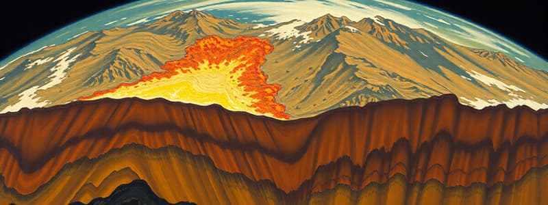
- Features include: subduction (one plate descending into the mantle beneath another), volcanic arcs and island arcs, trenches.
- Oceanic lithosphere is consumed beneath continental plates.
- Continental lithosphere and oceanic lithosphere can collide.
- The resulting collision results in mountains (e.g., Himalayas).
- Magma rising to form island arcs, rather than volcanic arcs, is characteristic of some convergent plate boundaries.
- Convergent boundaries have wider zones of earthquake activity, with deeper earthquake foci as the plate descends.
Divergent Plate Boundaries
- Plates move apart.
- Ocean basins are formed.
- Features include: oceanic ridges, earthquakes, and volcanic activity.
- Rift valleys are a common feature.
Transform Plate Boundaries
- Plates slide past each other.
- Features include: earthquakes, and offset segments of ridges.
- An example is the San Andreas Fault, which connects to oceanic ridges and has segments in North America.
- Transform boundaries can have a significant impact on populated areas, including large earthquakes. (e.g., San Francisco earthquake in 1906, Haiti earthquake in 2010).
Earthquake Hazards
- Earthquakes produce shaking, ground failure, and other hazards, like landslides, tsunamis, and liquefaction.
- These hazards have significant impacts on structures and populations.
- The severity of shaking depends on factors like ground material, building design, and distance from the epicenter.
- The severity of shaking can be amplified by factors like the type of material and topography in an area.
- Structures and buildings, particularly those built on weaker materials, can be prone to damage from earthquakes.
- The type of earthquake and resulting shaking can vary based on the location of the epicenter or fault (i.e., deep or shallow).
Studying That Suits You
Use AI to generate personalized quizzes and flashcards to suit your learning preferences.


