Podcast
Questions and Answers
Which geological feature is characterized by high seismic and volcanic activity?
Which geological feature is characterized by high seismic and volcanic activity?
- The Amazon Basin
- The Isthmus of Central America (correct)
- The Pampas
- The Laurentian Shield
The Amazon River is the second most voluminous river in the world.
The Amazon River is the second most voluminous river in the world.
False (B)
What two countries share Lake Titicaca?
What two countries share Lake Titicaca?
Bolivia and Peru
The most fertile soils in America are located in the ______________ and alluvial soils.
The most fertile soils in America are located in the ______________ and alluvial soils.
Match each river with its key characteristic:
Match each river with its key characteristic:
Which of the following factors does not directly modify the climate of a region?
Which of the following factors does not directly modify the climate of a region?
The predominant vegetation in coastal areas is typically grassland.
The predominant vegetation in coastal areas is typically grassland.
What type of soil is known for being black, fertile, and ideal for agriculture, commonly found in North America?
What type of soil is known for being black, fertile, and ideal for agriculture, commonly found in North America?
______________, such as iron, copper, and gold, are essential to industrial development and are classified as metallic minerals.
______________, such as iron, copper, and gold, are essential to industrial development and are classified as metallic minerals.
Match the following conservation strategies with their environmental benefits:
Match the following conservation strategies with their environmental benefits:
Which South American country is renowned for its biological reserve, the Galápagos Islands?
Which South American country is renowned for its biological reserve, the Galápagos Islands?
The most significant urban and industrial development in North America is concentrated in the western region.
The most significant urban and industrial development in North America is concentrated in the western region.
What instrument is used to measure atmospheric pressure?
What instrument is used to measure atmospheric pressure?
Winds that originate in tropical areas are known as __________.
Winds that originate in tropical areas are known as __________.
Match the following locations with their corresponding descriptions:
Match the following locations with their corresponding descriptions:
Which activity is not typically associated with soil conservation?
Which activity is not typically associated with soil conservation?
Panama's climate is classified as continental.
Panama's climate is classified as continental.
Regarding metalllic minerals, what mineral is the basis of industrial development?
Regarding metalllic minerals, what mineral is the basis of industrial development?
The ______________, located primarily in the Amazon basin, is one of the most significant forested regions on Earth.
The ______________, located primarily in the Amazon basin, is one of the most significant forested regions on Earth.
Match the typical fauna of the Andes with their descriptions:
Match the typical fauna of the Andes with their descriptions:
Flashcards
Meseta de Anáhuac
Meseta de Anáhuac
Located in the Mexican highlands.
American Mountain System
American Mountain System
Starts in Alaska and ends in Tierra del Fuego.
Monte Denali
Monte Denali
Highest point in North America, located in the USA.
Aconcagua
Aconcagua
Signup and view all the flashcards
Istmo Centroamericano
Istmo Centroamericano
Signup and view all the flashcards
Escudo Laurentino
Escudo Laurentino
Signup and view all the flashcards
Suramérica Insular
Suramérica Insular
Signup and view all the flashcards
Región del Río de La Plata
Región del Río de La Plata
Signup and view all the flashcards
Las Pampas
Las Pampas
Signup and view all the flashcards
El Chaco
El Chaco
Signup and view all the flashcards
Río Amazonas
Río Amazonas
Signup and view all the flashcards
Río Coco
Río Coco
Signup and view all the flashcards
Río Chagres
Río Chagres
Signup and view all the flashcards
Río de la Plata
Río de la Plata
Signup and view all the flashcards
Lago Titicaca
Lago Titicaca
Signup and view all the flashcards
Lago Superior
Lago Superior
Signup and view all the flashcards
Lago Maracaibo
Lago Maracaibo
Signup and view all the flashcards
Lago Ontario
Lago Ontario
Signup and view all the flashcards
Clima de Panamá
Clima de Panamá
Signup and view all the flashcards
Factors Modifying Climate
Factors Modifying Climate
Signup and view all the flashcards
Study Notes
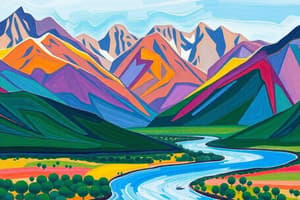
Physical Geography of the Americas
- The Mesa de Anáhuac is located in the Mexican highlands.
- The American mountain system starts in Alaska and ends in Tierra del Fuego.
- The highest point in North America is Denali (formerly McKinley) in the USA.
- The highest point of South America is Aconcagua, located in Argentina.
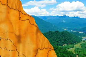
- The Central American Isthmus has high seismic and volcanic activity.
- The Laurentian Shield is located in the north and central parts of North America, mainly Canada.
- The insular South America (Caribbean islands) extends from the Florida Strait to the Venezuelan coasts.
- The Río de la Plata region is in southern South America, including parts of Argentina, Uruguay, and Paraguay.
- The Pampas are fertile plains in Argentina.
- The Chaco is a plain between Paraguay, Bolivia, and Argentina.
Hydrography and Water Resources
- The Amazon River is the most voluminous river in the world, with tributaries like the Negro and Madeira.
- The Coco River serves as the border between Nicaragua and Honduras.
- The Chagres River is the most extensive river and crucial for the Panama Canal.
- The Río de la Plata is an estuary formed by the union of the Paraná and Uruguay rivers.
- Lake Titicaca is shared between Bolivia and Peru.
- Lake Superior is the largest freshwater lake by surface area, located between the USA and Canada.
- Lake Maracaibo is in Venezuela and is rich in oil.
- Lake Ontario is one of the Great Lakes, with its basin including part of New York State.
- The Americas are rich in water resources.
- Panama has abundant water due to its tropical climate and numerous rivers.
- Water is a renewable resource but not always abundant or potable for everyone.
- Electric energy is produced through hydroelectric dams, such as Itaipu (Brazil-Paraguay) and Salto Grande (Uruguay-Argentina).
- Well-managed ecotourism can be sustainable, but if poorly managed, it can negatively impact the environment.
- Subsistence fishing exists but is not for industrial development.
- Commercial fishing occurs in areas like Newfoundland and the Gulf of Mexico.
Climate and Vegetation
- Panama has a tropical humid climate.
- Factors that modify the climate are altitude, ocean currents, mountains, and latitude.
- Trade winds originate in the tropical zone.
- Mangroves predominantly make up the coastal vegetation.
- Tropical rainforest (AF) is mainly located in the Amazon.
Soils and Natural Resources
- Zonal soils are formed by climate and vegetation, such as those found in mountains.
- Alluvial soils are fertilized by river deposits.
- Chernozem is black and fertile soil, ideal for agriculture and common in North America.
- The most fertile soils are located in the Pampas and alluvial soils.
- Soil problems caused by misuse include erosion, desertification, and loss of fertility.
- Methods to improve productivity include rotation techniques, organic fertilizer, and irrigation.
- Conservation practices include reforestation, terracing, and avoiding indiscriminate logging.
- Minerals are classified as metallic (iron, copper, gold, silver, aluminum) and non-metallic (salt, sulfur, gypsum).
- Iron is the foundation of industrial development.
- Countries that produce gold (monetary reserve) include Canada, United States, Mexico, Brazil, Chile, Colombia, Venezuela, and Peru.
Fauna, Flora, and Environmental Conservation
- The Amazon is one of the most important forested regions on the planet.
- Forests are a source of natural resources (wood, oxygen) and should be exploited with control.
- Flora and fauna depend on climate and soil.
- Problems include deforestation, river contamination (oil spills), and unregulated hunting.
- Conservation efforts include creating natural parks, fishing bans, and reforestation.
- Typical fauna of the Andes include guanaco, vicuña, and llama.
- The Galápagos Islands are a biological reserve of the planet (Ecuador).
Urban and Industrial Regions
- In North America, the greatest urban and industrial development occurs in the eastern region.
- Washington, Ottawa, and Niagara Falls are in eastern North America.
- Puerto Vallarta, Mexico, is a tourist destination on the Pacific coast.
- Nova Scotia is a peninsula in the North Atlantic.
- Ungava is a bay in the Canadian Arctic.
Technology, Energy, and Climate
- Electric energy in the Americas primarily comes from water, but it is also produced by other sources.
- The most industrialized areas consume the most energy.
- A barometer measures atmospheric pressure.
Studying That Suits You
Use AI to generate personalized quizzes and flashcards to suit your learning preferences.