Podcast
Questions and Answers
What does 'Cordillera' refer to?
What does 'Cordillera' refer to?
- Parallel chains or ranges of mountains (correct)
- Grassy, treeless plains
- Steep cliff or slope
- Fertile plains in inland areas
What is the Altiplano?
What is the Altiplano?
A region in Peru and Bolivia encircled by the Andes peaks.
Define Escarpment.
Define Escarpment.
A steep cliff or slope between a higher and lower land surface.
What is a Llano?
What is a Llano?
Describe the Pampas.
Describe the Pampas.
Who are Guacho?
Who are Guacho?
What is an Estuary?
What is an Estuary?
What does Canopy refer to in a rain forest?
What does Canopy refer to in a rain forest?
What is Tierra Caliente?
What is Tierra Caliente?
What is the significance of Lake Titicaca?
What is the significance of Lake Titicaca?
Which countries are two of the largest oil producers in the world?
Which countries are two of the largest oil producers in the world?
Which country is known as the world's largest exporter of copper?
Which country is known as the world's largest exporter of copper?
Most of Latin America has a tropical climate.
Most of Latin America has a tropical climate.
What are the main crops of Tierra Templada?
What are the main crops of Tierra Templada?
What are the main crops in Tierra Fria?
What are the main crops in Tierra Fria?
Flashcards are hidden until you start studying
Study Notes
Physical Geography of Latin America
-
Cordillera: Consists of parallel chains or ranges of mountains, crucial for understanding mountain formations in the region.
-
Altiplano: Known as "high plain," this area in Peru and Bolivia is surrounded by the Andes, indicating significant geographical elevation.
-
Escarpment: Defined as a steep cliff or slope, this feature marks the transition between higher and lower land surfaces commonly found in Latin America.
-
Llano: Fertile plains found in Colombia and Venezuela, important for agriculture due to their rich soil.
-
Pampas: Grassy, treeless plains in southern South America, known for their significance in agriculture and livestock grazing.
-
Guacho: Refers to cowhands in Argentina and Uruguay, highlighting the agricultural lifestyle present in these regions.
-
Estuary: The area where river currents meet tidal influences, serving as crucial ecosystems for diverse wildlife.
-
Canopy: The top layer of the rainforest, formed by the tops of tall trees, essential for understanding rain forest ecology.
-
Tierra Caliente: Spanish for "temperate land," this climate zone lies below 2,500 feet and supports crops like bananas and sugar.
-
Tierra Templada: Also translating to "temperate land," found between 2,500 and 6,500 feet, noted for coffee and corn cultivation.
-
Tierra Fria: Meaning "cold land," this region lies above 6,000 feet with crops like barley and potatoes, reflecting adaptations to altitude.
-
Geographical Size: Latin America covers 8,000 miles, stretching from the US-Mexico border to southern Argentina, showcasing its vastness.
-
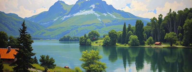
Topography: Characterized by rugged landscapes that are influenced by its location on the Pacific Ring of Fire, resulting in frequent earthquakes and volcanic activity.
-
Mountain Ranges: Sierra Madre is the main range in Mexico; Caribbean islands are part of the Central Highlands.
-
Andes Mountains: This range extends over 4,000 miles along western South America, with the highest point reaching 22,000 feet.
-
Brazil Highlands: Major plateaus and mountain ranges in Brazil provide varied landscapes despite much of the country being flat.
-
Lowlands and Plains: Coastal lowlands along the Gulf of Mexico and inland grasslands are vital for livestock grazing and agriculture.
-
River Systems: Major rivers like the Amazon are crucial for transportation and generate significant hydroelectric power.
-
Lakes: Lake Titicaca is the world's highest navigable lake, emphasizing the region's unique topography.
-
Natural Resources: Mexico and Venezuela are prominent oil producers, impacting the economy and energy sectors.
-
Mineral Resources: Venezuela's Orinoco River harbors 11% of the world's gold, while Peru and Mexico are known for substantial silver deposits.
-
Copper Production: Chile stands as the largest exporter of copper globally, a key economic contributor in the region.
-
Climate Range: Most of Latin America is situated between the Tropics of Cancer and Capricorn, leading to its predominantly tropical climate.
-
Tropical Rainforest Climate: Found in Mexico, Central America, and northern South America, characterized by high temperatures and year-round rainfall.
-
Amazon Rainforest: Spanning one-third of South America, it features vast biodiversity and an intricate canopy structure.
-
Tropical Savanna: Located in southwestern Mexico and parts of South America, known for grasslands and distinct wet and dry seasons.
-
Humid Subtropics: In southeastern South America, this region experiences short mild winters and long hot summers.
-
Desert and Steppe Climates: Northern Mexico and southwestern South America exhibit desert environments like the Atacama and steppe climates with varying rainfall.
-
Elevation's Impact on Climate: In Latin America, elevation influences climate more than proximity to the equator, showcasing significant altitude effects.
-
Crop Diversity by Climate Zones: Different altitude zones dictate the primary crops cultivated, such as cocoa in Tierra Caliente, coffee in Tierra Templada, and barley in Tierra Fria.
Studying That Suits You
Use AI to generate personalized quizzes and flashcards to suit your learning preferences.


