Podcast
Questions and Answers
What geological evidence supports the existence of Pangaea?
What geological evidence supports the existence of Pangaea?
- The decreasing volcanic activity in the Pacific Ring of Fire.
- The increasing distance between Europe and North America.
- The presence of similar fossils on different continents. (correct)
- The thinning of the Earth's crust along the Mid-Atlantic Ridge.
How did the formation of Pangaea influence the development of certain geological features we observe today?
How did the formation of Pangaea influence the development of certain geological features we observe today?
- It resulted in the creation of the Himalayas from the collision of the Indian and Antarctic Plates.
- It initiated the subduction of the Pacific Plate under the North American Plate, forming the Rocky Mountains.
- It caused the formation of the Ural Mountains through the collision of the European and Asian continental plates. (correct)
- It led to the creation of the Great Rift Valley in Africa due to divergent plate boundaries.
What is the significance of the Tethys Sea in the context of Pangaea's breakup?
What is the significance of the Tethys Sea in the context of Pangaea's breakup?
- It marked the boundary between the separating supercontinents of Laurasia and Gondwana. (correct)
- It accelerated the erosion of coastal regions in the newly formed continents.
- It acted as a barrier preventing the migration of terrestrial animals.
- It facilitated the movement of marine species between Laurasia and Gondwana.
Considering the current rate of continental drift, what can be inferred about the future configuration of the continents?
Considering the current rate of continental drift, what can be inferred about the future configuration of the continents?
How does the concept of plate tectonics explain the formation and breakup of Pangaea?
How does the concept of plate tectonics explain the formation and breakup of Pangaea?
Flashcards
What is Pangaea?
What is Pangaea?
A supercontinent that existed during the late Paleozoic and Triassic eras, about 280-230 million years ago.
Continental Drift
Continental Drift
The theory that continents move across Earth's surface due to geological forces.
Pangaea Breakup
Pangaea Breakup
The splitting of Pangaea led to the formation of Laurasia and Gondwana.
Laurasia
Laurasia
Signup and view all the flashcards
Gondwana
Gondwana
Signup and view all the flashcards
Study Notes
- Pangaea was a supercontinent that existed during the late Paleozoic to late Triassic eras, approximately 280-230 million years ago.
- It was a merging of modern-day continents into a large C-shaped landmass.
- Pangaea covered one-third of the planet and was surrounded by the Panthalassa ocean.
Formation
- Pangaea's formation resulted from geological processes that created landforms still present today.
- The Ural Mountains formed from the collision of the European and Asian continental plates during Pangaea's formation.
Discovery
- Alfred Wegener (1880-1930) proposed the theory of continental drift after observing the fit of continents and examining identical fossils on opposite sides of the Atlantic.
- In 1912, Wegener published "The Origin of Continents and Oceans," describing his theory of continental drift.
- Continental drift explains the movement of continents on Earth's surface due to geological forces.
Breakup
- Seafloor spreading broke Pangaea into Laurasia and Gondwana.
- Laurasia consisted of North America and most of Europe.
- Gondwana consisted of South America, Africa, Antarctica, Australia, and Indo-Pakistan.
- The Tethys Sea formed between Laurasia and Gondwana.
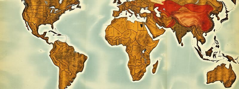
Pangaea Map
- The name Pangaea comes from the Greek words "pan" (all) and "gaia" (earth), meaning "all the Earth."
- Scientists attribute Pangaea's formation to continental drift, known as the theory of plate tectonics.
- Tectonic plates, broken pieces of Earth's crust, float on a fluid mantle of magma, causing collisions and separations.
- Continents move at a measurable rate, around 2.5 centimeters per year.
- Continent movement helps scientists determine what the continents looked like in the past and what they will look like in the future.
- Wegener first proposed what Pangaea looked like after observing the complementary coastlines of South America and Africa.
- Wegener studied fossil distribution and geological features across oceans to support his proposition.
- Pangaea began to break up approximately 200 million years ago.
- Convection currents beneath Earth's crust moved tectonic plates, causing seafloor spreading.
- Seafloor spreading broke Pangaea longitudinally, separating Laurasia and Gondwana and forming the Tethys Sea.
Jurassic Period
- During the Jurassic period, 195 million years ago, the continents began to fracture and drift further apart.
- Gondwana drifted away from Laurasia.
- 150 million years ago, Gondwana began to break apart.
- Gondwana fractured into Africa, Australia, South America, the Indian subcontinent, and the Arabian Peninsula.
- South America and Africa drifted apart 140 million years ago, with the Atlantic Ocean forming between them.
- Australia and Antarctica drifted away, separating 45 million years ago.
- Madagascar broke away from India and moved away from Australia and Antarctica.
- Laurasia broke into North America, Europe, and Asia approximately 66-30 million years ago.
- The Atlantic Ocean formed between North America and Europe, which continue to drift apart due to seafloor spreading.
Current Day
- Continents are constantly moving away from and toward each other at varying rates.
- Earthquakes and volcanic activity evidence continental movement
- The North American Plate is moving away from the Eurasian Plate.
- The Juan de Fuca Plate is pushing against the North American Plate off the Washington and Oregon coastlines.
Tectonic Plates
- Earth's crust comprises large tectonic plates that gradually move apart and together, forming landforms.
Existence Evidence
- Matching geological features, such as the Appalachian Mountains and Scottish Highlands, support Pangaea's existence.
- Complimentary fit of the coastlines of South America and Africa supports the existence of a supercontinent.
- Fossils of tropical plants found in Antarctica indicate a drastically different past climate.
- Fossil species found on separate continents suggest the continents were once connected.
- Fossil distribution has provided significant evidence of the past geographical positions of continents.
- Before Wegener's work, land bridges that had sunk into the oceans were the accepted explanation for similar fossils on different continents.
- Rock strata patterns match across different continents.
- Coal distribution in climates where it does not typically form indicates different past locations of continents. Measured movement of continents due to plate tectonics.
Studying That Suits You
Use AI to generate personalized quizzes and flashcards to suit your learning preferences.
Description
Learn about Pangaea, a supercontinent that existed millions of years ago, its formation through geological processes like continental plate collision and Ural Mountains formation. Also, understand Alfred Wegener's continental drift theory explaining Pangaea's breakup into Laurasia and Gondwana.


