Podcast
Questions and Answers
What does Bathymetry refer to?
What does Bathymetry refer to?
- Mapping depths below the ocean's surface (correct)
- Mapping surface temperature
- Mapping ocean currents
- Mapping life forms in the ocean
What are Continental Margins?
What are Continental Margins?
Submerged portion of continent, with passive margins facing spreading centers and active margins facing converging or transform boundaries.
What are the components of the Continental Shelf, Slope, and Rise?
What are the components of the Continental Shelf, Slope, and Rise?
Continental shelf: shallow submerged continent extension; Continental slope: transition between shelf and ocean floor; Continental rise: accumulated sediment.
What is an Epicenter?
What is an Epicenter?
What is a Submarine Canyon?
What is a Submarine Canyon?
What are Trenches and Island Arcs?
What are Trenches and Island Arcs?
Which of the following best describes Abyssal Plains and Hills?
Which of the following best describes Abyssal Plains and Hills?
What are Hydrothermal Vents?
What are Hydrothermal Vents?
What are Turbidity Currents?
What are Turbidity Currents?
What are Seamounts and Guyots?
What are Seamounts and Guyots?
How were the earliest depth measurements of the ocean bottom taken?
How were the earliest depth measurements of the ocean bottom taken?
How are ocean depth measurements done now?
How are ocean depth measurements done now?
Where are the deepest parts of the ocean found?
Where are the deepest parts of the ocean found?
The average depth of the ocean is greater than the average height of the continents.
The average depth of the ocean is greater than the average height of the continents.
How have sea levels changed in the past?
How have sea levels changed in the past?
Where are sea levels now related to their historical minimum and maximum heights?
Where are sea levels now related to their historical minimum and maximum heights?
Flashcards are hidden until you start studying
Study Notes
Oceanography Key Concepts
-
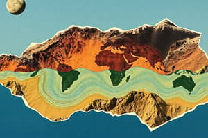
Bathymetry: The process of mapping ocean depths, essential for understanding underwater landscapes.
-
Continental Margins:
- Passive Margin: Associated with the edges of tectonic plates that face spreading centers, typically characterized by a gentle slope.
- Active Margin: Occurs near converging or transform boundaries, featuring steeper slopes due to tectonic activity.
-
Continental Shelf, Slope, and Rise:
- Continental Shelf: The shallow extension of a continent submerged underwater.
- Continental Slope: The steep transition from the continental shelf to the ocean floor.
- Continental Rise: This region is formed from the accumulation of sediments from the continent, leading to a gentler slope.
-
Epicenter: The point on the Earth's surface directly above the origin (focus) of an earthquake.
-
Submarine Canyon: Formed by the erosion of continental margins, these canyons collect sediments that accumulate on the ocean floor.
-
Trenches and Island Arcs:
- Trenches: Deep, arc-shaped depressions in the ocean floor created by the subduction of tectonic plates.
- Island Arcs: Chains of volcanic islands that form near subduction zones, typically following trench lines.
-
Abyssal Plains and Hills:
- Abyssal Plains: Broad, flat areas of the ocean floor, representing the most extensive features on Earth.
- Abyssal Hills: Small hills that protrude from the abyssal plains, adding variety to the ocean landscape.
-
Hydrothermal Vents (Black Smokers): Located near mid-ocean ridges, these vents release superheated water (around 660°F) rich in minerals from volcanic activity.
-
Turbidity Currents: Underwater avalanche of sediments that can be triggered by earthquakes, capable of carving deep canyons.
-
Seamounts and Guyots:
- Seamounts: Underwater mountains formed by volcanic activity at spreading centers or hot spots.
- Guyots: Flat-topped underwater mountains resembling seamounts but eroded flat by waves and currents.
-
Early Depth Measurements: Initially measured by lowering a weight on a line to gauge ocean depth.
-
Modern Depth Measurement Techniques:
- Utilizes echo sounders that emit sound waves; by calculating the time for the sound waves to return, precise depth measurements can be obtained.
- Example: A sound pulse taking about 2 seconds to return indicates a depth of approximately 1,500 meters.
-
Challenger Deep: The deepest known part of the ocean located in the Mariana Trench, approximately 36,200 feet deep.
-
Ocean Depth vs. Land Elevation:
- The average depth of the ocean (3,796 meters or 12,451 feet) is significantly greater than the average height of continents (840 meters or 2,760 feet).
-
Historical Sea Level Changes: Sea levels have fluctuated with Earth's temperature changes, influenced by water and ice volume in glaciers and ice sheets.
-
Current Sea Level Trends: Sea level variations relate to glaciation cycles, with significant drops occurring during ice ages, such as a drop of 125 meters (410 feet) at the peak of the last ice age approximately 18,000 years ago.
Studying That Suits You
Use AI to generate personalized quizzes and flashcards to suit your learning preferences.