Podcast
Questions and Answers
What was the primary advancement of the Ocean Drilling Program (ODP) compared to the Deep Sea Drilling Project (DSDP)?
What was the primary advancement of the Ocean Drilling Program (ODP) compared to the Deep Sea Drilling Project (DSDP)?
- The ODP could drill more than two kilometers deeper than the ocean floor. (correct)
- The ODP was able to retrieve rocks from a wider geographic area.
- The ODP utilized more advanced submersible technology.
- The ODP focused on studying active continental margins exclusively.
The term 'JOIDES' in the context of ocean drilling refers to:
The term 'JOIDES' in the context of ocean drilling refers to:
- The geological analysis performed on the ocean floor.
- A specific type of drill bit used in the Deep Sea Drilling Project.
- An acronym for Joint Oceanographic Institutions for Deep Earth Sampling. (correct)
- The vessel used by the International Ocean Discovery Program for drilling.
What is the key characteristic that distinguishes active continental margins from passive continental margins?
What is the key characteristic that distinguishes active continental margins from passive continental margins?
- The depth of the ocean at the margin.
- The level of igneous and seismic activity. (correct)
- The type of sediment found on the continental shelf.
- The presence of a continental rise.
If a scientist is studying a subduction zone along a continental margin, which specific term would they most likely use to describe this feature?
If a scientist is studying a subduction zone along a continental margin, which specific term would they most likely use to describe this feature?
Which of the following statements best describes the composition and characteristics of the continental shelf?
Which of the following statements best describes the composition and characteristics of the continental shelf?
What geological feature lies beyond the continental slope in the general topography of a passive continental margin?
What geological feature lies beyond the continental slope in the general topography of a passive continental margin?
How do turbidity currents contribute to the formation of both submarine canyons and the continental rise?
How do turbidity currents contribute to the formation of both submarine canyons and the continental rise?
What evidence initially suggested to scientists that submarine canyons are carved out by turbidity currents rather than rivers?
What evidence initially suggested to scientists that submarine canyons are carved out by turbidity currents rather than rivers?
How does the composition of biogenic sedimentary rock on the ocean floor primarily form, based on the information?
How does the composition of biogenic sedimentary rock on the ocean floor primarily form, based on the information?
How does the thickness of sediment covering the mountains in the ocean basins (abyssal plains) relate to their distance from oceanic ridges?
How does the thickness of sediment covering the mountains in the ocean basins (abyssal plains) relate to their distance from oceanic ridges?
Which of the following best describes the progression in the degradation and aging of mountains from oceanic ridges to continents?
Which of the following best describes the progression in the degradation and aging of mountains from oceanic ridges to continents?
What is the primary force driving turbidity currents down the continental slope?
What is the primary force driving turbidity currents down the continental slope?
Why are the ocean basins (abyssal plains) described as both the flattest and yet also covered with thousands of mountains?
Why are the ocean basins (abyssal plains) described as both the flattest and yet also covered with thousands of mountains?
The International Ocean Discovery Program (IODP), formerly the Integrated Ocean Drilling Program, has the capability to drill how far below the ocean floor?
The International Ocean Discovery Program (IODP), formerly the Integrated Ocean Drilling Program, has the capability to drill how far below the ocean floor?
What role did the United States Navy play in the development of the Theory of Plate Tectonics and subsequent ocean exploration?
What role did the United States Navy play in the development of the Theory of Plate Tectonics and subsequent ocean exploration?
Which of the following is NOT a characteristic of the continental rise?
Which of the following is NOT a characteristic of the continental rise?
If a newly discovered mountain on the abyssal plain is found to have a flat top, what type of mountain is it most likely to be called?
If a newly discovered mountain on the abyssal plain is found to have a flat top, what type of mountain is it most likely to be called?
Harry Hess contributed to the study of ocean floor topography. How did his work relate to the naming of guyots?
Harry Hess contributed to the study of ocean floor topography. How did his work relate to the naming of guyots?
The telegraph cables laid on the floor of the Atlantic Ocean in the 1850s had what impact on global communications?
The telegraph cables laid on the floor of the Atlantic Ocean in the 1850s had what impact on global communications?
What is the relationship between the age of rock and sediment thickness in the ocean basins (abyssal plains)?
What is the relationship between the age of rock and sediment thickness in the ocean basins (abyssal plains)?
Which of these geological terms aligns with the meaning of 'edge'?
Which of these geological terms aligns with the meaning of 'edge'?
What type of ocean life would primarily influence the composition of biogenic sedimentary rock found directly beneath them on the ocean floor?
What type of ocean life would primarily influence the composition of biogenic sedimentary rock found directly beneath them on the ocean floor?
Given the relationship between turbidity currents and submarine canyons, what would be a logical prediction about the location of a submarine canyon?
Given the relationship between turbidity currents and submarine canyons, what would be a logical prediction about the location of a submarine canyon?
If a geologist finds a rock sample from a continental shelf, what type of rock is it most likely to be, and what does this indicate about the shelf's origin?
If a geologist finds a rock sample from a continental shelf, what type of rock is it most likely to be, and what does this indicate about the shelf's origin?
Which geological feature is typically found at the edges of tectonic plates within ocean basins?
Which geological feature is typically found at the edges of tectonic plates within ocean basins?
What distinguishes an oceanic trench from a continental trench in oceanography?
What distinguishes an oceanic trench from a continental trench in oceanography?
Which of the following is NOT a characteristic of turbidity currents?
Which of the following is NOT a characteristic of turbidity currents?
What does the presence of a transform fault along a continental margin indicate about that margin?
What does the presence of a transform fault along a continental margin indicate about that margin?
To what extent does river water contribute to the formation of submarine canyons?
To what extent does river water contribute to the formation of submarine canyons?
What does the adjective 'turbid' mean in the context of turbidity currents?
What does the adjective 'turbid' mean in the context of turbidity currents?
How did the shape of submarine canyons reveal that they were built from the ocean toward the continent?
How did the shape of submarine canyons reveal that they were built from the ocean toward the continent?
Which location can be considered a passive Continental Margin?
Which location can be considered a passive Continental Margin?
Which submarine mountains is closest to the continent?
Which submarine mountains is closest to the continent?
What builds the Passive Continental Margin?
What builds the Passive Continental Margin?
Submarine canyons are actually carved out by what?
Submarine canyons are actually carved out by what?
What are the tallest mountains in the ocean?
What are the tallest mountains in the ocean?
What is another name for Ocean Basins?
What is another name for Ocean Basins?
What is a mixture of rocks, sediments, mud, and water pulled downward by gravity?
What is a mixture of rocks, sediments, mud, and water pulled downward by gravity?
Where is the Continental Rise located?
Where is the Continental Rise located?
What are Oceanic-Oceanic subduction zones called?
What are Oceanic-Oceanic subduction zones called?
What fundamental theory of geology was directly influenced by research conducted by the United States Navy after World War II?
What fundamental theory of geology was directly influenced by research conducted by the United States Navy after World War II?
The Deep Sea Drilling Project (DSDP) could drill more than two kilometers deeper than the ocean floor.
The Deep Sea Drilling Project (DSDP) could drill more than two kilometers deeper than the ocean floor.
What is the acronym JOIDES short for?
What is the acronym JOIDES short for?
The mission that replaced the Ocean Drilling Program (ODP) in 2003 was called the Integrated Ocean Drilling Program (_____).
The mission that replaced the Ocean Drilling Program (ODP) in 2003 was called the Integrated Ocean Drilling Program (_____).
Match the following drilling programs with their capabilities:
Match the following drilling programs with their capabilities:
What term defines the edge of a continent where it meets the ocean?
What term defines the edge of a continent where it meets the ocean?
Passive continental margins are characterized by a high abundance of geologic activity.
Passive continental margins are characterized by a high abundance of geologic activity.
What are the two types of geologic activity that cause the abundance of earthquakes at active continental margins?
What are the two types of geologic activity that cause the abundance of earthquakes at active continental margins?
In oceanography, the term 'trench' is another word for a(n) ______ zone.
In oceanography, the term 'trench' is another word for a(n) ______ zone.
Match the following coastlines with their type of continental margin:
Match the following coastlines with their type of continental margin:
Which part of the continent extends into the ocean, and is considered part of the continent itself?
Which part of the continent extends into the ocean, and is considered part of the continent itself?
The continental shelf is primarily composed of mafic igneous rock.
The continental shelf is primarily composed of mafic igneous rock.
What is the name for the largest, flattest parts of the surface of the Earth?
What is the name for the largest, flattest parts of the surface of the Earth?
The seabed that steepens to deeper depths beyond the continental shelf is called the continental ______.
The seabed that steepens to deeper depths beyond the continental shelf is called the continental ______.
Match the following features of a passive continental margin with their descriptions:
Match the following features of a passive continental margin with their descriptions:
Which of the following is responsible for carving out submarine canyons?
Which of the following is responsible for carving out submarine canyons?
Submarine canyons are primarily carved out by rivers carrying water from the continent to the ocean.
Submarine canyons are primarily carved out by rivers carrying water from the continent to the ocean.
What is a turbidity current?
What is a turbidity current?
The disruption of transatlantic ______ cables in the early twentieth century provided historical evidence that submarine canyons are caused by turbidity currents.
The disruption of transatlantic ______ cables in the early twentieth century provided historical evidence that submarine canyons are caused by turbidity currents.
Match the following terms with their descriptions:
Match the following terms with their descriptions:
What geological feature is formed by the accumulation of rocks and sediments at the base of the continental slope due to repeated turbidity currents?
What geological feature is formed by the accumulation of rocks and sediments at the base of the continental slope due to repeated turbidity currents?
Deep sea fans are formed by continental landslides on land.
Deep sea fans are formed by continental landslides on land.
What is another name for deep sea fans?
What is another name for deep sea fans?
Each accumulation of rocks and sediments that compose the continental rise is called a deep sea fan or a ______ fan.
Each accumulation of rocks and sediments that compose the continental rise is called a deep sea fan or a ______ fan.
Match the location with the description of where similar geological processes occur:
Match the location with the description of where similar geological processes occur:
Which of the following mountains is generally found closest to the oceanic ridge?
Which of the following mountains is generally found closest to the oceanic ridge?
Tablemounts, also known as guyots, are formed by volcanic activity on the continents.
Tablemounts, also known as guyots, are formed by volcanic activity on the continents.
What is the name of the flat-roofed building at Princeton University that inspired the name for guyots?
What is the name of the flat-roofed building at Princeton University that inspired the name for guyots?
The seamounts, tablemounts (guyots), and abyssal hills (seaknolls) provide strong evidence for the Theory of Plate _____.
The seamounts, tablemounts (guyots), and abyssal hills (seaknolls) provide strong evidence for the Theory of Plate _____.
Match the mountain types found in the ocean basins with their relative age:
Match the mountain types found in the ocean basins with their relative age:
What covers all of the mountains on the ocean basins (abyssal plains)?
What covers all of the mountains on the ocean basins (abyssal plains)?
The sediment covering the abyssal hills (seaknolls) is thinnest because they are the tallest mountains.
The sediment covering the abyssal hills (seaknolls) is thinnest because they are the tallest mountains.
Which is the oldest type of rock, rocks from seamounts, tablemounts, or abyssal hills?
Which is the oldest type of rock, rocks from seamounts, tablemounts, or abyssal hills?
The thickest sediment covers the shortest abyssal hills (_____), while the thinnest sediment covers the tallest seamounts.
The thickest sediment covers the shortest abyssal hills (_____), while the thinnest sediment covers the tallest seamounts.
Match the mountain type with the general thickness of sediment:
Match the mountain type with the general thickness of sediment:
What type of sedimentary rock primarily makes up the covering of ocean basins (abyssal plains)?
What type of sedimentary rock primarily makes up the covering of ocean basins (abyssal plains)?
The composition of biogenic sedimentary rock on the ocean floor has nothing to do with the composition of microorganisms found near the surface.
The composition of biogenic sedimentary rock on the ocean floor has nothing to do with the composition of microorganisms found near the surface.
What is the primary way microscopic marine life contributes to the formation of biogenic sedimentary rock on the ocean floor?
What is the primary way microscopic marine life contributes to the formation of biogenic sedimentary rock on the ocean floor?
If we were able to walk upon the ocean floor, we would be walking upon biogenic sedimentary rock that has been lithified from layer upon layer upon layer of heavy, hard, dense ______.
If we were able to walk upon the ocean floor, we would be walking upon biogenic sedimentary rock that has been lithified from layer upon layer upon layer of heavy, hard, dense ______.
Match the process with the description that explains the origins of ocean floor composition:
Match the process with the description that explains the origins of ocean floor composition:
Flashcards
International Ocean Discovery Program (IODP)
International Ocean Discovery Program (IODP)
Mission that drills deep into the ocean floor. Started as DSDP in 1968, then ODP in 1983, IODP in 2003, and finally renamed to International Ocean Discovery Program (IODP) in 2013, which is still in operation.
Continental margin
Continental margin
The edge of a continent where it meets the ocean.
Active continental margins
Active continental margins
Continental margins with significant geologic activity, such as igneous and seismic activity, caused by transform faults and subduction zones.
Passive continental margins
Passive continental margins
Signup and view all the flashcards
Trench
Trench
Signup and view all the flashcards
Oceanic Trench
Oceanic Trench
Signup and view all the flashcards
Continental Trench
Continental Trench
Signup and view all the flashcards
Continental shelf
Continental shelf
Signup and view all the flashcards
Continental slope
Continental slope
Signup and view all the flashcards
Continental rise
Continental rise
Signup and view all the flashcards
Ocean basin (abyssal plain)
Ocean basin (abyssal plain)
Signup and view all the flashcards
Submarine canyons
Submarine canyons
Signup and view all the flashcards
Turbidity currents
Turbidity currents
Signup and view all the flashcards
Deep sea fan
Deep sea fan
Signup and view all the flashcards
Seamounts
Seamounts
Signup and view all the flashcards
Tablemounts (guyots)
Tablemounts (guyots)
Signup and view all the flashcards
Abyssal hills (seaknolls)
Abyssal hills (seaknolls)
Signup and view all the flashcards
Biogenic Sedimentary Rock (ocean floor)
Biogenic Sedimentary Rock (ocean floor)
Signup and view all the flashcards
Theory of Plate Tectonics
Theory of Plate Tectonics
Signup and view all the flashcards
Deep Sea Drilling Project (DSDP)
Deep Sea Drilling Project (DSDP)
Signup and view all the flashcards
Ocean Drilling Program (ODP)
Ocean Drilling Program (ODP)
Signup and view all the flashcards
JOIDES Resolution
JOIDES Resolution
Signup and view all the flashcards
Cause of geologic activity at active continental margins
Cause of geologic activity at active continental margins
Signup and view all the flashcards
Margin
Margin
Signup and view all the flashcards
Historical evidence of turbidity currents
Historical evidence of turbidity currents
Signup and view all the flashcards
Formation of Biogenic Sedimentary Rock
Formation of Biogenic Sedimentary Rock
Signup and view all the flashcards
Study Notes
- Research after World War II by the U.S. Navy led to the Theory of Plate Tectonics.
- The U.S. Navy continues to explore the ocean floor.
Deep Sea Drilling Project (DSDP)
- The project started in 1968.
- The project drilled and retrieved rocks from the ocean floor.
Ocean Drilling Program (ODP)
- The project started in 1983 - replacing the DSDP
- The ODP could drill more than two kilometers deeper than the ocean floor.
- The ship JOIDES Resolution was used to drill submarine rocks.
- JOIDES stands for Joint Oceanographic Institutions for Deep Earth Sampling.
- The drill was assembled and disassembled on site.
Integrated Ocean Drilling Program (IODP)
- The project started in 2003 - replacing the ODP
International Ocean Discovery Program (IODP)
- The mission was renamed in 2013
- The project is still in operation.
- This mission is able to drill more than seven kilometers deeper than the ocean floor.
Continental Margins
- Continental margin refers to the edge of a continent where it meets the ocean.
- Margin means edge.
- Margins are either active or passive
Active Continental Margins
- Active margins have abundant geologic activity caused by a transform fault or subduction zone.
- Examples include the west coast of North and South America.
Passive Continental Margins
- Passive margins have very little geologic activity.
- Examples include the east coasts of North and South America, and the west coast of Africa.
Trenches
- Trench is another word for subduction zone
- There are two types: oceanic trenches (oceanic-oceanic subduction) and continental trenches (oceanic-continental subduction).
- Both types are at the bottom of the ocean.
- Continental trenches and transform faults are found at active continental margins.
Topography of a Passive Continental Margin
- The continent extends into the ocean through the continental shelf.
- The continental shelf is part of the continent, composed of felsic igneous rock.
- The size of the continental shelf depends on sea levels.
- There is an abundance of ocean life is on the continental shelf due to sunlight penetration.
- The continental slope is where the seabed steepens beyond the continental shelf.
- The continental rise is where the seabed begins to level out beyond the continental slope.
- The ocean basin (abyssal plain) is beyond the continental rise
- Ocean basins (abyssal plains) are the largest, flattest parts of the world's surface.
- Continents together with the seabed comprise the surface of the Earth.
- The edge of the ocean basin is where oceanic ridges (mountain ranges from submarine igneous activity) are found.
Submarine Canyons
- Submarine canyons are within the continental slope.
- The canyons are carved out by turbidity currents (submarine landslides), not rivers.
- Turbidity currents are mixtures of rocks, sediments, mud, and water pulled downward by gravity.
- Turbidity is synonymous with murky or thick
- The Grand Banks earthquake in 1929 caused a turbidity current that disrupted transatlantic telegraph cables and carved out a submarine canyon.
- The damaged telegraph cables revealed that turbidity currents carve submarine canyons in the continental slope.
- River waters do not continue to carve into the rock when arriving at the ocean.
- The shape of submarine canyons reveals that they are built from the ocean toward the continent.
- Turbid may also mean perplexed or confused.
- The words turbulent and turbulence are related to the adjective turbid.
- The telegraph was invented in the 1830s by American inventor Samuel Morse.
- Giant telegraph cables were dropped to the bottom of the Atlantic Ocean during the 1850s, permitting fairly rapid communication between the United States and Europe.
Continental Rise Formation
- Continental rise is built by turbidity currents with rocks and sediment accumulating at the base of the continental slope.
- Accumulations of rocks and sediments form deep sea fans or submarine fans.
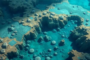
Ocean Basins (Abyssal Plains)
- Ocean basins are covered with thousands of mountains
- Seamounts are tallest mountains, nearest to the oceanic ridge
- Tablemounts / Guyots are medium-height mountains with flat tops, roughly halfway from oceanic ridges to continents.
- Harry Hammond Hess named tablemounts "guyots" after Guyot Hall at Princeton University.
- Abyssal hills / Seaknolls are the shortest mountains, closest to the continent.
- Seamounts, tablemounts (guyots), and abyssal hills (seaknolls) provide evidence for the Theory of Plate Tectonics.
- Molten rock at divergent plate boundaries cools to form seamounts.
- Over millions of years, tectonic plate movement and natural forces degrade seamounts into tablemounts (guyots) and then into abyssal hills (seaknolls).
- Seamounts have the youngest rocks, tablemounts (guyots) have middle-aged rocks, and abyssal hills (seaknolls) have the oldest rocks.
- The continuum of rock ages was discovered by the seafloor-drilling programs of the U.S. Navy.
Sediment Thickness
- All mountains on the ocean basins (abyssal plains) are covered with sediments.
- The oldest rock is closest to the continents and has the thickest sediment.
- The youngest rock is closest to the oceanic ridges and has the thinnest sediment.
- The thickest sediment covers the shortest abyssal hills (seaknolls), while the thinnest sediment covers the tallest seamounts.
- Sediment thicknesses were discovered by the seafloor-drilling programs of the U.S. Navy
Sedimentary Rock Composition
- Sedimentary rock covering ocean basins is primarily biogenic with a composition closely matching the lifeforms living near the surface.
- Most ocean life excrete fecal pellets that are dense enough to sink to the ocean floor.
- Layer upon layer of this accumulates on the seabed and eventually lithifies to form biogenic sedimentary rock.
Studying That Suits You
Use AI to generate personalized quizzes and flashcards to suit your learning preferences.