Podcast
Questions and Answers
What factor contributes to the formation of ocean waves by transferring energy from the air to the water?
What factor contributes to the formation of ocean waves by transferring energy from the air to the water?
- Temperature difference
- Pressure gradient
- Humidity level
- Wind speed (correct)
What determines the final size of ocean waves, beyond which they are no longer sustainable and form whitecaps?
What determines the final size of ocean waves, beyond which they are no longer sustainable and form whitecaps?
- Wave height at the shore
- Changes in water temperature
- Maximum fetch and duration for a given wind velocity (correct)
- Wind direction
What happens to the waves generated when the wind stops or changes direction?
What happens to the waves generated when the wind stops or changes direction?
- They continue to grow larger indefinitely
- They quickly transform into tsunamis
- They maintain the same size
- They lose energy and dissipate (correct)
What term is used for ocean waves that are lower in height, longer in length, and carry the wind's original energy to the shore?
What term is used for ocean waves that are lower in height, longer in length, and carry the wind's original energy to the shore?
What kind of motion do ocean waves exhibit that allows the waveform to move forward while the water particles move in a circular path?
What kind of motion do ocean waves exhibit that allows the waveform to move forward while the water particles move in a circular path?
What term is used for the state of ocean waves where the energy lost from whitecapping equals the energy gained from the wind's velocity?
What term is used for the state of ocean waves where the energy lost from whitecapping equals the energy gained from the wind's velocity?
In the process of wave formation, what role does the length of time the wind blows play?
In the process of wave formation, what role does the length of time the wind blows play?
What factor helps in the transfer of energy from the air to the water in the creation of ocean waves?
What factor helps in the transfer of energy from the air to the water in the creation of ocean waves?
What happens to the density of seawater in high latitude areas when seawater freezes into sea ice?
What happens to the density of seawater in high latitude areas when seawater freezes into sea ice?
What creates the highest-density water in the world near Antarctica?
What creates the highest-density water in the world near Antarctica?
What are some natural processes that can modify coastlines?
What are some natural processes that can modify coastlines?
Which factor provides most of the energy that modifies shorelines?
Which factor provides most of the energy that modifies shorelines?
What is the role of wave crests in ocean waves?
What is the role of wave crests in ocean waves?
What causes large waves to crash along a shoreline on windless days?
What causes large waves to crash along a shoreline on windless days?
What is the primary source of energy that impacts shorelines?
What is the primary source of energy that impacts shorelines?
Where does thermohaline circulation begin?
Where does thermohaline circulation begin?
What is the interface where shoreline, air, land, and sea meet called?
What is the interface where shoreline, air, land, and sea meet called?
How do humans impact shorelines?
How do humans impact shorelines?
Why does the west coast of the United States experience deformation and uplift?
Why does the west coast of the United States experience deformation and uplift?
What is the primary reason for shoreline erosion problems along the Pacific Coast?
What is the primary reason for shoreline erosion problems along the Pacific Coast?
Why are many shorelines complex and difficult to understand?
Why are many shorelines complex and difficult to understand?
What is an emergent coast?
What is an emergent coast?
What is the primary cause of tides?
What is the primary cause of tides?
Why are barrier islands prone to extensive modification during storms?
Why are barrier islands prone to extensive modification during storms?
What is a common characteristic of the Atlantic and Gulf Coast shorelines?
What is a common characteristic of the Atlantic and Gulf Coast shorelines?
What is an example of a submerged coast?
What is an example of a submerged coast?
In which season is wave activity generally light?
In which season is wave activity generally light?
What happens to sediment when wave activity is high?
What happens to sediment when wave activity is high?
What is the role of wave refraction in sediment movement along the shoreline?
What is the role of wave refraction in sediment movement along the shoreline?
What happens when waves approach the shore at an angle?
What happens when waves approach the shore at an angle?
What is the result of significant backwash due to high wave activity?
What is the result of significant backwash due to high wave activity?
How does wave refraction influence erosion and deposition along the shoreline?
How does wave refraction influence erosion and deposition along the shoreline?
What is the impact of a net loss of sediment from a beach face?
What is the impact of a net loss of sediment from a beach face?
How does wave activity affect the movement of sediment along the shoreline?
How does wave activity affect the movement of sediment along the shoreline?
What is the primary source of energy for generating ocean currents?
What is the primary source of energy for generating ocean currents?
What is the name given to the large, circular-moving surface currents located within each ocean basin?
What is the name given to the large, circular-moving surface currents located within each ocean basin?
At approximately what latitude are the centers of the subtropical gyres located?
At approximately what latitude are the centers of the subtropical gyres located?
What is the term given to the deflection of free-flowing objects to the right in the Northern Hemisphere and to the left in the Southern Hemisphere?
What is the term given to the deflection of free-flowing objects to the right in the Northern Hemisphere and to the left in the Southern Hemisphere?
How many years does it take for the North Pacific Gyre to complete its current?
How many years does it take for the North Pacific Gyre to complete its current?
Which of the following currents is not part of the North Pacific Gyre?
Which of the following currents is not part of the North Pacific Gyre?
What is the primary factor that influences the shape and direction of ocean currents?
What is the primary factor that influences the shape and direction of ocean currents?
How many main gyres are there in the world's oceans?
How many main gyres are there in the world's oceans?
What is the diameter of the circular orbits at the ocean's surface equal to?
What is the diameter of the circular orbits at the ocean's surface equal to?
At what depth does the circular orbit become negligible?
At what depth does the circular orbit become negligible?
What happens to the wave as it approaches the shore?
What happens to the wave as it approaches the shore?
What is the term for the turbulent water created by breaking waves?
What is the term for the turbulent water created by breaking waves?
What is the scientific definition of a beach?
What is the scientific definition of a beach?
What is the approximate time it takes for the North Atlantic Gyre to complete its current?
What is the approximate time it takes for the North Atlantic Gyre to complete its current?
Which current is the only one that encircles the Earth?
Which current is the only one that encircles the Earth?
What is a common composition of beaches near volcanic islands?
What is a common composition of beaches near volcanic islands?
What is the primary cause of wave erosion during calm weather?
What is the primary cause of wave erosion during calm weather?
What is the main factor that influences the Indian Ocean circulation?
What is the main factor that influences the Indian Ocean circulation?
What is the force exerted by waves on the Atlantic Coast in the winter?
What is the force exerted by waves on the Atlantic Coast in the winter?
What is the primary purpose of ocean surface circulation?
What is the primary purpose of ocean surface circulation?
What is the process that occurs when the air expands rapidly in the cracks of rocks?
What is the process that occurs when the air expands rapidly in the cracks of rocks?
Which type of currents warm the regions they flow near?
Which type of currents warm the regions they flow near?
What type of shorelines are more easily eroded?
What type of shorelines are more easily eroded?
What is the result of the California Current on the climate of Southern California?
What is the result of the California Current on the climate of Southern California?
What is the effect of the cool Peru Current on the climate of coastal Peru and Chile?
What is the effect of the cool Peru Current on the climate of coastal Peru and Chile?
What is the primary mechanism of deep-ocean circulation?
What is the primary mechanism of deep-ocean circulation?
What is the result of upwelling on the surface water temperature?
What is the result of upwelling on the surface water temperature?
What is the primary effect of upwelling on marine ecosystems?
What is the primary effect of upwelling on marine ecosystems?
What is the primary reason for the formation of wave-cut cliffs?
What is the primary reason for the formation of wave-cut cliffs?
What is the term for the zigzag pattern of sediment movement along the beach face?
What is the term for the zigzag pattern of sediment movement along the beach face?
Which type of shoreline feature is formed from the erosion of rock and sediment?
Which type of shoreline feature is formed from the erosion of rock and sediment?
What is the term for the current that flows parallel to the shore within the surf zone?
What is the term for the current that flows parallel to the shore within the surf zone?
What is the term for a ridge of sediment that extends from land into deeper water near the mouth of a bay?
What is the term for a ridge of sediment that extends from land into deeper water near the mouth of a bay?
What is the term for a low ridge of sand that parallels the coast at distances from 2 to 20 miles offshore?
What is the term for a low ridge of sand that parallels the coast at distances from 2 to 20 miles offshore?
What is the term for a sea cave that has eroded through to the opposite side of the headland, forming an arch?
What is the term for a sea cave that has eroded through to the opposite side of the headland, forming an arch?
What is the primary reason for the formation of a marine terrace?
What is the primary reason for the formation of a marine terrace?
What is the direction of longshore currents along the east and west coasts of the U.S.?
What is the direction of longshore currents along the east and west coasts of the U.S.?
What is the term for a ridge of sand that connects an island or sea stack to the mainland?
What is the term for a ridge of sand that connects an island or sea stack to the mainland?
Why do most places experience two high tides and two low tides each day?
Why do most places experience two high tides and two low tides each day?
What is the reason for the 50-minute delay in tidal cycles each day?
What is the reason for the 50-minute delay in tidal cycles each day?
What is the primary factor that determines the magnitude of tidal ranges?
What is the primary factor that determines the magnitude of tidal ranges?
What type of tidal pattern is characterized by a single high tide and a single low tide each lunar day?
What type of tidal pattern is characterized by a single high tide and a single low tide each lunar day?
What is the term used to describe the horizontal flow of water associated with the rise and fall of the tide?
What is the term used to describe the horizontal flow of water associated with the rise and fall of the tide?
What is the term used to describe periods of little or no current during tidal cycles?
What is the term used to describe periods of little or no current during tidal cycles?
What is the result of the linear alignment of the Earth, Moon, and Sun during spring tides?
What is the result of the linear alignment of the Earth, Moon, and Sun during spring tides?
What is the approximate percentage of the Sun's tide-generating effect compared to the Moon's?
What is the approximate percentage of the Sun's tide-generating effect compared to the Moon's?
How many variables must be precisely evaluated to predict the tides?
How many variables must be precisely evaluated to predict the tides?
What is the term used to describe the areas affected by tidal currents?
What is the term used to describe the areas affected by tidal currents?
What happens to a shoreline that remains stable for an extended period of time?
What happens to a shoreline that remains stable for an extended period of time?
Why does shoreline erosion pose a significant threat to human life and property?
Why does shoreline erosion pose a significant threat to human life and property?
What is the primary purpose of breakwaters?
What is the primary purpose of breakwaters?
What is a common environmental impact of beach nourishment?
What is a common environmental impact of beach nourishment?
What is the primary advantage of beach nourishment?
What is the primary advantage of beach nourishment?
What is the purpose of jetties?
What is the purpose of jetties?
Why do coastal scientists and urban planners recommend relocation?
Why do coastal scientists and urban planners recommend relocation?
What is a factor that affects the rate of shoreline erosion?
What is a factor that affects the rate of shoreline erosion?
What is the term for structures built to protect a coast from erosion or prevent the movement of sediment?
What is the term for structures built to protect a coast from erosion or prevent the movement of sediment?
Why is shoreline erosion a significant concern compared to other natural hazards?
Why is shoreline erosion a significant concern compared to other natural hazards?
Flashcards are hidden until you start studying
Study Notes
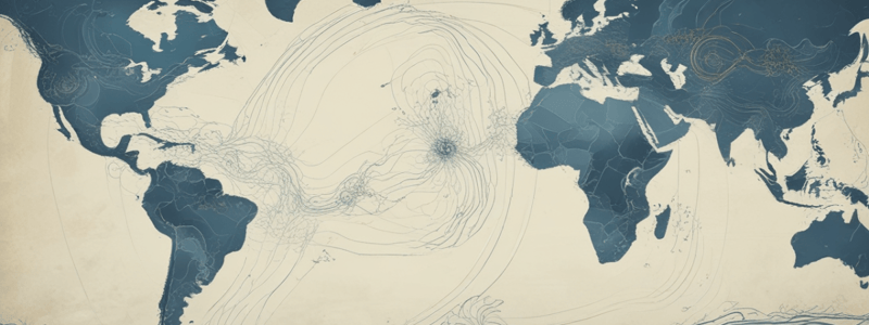
The Ocean's Surface Circulation
- Ocean currents are generated by the transfer of energy from wind to water.
- Major surface currents are closely related to global patterns of prevailing winds.
- The distribution of landmasses and the Coriolis Effect also influence surface currents.
- Large, circular-moving surface currents (gyres) are located within each ocean basin.
- There are 5 main gyres: North Pacific, South Pacific, North Atlantic, South Atlantic, and Indian Ocean.
- The center of each gyre is located at approximately 30° north or south latitude, referred to as subtropical gyres.
Coriolis Effect
- Due to Earth's eastward rotation, free-flowing objects are deflected to the right of their apparent direction in the Northern Hemisphere and to the left in the Southern Hemisphere.
- This deflection is termed the Coriolis Effect.
Ocean Gyres
- North Pacific Gyre: consists of North Equatorial Current, Kuroshio Current, North Pacific Current, and California Current; takes approximately 6 years to complete.
- North Atlantic Gyre: consists of North Equatorial Current, Gulf Stream, North Atlantic Current, and Canary Current; takes approximately 3 years to complete.
- Large gyres develop a central area with no well-defined currents, such as the Sargasso Sea in the North Atlantic.
- South Pacific Gyre: consists of South Equatorial Current, East Australian Current, West Wind Drift, and Peru Current.
- South Atlantic Gyre: consists of South Equatorial Current, Brazil Current, West Wind Drift, and Benguela Current.
- Indian Ocean Gyre: consists of South Equatorial Current, Agulhas Current, West Wind Drift, and West Australian Current; influenced by monsoons.
Surface Currents and Climate
- Surface currents have a pronounced influence on climate.
- Ocean water accounts for ¼ of the total heat transport, while winds account for the remaining ¾.
- Poleward-moving warm currents warm the regions they flow near, such as the Gulf Stream and East Australian Current.
- Equatorial-moving cool currents cool the regions they flow near, such as the Canary Current and Peru Current.
- The California Current lowers temperatures in Southern California by nearly 11° F compared to the same latitudes on the US East Coast.
Upwelling and Deep-Ocean Circulation
- Surface currents generate vertical movements of water (upwelling and downwelling).
- Upwelling is the rising of cold water from deeper water to replace warmer surface water.
- Coastal upwelling occurs in regions when winds blow parallel to the coast and toward the equator.
- Upwelling brings higher concentrations of dissolved nutrients to the surface, promoting primary productivity.
- Deep-ocean circulation is responsible for the mixing of seawater, with a significant vertical component due to density differences.
- Thermohaline circulation begins in high-latitude areas where cold seawater freezes into sea ice, increasing the salinity and density of the surrounding water.
The Shoreline: A Dynamic Interface
- Shorelines are dynamic locations that vary in topography, geology, and climate.
- Shorelines are the transition zone of sediment deposition between the marine and continental environments.
- The shore is the interface of the air, land, and sea.
- Wave activity continually changes the shoreline, with some changes occurring rapidly and others slowly.
- Human activities, such as overdevelopment and unsustainable resource use, can also impact shorelines.
Ocean Waves
- Ocean waves are energy traveling along the interface between seawater and the atmosphere.
- Wave characteristics include wave height, wavelength, and wave period.
- The height, length, and period of a wave are dependent on wind speed, duration, and fetch.
- As waves approach the shore, the water becomes shallower, and the waves begin to "feel" the bottom.
- Waves eventually break, creating turbulent water (surf) and a turbulent sheet of water moving up the beach slope (swash).
Beaches and Shoreline Processes
- Beaches are accumulations of sediment along the landward edge of an ocean, marginal sea, or lake.
- Beaches are composed of material that is locally available.
- Beach material can come from erosion of beach cliffs or coastal mountains, or from rivers.
- Some beaches have a large biological component, such as shells and coral.
- Beaches are constantly moving along the shoreline due to wave activity.
- Wave erosion can be caused by pressure, wave impact forces, and abrasion.
- Breaking waves can cause sediment to move toward and away from the shoreline.
- Wave refraction (the slowing and bending of waves in shallow water) plays an important role in the distribution of wave energy along the shore.Here are the study notes for the text:
Beaches and Shoreline Processes
- Waves reaching the shore at an angle generate a swash that is not perpendicular to the beach face, resulting in a zigzag pattern of sediment movement along the beach face, known as beach drift.
- Non-perpendicular waves also generate a longshore current that flows parallel to the shore, which moves more sediment than the beach drift.
- The direction of longshore currents can vary daily and seasonally with the direction of the approaching waves.
Shoreline Features
- Shorelines vary in terms of features, which are the result of rock types, wave intensity, coastal currents, and whether the coast is stable, sinking, or rising.
- Features developed from erosion are called erosional features, while those developed from sediment deposition are called depositional features.
- Erosional features:
- Headlands are eroded as the shoreline retreats, leading to the formation of wave-cut cliffs.
- Sea caves can form at the base of cliffs, which can eventually erode to the opposite side, forming a sea arch.
- If erosion continues, the top of the arch may collapse, producing a sea stack.
- Depositional features:
- Beaches are the most prominent feature of depositional shores.
- Spits are linear ridges of sediment that extend from land into deeper water near the mouth of a bay.
- Tidal currents can keep the mouth of a bay open, but if not, the spit may completely cut off the bay from the open ocean, forming a bay barrier or bay-mouth bar.
- A tombolo is a ridge of sand that connects an island or sea stack to the mainland.
Barrier Islands
- The US Atlantic and Gulf Coasts are relatively flat and have a gentle slope, and barrier islands are common in these regions.
- Barrier islands are defined as low ridges of sand that parallel the coast at distances from 2 to 20 miles offshore.
- These features develop in various ways, including:
- Spits that were cut off from the mainland by wave erosion or by a rise in sea level.
- Deposits of sand piled up by turbulent waters.
- Sand dunes that developed during the last glacial episode and were cut off from the mainland by rising sea waters.
Stabilizing the Shore
- Humans have utilized coastal areas inappropriately, leading to erosion and property damage.
- Factors affecting erosion include:
- Proximity to sediment-laden rivers.
- Degree of tectonic activity.
- Topography and composition of the land.
- Prevailing winds and weather patterns.
- Configuration of the coastline and nearshore areas.
- Hard stabilization structures, such as:
- Jetties.
- Groins.
- Breakwaters.
- Seawalls.
- Alternative solutions:
- Beach nourishment: adding large quantities of sand to the beach.
- Relocation: removing or relocating storm-damaged property and letting nature reclaim the beach.
Contrasting America's Coasts
- The Pacific, Atlantic, and Gulf Coasts of the United States have different geological characteristics.
- The west coast is the leading edge of the North American plate, experiencing deformation and uplift.
- The east coast is tectonically inactive.
- Barrier islands absorb a good portion of a storm's energy, causing extensive modification of these islands.
Tides
- Tides are daily changes in the elevation of the ocean surface.
- The gravitational attraction between the Earth, moon, and sun generates a bulge on both sides of the Earth.
- The Moon's position changes slightly during the day, resulting in two high tides and two low tides each day.
- The lunar bulges migrate as the Moon revolves around the Earth, resulting in a 50-minute delay in tidal cycles each day.
- The Sun's tide-generating effect is only about 46% that of the moon.
- Spring tides occur during the new and full moon, resulting in a large tidal range.
- Neap tides occur during the ¼ and ¾ moon phases, resulting in a lower tidal range.
- Tidal patterns: diurnal, semidiurnal, and mixed.
Tidal Currents
- Tidal currents are the horizontal flow of water associated with the rise and fall of the tide.
- Flood currents move into a coastal zone as the tide rises, while ebb currents move out of a coastal zone as the tide falls.
- Slack water is the term used to describe periods of little or no current.
- Tidal flats are areas affected by these tidal currents, which can vary greatly in size and shape.
- Tidal deltas are created by tidal currents, either as flood deltas landward of an inlet or as ebb deltas on the seaward side of an inlet.
Studying That Suits You
Use AI to generate personalized quizzes and flashcards to suit your learning preferences.