Podcast
Questions and Answers
What is a characteristic of renewable natural resources?
What is a characteristic of renewable natural resources?
- They can be replenished naturally (correct)
- They are only found in urban areas
- They are only used for economic gain
- They are finite in quantity
What is a social factor that influences human settlement?
What is a social factor that influences human settlement?
- Climate
- Topography
- Mineral deposits
- Culture (correct)
What is the term for the study of the shape and features of the Earth's surface?
What is the term for the study of the shape and features of the Earth's surface?
- Natural Resource Management
- Climate Science
- Cartography
- Geomorphology (correct)
What is the purpose of map projections in cartography?
What is the purpose of map projections in cartography?
Which of the following is a characteristic of tropical climate zones?
Which of the following is a characteristic of tropical climate zones?
What is the term for the natural features of the Earth's surface, such as mountains and valleys?
What is the term for the natural features of the Earth's surface, such as mountains and valleys?
What is the ratio of map distance to real-world distance in cartography?
What is the ratio of map distance to real-world distance in cartography?
What is the process of human settlement influenced by?
What is the process of human settlement influenced by?
Flashcards are hidden until you start studying
Study Notes
Natural Resources
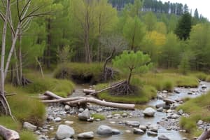
- Definition: Natural resources are elements of the natural environment that can be used for economic gain or human well-being.
- Types of natural resources:
- Renewable resources: Can be replenished naturally, e.g., solar energy, wind, water, and forests.
- Non-renewable resources: Cannot be replenished in a short period, e.g., fossil fuels, minerals, and metals.
- Importance: Natural resources are essential for human survival, economic development, and environmental sustainability.
Human Settlement
- Definition: Human settlement refers to the process of people settling in a particular area, leading to the formation of cities, towns, and villages.
- Factors influencing human settlement:
- Physical factors: Climate, topography, soil, and natural resources.
- Economic factors: Job opportunities, transportation, and infrastructure.
- Social factors: Culture, education, and healthcare.
- Types of human settlements:
- Urban: Cities and towns with high population density.
- Rural: Countryside areas with low population density.
Geomorphology
- Definition: Geomorphology is the study of the shape and features of the Earth's surface.
- Key concepts:
- Landforms: Natural features such as mountains, valleys, and plateaus.
- Processes: Weathering, erosion, and deposition that shape the Earth's surface.
- Landscapes: Combination of landforms and features that make up a region.
Cartography
- Definition: Cartography is the study and practice of creating maps to represent geographic data.
- Key concepts:
- Map projections: Methods of representing the curved Earth's surface on a flat map.
- Scale: The ratio of map distance to real-world distance.
- Symbols: Visual representations of geographic features, such as points, lines, and areas.
Climate Zones
- Definition: Climate zones are regions with similar climate characteristics, such as temperature, precipitation, and seasonal patterns.
- Classification:
- Tropical: Hot and humid, near the equator.
- Temperate: Mild temperatures and moderate precipitation, mid-latitudes.
- Polar: Cold and icy, high-latitudes.
- Arid: Dry and hot or cold, low-latitude deserts.
- Importance: Understanding climate zones is crucial for agriculture, urban planning, and environmental management.
Natural Resources
- Natural resources are essential for human survival, economic development, and environmental sustainability.
- There are two types of natural resources: renewable and non-renewable resources.
- Renewable resources can be replenished naturally, such as solar energy, wind, water, and forests.
- Non-renewable resources cannot be replenished in a short period, such as fossil fuels, minerals, and metals.
Human Settlement
- Human settlement refers to the process of people settling in a particular area, leading to the formation of cities, towns, and villages.
- Physical factors such as climate, topography, soil, and natural resources influence human settlement.
- Economic factors such as job opportunities, transportation, and infrastructure also influence human settlement.
- Social factors such as culture, education, and healthcare influence human settlement.
- There are two main types of human settlements: urban and rural.
- Urban settlements are cities and towns with high population density.
- Rural settlements are countryside areas with low population density.
Geomorphology
- Geomorphology is the study of the shape and features of the Earth's surface.
- Landforms are natural features such as mountains, valleys, and plateaus.
- Processes such as weathering, erosion, and deposition shape the Earth's surface.
- Landscapes are the combination of landforms and features that make up a region.
Cartography
- Cartography is the study and practice of creating maps to represent geographic data.
- Map projections are methods of representing the curved Earth's surface on a flat map.
- Scale is the ratio of map distance to real-world distance.
- Symbols are visual representations of geographic features, such as points, lines, and areas.
Climate Zones
- Climate zones are regions with similar climate characteristics, such as temperature, precipitation, and seasonal patterns.
- There are four main climate zones: tropical, temperate, polar, and arid.
- Tropical climate zones are hot and humid, near the equator.
- Temperate climate zones have mild temperatures and moderate precipitation, in mid-latitudes.
- Polar climate zones are cold and icy, in high-latitudes.
- Arid climate zones are dry and hot or cold, in low-latitude deserts.
- Understanding climate zones is crucial for agriculture, urban planning, and environmental management.
Studying That Suits You
Use AI to generate personalized quizzes and flashcards to suit your learning preferences.