Podcast
Questions and Answers
Who is Albert Lin in the context of archaeological exploration?
Who is Albert Lin in the context of archaeological exploration?
- An engineer
- A teacher
- An archaeologist (correct)
- A doctor
What technology is used to obtain aerial pictures of a region?
What technology is used to obtain aerial pictures of a region?
- GPS
- Infrared cameras
- Magnetometer
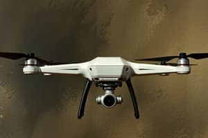
- Drones (correct)
Which tool is primarily used to locate underground objects?
Which tool is primarily used to locate underground objects?
- Optical scanner
- Magnetometer
- GPS
- GPR (correct)
What does the GPS in your mobile device use to determine locations?
What does the GPS in your mobile device use to determine locations?
Which technology measures the magnetic field underground for archaeological purposes?
Which technology measures the magnetic field underground for archaeological purposes?
Flashcards are hidden until you start studying
Study Notes
Albert Lin and Modern Archaeology
- Albert Lin is an archaeologist utilizing modern technology to explore archaeological sites non-invasively.
Remote Sensing Technologies
- Drones are employed to capture aerial images, enhancing archaeological research without the need for excavation.
- Ground Penetrating Radar (GPR) is a tool used to identify and analyze buried objects by sending radar pulses into the ground.
Global Positioning System (GPS)
- GPS technology, integral to mobile devices, connects to satellites to accurately determine and share locations.
Archaeological Tools
- Satellites serve as an essential tool for photographers to capture images of the Earth from above for archaeological analysis.
- A magnetometer measures variations in the Earth's magnetic field, assisting archaeologists in detecting underground features.
- Ground Penetrating Radar (GPR) aids archaeologists in exploring objects located beneath the surface, contributing to significant findings in archaeology.
Communication and Location Sharing
- Sharing location via messaging platforms like WhatsApp indicates the use of GPS technology by individuals to communicate their whereabouts.
Studying That Suits You
Use AI to generate personalized quizzes and flashcards to suit your learning preferences.


