Podcast
Questions and Answers
What percentage of wind speeds exceeding force 8 Beaufort is used to determine the Summer zone?
What percentage of wind speeds exceeding force 8 Beaufort is used to determine the Summer zone?
- 20%
- 1%
- 10% (correct)
- 5%
What is the maximum load line mark a ship can reach when in a Tropical zone with seawater density of 1.025?
What is the maximum load line mark a ship can reach when in a Tropical zone with seawater density of 1.025?
- The upper edge of the line marked LT/ T (correct)
- The upper edge of the line marked LS/ S
- The upper edge of the line marked LW/ W
- The centre of the load line disc
What is the primary purpose of Load Line Zones?
What is the primary purpose of Load Line Zones?
- To regulate the speed of a ship in different sea areas
- To ensure the safety of a ship in various weather conditions (correct)
- To determine the fuel efficiency of a ship
- To determine the maximum cargo capacity of a ship
What is the definition of a Winter zone in terms of wind speed and tropical storms?
What is the definition of a Winter zone in terms of wind speed and tropical storms?
What is the importance of ensuring the appropriate load line is not submerged during a voyage?
What is the importance of ensuring the appropriate load line is not submerged during a voyage?
What is the significance of the line marked LS/ S in Load Line Zones?
What is the significance of the line marked LS/ S in Load Line Zones?
What is the primary purpose of the Load Line markings on a vessel?
What is the primary purpose of the Load Line markings on a vessel?
What is the distance from the centre of the Load Line Disc to the vertical line from which the Load Lines extend?
What is the distance from the centre of the Load Line Disc to the vertical line from which the Load Lines extend?
What is the Winter North Atlantic (WNA) Load Line marking relative to the Winter Load Line marking?
What is the Winter North Atlantic (WNA) Load Line marking relative to the Winter Load Line marking?
What is the percentage of the summer draft marked above the Summer Load Line to indicate the Tropical Load Line?
What is the percentage of the summer draft marked above the Summer Load Line to indicate the Tropical Load Line?
What is the name of the horizontal line that marks the upper surface of the freeboard and passes through the upper surface of the freeboard?
What is the name of the horizontal line that marks the upper surface of the freeboard and passes through the upper surface of the freeboard?
What was the main reason for the sinking of over 500 English ships in one year during the 1800's?
What was the main reason for the sinking of over 500 English ships in one year during the 1800's?
What is the primary purpose of the Plimsoll mark on a ship?
What is the primary purpose of the Plimsoll mark on a ship?
What is the name of the load line marking that indicates the maximum draft for a vessel in fresh water?
What is the name of the load line marking that indicates the maximum draft for a vessel in fresh water?
What is the International Load Line used for?
What is the International Load Line used for?
What is the name of the Englishman who devised a means to calculate a ship's capacity?
What is the name of the Englishman who devised a means to calculate a ship's capacity?
How many types of Load Line markings are there?
How many types of Load Line markings are there?
What is one of the factors that affects a vessel's draft allowance?
What is one of the factors that affects a vessel's draft allowance?
Flashcards are hidden until you start studying
Study Notes
Load Lines and Fresh Water Allowance
- In the 1800s, overloaded merchant ships often sank in stormy seas, leading to the development of the Plimsoll mark by Samuel Plimsoll to calculate a ship's capacity and mark its safe load limit.
- The Plimsoll mark is now known as the International Load Line.
Types of Load Line Markings
- There are two types of Load Line markings: Standard Load Line markings (applicable to all types of vessels) and Load Line Zones (seasonal zones, areas, and periods that determine the appropriate load line).
Load Line Zones
- Summer zones: regions where not more than 10% of wind speeds exceed force 8 Beaufort (34 knots).
- Tropical zones: regions where not more than 1% of wind speeds exceed force 8 Beaufort (34 knots) and not more than one tropical storm in a ten-year period occurs in an area of 50 Latitude/Longitude square in any one separate calendar month.
- Winter zones: all other regions.
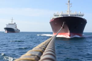
- A ship must ensure that the appropriate load line is not submerged at all times during its voyage.
Load Line Markings
- The complete Load Line markings consist of three vital parts: Deck Line, Load Line Disc, and Load Lines.
- Deck Line: a horizontal line measuring 300mm by 25mm that passes through the upper surface of the freeboard.
- Load Line Disc: a 300mm diameter and 25mm thick round-shaped disc intersected by a horizontal line, with the upper edge of the horizontal line marking the 'Summer salt water line' or 'Plimsoll Line'.
- Load Lines: horizontal lines extending forward and aft from a vertical line, measuring 230mm by 25mm, indicating the maximum depths to which the ship may be submerged in different seasons and circumstances.
Load Line Markings (Seasonal and Circumstantial)
- S (Summer): the basic freeboard line at the same level as the Plimsoll Line.
- T (Tropical): 1/48th of summer draft marked above the Summer load line.
- W (Winter): 1/48th of summer draft marked below the Summer load line.
- WNA (Winter North Atlantic): marked 50mm below the Winter load line, applicable to voyages in North Atlantic (above 36 degrees of latitude) during winter months for ships with a length not exceeding 100m.
- F (Fresh Water): the summer fresh water load line.
Fresh Water Allowance
- Fresh water marks are used to determine the vessel's draft allowance due to water density.
- The fresh water allowance is calculated based on the vessel's load line and water density.
Studying That Suits You
Use AI to generate personalized quizzes and flashcards to suit your learning preferences.