Podcast
Questions and Answers
Which of the following is NOT a primary reason for studying marine sediment?
Which of the following is NOT a primary reason for studying marine sediment?
- To understand past climate conditions
- To understand the impact of seafloor habitat on fisheries
- To determine real estate values along coastlines (correct)
- To safely route cables and offshore structures
The Deep Sea Drilling Project was initiated in 1983 with the collaboration of 20 countries.
The Deep Sea Drilling Project was initiated in 1983 with the collaboration of 20 countries.
False (B)
What grain size range is typically observed in terrigenous sediment?
What grain size range is typically observed in terrigenous sediment?
clay to boulders
Distribution of terrigenous sediment is closely tied to ______ winds.
Distribution of terrigenous sediment is closely tied to ______ winds.
Match the following sediment types with their primary components:
Match the following sediment types with their primary components:
Which of the following is a characteristic feature of siliceous ooze?
Which of the following is a characteristic feature of siliceous ooze?
Diatom photosynthesis is responsible for producing a small fraction of the oxygen on Earth.
Diatom photosynthesis is responsible for producing a small fraction of the oxygen on Earth.
What process occurs at the Carbonate Compensation Depth (CCD)?
What process occurs at the Carbonate Compensation Depth (CCD)?
Methane hydrate is formed when bacteria decompose organic material trapped in seafloor sediment under cold temperatures and high ______.
Methane hydrate is formed when bacteria decompose organic material trapped in seafloor sediment under cold temperatures and high ______.
Match the following hydrogenous sediment types with their formation environments:
Match the following hydrogenous sediment types with their formation environments:
Which property of water allows it to dissolve almost any substance?
Which property of water allows it to dissolve almost any substance?
Water has its maximum density at 0°C.
Water has its maximum density at 0°C.
What two factors primarily affect the density of seawater?
What two factors primarily affect the density of seawater?
The ______ zone is the region of the ocean that receives sufficient light for photosynthesis.
The ______ zone is the region of the ocean that receives sufficient light for photosynthesis.
Match the following atmospheric circulation cells with their locations:
Match the following atmospheric circulation cells with their locations:
Flashcards
Why study marine sediments?
Why study marine sediments?
Past climates are understood through the study of marine sediments, which helps in making better predictions.
Taking Sediment Samples
Taking Sediment Samples
A method of studying marine sediment which involves physically collecting samples from the seabed
Terrigenous Sediment
Terrigenous Sediment
Sediment derived from land sources; also known as Lithogenous sediment.
Biogenous Sediment
Biogenous Sediment
Signup and view all the flashcards
Siliceous Ooze
Siliceous Ooze
Signup and view all the flashcards
Calcareous Ooze
Calcareous Ooze
Signup and view all the flashcards
Hydrogenous Sediment
Hydrogenous Sediment
Signup and view all the flashcards
Atom
Atom
Signup and view all the flashcards
Ion
Ion
Signup and view all the flashcards
Molecule
Molecule
Signup and view all the flashcards
Covalent Bond
Covalent Bond
Signup and view all the flashcards
Heat Capacity
Heat Capacity
Signup and view all the flashcards
Salinity
Salinity
Signup and view all the flashcards
Attenuation (Light)
Attenuation (Light)
Signup and view all the flashcards
Photic Zone
Photic Zone
Signup and view all the flashcards
Study Notes
Marine Sediment Study
- Studying marine sediment enables understanding of past climate conditions for better predictions.
- It helps in understanding the impact of seafloor habitats on fisheries and marine organisms.
- It is used to understand pollution patterns and mechanisms.
- Marine sediment study contributes to safely routing cables and constructing offshore structures.
- It is necessary for extracting offshore seabed resources.
- Studying marine sediment aids in understanding Earth's environmental systems and their functions.
Methods to Study Marine Sediment
- Marine sediment is studied by taking samples using various tools: sediment grab, gravity corer, piston corer, drilling, and dredging.
- Another method involves looking at the bottom of the sea using video cameras and remotely operated vehicles (ROVs).
Drilling Projects
- The Deep Sea Drilling Project started in 1968 with the U.S. Glomar Challenger.
- The Ocean Drilling Program began in 1983 with 20 countries participating, under JOIDES ‘85.
- The Integrated Ocean Drilling Program started in 2003, led by the U.S., Japan, Europe, China, and Korea, reaching 2466m below the seafloor in 2012.
Sediment Classification
- Sediment is classified by its origin into four types: terrigenous, biogenous, hydrogenous, and cosmogenous.
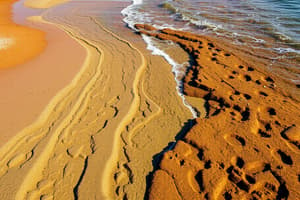
Terrigenous Sediment
- Terrigenous sediment is derived from land.
- It is transported to the ocean by rivers, wind, glaciers, and gravity.
- Asia contributes 80% of terrigenous sediment.
- Rafting is a major transport vector
- Smaller particles travel farther.
- Distribution of terrigenous sediment is closely tied to prevailing winds.
- It is mainly composed of quartz, which is strong and resistant to abrasion/erosion.
- Particle sizes range from clay to boulders.
- An example includes African wind dust and beach sand.
- Terrigenous sediments are found in neritic zones close to shore, beaches, continental margins & shelves, turbidites, and glacial deposits.
- In deep ocean areas, abyssal clay is found.
- Uses of terrigenous sediment include sand & gravel, aggregate in concrete, seabed mining, fill material in grading projects, beach renourishment, and valuable minerals.
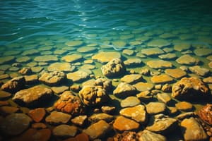
Biogenous Sediment
- Biogenous sediment consists of siliceous & calcareous materials, which are hard part remnants of organisms.
- It is both macroscopic and microscopic, with microscopic forms being more common and useful.
- Microscopic biogenous ooze contains ≥ 30% of biogenous remains.
Siliceous Ooze
- Siliceous ooze contains organisms with silica shells, such as diatoms (plants) and radiolarians (animals).
- It is found in areas of strong upwelling, high nutrients, the equator, and polar regions (60°C N/S).
Diatoms
- Diatoms are phytoplankton that are micro in size (<2 mm).
- Centric diatoms are planktonic.
- Pennate diatoms form on the shallow sea floor or float.
- The frustule is a pill box-shaped, hard, rigid, transparent structure that can form long chains, make and store oil, and is most abundant in cold, nutrient-rich water.
- They reproduce asexually and sexually, with division occurring every 12-24 hours under ideal conditions, and produce resting spores under unfavorable conditions.
- Diatoms are mined as diatomaceous earth.
- Uses include soil conditioners, filters (pools, wine, beer), abrasives (silver polish, toothpaste, facial scrubs), concrete, drywall, paint, space shuttle tiles, absorbents, and optical glass.
- Diatom photosynthesis is responsible for producing most of the O₂ in the atmosphere.
Radiolarians
- Radiolarians capture food using pseudopodia.
- They are single-celled and microscopic.
- Ornamentation increases surface area.
Calcareous Ooze
- Calcareous ooze is made of organisms with calcium carbonate shells, such as coccolithophores (plants) and foraminiferans (animals).
- It is found in shallow, warm waters and dissolves in cold water.
- The Carbonate Compensation Depth (CCD) marks when accumulation equals dissolution, occurring at 4500m depth.
- It can forms chalk, limestone, which takes acid from soil and causes caves to form.
Coccolithophores
- Coccolithophores are mostly < 20 µm in size.
- Spherical cells with flagella are covered in plates (coccoliths), which are the size of bacteria.
- They are highly reflective and can cause huge blooms, having possible global climate implications.
Foraminiferans
- Foraminiferans are single-celled, multi-chambered organisms.
- They have spines that increase surface area and use pseudopodia.
- The chalky cliffs of Dover contain remains of coccolithophores and foraminiferans.
- Sandstone blocks used to build the pyramids contain remains of foraminiferans.
- Tiny remains take 20-50 years to reach the seafloor, but fecal pellets speed up the process in 2 weeks.
Petroleum and Methane Hydrate
- Petroleum forms under pressure and with time from biogenous ooze remains.
- Methane hydrate forms when bacteria decompose organic material trapped in seafloor sediment, freezing under cold temperatures and high pressure, found on continental margins below 525m deep, and may be a future energy source.
Oolite Sand
- Oolite sand is found in the Bahamas.
- It requires warm water and abundant phytoplankton.
- CO2 removed, water is more basic
- Calcium carbonate precipitates around particles
Hydrogenous Sediment
- Hydrogenous sediment forms when chemical reactions within seawater cause minerals to solidify.
- It needs a change in conditions such as temperature, pressure, or chemical changes.
- Carbonates like limestone form aragonite & calcite in shallow tropical waters.
- Metal sulfides are associated with hydrothermal vents, seafloor spreading transports sediment across floor, iron, nickel, silver, copper and zinc
- Manganese nodules are round, hard lumps of manganese and iron, growing at a rate of 1cm/my, found 5-20 cm deep on the ocean floor.
- Uses include manganese for steel alloys, copper for wiring and pipes, nickel for stainless steel, and cobalt for alloys with iron to make magnets, steel tools, and airplane parts.
Evaporites & Phosphates
- Evaporites form from evaporation leaving salts behind.
- Halite becomes table salt and is used in water conditioners, agriculture, and dying fabric.
- Gypsum is used in plaster of Paris and gypsum board.
- Phosphates are coatings on rocks on continental shelves and banks < 1000m deep and are valuable as fertilizers.
Cosmogenous Sediment
- Cosmogenous sediment includes tektites from meteor impacts and space dust.
- A cosmogenous sediment is used for identifying the KT boundary.
Sediments Mixing
- Marine sediments are rarely pure.
- Oozes mix together.
- Clay is ubiquitous.
- Biogenous ooze must be ≥ 30% of the material.
- Sediment is named based on the dominant type present.
Water Molecule Properties
- An atom is the smallest piece of an element.
- An ion is an atom with an unequal amount of protons and electrons.
- A molecule is a group of atoms held together by chemical bonds.
- A covalent bond is a shared electron.
- The water molecule has hydrogens on the same side of oxygen, resulting in an unusual bent geometry with a positive H side and a negative O side.
- Water molecules are polar.
- Water can dissolve almost any substance due to its polarity.
Hydrogen Bonds
- Hydrogen bonds bind water molecules together.
- They are weaker than covalent bonds.
- Hydrogen bonds are constantly forming.
- These bonds contribute to water's high solubility, unusual thermal properties, adhesive & cohesive properties, high surface tension, and blue color.
- Water exists in 3 states.
- Water is held in solid-state by Van der Waals forces (all solids) and hydrogen bonds (ice only).
- Changing state requires breaking/forming bonds and adding/releasing heat.
- It takes a lot of heat to change water into ice/vapor.
Heat Measurement
- Heat is measured in calories.
- A calorie is the amount of heat needed to raise the temperature of 1 g of water by 1°C.
- Temperature is the average kinetic energy of atoms and molecules in a substance.
- Heat is the total kinetic energy of atoms or molecules in a substance.
Latent Heat
- Latent heat is present or potential but not evident or active.
- Latent heat marks the moment of change between states and indicates a change in physical state, not temperature.
- The latent heat of melting is 80 cal/g/C, occurring at 0°C.
- The latent heat of vaporization is 540 cal/g/°C, occurring at 100°C.
Evaporation
- Heat for evaporation comes from nearby molecules.
- Evaporation is the change from liquid to vapor.
- Evaporation occurs at the surface of the liquid.
- Evaporation cools because as molecules escape as vapor, the remaining molecules have a lower kinetic energy.
- Evaporation in relation to oceans creates a mechanism for global heat transfer.
- Water evaporates at the equator, absorbs heat, and cools the area and then condenses at polar regions, releasing heat, and warms them.
Heat Capacity
- Heat capacity is the measure of heat required to raise the temperature of 1 g of a substance by 1°C.
- Water has high heat capacity.
- It requires energy to increase temperature due to H bonds.
- Water is used as a coolant.
- Ocean temperatures remain relatively constant.
- Ocean currents spread heat around the globe.
- Land temperature ranges from -50℃ to 50℃, while ocean temperature ranges from -2℃ to 28℃.
- Water absorbs/releases large quantities of heat without changing temperature.
Water Density
- Water density (D) is calculated as mass/volume (m/v).
- Maximum density (1 g/cm³) occurs at 4°C.
- Water density varies with temperature and salinity.
- Colder temperature leads to lower energy, more densely packed molecules, and higher density.
- Denser materials sink below less dense materials.
Salt Water Properties
- Saltwater does not freeze easily.
- Salt interferes with crystal formation.
- Saltwater can be denser than freshwater.
- Ice floats because it's less dense than water.
- Ice crystals take up more space.
- Water expands as it freezes.
- 24 ice molecules per 27 water molecules in any volume when it freezes.
- Oceans have negative temperatures due to salt and pressure.
Cohesion, Surface Tension, & Viscosity
- Cohesion: H bonds hold water molecules together
- Surface tension measures how difficult it is to stretch/penetrate the surface of a liquid.
- It is the ability of water to cling to itself and other surfaces.
- Increasing salt or decreasing temperature will increase surface tension.
- Viscosity is resistance to motion or internal friction.
- It is resistance to flow.
- Colder water is more viscous.
- Halobates are the only pelagic insect.
Tuvalu
- Tuvalu is an island nation with 4 reefs and 5 atolls.
- It is experiencing sea level rise because of melting terrestrial ice and the thermal expansion of oceans.
Ocean Salinity
- Rain dissolves rocks.
- Ions accumulate in the ocean.
- Salinity is based on the balance between input/output of ions.
- It has been nearly constant over the past 4 billion years at approximately 35 ppt.
- Ions enter the ocean via rivers, volcanic activity, groundwater, hydrothermal vents, and the decay of organisms.
- Ions leave the ocean through chemical entrapment at ridges, sea spray, uptake by organisms, incorporation into sediments, and subduction.
- Salinity is the total amount of solid inorganic material dissolved in water.
- Chloride is the most abundant ion in the ocean.
- Nitrogen and Phosphorus are major nutrients that exist as trace elements in the ocean.
Determining Salinity
- Salinity can be determined by chlorinity and refractometry, or conductivity.
- Determining by Chlorinity: Measure just the amount of chloride because all salts exist in the same ratios in the ocean.
Principle of Constant Proportions
- Proportions of major conservative elements in seawater remain nearly constant, even if total salinity changes with location.
- Conservative constituents are elements that occur in constant proportion in seawater (e.g., Cl, Na, Mg).
- Nonconservative constituents vary with time and space, depending on biological demand or chemical reactivity (e.g., N, P, Fe, Al, O2, CO2).
Salinity Variations
- Salinity varies from brackish (low) to hypersaline (high).
- Factors that vary the amount of freshwater: increase (evaporation + sea ice formation) and decrease [precipitation + runoff + icebergs & sea ice melting].
- Factors that vary the salt content: increase[stream runoff + hydrothermal vent deposits] and decrease [salt spray + critter use + hydrothermal vent deposits].
- Brackish example → Baltic Sea 10 ppt
- Hypersaline example → Red Sea 42 ppt
- Over time these variations cancel out, keeping salinity content consistent.
Salinity Varies With Depth
- The deep ocean layer stays the same average 35 ppt
- Surface varies
- Polar lower salinity 33 ppt
- Equatorial higher salinity 37 ppt
- Halocline is a rapid change in salinity occurs at 300-1000 m depth
- Thermocline is rapid change in temperature, typically occurs with halocline
- Pycnocline is rapid change in density caused by the halocline & thermocline
- Density of seawater is affected by salinity and temperature
- Increasing salinity decreases the temperature of maximum density and freezing
Removing Salt From Seawater
- Distillation: boiling water & collecting vapor, using artificial or solar heat.
- Electrolysis: using electricity to separate ions.
- Positive salt ions on one side and negative salt ions on the other, middle is freshwater.
- Reverse osmosis: pushing water through a filter, trapping salt.
- Freeze separation: pushing out salt as seawater freezes (must repeat process).
pH Scale
- pH measures acidity or alkalinity.
- Acid has extra H⁺ ions and has a pH of <7.
- Base has extra OH ions and has a pH of >7.
- Pure water has a pH of 7.
- The Ocean has a pH of 8.1.
- Ocean pH stays constant due to the buffer system, that prevents changes in pH.
- Excess CO2 in water makes carbonic acid and bicarbonate.
- Ocean Acidification occurs when there's too much CO2.
Oxygen and Carbon Dioxide Variations
- Photosynthesis, which is well prevelant in lit surface waters, adds O2 and removes CO2.
- Respiration, which is prevelant throughout the water column, adds CO2 and removes O2.
- The Compensation Depth is where photosynthesis equals respiration, and oxygen is at a minimum.
Nutrients in Seawater
- Key nutrients include nitrate, phosphorus, and silicate.
- They are brought to oceans by freshwater runoff.
- Nutrients are low in concentrations.
- Concentrations are cyclical, decreasing as biological productivity removes them, and increasing as populations decline and decay return nutrients to water.
- Nutrients are non-conservative.
Light in the Ocean
- Attenuation is the decrease in the intensity of light over a distance.
- Attenuation depends on absorption & scattering, also depends on water clarity and wavelength of light.
- Light affects the color of water, vertical distribution of organisms, and the pigments organisms use.
- This explains why objects appear blue at depths, as only blue wavelengths penetrate and are reflected.
Photic Zone
- The photic zone is where marine life is richest.
- It receives sufficient light for photosynthesis.
- It supports phytoplankton, benthic algae and higher trophic levels (90% of marine life).
- The photic zone generates oxygen.
- It receives the most heat.
- The photic zone extends to 100 m deep in clear open ocean (max of 600 m), 15-40 m in the coastal ocean, and << 1 m in turbid lakes and shallow coastal areas.
- Depth varies with seasonal turbidity, river input, wind mixing, and phytoplankton densities.
Benthic Algae
- Benthic algae color depends on the pigments used to absorb light for photosynthesis.
- Green algae are nearer to the surface
- Brown algae are moderate in depth
- Red algae are located the deepest
Sound in the Ocean
- Sound transmits efficiently in water at 1500 m/s.
- It is used to locate organisms or objects by producing sounds or sending pulses of sound into water to be reflected back.
- Depth recorders routinely detect echoes coming from groups of small organisms that form dense layers at night as they rise to the surface to feed, then disperse through the day.
- The SOFAR (Sound Fixing and Ranging) Channel
- Temperature, pressure, and salinity create a velocity minimum zone at 1000 m
ATOC
- ATOC: Acoustic Thermometry of Ocean Climate.
- Warmer water = faster sound transmission.
- An explosion in Australia was heard in Bermuda.
- Named after life-saving technique
- Strange sounds are heard (whales).
Pressure in the Ocean
- 1 atm = 10 m
- Sperm whales can dive down to 2250 m, experiencing 223 atm.
Atmospheric Circulation
- The atmosphere and ocean are one interdependent system.
- Solar energy creates winds.
- Winds drive surface ocean currents and waves.
- Interactions influence Earth's average climate, local climate and weather patterns, El Nino southern oscillation, and hurricanes.
Earth's Atmosphere
- The atmosphere is composed mainly of nitrogen, oxygen, and water vapor.
- The lower atmosphere is homogeneous.
- Water vapor occupies up to 4% of the volume of the atmosphere.
- Air density is influenced by temperature and water content.
- Warm air is less dense, rises, holds water, and has low pressure.
- Cool air is more dense, sinks, holds little water, and has high pressure.
- Wind is air moving from high to low pressure.
Atmosphere and Oceans
- The atmosphere and oceans are two fluid bodies.
- The atmosphere surrounds Earth, and the ocean covers 71% of Earth's surface.
- Direct contact leads to constant interaction.
- Weather and climate is influenced by these interactions.
- Weather refers to conditions of the atmosphere at a particular time and place.
- Climate is the long time average of weather.
Air Density and Pressure
- Motion in the atmosphere results from density differences in air from one location to another.
- Density increases with decreasing temperature, altitude, and water vapor content, and increasing atmospheric pressure.
- Density decreases with increasing temperature, altitude, and water vapor content, and decreasing atmospheric pressure.
- The weight of air at the surface pushes down, creating pressure.
Uneven Solar Heating
- Caused by angle of incidence of solar rays (equatorial regions receive more heat than poles), thickness of atmosphere, albedo (reflectance), day/night, and seasons.
- Solar heating varies with the sun.
- Sun rays only strike earth at right angles between 23.5°N - 23.5° S.
- Equal amounts of sunlight are spread over a greater surface area at the poles than in the tropics.
- Sunlight passes through more of the atmosphere at the poles.
- Ice near poles reflects much of the energy that reaches the surface.
- Solar heating also varies with the seasons.
- Earth's ecliptic is nearly circular.
- Earth's axis of rotation is tilted with respect to the ecliptic.
- Tilt is responsible for seasons, Vernal & Autumnal equinox, Summer & Winter solstice.
- The Earth is in thermal equilibrium, but different latitudes are not.
- The ocean does not boil away near the equator or freeze solid near the poles because heat is transferred by winds and oceans currents from equatorial to polar regions via convection cells.
Coriolis Effect
- The Coriolis Effect deflects the path of moving objects.
- It is caused by the moving frame of reference on the spinning Earth and due to rotation east.
- Most pronounced on objects that move long distances across latitudes.
- Deflection is to the right in the northern hemisphere.
- Deflection is to the left in the southern hemisphere.
- Coriolis Effect is maximum at the poles.
- There is no Coriolis Effect at the equator.
- It affects moving air, water, and objects.
- The effect depends on the observer's frame of reference.
- Influences the movement of air in atmospheric circulation cells.
Earth's Air Circulation
- Modeled by a 6 cell model.
- 3 cells in each hemisphere.
- Polar, Ferrel, Hadley
- Circulation is complex due to seasonal changes, the distribution of continents and oceans, and the differences in heat capacity of contents and oceans.
- Land and Ocean respond differently to annual changes in solar radiation.
- Variations in sea surface temperature are 0° - 2° in tropics, 5° - 8° at middle latitudes, and 2° - 4° at poles.
Monsoons + Breezes
- Monsoons are patterns of wind circulation that change with the seasons.
- They create dry winters and wet summers.
- Jan-July winds deflect to the right in the northern hemisphere and to the left in the southern hemisphere.
- Sea breezes occur when cool air from over the water moves toward the land, occurring after sunrise.
- Land breezes occur when warm air on land blows towards the water, occurring after sunset.
- Sea and land breezes are the flow of air in coastal regions during stable weather conditions.
Storms
- Storms are variations in large-scale atmospheric circulation, regional atmospheric disturbances with high winds and precipitation.
- Tropical cyclones occur in tropical regions resulting in millions of dollars in damage, and endanger life
- Fall apart over land, equator, water < 24°C
- Transfer heat to higher latitudes
- Storms during a season: from June 1 - Nov 30
- Storms turn counterclockwise in the northern hemisphere
- Required conditions:
- Sea surface > 26°C
- Warm moist air to supply latent heat as water vapor
- Coriolis effect
- Extratropical cyclones: occur in ferrel cells during the winter bringing extensive damage.
Storms (Hurricanes)
- Both storms are cyclones aka rotating masses of low pressure air.
- Large rotating masses of low pressure and high humidity.
- Break away from the low-pressure equatorial belt.
- Hazards include strong winds, torrential rain, and storm surge.
- Hurricanes, typhoons, and cyclones willi-willis classified by maximum sustained winds.
- Destruction includes winds > 74 mph, flooding, and storm surge, most of the damage to coastal areas, decline in death but increase in cost of damages because of better warning systems and more expensive infrastructure.
Hurricane Katrina
- Gulf of Mexico
- Landfall 8/29/2005, New Orleans
- 175 mph winds
- 3-10 m storm surge
- 80% of New Orleans flooded
- 1500 dead
- $168 billion in damages
Storm Surges
- Storm surges are exacerbated by dredging and the destruction of wetlands.
- Storm surges are not tsunamis!
Long Island Express
- 1938
- Category 3
- 600 deaths
- $300 million in damages
- 5 m storm surge in Hamptons
- Landfall in Center Moriches
Studying That Suits You
Use AI to generate personalized quizzes and flashcards to suit your learning preferences.