Podcast
Questions and Answers
What does SENC stand for in the context of electronic navigation?
What does SENC stand for in the context of electronic navigation?
- Supreme Electronic Navigation Chart
- Stored Electronic Navigation Code
- System Electronic Navigation Chart (correct)
- Standard Electronic Navigation Control
Which of the following is NOT a function of ECDIS?
Which of the following is NOT a function of ECDIS?
- Replacing traditional paper nautical charts
- Offering interactive navigation features
- Providing static navigation (correct)
- Complying with IMO regulation
What is the primary purpose of an Electronic Navigational Chart (ENC)?
What is the primary purpose of an Electronic Navigational Chart (ENC)?
- To standardize data for use with ECDIS (correct)
- To store dynamic maritime weather data
- To replace paper charts without any additional features
- To provide supplementary information only
Which statement correctly describes the relationship between ENC and RNC?
Which statement correctly describes the relationship between ENC and RNC?
What is required for the SENC to comply with SOLAS Regulations?
What is required for the SENC to comply with SOLAS Regulations?
Which elements are common features found in both raster and vector charts?
Which elements are common features found in both raster and vector charts?
Which of the following best describes ECDIS?
Which of the following best describes ECDIS?
What does compliance with Regulation V/19 entail for shipborne navigational systems?
What does compliance with Regulation V/19 entail for shipborne navigational systems?
Which office is responsible for producing nautical charts in Canada?
Which office is responsible for producing nautical charts in Canada?
What distinguishes official charts from unofficial charts?
What distinguishes official charts from unofficial charts?
Which of the following is a private company that produces digital navigation charts?
Which of the following is a private company that produces digital navigation charts?
What is one main function of an Electronic Chart System (ECS)?
What is one main function of an Electronic Chart System (ECS)?
Which Hydrographic Office produces nautical charts for Japan?
Which Hydrographic Office produces nautical charts for Japan?
Which agency is known for providing nautical charts for South Korea?
Which agency is known for providing nautical charts for South Korea?
Which of the following is NOT typically a product of Hydrographic Offices?
Which of the following is NOT typically a product of Hydrographic Offices?
Which of these organizations regulates the production of official nautical charts in the United States?
Which of these organizations regulates the production of official nautical charts in the United States?
What is the primary function of an Electronic Chart Data Base (ECDB)?
What is the primary function of an Electronic Chart Data Base (ECDB)?
Which of the following statements accurately describes vector charts?
Which of the following statements accurately describes vector charts?
What does SOLAS Chapter V require concerning charts on ships?
What does SOLAS Chapter V require concerning charts on ships?
How do raster charts differ from vector charts?
How do raster charts differ from vector charts?
Which of the following features is NOT typically associated with vector charts?
Which of the following features is NOT typically associated with vector charts?
What is the primary benefit of digital representation of data in vector charts?
What is the primary benefit of digital representation of data in vector charts?
What is a characteristic common to both raster and vector charts?
What is a characteristic common to both raster and vector charts?
Which option describes a limitation of raster charts compared to vector charts?
Which option describes a limitation of raster charts compared to vector charts?
What occurs when an option button is activated?
What occurs when an option button is activated?
Which dialogue box allows users to enter alphanumeric values?
Which dialogue box allows users to enter alphanumeric values?
What action does a user take to switch between different sets of options in a Bookmark dialogue box?
What action does a user take to switch between different sets of options in a Bookmark dialogue box?
What is the purpose of a Push Button in a dialogue box?
What is the purpose of a Push Button in a dialogue box?
In which scenario would you use the Cancel option in a dialogue box?
In which scenario would you use the Cancel option in a dialogue box?
Which type of dialogue box allows users to select from a displayed list of values?
Which type of dialogue box allows users to select from a displayed list of values?
What does the Information Box display?
What does the Information Box display?
How can a user reveal the entire list in a Drop Down List Box?
How can a user reveal the entire list in a Drop Down List Box?
What action should be taken to activate the Route Plan window?
What action should be taken to activate the Route Plan window?
Which of the following is true about the Log Book?
Which of the following is true about the Log Book?
How can a target be hidden on the chart?
How can a target be hidden on the chart?
What does the Target Prediction function allow users to do?
What does the Target Prediction function allow users to do?
What is the purpose of the Lost Targets alarm?
What is the purpose of the Lost Targets alarm?
What happens when you double click on a target name?
What happens when you double click on a target name?
What function does the Own Vector Predictor serve in Target Prediction?
What function does the Own Vector Predictor serve in Target Prediction?
When does the Active Route plan button become disabled?
When does the Active Route plan button become disabled?
Flashcards are hidden until you start studying
Study Notes
Official and Unofficial Charts
- Official charts are produced by government-authorized Hydrographic Offices for marine navigation.
- NOAA, UKHO, AHO, CHS, JHOD, SHOM, NHS, INHO, KHOA, and CHM are notable hydrographic services in their respective countries.
- Unofficial charts come from private companies and may vary in data accuracy and completeness.
- Companies like Navionics, C-Map, Garmin, Jeppesen Marine, Transas, and iNavX produce electronic navigation charts.
Electronic Chart Systems and Databases
- An Electronic Chart System (ECS) displays electronic nautical charts and vessel position in near real-time but does not meet full ECDIS functionality.
- An Electronic Chart Database (ECDB) is the digital repository from which electronic charts are generated, acting as the master database.
Types of Electronic Charts
- Electronic charts (EC) come in two types: Vector and Raster.
- Vector Charts
- Represent data digitally as customizable objects, showing additional information on interaction.
- Allow alterations in depth units, safety depths, color schemes, and zoom detail.
- Raster Charts
- Image-based, resembling traditional paper charts with multiple zoom levels.
Regulatory Requirements
- SOLAS Chapter V mandates that all ships carry adequate and up-to-date charts necessary for their voyage.
System Electronic Navigation Chart (SENC)
- SENC is derived from ENC transformations, used by ECDIS, ensuring the data is up-to-date to comply with SOLAS regulations.
Electronic Navigational Chart (ENC)
- An ENC is standardized and issued by authoritative hydrographic offices, containing essential navigation information.
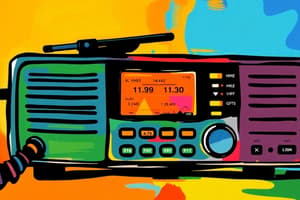
Electronic Chart Display and Information System (ECDIS)
- ECDIS is a computer-based navigation system that replaces traditional paper charts, providing an interactive and dynamic navigation experience.
- Regulates shipborne navigational equipment under IMO Regulation and SOLAS amendments.
ECDIS Interface Features
- Bookmark for accessing different sets of options.
- Option Button groups where only one option may be selected at a time.
- Input Box for entering numeric or alphanumeric data.
- Information Box for viewing data.
- Text Box and List Box for entering and selecting values, respectively.
- Drop Down List combines functionality of text and list boxes.
- Push Button for applying changes or exiting functions.
Navigation Functionality
- Man Overboard (MOB) alert to plot recovery points.
- Route Planning enables graphical route plotting and management.
- New logbook records and target setting integrated into ECDIS for efficient tracking and navigation.
- Target List displays and manages targets for navigation.
- Target Prediction functionality to estimate future locations based on current data.
- Docking Function aids in safe mooring and berthing.
Operational Integration
- ECDIS provides a comprehensive toolkit for modern maritime navigation, enabling effective route planning, real-time updates, and detailed vessel tracking.
Studying That Suits You
Use AI to generate personalized quizzes and flashcards to suit your learning preferences.