Podcast
Questions and Answers
Looking at the image, describe the impact of reclamation on flora and fauna.
Looking at the image, describe the impact of reclamation on flora and fauna.
Reclamation can alter the natural environment and may affect the environment in which plants and animals live.
What are the impacts of Windfall building on the environment and community?
What are the impacts of Windfall building on the environment and community?
Environmental impact: blocks ventilation, causes air pollutants to accumulate. Impact on residents: poor air circulation, streets become crowded, temperatures rise, increased spread of infectious diseases, affecting residents' health.
What factors should be considered when constructing buildings to reduce the impact on the environment and residents?
What factors should be considered when constructing buildings to reduce the impact on the environment and residents?
Factors to be considered include ventilation and building density.
What are the differences between Kwun Tong in the early days and now?
What are the differences between Kwun Tong in the early days and now?
How can the government overcome the limitations of the natural environment to increase land supply and develop Kwun Tong?
How can the government overcome the limitations of the natural environment to increase land supply and develop Kwun Tong?
What projects has the government undertaken to connect new towns and urban areas?
What projects has the government undertaken to connect new towns and urban areas?
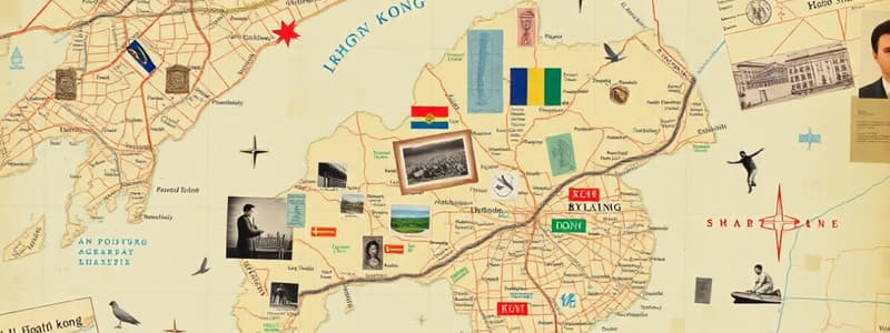
What basic information does a map provide?
What basic information does a map provide?
How can you find the location of objects on a map?
How can you find the location of objects on a map?
What are the steps for drawing a simple map?
What are the steps for drawing a simple map?
What are the effects of land reclamation on the environment?
What are the effects of land reclamation on the environment?
How does windfall building affect the environment and residents?
How does windfall building affect the environment and residents?
How to use electronic maps?
How to use electronic maps?
What help do legends and grid coordinates provide when viewing a map?
What help do legends and grid coordinates provide when viewing a map?
What map elements are missing from this map? Draw them on the map in the appropriate places.
What map elements are missing from this map? Draw them on the map in the appropriate places.
Hong Kong has more mountainous areas than flat land.
Hong Kong has more mountainous areas than flat land.
What problems does this topography pose for Hong Kong's development?
What problems does this topography pose for Hong Kong's development?
What are the three main areas of Hong Kong shown on the Hong Kong map?
What are the three main areas of Hong Kong shown on the Hong Kong map?
What can you see on the streets and buildings of Tsim Sha Tsui on the street map of Hong Kong?
What can you see on the streets and buildings of Tsim Sha Tsui on the street map of Hong Kong?
What common elements do maps have? Try to find them in these four maps and explain their uses.
What common elements do maps have? Try to find them in these four maps and explain their uses.
First go [blank] , pass by the lotus pond. The Arboretum and Hong Kong Museum of History are located [blank] of the Lotus Pond.
First go [blank] , pass by the lotus pond. The Arboretum and Hong Kong Museum of History are located [blank] of the Lotus Pond.
After visiting [blank], going [blank] will lead yo to the Bird Lake.
After visiting [blank], going [blank] will lead yo to the Bird Lake.
From Bird Lake, straight to the [blank] direction, you can leave the park from Exit 2.
From Bird Lake, straight to the [blank] direction, you can leave the park from Exit 2.
Hong Kong has more mountainous terrain and less flat land.
Hong Kong has more mountainous terrain and less flat land.
What is the distance between the distance of drinks cans in test one
What is the distance between the distance of drinks cans in test one
Match the location with grid square:
Match the location with grid square:
Flashcards
Hong Kong's main areas
Hong Kong's main areas
Hong Kong's three main areas are Hong Kong Island, Kowloon, and the New Territories.
Common map elements
Common map elements
Common map elements include a title, legend, scale, and direction indicator.
Map information varies
Map information varies
Maps provide different information; world maps show location, while street maps show streets and buildings.
Hong Kong's terrain
Hong Kong's terrain
Signup and view all the flashcards
Drawing a simple map
Drawing a simple map
Signup and view all the flashcards
Using map features
Using map features
Signup and view all the flashcards
Electronic map functions
Electronic map functions
Signup and view all the flashcards
Benefits of digital maps
Benefits of digital maps
Signup and view all the flashcards
Hong Kong's location
Hong Kong's location
Signup and view all the flashcards
Hong Kong terrain challenges
Hong Kong terrain challenges
Signup and view all the flashcards
Land reclamation impacts
Land reclamation impacts
Signup and view all the flashcards
Finding places on maps
Finding places on maps
Signup and view all the flashcards
Land reclamation
Land reclamation
Signup and view all the flashcards
Three main regions of Hong Kong
Three main regions of Hong Kong
Signup and view all the flashcards
Terrain of Hong Kong
Terrain of Hong Kong
Signup and view all the flashcards
Impact of limited space
Impact of limited space
Signup and view all the flashcards
Ways to increase land
Ways to increase land
Signup and view all the flashcards
Environmental modification
Environmental modification
Signup and view all the flashcards
Using map grid
Using map grid
Signup and view all the flashcards
How maps are useful
How maps are useful
Signup and view all the flashcards
High rise buildings, impact
High rise buildings, impact
Signup and view all the flashcards
High rise buildings, cause what?
High rise buildings, cause what?
Signup and view all the flashcards
Land features
Land features
Signup and view all the flashcards
Moving earth
Moving earth
Signup and view all the flashcards
What is built?
What is built?
Signup and view all the flashcards
How do you travel?
How do you travel?
Signup and view all the flashcards
Proper ventilation
Proper ventilation
Signup and view all the flashcards
Electronic Maps
Electronic Maps
Signup and view all the flashcards
Where are they?
Where are they?
Signup and view all the flashcards
City connections
City connections
Signup and view all the flashcards
Study Notes
Map Information
- Different maps offer different geographical data
- World maps show Hong Kong's location in Asia
- Asian maps pinpoint Hong Kong in China's southeastern region
- Hong Kong's general maps display its three key areas
- Hong Kong's street maps detail streets and buildings
Finding Locations on a Map
- Utilize map legends and grid coordinates to locate specific places
Creating Basic Maps
- Map out the route, marking both the starting and ending points
- Symbols can represent key points of interest and nearby objects
- Include essential elements, like titles, legends, and directional markers
- Trace the route taken on the map
Studying That Suits You
Use AI to generate personalized quizzes and flashcards to suit your learning preferences.