Podcast
Questions and Answers
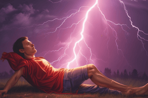
Which type of lightning is contained within a single cloud and is often invisible from the ground?
Which type of lightning is contained within a single cloud and is often invisible from the ground?
- Anvil lightning
- Intra-cloud lightning (correct)
- Cloud-to-ground lightning
- Cloud-to-cloud lightning
Which of the following best describes the primary direction of movement of the stepped leader in a lightning strike?
Which of the following best describes the primary direction of movement of the stepped leader in a lightning strike?
- Horizontally across the cloud
- Upward from the ground
- In a circular motion within the cloud
- Downward toward the ground (correct)
What atmospheric phenomenon causes thunder?
What atmospheric phenomenon causes thunder?
- Colliding ice crystals in the cloud
- Rapid heating and air expansion from lightning (correct)
- Electrostatic discharge between clouds
- The Doppler effect from the storm's movement
Using the rule of thumb for estimating the distance of a lightning strike, if you see lightning and hear thunder 15 seconds later, approximately how far away was the strike?
Using the rule of thumb for estimating the distance of a lightning strike, if you see lightning and hear thunder 15 seconds later, approximately how far away was the strike?
According to the guidelines, what is the minimum amount of time one should wait indoors after the last observed lightning or thunder to ensure safety?
According to the guidelines, what is the minimum amount of time one should wait indoors after the last observed lightning or thunder to ensure safety?
What is the primary factor that drives the energy within thunderstorms?
What is the primary factor that drives the energy within thunderstorms?
What is the approximate diameter of the main updraft in a typical thunderstorm?
What is the approximate diameter of the main updraft in a typical thunderstorm?
During which stage of a thunderstorm cell's life cycle does heavy rain typically occur, along with the presence of both up and down drafts?
During which stage of a thunderstorm cell's life cycle does heavy rain typically occur, along with the presence of both up and down drafts?
Which type of thunderstorm is characterized by a rotating single-cell and is associated with tornadoes, large hail, and strong winds?
Which type of thunderstorm is characterized by a rotating single-cell and is associated with tornadoes, large hail, and strong winds?
How does solar energy absorbed at the Earth's surface contribute to storm development?
How does solar energy absorbed at the Earth's surface contribute to storm development?
According to the information provided, where is the greatest accumulation of heat in the atmosphere typically found during the daily cycle?
According to the information provided, where is the greatest accumulation of heat in the atmosphere typically found during the daily cycle?
What weather phenomenon is indicated by rounded, pouch-like cloud structures hanging from the underside of a cloud, often associated with thunderstorms?
What weather phenomenon is indicated by rounded, pouch-like cloud structures hanging from the underside of a cloud, often associated with thunderstorms?
Which term describes an intense dust or sand storm, often characterized by a wall of dust rapidly moving across a landscape, commonly caused by thunderstorm downdrafts?
Which term describes an intense dust or sand storm, often characterized by a wall of dust rapidly moving across a landscape, commonly caused by thunderstorm downdrafts?
What condition is indicated by virga?
What condition is indicated by virga?
What is the primary characteristic of a gust front?
What is the primary characteristic of a gust front?
During a thunderstorm, what is the recommended safety measure to take if driving and encountering floodwaters?
During a thunderstorm, what is the recommended safety measure to take if driving and encountering floodwaters?
What is the effect of condensation on storm intensity?
What is the effect of condensation on storm intensity?
According to the information, why is it important to understand the concepts of humidity, saturation, and latent heat when studying storms?
According to the information, why is it important to understand the concepts of humidity, saturation, and latent heat when studying storms?
What is the typical width of the damage path caused by a tornado?
What is the typical width of the damage path caused by a tornado?
What is the primary cause of rotation in a mesocyclone?
What is the primary cause of rotation in a mesocyclone?
If caught in a car during a tornado, which direction should you drive relative to the tornado's translation direction to escape?
If caught in a car during a tornado, which direction should you drive relative to the tornado's translation direction to escape?
What does a tornado watch indicate?
What does a tornado watch indicate?
According to the provided information, what ultimately causes winds?
According to the provided information, what ultimately causes winds?
How does temperature influence buoyancy in the atmosphere?
How does temperature influence buoyancy in the atmosphere?
Which of the following is a key factor for hurricane formation?
Which of the following is a key factor for hurricane formation?
Flashcards
Intra-Cloud (IC) Lightning
Intra-Cloud (IC) Lightning
Lightning within a single cloud, often invisible from the ground.
Cloud-to-Ground (CG) Lightning
Cloud-to-Ground (CG) Lightning
Lightning that travels from a cloud to the ground.
Charge Separation
Charge Separation
Friction in storm clouds separates charges, positive at the top and negative at the bottom.
Stepped Leader
Stepped Leader
Signup and view all the flashcards
Return Stroke
Return Stroke
Signup and view all the flashcards
Thunder
Thunder
Signup and view all the flashcards
Thunderstorm
Thunderstorm
Signup and view all the flashcards
Thunderstorm Updraft
Thunderstorm Updraft
Signup and view all the flashcards
Thunderstorm Cells
Thunderstorm Cells
Signup and view all the flashcards
Supercell
Supercell
Signup and view all the flashcards
Mesocyclone
Mesocyclone
Signup and view all the flashcards
Storm Energy Source
Storm Energy Source
Signup and view all the flashcards
dBZ
dBZ
Signup and view all the flashcards
Mammatus Clouds
Mammatus Clouds
Signup and view all the flashcards
Cloud Striations
Cloud Striations
Signup and view all the flashcards
Virga
Virga
Signup and view all the flashcards
Haboob
Haboob
Signup and view all the flashcards
Gust Front
Gust Front
Signup and view all the flashcards
Rain Downpours
Rain Downpours
Signup and view all the flashcards
Humidity
Humidity
Signup and view all the flashcards
Mixing Ratio
Mixing Ratio
Signup and view all the flashcards
Saturation
Saturation
Signup and view all the flashcards
Latent Heat
Latent Heat
Signup and view all the flashcards
Advection
Advection
Signup and view all the flashcards
Mesocyclone
Mesocyclone
Signup and view all the flashcards
Study Notes
- Lecture 1 is about different types of lightning and the sequence of events in a lightning strike
Common Types of Lightning
- Intracloud lightning (IC) happens within a single cloud and is the most common type that's often invisible from the ground.
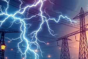
- Cloud-to-ground lightning involves an anvil shape at the top with positively charged voltage.
- Positive strikes travel a longer distance and happen only if it has more volts.
- Positive strikes are less frequent, come from the anvil, often much stronger, cause natural wildfires, and account for 10-25% of Canadian CG lightning being positive.
- Negative strikes are more numerous and come from the cloud base.
Sequence of Events in a Lightning Strike
- Charge Separation refers to friction in the storm cloud that causes positive charges at the top and negative charges at the bottom.
- Stepped Leader's negative charge forms an ionized path (stepped leader) moving downward toward the ground.
- Return Stroke involves positive charge rising from the ground, meeting the stepped leader, resulting in a bright lightning flash
- Dart Leader's follow-up leader may travel along the same path, causing additional, less intense strikes.
- Thunder is rapid heating and air expansion from the lightning causing a shockwave.
- Thunder delay helps estimate strike distance at 5 seconds per mile.
- Africa has the highest density of lightning worldwide
- Florida is "lightning alley" in America
- Lightning in Canada results in 2.4 million CG strikes per year with 6-12 deaths
- Lightning detection networks include a Canadian lightning detection network and lightning detection from space.
- Sound travels slower than light, so divide the seconds between seeing lightning and hearing thunder by 3 to estimate range in kilometers.
- Monitor weather conditions
- Use the 30/30 rule: If less than 30 seconds between a lightning flash and thunder, move indoors and stay there 30 minutes after the last lightning or thunder.
- Safe places include a fully enclosed metal vehicle with windows up or a substantial permanent building but avoid hard-wired telephones
- When outdoors, avoid unsafe areas with small structures, huts, rain shelters, nearby metallic objects (pole, fence), trees, water, open fields, and hill tops
- Use lightning safety crouch feet together, hands over ears
- Start CPR on nearby people struck by lightning
Thunderstorm Clouds
- Thunderstorms are thick clouds with lightning and thunder under
- Thunderstorms have a cloud top near the top of the troposphere (10-15km) and a cloud base near the ground
- Main updraft (stem of mushroom) is about 15km in diameter
- Anvil can be 100s km in diameter
- Strong updrafts and downdrafts are typical
- With very strong updrafts, the dome of clouds overshoot above the anvil
- Storm energy is derived from temperature and humidity
Thunderstorm Cells
- Cumulonimbus are thunderstorms and are composed of large cells that evolve during 15-45 minutes
- Most thunderstorms contain 2+ cells, each in different stages of evolution
Multicell Thunderstorms
- Typically lasts longer than an individual cell
- A squall line is a line of thunderstorms consisting of many thunderstorms in a line
- Squall lines often form along a cold front
- Supercells are very large, rotating single-cell thunderstorms
- Supercells can cause tornadoes, large hail, frequent lightning, heavy rain, strong winds, and can last for hours
- Includes supercell types that are low precipitation, classical, and high precipitation
- Rotating thunderstorms are also called a mesocyclone
- A thunderstorm cell's life cycle has the cumulus stage with updraft, mature stage, and dissipating stage
- Multi-cell thunderstorms are made up of various stages of multiple cells that may last several hours
Storm Energy
- The sun is the source of atmospheric heat, with solar energy being absorbed at the top thermosphere, middle stratosphere), and bottom (earth surface).
- The absorbed ground warms the air in the troposphere and powers the storm
- Solar energy is absorbed by the ground, making it warmer and affecting the air via sensible heat and latent heat
- Latent heat increases humidity in air and sensible heat increases temperature in air
Storm Locations
- Favorable locations for thunderstorms have the greatest supply of heat and moisture
- Areas closer to the equator have warm ocean currents that lead to warm, humid air, such as Florida, Gulf States of USA, Prairies and central Canada
Lecture 2: Weather Radars
- Remote sensors measure the storm from the outside
- Identify thunderstorms from satellite images that may have an oval shape of anvil cloud and shadow the lumpy region of updraft overshoot.
- Visible images show clouds during daytime only, whereas IR images can show clouds both day and night
- Weather radars with environment and climate change Canada have been deployed
- Radar images of thunderstorm cells show the precipitation inside the storm, namely up and downdraft stem of mushroom cloud
- Radar microwaves reflect on everything in the atmosphere, including bird migration
- dBZ is a disaster density scale for radar-echo strength and an indicator of rainfall-rate
Supercells
- Types of supercells include low precipitation that produces lots of hail potentially, classic rainy downdraft combined with rain-free updraft, and high precipitation with updraft mostly surrounded by rain
- Hybrid storms/mixed mode supercells may be in-between or can feature 2+ types
Mammatus Clouds
- Bulbous clouds are on the underside of an anvil
- Rounded, pouch-like structures hang from the underside of clouds, often associated with thunderstorms.
- Indicate severe weather potential, such as thunderstorms or tornadoes because they are caused by sinking air and often appear after the storm has passed
Supercell Striations
- Rotating supercells typically have striations, or layers, around the mesocyclone
- Parallel, streaky lines of clouds often form in layers
- Striations indicate a stable atmosphere or a weather front
- Turbulence at higher altitudes is common as well as cloud types like altostratus or cirrostratus
Virga
- Wispy streaks of precipitation fall from the clouds but evaporate before reaching the ground
- Indicate dry below the cloud level and a potential for rain or thunderstorms if conditions change
Haboobs
- Intense dust or sand storms are often characterized by a wall of dust that moves quickly across the landscape
- Occurs in desert regions, storms are caused by the downdrafts of thunderstorms, which lifts sand or dust into the air
Arc Clouds
- Arc-shaped cloud formations are often a part of a larger storm system or weather front
- Associated with warm or cold fronts that indicate changes such as the approach of a storm system
Thunderstorm Hazards
- Rain downpours have extremely large rainfall rates that can causes flash floods - do not go into fast flowing water, even in a car because 30 cm of flowing will sweep it away.
- More than half of the US flooding deaths occur in vehicles
- Downbursts lead to a gust front creating a haboob (dust storm)
- The haboob leads to an arc cloud of warm air
- Downdraft speeds are between 20-90km/h
- Horizontal wind speeds near ground can reach 250km/h
- Micro bursts are small in diameter which are 1km downbursts
- Invisible micro bursts are hazardous for aircrafts
- Gust fronts occur because downburst air hits the ground and spread outward in straight lines
- Haboobs are visible if the ground is dry, and arc clouds are visible if the air is moist-gustnado
- Strong winds can blow down large trees and destroy weak things
- Avoid weak buildings and trees that could fall in a storm
Thunderstorms
- Airports have sensors for thunderstorms, flights avoid thunderstorms, and all pilots are trained
- Virga, a precipitation that evaporates before the ground, lead to downbursts
- Haboobs = sandstorms, hazard of downburst
- Storms can draw in humid air, condense the moisture, and release its heat into the storm, increasing the strength with violent winds
- Concepts include humidity, saturation, latent heat, advection, and adiabatic cooling
Humidity
- Humidity is the amount of water vapor in the air, made of water vapor, nitrogen, oxygen, trace gases, and liquid water droplets.
- Mixing ratio= amount of water vapour divided by the amount of all other gases
- Saturation is an equilibrium between evaporation and condensation
- Water vapor can easily condense into a liquid and an exchange of water molecules occurs between vapor and liquid
- Warmer air can hold more water vapor at equilibrium than colder air
- Air containing the max amount of water vapor is saturated
- Unsaturated air is not cloudy
Advection and Cooling
- Advection is movement of air by the wind
- Cooling is water vapor that can be advected into a thunderstorm by wind.
- Air cools when it is with no heat transfer to the surrounding environment
- Condensation releases latent heat, to provide energy to the storm
- If the humidity value becomes smaller than the actual humidity, condensation occurs
- Condensation releases the stored latent heat back into sensible heat to make storms warmer and even stronger
- Reduces the humidity to the equilibrium and produces or increases liquid cloud drops which can grow to become rain drops
- The release of latent heat increases the strength of the storm
Lecture 3: Tornadoes
- The shapes of tornadoes, what makes them visible, descriptions of wall clouds and where tornadoes form relative to thunderstorms
- Most tornadoes are visible by the droplets (funnel cloud) and/or dust from the ground
- Some tornadoes are invisible
- There a re tornado shapes. shape independent of intensity classification: cone, v-shaped, wedge, cylinder, hour-glass, rope
- Only a small percentages of supercell storms actually produce tornadoes
- Strong tornadoes are associated with supercell storms
- Attached dust or a tornado at the bottom of the thunderstorm suggests the presence of a supercell
- A rotating wall cloud around the mesocyclone leads to supercell formation
- Isolated lowering of the cloud base suggests a wall cloud
- tornadoes come from rotating wall clouds in supercells
Enhanced Fujita Scale
- Use enhanced Fujita scale to identify the tornado intensity
- Movement in North America is usually from SW toward NE
- Movement in any tornado has been observed in another direction
- If in car when a tornado happens, easily able to drive away
- Around 75% of the world's tornadoes occur in North America
Tornado Safety
- Rotational speeds around tornado are much faster than translation (how fast it travels)
- Tornadoes are classified by the enhanced Fujita scale in North America
- Europe uses TORRO scale
Tornado Evolution
- Characteristics of tornado evolution, tornado outbreaks, and mesocyclones
- Tornadoes are short lived, usually lasting a minute
- A path of damage is short, often 1-10s of km long
- Very occasionally, a tornado is able to last for hours
- A tornado outbreak is 6 tornadoes in one day, or many within a week
- Often associated with squall lines along cold fronts
- As cold fronts move toward the southeast, the storms move toward the northeast
Tornado Hazards
- If indoors, get below ground into a basement or storm cellar, and out of mobile homes
- If outdoors, get into a ditch or hole to place body below the “line of fire” of fast moving debris
- If in car, drive out of tornado towards right to left direction
- Tornadoes are most prone in tornado alley in the US
- In Canada, they are most frequent the prairies stretching to Nova Scotia
- Tornado watch is a 6-13 hr forecast for a broad region, and normal activities can continue
- A tornado warning means a tornado was actually detected
Lecture 4: Forces and Winds
- The lecture covers how forces, acceleration, buoyancy, and pressure-gradients relate to winds
- Prognostic equation applies to all objects
- How winds will increase, decrease, or change is dependent on the forces that act on air parcel Forces: -Buoyancy force (vertical) that causes up and downdrafts
- Pressure-gradient force (horizontal) that causes horizontal winds
Atmospheric Buoyancy
- Warm air rises which drives the release of latent heat and the production of violent updrafts
- Forces are used to create winds.
- Temperature determines buoyancy that causes vertical movement
- Pressure determines horizontal forces
- When air hits mountain ranges and is forced to rise, it cools at ~10C/km
- Sumas was drained by European colonization in Abbotsford
- the lake residents built their new home higher up
Atmospheric Continuity
- Continuity concept: air is spread relatively evenly
- Circulation occurs in real life, as air parcels start to move
- Circulation can be driven by buoyancy in the vertical or by horizontal
- Hail and a tornado have similar risk
- in the USA and canada, risk of hail is high in Alberta, Manitoba, and BC
- Risk of hail and rain: avoid the storm at the top, use care as heavy rainfall may cause water
Lecture 5: Hurricanes
- Hurricanes (typhons) have a height of 15 km.
- Wind turns counter-clockwise and the diameter is 150-300 km
- The center (eye) of a hurricane is clear, calm and has a low pressure
- Hurricanes and typhoons are tropical climates with surface winds turning
- relatively clear, calm, and low pressure
- Eye walls are rings of thunderstorms around the center, forming a cylindrical shape
- spiral bands= the thunderstorms extending from the center
- A warm core of warm air causes wind to be faster
Factors Affecting Hurricanes
- Hurricanes depend when SST is > 26 deg Celsius/79F + moisture
- Trade winds move storms
- Winds can weaken storm formation
- Waves are large and generate surges
- Hurricane self-fueling is possible when organized to create their own fuel in humid weather
- During hurricane formation, low pressures create air and condensation increases to create and circulate warm currents of air to make the strom last for several weeks/hour
- Core = eye + eye wall with high water and thunder
- Strong upward drafts, outflow and inflow occur with cycles that create complete rotation of the hurricane
- The risk is greatest during hurricane season
Hurricane Formation
- The tropics are favourable to hurricane formation due the rotation and temperature.
- Hurricanes only persist if central pressure in the eye remains low and the hurricane remains over warm
Storm Surge
- Large scale weather systems can interfere with those hurricanes
- hurricanes head where steer them, and get larger there
- Storms can also cause problems and affect lives (fatal)
- Theyre driven by strong wind that oceans push and can sea water to push towards shore, with high levels and floodings
Risk & Safety
- Its important to plan ahead during hurricanes and get ready for evacuation
- Predictors dont have probabilities
- Canada (especially in the Atlantic provinvces) experiences few hurricanes each decade
Studying That Suits You
Use AI to generate personalized quizzes and flashcards to suit your learning preferences.