Podcast
Questions and Answers
Which layer of the Earth is the thickest?
Which layer of the Earth is the thickest?
- outer core
- crust
- inner core
- mantle (correct)
Which layer of the Earth is composed of semi-molten rock?
Which layer of the Earth is composed of semi-molten rock?
- mantle (correct)
- crust
- outer core
- inner core
What is the main component of Earth's inner core?
What is the main component of Earth's inner core?
- magma
- granite
- iron and nickel (correct)
- basalt
What drives the movement of tectonic plates?
What drives the movement of tectonic plates?
How thick is the Earth's crust on average?
How thick is the Earth's crust on average?
Which type of crust is denser?
Which type of crust is denser?
Which material is most commonly found in continental crust?
Which material is most commonly found in continental crust?
Which statement is true about oceanic crust?
Which statement is true about oceanic crust?
Where are the majority of volcanoes and earthquakes found?
Where are the majority of volcanoes and earthquakes found?
What percentage of Earth's volcanoes are located along the Pacific Ring of Fire?
What percentage of Earth's volcanoes are located along the Pacific Ring of Fire?
What type of volcanic structure is formed at a destructive plate boundary?
What type of volcanic structure is formed at a destructive plate boundary?
What happens at a constructive plate boundary?
What happens at a constructive plate boundary?
Which is an example of a conservative plate boundary?
Which is an example of a conservative plate boundary?
What geological feature is formed when two continental plates collide?
What geological feature is formed when two continental plates collide?
What is a common characteristic of regions with a high density of earthquakes?
What is a common characteristic of regions with a high density of earthquakes?
What creates anomalies in the pattern of volcanic activity?
What creates anomalies in the pattern of volcanic activity?
What is an opening in the Earth's crust that allows molten rock, ash, dust, and gases to escape?
What is an opening in the Earth's crust that allows molten rock, ash, dust, and gases to escape?
Which type of volcano is characterized by steep sides and alternating layers of lava and ash?
Which type of volcano is characterized by steep sides and alternating layers of lava and ash?
Which feature of a volcano is a channel through which magma travels to reach the Earth's surface?
Which feature of a volcano is a channel through which magma travels to reach the Earth's surface?
Which stage of a volcano is described as erupting very recently or frequently?
Which stage of a volcano is described as erupting very recently or frequently?
Where are shield volcanoes usually found?
Where are shield volcanoes usually found?
What is the name of the location where magma is stored beneath the ground?
What is the name of the location where magma is stored beneath the ground?
What type of lava do stratovolcanoes typically erupt?
What type of lava do stratovolcanoes typically erupt?
A volcano that has not erupted in historical times is known as what?
A volcano that has not erupted in historical times is known as what?
What does the Mercalli Scale measure?
What does the Mercalli Scale measure?
How many points are on the Mercalli Scale?
How many points are on the Mercalli Scale?
Where are observations for the Mercalli Scale typically taken from?
Where are observations for the Mercalli Scale typically taken from?
What is a notable characteristic of the Mercalli Scale measurements?
What is a notable characteristic of the Mercalli Scale measurements?
According to the Mercalli Scale, what happens at level 1?
According to the Mercalli Scale, what happens at level 1?
What are hotspots?
What are hotspots?
What causes the crust to dome and crack?
What causes the crust to dome and crack?
What happens to a volcano as the crust moves over the hotspot?
What happens to a volcano as the crust moves over the hotspot?
Which of the following is a primary volcanic hazard?
Which of the following is a primary volcanic hazard?
What is acidification caused by?
What is acidification caused by?
Which of the following is NOT a negative impact of volcanic hazards?
Which of the following is NOT a negative impact of volcanic hazards?
What opportunity does geothermal energy provide near volcanoes?
What opportunity does geothermal energy provide near volcanoes?
What is a benefit of lava and ash deposits from volcanic eruptions?
What is a benefit of lava and ash deposits from volcanic eruptions?
Where is Eyjafjallajökull (E-15) located?
Where is Eyjafjallajökull (E-15) located?
What was a primary short-term impact of the Eyjafjallajökull eruption on farming?
What was a primary short-term impact of the Eyjafjallajökull eruption on farming?
What measure was suggested to farmers to prevent contamination of livestock water supplies?
What measure was suggested to farmers to prevent contamination of livestock water supplies?
Which type of tourism increased due to the Eyjafjallajökull eruption?
Which type of tourism increased due to the Eyjafjallajökull eruption?
What causes earthquakes most frequently?
What causes earthquakes most frequently?
What is the focus in relation to an earthquake?
What is the focus in relation to an earthquake?
How much stronger is a 6-magnitude earthquake compared to a 5-magnitude earthquake on the Richter Scale?
How much stronger is a 6-magnitude earthquake compared to a 5-magnitude earthquake on the Richter Scale?
What do seismic or shock waves do during an earthquake?
What do seismic or shock waves do during an earthquake?
Which factor does the Volcanic Explosivity Index (VEI) depend on?
Which factor does the Volcanic Explosivity Index (VEI) depend on?
What is one method used to measure earthquakes occurring near a volcano?
What is one method used to measure earthquakes occurring near a volcano?
Which system is used to monitor changes in the landscape near a volcano?
Which system is used to monitor changes in the landscape near a volcano?
What technique involves using cameras to monitor heat sources within the crust of a volcano?
What technique involves using cameras to monitor heat sources within the crust of a volcano?
In reducing the impacts of volcanoes, which method involves creating channels and setting off explosives?
In reducing the impacts of volcanoes, which method involves creating channels and setting off explosives?
What is the purpose of mudflow barriers in volcanic regions?
What is the purpose of mudflow barriers in volcanic regions?
How can building design help reduce the impacts of volcanic eruptions?
How can building design help reduce the impacts of volcanic eruptions?
Which of these methods is used to educate the population about volcanic hazards?
Which of these methods is used to educate the population about volcanic hazards?
What tool is used to monitor earth tremors for earthquake prediction?
What tool is used to monitor earth tremors for earthquake prediction?
How can building guidelines help protect against earthquakes?
How can building guidelines help protect against earthquakes?
Why is predicting the exact time of an earthquake very difficult despite knowing where they are likely to occur?
Why is predicting the exact time of an earthquake very difficult despite knowing where they are likely to occur?
Which of the following is NOT a feature used in buildings to withstand earthquakes?
Which of the following is NOT a feature used in buildings to withstand earthquakes?
How do earthquake drills benefit residents in earthquake-prone areas?
How do earthquake drills benefit residents in earthquake-prone areas?
Why might someone continue to live in an earthquake-prone area for sentimental reasons?
Why might someone continue to live in an earthquake-prone area for sentimental reasons?
Which of these features is most likely included in building codes to reduce earthquake impacts?
Which of these features is most likely included in building codes to reduce earthquake impacts?
What is a common practice in Japan to prepare for earthquakes?
What is a common practice in Japan to prepare for earthquakes?
Where did the magnitude 9 earthquake occur on 11 March 2011?
Where did the magnitude 9 earthquake occur on 11 March 2011?
How high were the original anti-tsunami defences built by Japan?
How high were the original anti-tsunami defences built by Japan?
How many people were displaced by the Japan earthquake and tsunami?
How many people were displaced by the Japan earthquake and tsunami?
What caused the flooding of Fukushima plant's generators and electrical wiring?
What caused the flooding of Fukushima plant's generators and electrical wiring?
What was one of the immediate responses to the Japan earthquake?
What was one of the immediate responses to the Japan earthquake?
What is the height of the new tsunami barriers built after the earthquake?
What is the height of the new tsunami barriers built after the earthquake?
What annual event does Japan conduct to prepare for earthquake emergencies?
What annual event does Japan conduct to prepare for earthquake emergencies?
What major disaster occurred at the Fukushima plant due to the earthquake?
What major disaster occurred at the Fukushima plant due to the earthquake?
What is the minimum wind speed for a weather system to be classified as a tropical cyclone?
What is the minimum wind speed for a weather system to be classified as a tropical cyclone?
In which direction does the Coriolis Effect deflect the wind in the southern hemisphere?
In which direction does the Coriolis Effect deflect the wind in the southern hemisphere?
Which characteristic is NOT part of a tropical cyclone's formation?
Which characteristic is NOT part of a tropical cyclone's formation?
At what sea temperature do tropical cyclones typically form?
At what sea temperature do tropical cyclones typically form?
Which category on the Saffir-Simpson Hurricane Wind Scale represents wind speeds over 156 km/h?
Which category on the Saffir-Simpson Hurricane Wind Scale represents wind speeds over 156 km/h?
During which season do tropical cyclones occur most commonly?
During which season do tropical cyclones occur most commonly?
What is a significant hazard caused by the heavy rainfall from tropical cyclones?
What is a significant hazard caused by the heavy rainfall from tropical cyclones?
How high can storm surges caused by tropical cyclones reach?
How high can storm surges caused by tropical cyclones reach?
Flashcards
Inner Core
Inner Core
The Earth's innermost layer, solid, made of iron and nickel, extremely hot.
Outer Core
Outer Core
Liquid layer surrounding the inner core, also made of iron and nickel.
Mantle
Mantle
Thickest layer of the Earth beneath the crust, semi-molten rock (magma).
Crust
Crust
Signup and view all the flashcards
Plate Tectonics
Plate Tectonics
Signup and view all the flashcards
Tectonic Plate
Tectonic Plate
Signup and view all the flashcards
Tectonic Plate Boundary
Tectonic Plate Boundary
Signup and view all the flashcards
Oceanic Crust
Oceanic Crust
Signup and view all the flashcards
Continental Crust
Continental Crust
Signup and view all the flashcards
Earthquake
Earthquake
Signup and view all the flashcards
Volcano
Volcano
Signup and view all the flashcards
Constructive Boundary
Constructive Boundary
Signup and view all the flashcards
Destructive Boundary
Destructive Boundary
Signup and view all the flashcards
Collision Boundary
Collision Boundary
Signup and view all the flashcards
Conservative Boundary
Conservative Boundary
Signup and view all the flashcards
Ring of Fire
Ring of Fire
Signup and view all the flashcards
Volcanic Explosivity Index (VEI)
Volcanic Explosivity Index (VEI)
Signup and view all the flashcards
Primary Hazard
Primary Hazard
Signup and view all the flashcards
Secondary Hazard
Secondary Hazard
Signup and view all the flashcards
Richter Scale
Richter Scale
Signup and view all the flashcards
Focus
Focus
Signup and view all the flashcards
Epicenter
Epicenter
Signup and view all the flashcards
Convection Currents
Convection Currents
Signup and view all the flashcards
Study Notes
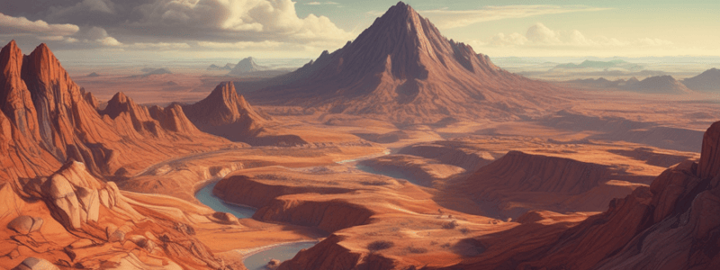
Layers of the Earth
- The Earth is composed of four main layers: inner core, outer core, mantle, and crust
- Inner core: solid, iron and nickel, temperatures up to 5,500°C
- Outer core: liquid, iron and nickel
- Mantle: thickest section, approximately 2,900 km, semi-molten rock (magma)
- Crust: thin, rocky outer layer, approximately 5-70 km thick
Plate Tectonics
- Movement of plates and activity inside the Earth is called plate tectonics
- Tectonic plate: section of the Earth's crust
- Tectonic plate boundary: area where two or more plates meet
- Convection currents in the mantle cause plate movement
- Plates move apart where convection currents move in opposite directions
Types of Crust
- Oceanic crust: thinner (5-10 km), more dense, often subducted
- Continental crust: thicker (30-50 km), less dense, cannot be subducted
Distribution of Earthquakes and Volcanoes
- Majority of volcanoes and earthquakes occur at plate boundaries
- Friction and pressure at plate boundaries cause earthquakes and volcanic activity
The Pacific Ring of Fire
- 75% of Earth's volcanoes, 90% of Earth's earthquakes occur along the Ring of Fire
Plate Boundaries
- Destructive plate boundary: oceanic and continental plates converge, oceanic plate is subducted
- Constructive plate boundary: plates move apart, magma rises to fill the gap, new crust is formed
- Collision plate boundary: continental plates collide, forming fold mountains
- Conservative plate boundary: plates slide past each other, no creation or destruction of crust
Volcanoes
- Definition: opening in the Earth's crust allowing molten rock, ash, and gases to escape
- Can occur at destructive and constructive plate boundaries, and over hotspots
- Types of volcanoes: stratovolcano (composite cone) and shield volcano
Volcanic Hazards
- Primary hazards: direct hazards associated with natural events (short-term)
- Secondary hazards: indirect hazards associated with natural events (long-term)
- Examples: pyroclastic flow, acidification, lahars
Impacts and Opportunities of Volcanic Hazards
- Negative impacts: loss of life, destruction of settlements, infrastructure damage, environmental damage
- Opportunities: tourism, fertile soil, geothermal energy, creation of new land
Measuring Volcanic Hazards
- Volcanic Explosivity Index (VEI) Scale: 0 (non-explosive) to 8 (mega-colossal)
- Seismometers, GPS satellites, thermal imaging, and infrared camera imagery used to monitor volcanic activity
Reducing Vulnerability
- Monitoring volcanic activity, hazard mapping, and planning
- Building design, lava flow diversion, and mudflow barriers
Earthquakes
- Definition: shaking and vibration of the Earth's crust due to plate movement
- Focus: point where the earthquake occurs
- Epicentre: point directly above the focus on the Earth's surface
- Seismic waves: shock waves that start at the focus and travel through the Earth
Measuring Earthquakes
- Richter Scale: measures the magnitude of an earthquake
- Mercalli Scale: measures the effects of an earthquake on a 12-point scale
Reducing the Impacts of Earthquakes
- Prediction: using seismometers to monitor earth tremors
- Protection: building codes, rubber shock absorbers, steel frames, and open areas
- Preparation: drills, emergency services, and resident preparedness
Why People Continue to Live in Hazardous Zones
- Reasons: employment, scenery, family, friends, sentimental value, and preparedness
Studying That Suits You
Use AI to generate personalized quizzes and flashcards to suit your learning preferences.


