Podcast
Questions and Answers
Which of the following best describes the definition of a landform, according to geomorphologists?
Which of the following best describes the definition of a landform, according to geomorphologists?
- Ancient ruins and archaeological sites left by past civilizations.
- Specific rock formations found only in mountainous regions.
- Naturally occurring physical features of Earth's terrain, developed over geological time. (correct)
- Man-made structures built on the Earth's surface.
Apart from volcanic activity and plate tectonics, what other significant factor contributes to landform establishment?
Apart from volcanic activity and plate tectonics, what other significant factor contributes to landform establishment?
- Glacial melting and sea level rise.
- Deforestation and human construction.
- Meteorite impacts causing craters.
- Erosion caused by precipitation, running water, and wind. (correct)
What is geomorphology?
What is geomorphology?
- The study of ancient civilizations.
- The study of weather patterns.
- The study of rock formations.
- The study of land formation processes. (correct)
How do geomorphologists study landforms?
How do geomorphologists study landforms?
What external factors primarily shape ocean coastlines?
What external factors primarily shape ocean coastlines?
Which of the following geological processes are primarily responsible for the formation of the Hawaiian Islands?
Which of the following geological processes are primarily responsible for the formation of the Hawaiian Islands?
What distinguishes a peninsula from an island?
What distinguishes a peninsula from an island?
How do barrier islands, such as those along the U.S. Atlantic and Gulf Coasts, primarily form?
How do barrier islands, such as those along the U.S. Atlantic and Gulf Coasts, primarily form?
What geological forces contribute to the formation of bays?
What geological forces contribute to the formation of bays?
Which statement correctly describes the difference between mountains and hills?
Which statement correctly describes the difference between mountains and hills?
How are plateaus distinct from mountains and hills?
How are plateaus distinct from mountains and hills?
What distinguishes a V-shaped valley from a U-shaped valley?
What distinguishes a V-shaped valley from a U-shaped valley?
What is a key characteristic used to define plains?
What is a key characteristic used to define plains?
How does the bedrock composition of a canyon affect its appearance?
How does the bedrock composition of a canyon affect its appearance?
What are outliers in the context of plateaus?
What are outliers in the context of plateaus?
Flashcards
Landform
Landform
Natural physical features of Earth's terrain shaped over geological time.
Geomorphology
Geomorphology
The study of landforms and the processes that shape them.
External factors
External factors
Forces like erosion from wind, water, and climate that change landforms.
Coastal landforms
Coastal landforms
Signup and view all the flashcards
Internal factors
Internal factors
Signup and view all the flashcards
Islands
Islands
Signup and view all the flashcards
Volcanic Islands
Volcanic Islands
Signup and view all the flashcards
Barrier Islands
Barrier Islands
Signup and view all the flashcards
Peninsulas
Peninsulas
Signup and view all the flashcards
Bays
Bays
Signup and view all the flashcards
Mountains
Mountains
Signup and view all the flashcards
Hills
Hills
Signup and view all the flashcards
Plateaus
Plateaus
Signup and view all the flashcards
Valleys
Valleys
Signup and view all the flashcards
Canyons
Canyons
Signup and view all the flashcards
Study Notes
Landforms Definition and Types
- Landforms are naturally occurring physical features of Earth's terrain, evolving over geological time.
- Internal factors like volcanic activity and plate tectonics shape landforms.
- External factors like erosion from precipitation, water, and wind also influence landform creation.
- These processes can take millions of years to noticeably alter topography.
- Continents themselves, including mountains, hills, plateaus, plains, valleys, canyons, ocean basins, coasts, bays, peninsulas, and islands are examples of landforms.
- Changes (e.g., landslides, earthquakes, volcanic eruptions) can rapidly alter the landscape.
Study of Landforms (Geomorphology)
- Geomorphology is the scientific study of landform processes.
- Geomorphologists use remote sensing, GIS, and LiDAR for creating detailed maps.
- Analyzing sediments (pollen, insects, diatoms, fossils) helps understand past climate impacts on present-day landforms.
Coastal Landforms
- Coasts: Gradual inclines from the ocean floor, influenced by waves, currents, tides, and sediment transport. Waves & currents also shape coastlines through abrasion.
- Islands: Land areas completely surrounded by water (smaller than a continent). Formed from volcanic activity, plate tectonics, or sand deposition. Hawaii is formed from volcanoes; The Channel Islands (California) from plate tectonics; and Barrier Islands (US Atlantic & Gulf coasts) by sand.
- Islands continually reshape due to external elements such as waves.
Other Landforms
- Peninsulas: Extensions of land jutting into oceans/lakes, partially surrounded by water. Caused by falling water levels or plate collisions.
- Bays: Semicircular inlets of water between headlands/peninsulas. Created by coastal erosion and sedimentation.
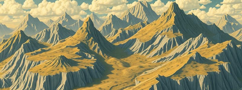
- Mountains/Hills: Steep slopes/summits formed by plate movements/volcanoes. Mountains form ranges. Hills have gentler slopes and are smaller than mountains.
- Plateaus: Elevated, flat-topped areas larger than hills. Created through volcanic eruptions or tectonic plate movement. Sides rise significantly and tops are often large and flat.
- Valleys/Canyons: Low-lying areas between mountains/hills. V-shaped valleys are formed by rivers while U-shaped valleys result from glacial erosion. Canyons are deep valleys with steep sides. Shape depends on the bedrock and erosion dynamics(water flow).
- Plains: Vast stretches of land with little elevation change. Most common landform type, covering significant portions of Earth, created from glacial retreat.
- Ocean Basins: Landforms also exist within oceans, including continental shelves, abyssal plains, seamounts, trenches, and volcanic islands.
Landform Characteristics
- Variety in soil type and sediment composition.
- Variations in land slope, elevation, and orientation.
- Erosion influenced by wind, water, glaciers, and weathering.
- Volcanic eruptions/plate movement are factors to rapidly introduce/alter landforms.
Studying That Suits You
Use AI to generate personalized quizzes and flashcards to suit your learning preferences.