Podcast
Questions and Answers
What is the primary role of land surveying?
What is the primary role of land surveying?
- Preparing topographic maps
- Creating property boundaries
- Establishing geographic control networks (correct)
- Measuring distances in outer space
Which type of land survey creates detailed representations of natural and man-made features?
Which type of land survey creates detailed representations of natural and man-made features?
- Elevation Surveys
- Boundary Surveys
- Topographic Surveys (correct)
- Aerial Surveys
What is the purpose of preparing topographic maps?
What is the purpose of preparing topographic maps?
- Resolving boundary disputes
- Designing and constructing infrastructure projects
- Monitoring changes in landforms
- Creating detailed representations of features on land (correct)
Which activity is NOT supported by the information obtained from land surveys?
Which activity is NOT supported by the information obtained from land surveys?
What is the main purpose of boundary surveys?
What is the main purpose of boundary surveys?
Why is land surveying considered critical in various industries?
Why is land surveying considered critical in various industries?
What is the main purpose of Control Surveys in land surveying?
What is the main purpose of Control Surveys in land surveying?
Which tool enables surveyors to measure distances and angles simultaneously?
Which tool enables surveyors to measure distances and angles simultaneously?
What is the role of Geographic Information Systems (GIS) in land surveying?
What is the role of Geographic Information Systems (GIS) in land surveying?
What is typically required for individuals to become licensed land surveyors in the United States?
What is typically required for individuals to become licensed land surveyors in the United States?
Which technology enables surveyors to precisely locate points on Earth's surface?
Which technology enables surveyors to precisely locate points on Earth's surface?
Why is land surveying considered a dynamic discipline?
Why is land surveying considered a dynamic discipline?
Flashcards are hidden until you start studying
Study Notes
Land Surveying: Understanding the Essentials
Land surveying is a critical discipline that plays a foundational role in various industries, from construction and engineering to real estate and law. It serves as the cornerstone for accurate and reliable spatial data, ensuring the precise location and measurement of natural and man-made features on Earth's surface.
The Role of Land Surveying
Land surveyors use a variety of techniques, tools, and technologies to establish accurate geographic control networks, measure distances, angles, and elevations, and determine the location and dimensions of natural and man-made features. The resulting information supports numerous activities, such as:
- Establishing property boundaries and legal descriptions
- Preparing topographic maps and site plans
- Designing and constructing infrastructure projects
- Monitoring changes in landforms and building structures
- Resolving boundary disputes and land use conflicts
Types of Land Surveys
Land surveying can be broadly categorized into four main types:
-
Boundary Surveys: These surveys establish property boundaries and legal descriptions, ensuring that property lines are precisely defined and recorded.
-
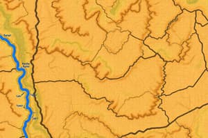
Topographic Surveys: These surveys create detailed representations of natural and man-made features on a particular piece of land or a specific area. They are used to prepare topographic maps, site plans, and design proposals.
-
Construction Surveys: These surveys support the construction of infrastructure projects by providing the required data on site conditions, control networks, and positioning reference points.
-
Control Surveys: These surveys establish a precise geodetic control network to serve as a reference for all other surveys in a specific area. Control surveys involve highly accurate measurements and the use of Global Navigation Satellite System (GNSS) technology.
Land Surveyor's Tools and Technologies
Land surveyors use a variety of tools and technologies to ensure accuracy and efficiency in their work. These include:
-
Total Stations and Robotic Total Stations: These instruments combine the functions of an electronic distance meter (EDM) and an electro-optical (E/O) system, enabling surveyors to measure distances and angles simultaneously.
-
Global Positioning System (GPS) and GNSS Receivers: These devices enable surveyors to precisely locate themselves and other points on Earth's surface, providing accurate spatial data for mapping and surveying applications.
-
Digital Levels: These instruments measure elevation differences between points on Earth's surface, providing essential data for topographic surveys and construction projects.
-
Geographic Information Systems (GIS): These software applications enable surveyors to collect, store, analyze, and visualize spatial data to support land surveying and other related activities.
Land Surveying Education and Certification
To become a land surveyor, individuals typically need to complete a four-year bachelor's degree program in surveying or a related field, such as civil engineering, geomatics, or geographic information systems. After graduation, surveyors usually pursue certifications or licenses, which vary by country or state.
In the United States, land surveyors must be licensed by their state's Board of Licensure for Professional Land Surveyors (BLPS). The licensure process typically involves completing an accredited four-year degree program, gaining relevant work experience, and passing a licensure exam.
Land surveying is a dynamic and exciting discipline that plays an essential role in our everyday lives. As technology continues to advance, land surveyors will need to adapt and embrace new tools and techniques to meet the growing demands of the profession. Whether you're interested in boundary disputes, construction projects, or mapping the world's landscapes, land surveying offers a rewarding and challenging career path.
Studying That Suits You
Use AI to generate personalized quizzes and flashcards to suit your learning preferences.


