Podcast
Questions and Answers
What is the main difference between absolute and relative location?
What is the main difference between absolute and relative location?
- Absolute location uses meridians and parallels for identification. (correct)
- Absolute location is defined using physical features.
- Relative location is determined by the distance to another place. (correct)
- Relative location is fixed and unchangeable.
Which concept refers to the number of individuals or items per unit area?
Which concept refers to the number of individuals or items per unit area?
- Location
- Pattern
- Concentration
- Density (correct)
What does 'time-space compression' refer to in geography?
What does 'time-space compression' refer to in geography?
- The phenomenon of population density decreasing over time.
- The separation of social and economic activities by geographical factors.
- The reduction in the time it takes to travel from one place to another due to improved technology. (correct)
- The process by which time is perceived to be longer in rural areas.
What are the two major positions concerning human-environment interaction debated by geographers?
What are the two major positions concerning human-environment interaction debated by geographers?
How is diffusion in geography primarily categorized?
How is diffusion in geography primarily categorized?
How do large-scale and small-scale maps differ?
How do large-scale and small-scale maps differ?
What is defined as a 'formal region' in geography?
What is defined as a 'formal region' in geography?
Which of the following is NOT one of the 'Three Pillars of Sustainability'?
Which of the following is NOT one of the 'Three Pillars of Sustainability'?
What distinguishes thematic maps from reference maps?
What distinguishes thematic maps from reference maps?
Which statement accurately describes the difference between absolute and relative distance?
Which statement accurately describes the difference between absolute and relative distance?
What do the terms clustering and dispersal refer to in geographic terms?
What do the terms clustering and dispersal refer to in geographic terms?
Which projection is often criticized for distorting size but remains popular for its overall representation?
Which projection is often criticized for distorting size but remains popular for its overall representation?
What role does GIS (Geographic Information Systems) play in geography?
What role does GIS (Geographic Information Systems) play in geography?
How do field observations benefit geographers in their data collection?
How do field observations benefit geographers in their data collection?
What essential function do time zones serve in geographical studies?
What essential function do time zones serve in geographical studies?
What is the significance of the International Date Line in geography?
What is the significance of the International Date Line in geography?
Flashcards are hidden until you start studying
Study Notes
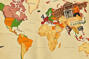
Topic 1.1: Introduction to Maps
- Reference vs. Thematic Maps: Reference maps provide general location information, while thematic maps emphasize specific data themes, such as population density or climate patterns.
- Absolute vs. Relative Direction/Distance: Absolute direction refers to cardinal points (N, S, E, W) while relative direction refers to location based on the position of other objects. Absolute distance is the exact measurement between two points; relative distance is the approximate distance based on time or cost.
- Clustering and Dispersal: Clustering indicates a concentrated arrangement of phenomena, whereas dispersal shows a spread-out distribution across a space.
- Map Projections:
- Mercator Projection: Maintains straight lines for navigation but distorts size, especially near poles.
- Robinson Projection: Balances size and shape distortion, most suitable for general use.
- Goode-Homolosine Projection: Minimizes distortion of area at the expense of shape; often used for thematic representation.
- Winkle-Triple Projection: Reduces distortion in size, shape, distance, and direction, presenting a visually appealing map.
- Site, Situation, and Typonym: Site refers to the physical attributes of a location, situation relates to its surroundings and connections, and typonym represents the name derived from a place's characteristics or historical significance.
Topic 1.2: Geographic Data
- Carl Sauer: A influential figure in human geography, known for advocating the cultural landscape approach and focusing on human-environment interaction.
- GIS (Geographic Information Systems): A tool that captures, analyzes, and displays spatial data, enabling geographers to visualize relationships and patterns.
- Remote Sensing: Involves acquiring data from a distance via satellites or aircraft, providing information like land use, environmental changes, and natural resources.
- Field Observations: Geographers collect firsthand data by observing environments, helping to understand local phenomena and context.
- GPS (Global Positioning System): Satellite-based system that allows geographers to determine precise locations on Earth, aiding in navigation and mapping.
- Time Zones: Regions with standardized time based on longitudinal lines, essential for coordinating activities across different areas.
- International Date Line: Imaginary line that defines where the date changes, typically located at 180° longitude.
Topic 1.3: Power of Geographic Data
- Geographic data aids individuals, companies, and governments in making informed decisions.
- Individuals: Use data for navigating, planning travel, and understanding local resources.
- Companies: Employ data for market analysis, site selection, and logistics management.
- Governments: Rely on data for urban planning, resource management, and policymaking.
Topic 1.4: Spatial Concepts
- Place vs. Location: Place encompasses the physical and cultural characteristics defining a space, while location refers to a position relative to other places.
- Absolute vs. Relative Location: Absolute location is a fixed point on the Earth's surface, while relative location is described in relation to other locations (e.g., "north of the river").
- Geographic Grid: System using latitude (parallels) and longitude (meridians) to locate any point on Earth.
- Density, Concentration, and Pattern:
- Density: The number of phenomena within a given area.
- Concentration: The spatial arrangement of phenomena; densely or sparsely distributed.
- Pattern: The overall layout or distribution of items within a defined space.
- Time-Space Compression: Concept describing how technological advancements reduce perceived distances in time and space, affecting social and economic interactions.
- Diffusion: The process of spreading ideas or innovations.
- Relocation Diffusion: Transfer of ideas through migration.
- Expansion Diffusion: Ideas spread while remaining strong in origin.
- Stimulus Diffusion: Adoption of specific traits from an idea, altering it in the process.
- Hierarchical Diffusion: Spread through established structures, often from larger to smaller entities.
- Contagious Diffusion: Rapid, widespread diffusion of characteristics.
Topic 1.5: Human-Environment Interaction
- Three Pillars of Sustainability: Economic viability, environmental protection, and social equity, essential for sustainable development.
- Environmental Determinism vs. Possibilism:
- Environmental Determinism: Belief that environment shapes human behaviors and cultures.
- Possibilism: Acceptance that while the environment influences actions, humans have the agency to adjust and adapt in various ways.
- Historical Examples of Environmental Modification: Deforestation for agriculture, urbanization, and flood control through dam construction.
- Global Economy Changes: Increasing globalization impacts labor markets and resources, often exacerbating inequalities in developing countries.
Topic 1.6: Scale of Analysis
- Definition of Scale: The representation of the real world in reduced form; commonly shown through ratio, written, or graphic scale.
- Large-Scale vs. Small-Scale: Large-scale maps show detailed areas, while small-scale maps encompass larger regions with less detail.
- Business Use of Geographic Scale: Companies leverage scale to target specific demographics and optimize logistics networks.
- Government Use of Geographic Scale: Governments assess scales for urban planning, resource allocation, and policy implementation.
Topic 1.7: Regional Analysis
- Defining Regions: Geographers categorize regions based on shared characteristics.
- Major Types of Regions:
- Formal Region: Defined by specific characteristics (e.g., language, climate).
- Functional Region: Organized around a focal point, with connections (e.g., metropolitan areas).
- Vernacular Region: Perceived regions based on cultural identity (e.g., “the South”).
Studying That Suits You
Use AI to generate personalized quizzes and flashcards to suit your learning preferences.