Podcast
Questions and Answers
What is a primary concern when integrating data from diverse sources in a GIS?
What is a primary concern when integrating data from diverse sources in a GIS?
- Inaccurate route planning
- Poor overall accuracy if not well managed (correct)
- Difficulties in representing dynamic data
- High cost of database creation
Which component is NOT essential for a successful GIS implementation?
Which component is NOT essential for a successful GIS implementation?
- Graphic user interface
- Skilled personnel
- A physical map (correct)
- Computer equipment
What does GIS primarily rely on for its operations?
What does GIS primarily rely on for its operations?
- Static map overlays
- Manual data entry systems
- Data referenced by spatial/geographical coordinates (correct)
- Basic graphical representations
Which application is NOT typically associated with the use of GIS?
Which application is NOT typically associated with the use of GIS?
Which of the following is a characteristic of GIS?
Which of the following is a characteristic of GIS?
What was a significant development in the 1950s regarding geographical analysis?
What was a significant development in the 1950s regarding geographical analysis?
Which of the following best describes a Geographic Information System (GIS)?
Which of the following best describes a Geographic Information System (GIS)?
What are the primary capabilities of a GIS as described by Arnoff?
What are the primary capabilities of a GIS as described by Arnoff?
What is a unique feature that distinguishes GIS from other information systems?
What is a unique feature that distinguishes GIS from other information systems?
Why is GIS considered valuable for both public and private enterprises?
Why is GIS considered valuable for both public and private enterprises?
In early geographical analyses, what method was commonly used?
In early geographical analyses, what method was commonly used?
Which of the following statements about GIS data is incorrect?
Which of the following statements about GIS data is incorrect?
Which of the following is NOT considered a component of a GIS?
Which of the following is NOT considered a component of a GIS?
Which of the following best describes the importance of analytical capability in GIS?
Which of the following best describes the importance of analytical capability in GIS?
What is a critical factor for the success of GIS technology?
What is a critical factor for the success of GIS technology?
Which of the following is NOT a component that contributes to GIS success?
Which of the following is NOT a component that contributes to GIS success?
What was a historical drawback of GIS technology?
What was a historical drawback of GIS technology?
The integration of data from different sources in GIS primarily contributes to which outcome?
The integration of data from different sources in GIS primarily contributes to which outcome?
Which statement correctly reflects the role of GIS software?
Which statement correctly reflects the role of GIS software?
Which factor has aided in the increasing accessibility of GIS technology?
Which factor has aided in the increasing accessibility of GIS technology?
What is necessary for effective decision-making in GIS?
What is necessary for effective decision-making in GIS?
What is the purpose of GIS in decision-making?
What is the purpose of GIS in decision-making?
Which of the following is NOT typically included in the tools used in GIS?
Which of the following is NOT typically included in the tools used in GIS?
Which of the following best represents an aspatial question?
Which of the following best represents an aspatial question?
In GIS, what kind of questions are known as modeling questions?
In GIS, what kind of questions are known as modeling questions?
Which of the following types of information is essential for spatial analysis?
Which of the following types of information is essential for spatial analysis?
What does the term 'spatial questions' refer to in the context of GIS?
What does the term 'spatial questions' refer to in the context of GIS?
What kind of information is considered aspatial?
What kind of information is considered aspatial?
Which statement about GIS information is accurate?
Which statement about GIS information is accurate?
Flashcards
Geographic Information System (GIS)
Geographic Information System (GIS)
A system that combines geographic data with other information to create interactive maps and visualizations. It allows analysis and manipulation of spatial information, supporting decision-making across various fields.
Cost & Difficulty of Database Creation
Cost & Difficulty of Database Creation
The accuracy of a geographic database is directly related to its cost and complexity. High accuracy often requires more resources and effort.
Data Integration in GIS
Data Integration in GIS
GIS can integrate data from multiple sources, like satellite imagery, sensor readings, and field surveys. However, poor data management can lead to inaccurate results.
Dynamic Data Representation in GIS
Dynamic Data Representation in GIS
Signup and view all the flashcards
Representation of Fuzzy Data in GIS
Representation of Fuzzy Data in GIS
Signup and view all the flashcards
What is a GIS?
What is a GIS?
Signup and view all the flashcards
GIS and Spatial References
GIS and Spatial References
Signup and view all the flashcards
Key Components of GIS
Key Components of GIS
Signup and view all the flashcards
What questions can GIS Answer?
What questions can GIS Answer?
Signup and view all the flashcards
Why Use GIS?
Why Use GIS?
Signup and view all the flashcards
Effective GIS Implementation
Effective GIS Implementation
Signup and view all the flashcards
Evolution of GIS
Evolution of GIS
Signup and view all the flashcards
GIS Weaknesses
GIS Weaknesses
Signup and view all the flashcards
Data Assimilation
Data Assimilation
Signup and view all the flashcards
Visualization Impact
Visualization Impact
Signup and view all the flashcards
Analytical Capability
Analytical Capability
Signup and view all the flashcards
Information Sharing
Information Sharing
Signup and view all the flashcards
Spatial Database Management
Spatial Database Management
Signup and view all the flashcards
Improved Decision Making
Improved Decision Making
Signup and view all the flashcards
Visual Analysis
Visual Analysis
Signup and view all the flashcards
Improved Organizational Integration
Improved Organizational Integration
Signup and view all the flashcards
What are the components of a GIS?
What are the components of a GIS?
Signup and view all the flashcards
What are Spatial Questions?
What are Spatial Questions?
Signup and view all the flashcards
What are Aspatial Questions?
What are Aspatial Questions?
Signup and view all the flashcards
What are Modeling Questions?
What are Modeling Questions?
Signup and view all the flashcards
Why is GIS Important?
Why is GIS Important?
Signup and view all the flashcards
How does GIS help in decision-making?
How does GIS help in decision-making?
Signup and view all the flashcards
What is spatial analysis?
What is spatial analysis?
Signup and view all the flashcards
Study Notes
Introduction to GIS
- GIS stands for Geographic Information Systems
- It's a computer-based system for representing and analyzing geographical features on Earth, including events occurring on the surface
- GIS uses spatial/geographical coordinates to reference data
- It combines database operations with visual map analysis
- GIS is used for wide-ranging applications in various fields
Presentation Outline
- Historical Background
- What is GIS
- Components of a GIS
- What questions GIS can answer
- Why use GIS
- Successful GIS Implementation
- Evolution of GIS
- Weaknesses of GIS
Background
- In the 1930s and 40s, geographical analyses involved overlaying different maps of the same area
- The 1950s saw the evolution of overlay techniques into digital systems, enabling map conversion to digital format
- These digital systems developed into Geographic Information Systems (GIS)
- Contemporary applications of GIS cover a wide range of analysis and problem-solving
- GIS software features are increasingly embedded in modern PCs
What is GIS?
- GIS is a computer-based information system for digitally representing and analyzing Earth's features and events
- It works with data referenced by spatial/geographical coordinates
- GIS combines standard database operations with distinctive map-based visualization and analysis capabilities
- These capabilities make GIS crucial for diverse public and private ventures, supporting tasks ranging from event explanation to outcome prediction and strategic planning
Specific Definition
- A set of tools for collecting, storing, retrieving, transforming and displaying spatial data for specific purposes
- GIS, as defined by Arnoff (1999), is a computer-based system encompassing four abilities to manage georeferenced data: input, storage/retrieval, manipulation/analysis, and output
- GIS aids in decision-making and management of attributes needing spatial analysis
Components of a GIS
- Computer equipment for handling geographic information input and processing
- Database management system (DBMS)
- Tools supporting geographic query, analysis, and visualization
- Graphical user interface (GUI) for user-friendly tool access
- Technical GIS staff, specializing in spatial and aspatial information
What Questions Can GIS Answer?
- Spatial Questions:
- Determining the number of GIS agencies within a 10km radius of Kuala Lumpur's city center
- Computing the shortest route connecting all GIS agencies
- This necessitates the use of latitude, longitude, and Earth's radius data
- Aspatial Questions:
- Calculating the average staff count for GIS agencies in various locations
- This doesn't involve latitude and longitude data, focusing on relationships between individuals instead of their positions
Modeling Questions
- Assessing the impact of adding a new road to a network
- Evaluating the consequences of toxic substance leakage into local water supplies
- Requires both geographic and other information, with specific models
Why Use GIS?
- Over 70% of information has a geographical component
- GIS provides the ability to bring together numerous diverse data sources (both spatial and non-spatial)
- It offers enhanced visualization capabilities
- GIS lends itself to effective analysis
- Facilitates knowledge and information sharing
Advantages of GIS
- Project Planning
- Improved Decision-Making
- Visual Analysis
- Enhanced Organizational Integration
Strengths of GIS
- Robust database management system for spatial information
- Efficient system updates
- Clear and effective display methods
- Ability to integrate data from multiple sources
Successful GIS Implementation
- Sufficient software
- High quality data
- Competent technical personnel
Success of GIS
- Extensive availability of commercial GIS software
- Data provided by numerous organizations, including government surveying departments
- GIS success hinges on the user's skill in formulating pertinent questions and interpreting results efficiently
Process for Successful GIS Implementation
- Define the problem
- Define GIS criteria
- Import or build datasets
- Perform GIS analysis
- Present output
Evolution of GIS
- GIS packages evolve from a blend of graphic/CAD and spreadsheet/database technologies
- Effective GIS users should understand both software disciplines and geographical principles
- Cost reduction makes GIS more accessible, particularly through the internet
- Customized maps are easily created using online GIS services
Examples
- Google Earth
- Google Maps
Weaknesses of GIS
- Data creation can be costly and challenging
- Higher accuracy often comes at a higher cost
- Integrating data from multiple sources can result in reduced accuracy if not properly managed
- Representing dynamic elements (flows, dispersion, time-dependent data) can present challenges
- Difficulty with representing fuzzy data
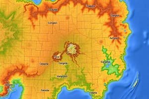
What Can GIS Do?
- Environmental monitoring (flood mapping)
- Cross-country movement analysis (CCM)
- Route analysis and intervisibility studies in facility management
- Airfield assessment
- Network analysis for roads, propagation coverage
- Observation post analysis
- Perspective views creation
Additional Topics
- The data input aspect of GIS
- Various GIS output formats
- Mapping specific data like flood analysis
Studying That Suits You
Use AI to generate personalized quizzes and flashcards to suit your learning preferences.