Podcast
Questions and Answers
What is the primary function of Geographic Information Systems (GIS)?
What is the primary function of Geographic Information Systems (GIS)?
- Conduct fieldwork observations.
- Manage, integrate, and analyze geographic data. (correct)
- Create physical maps based solely on fieldwork.
- Perform statistical analysis exclusively.
Which application of geography focuses on creating sustainable urban environments?
Which application of geography focuses on creating sustainable urban environments?
- Environmental Management
- Disaster Management
- Urban Planning (correct)
- International Relations
Which of the following best describes the purpose of disaster management in geography?
Which of the following best describes the purpose of disaster management in geography?
- To manage and conserve natural resources.
- To predict and mitigate the effects of natural disasters. (correct)
- To study demographic changes in urban areas.
- To enhance business strategies and market analysis.
What is a key focus of environmental management within geography?
What is a key focus of environmental management within geography?
Quantitative methods in geography are primarily used for what purpose?
Quantitative methods in geography are primarily used for what purpose?
What does physical geography primarily study?
What does physical geography primarily study?
Which branch of geography studies the distribution of living organisms?
Which branch of geography studies the distribution of living organisms?
What is the primary focus of human geography?
What is the primary focus of human geography?
Which of the following is not a key element of physical geography?
Which of the following is not a key element of physical geography?
What does environmental geography primarily explore?
What does environmental geography primarily explore?
Which of the following tools is essential for visualizing geographic information?
Which of the following tools is essential for visualizing geographic information?
Which aspect does climatology study?
Which aspect does climatology study?
What does regional geography focus on?
What does regional geography focus on?
Flashcards
Geography
Geography
The study of the Earth's surface, its features, climate, people, and human activities.
Physical Geography
Physical Geography
Examining the Earth's natural features (like mountains, climate, water, and living things).
Human Geography
Human Geography
Focuses on the relationship between people and their surroundings.
Landforms
Landforms
Signup and view all the flashcards
Climate
Climate
Signup and view all the flashcards
Population Geography
Population Geography
Signup and view all the flashcards
Maps
Maps
Signup and view all the flashcards
Remote Sensing
Remote Sensing
Signup and view all the flashcards
GIS
GIS
Signup and view all the flashcards
Quantitative Methods
Quantitative Methods
Signup and view all the flashcards
Urban Planning
Urban Planning
Signup and view all the flashcards
Environmental Management
Environmental Management
Signup and view all the flashcards
Fieldwork
Fieldwork
Signup and view all the flashcards
Study Notes
Introduction to Geography
- Geography is the study of the Earth's surface, including its physical features, climate, inhabitants, and human activities.
- It encompasses both physical and human aspects of the world.
Physical Geography
- Physical geography examines the natural aspects of the Earth.
- Key elements include:
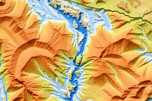
- Landforms: Mountains, valleys, plains, plateaus, and coastal features.
- Climate: Temperature, precipitation, and atmospheric conditions.
- Hydrosphere: Oceans, rivers, lakes, and groundwater.
- Biosphere: Distribution of plant and animal life.
- Atmosphere: The air surrounding the Earth.
- Geomorphology: The study of landforms and how they are created and changed.
- Hydrology: The study of water on Earth.
- Biogeography: The study of the distribution of living organisms.
- Climatology: The study of climate patterns.
- Meteorology: The study of weather patterns.
Human Geography
- Human geography focuses on the relationship between humans and their environment.
- Key elements include:
- Population geography: Distribution, density, and growth of human populations.
- Cultural geography: The spatial distribution of cultural elements like language, religion, and traditions.
- Economic geography: Location of industries, trade patterns, and economic activities.
- Political geography: Government boundaries, political systems, and relations between countries.
- Urban geography: The spatial structure of cities, urban development, and urban problems.
- Social geography: The spatial distribution of social groups and activities.
- Settlement geography: The location, size, and types of human settlements.
Branches of Geography
- Regional Geography: Study of specific regions of the world, focusing on their unique characteristics and interactions.
- Systematic Geography: Focuses on a particular geographic theme (climate, population, etc.).
- Environmental Geography: Explores the relationship between human activities and the environment, encompassing the study of environmental issues such as pollution, deforestation, and climate change.
Geographic Tools and Techniques
- Maps: Essential for visualizing geographic information. Includes various types (topographic, thematic, etc), and different map projections.
- Remote Sensing: Acquisition and analysis of data from a distance (e.g., satellites).
- Geographic Information Systems (GIS): Computer systems that integrate, manage, and analyze geographic data.
- Quantitative Methods: Use of statistical analysis to investigate geographic patterns and processes.
- Fieldwork: Direct observation of geographic phenomena in the physical environment.
Applications of Geography
- Urban Planning: Understanding population patterns and creating sustainable urban environments.
- Environmental Management: Addressing environmental issues like pollution and land degradation.
- Disaster Management: Predicting and mitigating the effects of natural disasters.
- Resource Management: Sustainable use of natural resources.
- International Relations: Understanding global interactions and cooperation.
- Business and Commerce: Strategic decision-making, market analysis and location planning.
Studying That Suits You
Use AI to generate personalized quizzes and flashcards to suit your learning preferences.