Podcast
Questions and Answers
Which subfield of geography is most concerned with the long-term effects of deforestation on local precipitation patterns?
Which subfield of geography is most concerned with the long-term effects of deforestation on local precipitation patterns?
- Biogeography
- Geomorphology
- Pedology
- Climatology (correct)
A city planner is trying to determine the best location for a new hospital to serve a growing suburban population. Which geographical tool would be most effective in analyzing accessibility and population density to make this decision?
A city planner is trying to determine the best location for a new hospital to serve a growing suburban population. Which geographical tool would be most effective in analyzing accessibility and population density to make this decision?
- Topographic Map
- Climate Classification Map
- Geographic Information System (GIS) (correct)
- Remote Sensing Imagery
A geographer is studying the impact of trade routes on the cultural diversity of port cities. Which branch of geography would be most relevant to this research?
A geographer is studying the impact of trade routes on the cultural diversity of port cities. Which branch of geography would be most relevant to this research?
- Political Geography
- Population Geography
- Cultural Geography (correct)
- Economic Geography
What is the primary difference between 'weather' and 'climate', and which field of geography focuses on the latter?
What is the primary difference between 'weather' and 'climate', and which field of geography focuses on the latter?
A researcher aims to map the spread of an invasive plant species across a national park using satellite imagery. Which geographic tool is being utilized and what type of data is being gathered?
A researcher aims to map the spread of an invasive plant species across a national park using satellite imagery. Which geographic tool is being utilized and what type of data is being gathered?
Which of the following scenarios best illustrates a concept studied in urban social geography?
Which of the following scenarios best illustrates a concept studied in urban social geography?
If you are examining the processes of weathering and erosion that create specific landforms, which field of physical geography are you working in?
If you are examining the processes of weathering and erosion that create specific landforms, which field of physical geography are you working in?
An agricultural geographer is researching the spatial patterns of coffee production in a mountainous region. Which factors would be most important to consider?
An agricultural geographer is researching the spatial patterns of coffee production in a mountainous region. Which factors would be most important to consider?
What is the main purpose of climate classification systems like the Köppen system?
What is the main purpose of climate classification systems like the Köppen system?
Which of the following is the most accurate description of 'urban morphology'?
Which of the following is the most accurate description of 'urban morphology'?
Flashcards
Geography
Geography
The study of the Earth's surface, including physical features, human populations, and their interactions.
Physical Geography
Physical Geography
Focuses on the natural environment of the Earth, examining processes and patterns in the natural world.
Geomorphology
Geomorphology
Studies landforms and the processes that shape them, including erosion, weathering, and tectonic activity.
Hydrology
Hydrology
Signup and view all the flashcards
Biogeography
Biogeography
Signup and view all the flashcards
Climatology
Climatology
Signup and view all the flashcards
Human Geography
Human Geography
Signup and view all the flashcards
Population Geography
Population Geography
Signup and view all the flashcards
Urban Geography
Urban Geography
Signup and view all the flashcards
Remote Sensing
Remote Sensing
Signup and view all the flashcards
Study Notes
- Geography is the study of the Earth's surface, including its physical features, human populations, and the interactions between them.
- It seeks to understand the spatial distribution of phenomena and how they vary across different locations.
- Geography bridges the natural sciences and the social sciences.
Physical Geography
- Physical geography focuses on the natural environment of the Earth.
- It examines processes and patterns in the natural world.
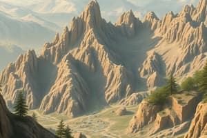
- Geomorphology studies landforms and the processes that shape them.
- Includes erosion, weathering, and tectonic activity.
- Hydrology deals with water on Earth.
- Covers rivers, lakes, oceans, and groundwater.
- Biogeography studies the distribution of species and ecosystems.
- Examines factors influencing these patterns, such as climate and soil.
- Pedology is the study of soils.
- Studies soil formation, classification, and properties.
Climatology
- Climatology is the study of climate.
- It analyzes long-term weather patterns and their causes.
- Climate differs from weather, which is the short-term atmospheric conditions at a specific time and place.
- Key elements of climate include temperature, precipitation, humidity, and wind.
- Factors influencing climate include latitude, altitude, and proximity to oceans.
- Climate change is a significant area of study.
- Focuses on changes in long-term weather patterns, including global warming and altered precipitation patterns.
- Climate classification systems, such as the Köppen system, help to categorize and understand different climate types around the world.
Human Geography
- Human geography studies the spatial aspects of human activities and how humans interact with their environment.
- Population geography examines the distribution, composition, migration, and growth of human populations.
- Cultural geography studies the spatial variations in cultural practices, beliefs, and landscapes.
- Economic geography focuses on the location, distribution, and organization of economic activities.
- Political geography studies the spatial dimensions of political systems and boundaries.
- Urban geography examines cities and urban processes.
- Agricultural geography studies agricultural practices and their spatial patterns.
Urban Geography
- Urban geography focuses on the study of cities and urban environments.
- It examines the spatial distribution of urban areas, their internal structure, and their interactions with surrounding regions.
- Urbanization is the process by which populations concentrate in urban areas.
- Leads to the growth and expansion of cities.
- Urban morphology studies the physical form and structure of cities.
- Includes street patterns, building types, and land use.
- Urban planning involves the design and regulation of urban spaces.
- Aims to improve the quality of life within cities.
- Urban social geography examines social patterns and inequalities within cities.
- Includes residential segregation, access to services, and social interactions.
- Transportation geography studies the movement of people and goods within and between cities.
Geographical Tools
- Geographical tools are used to collect, analyze, and visualize spatial data.
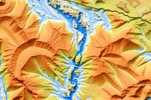
- Maps are visual representations of the Earth's surface.
- Show spatial relationships and geographic features.
- Different types of maps serve different purposes.
- Topographic maps show elevation.
- Thematic maps display specific data, such as population density.
- Remote sensing involves acquiring information about the Earth's surface from a distance.
- Uses satellites and aerial imagery.
- Provides data for land cover mapping, environmental monitoring, and urban planning.
- Geographic Information Systems (GIS) are computer-based systems for storing, analyzing, and displaying spatial data.
- Integrates data from various sources.
- Used for spatial analysis, mapping, and decision-making.
- Cartography is the art and science of mapmaking.
- Involves designing and creating maps that effectively communicate spatial information.
- Statistical analysis is used to analyze spatial data.
- Examines patterns, relationships, and trends.
- Includes techniques such as spatial autocorrelation and regression analysis.
- Qualitative methods are used to understand human experiences and perceptions of space.
- Includes interviews, focus groups, and ethnographic studies.
Studying That Suits You
Use AI to generate personalized quizzes and flashcards to suit your learning preferences.