Podcast
Questions and Answers
What is the primary purpose of remote sensing?
What is the primary purpose of remote sensing?
- Collecting data about the Earth from a distance (correct)
- Studying environmental conservation methods
- Performing statistical analysis on geographic data
- Creating detailed maps of local areas
Which field primarily involves direct observation and data collection in a specific location?
Which field primarily involves direct observation and data collection in a specific location?
- Spatial Analysis
- Remote Sensing
- Fieldwork (correct)
- Cartography
Which application of geography focuses on the development of sustainable cities?
Which application of geography focuses on the development of sustainable cities?
- Urban Planning (correct)
- Resource Management
- Business Planning
- International Relations
At which geographic scale would you focus on patterns and processes occurring worldwide?
At which geographic scale would you focus on patterns and processes occurring worldwide?
Which of the following best describes spatial analysis?
Which of the following best describes spatial analysis?
What does physical geography primarily study?
What does physical geography primarily study?
Which term describes the precise coordinates of a location?
Which term describes the precise coordinates of a location?
What is a characteristic of formal regions?
What is a characteristic of formal regions?
Which branch of geography analyzes patterns of human activity and their relation to physical factors?
Which branch of geography analyzes patterns of human activity and their relation to physical factors?
Which of the following best describes movement in geographical terms?
Which of the following best describes movement in geographical terms?
What primary tool is used in geography to analyze spatial data?
What primary tool is used in geography to analyze spatial data?
What aspect does human-environment interaction focus on?
What aspect does human-environment interaction focus on?
Which of the following is NOT a component of geography?
Which of the following is NOT a component of geography?
Flashcards
What is Remote Sensing?
What is Remote Sensing?
Collecting data about Earth from a distance, like using satellites or planes.
What is Cartography?
What is Cartography?
The art and science of creating maps.
What is Spatial Analysis?
What is Spatial Analysis?
Analyzing geographic patterns and relationships using stats and computers.
What is Fieldwork?
What is Fieldwork?
Signup and view all the flashcards
How can Geography help with Environmental Conservation?
How can Geography help with Environmental Conservation?
Signup and view all the flashcards
What is Geography?
What is Geography?
Signup and view all the flashcards
Physical Geography
Physical Geography
Signup and view all the flashcards
Human Geography
Human Geography
Signup and view all the flashcards
Absolute Location
Absolute Location
Signup and view all the flashcards
Relative Location
Relative Location
Signup and view all the flashcards
Formal Region
Formal Region
Signup and view all the flashcards
Functional Region
Functional Region
Signup and view all the flashcards
What are Geographic Information Systems (GIS)?
What are Geographic Information Systems (GIS)?
Signup and view all the flashcards
Study Notes
Introduction to Geography
- Geography is the study of the Earth's surface, including its physical features, populations, and interactions.
- It encompasses a broad range of topics, including the location of places, the distribution of populations, and the processes shaping the Earth's surface.
- Geographic inquiry encompasses human and physical aspects, using spatial analysis and fieldwork.
Branches of Geography
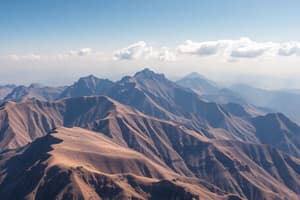
- Physical Geography: Studies natural features, processes, and systems of the Earth.
- This includes topics like landforms, climates, soils, water resources, and ecosystems.
- It examines the processes that shape the Earth's surface, such as erosion, weathering, and tectonic plate movement.
- Physical geographers often conduct fieldwork and use Geographic Information Systems (GIS) to analyze data.
- Human Geography: Examines the distribution and interactions of human populations, cultures, and activities across the Earth.
- This includes topics like population distribution, urbanization, economic activities, political systems, and cultural landscapes.
- Human geographers analyze patterns of human activity and how these patterns are shaped by physical factors and social processes.
- They use GIS and other analytical tools to understand spatial relationships and create maps.
Key Concepts in Geography
- Location: The position of a place on the Earth's surface.
- Absolute Location: Precise coordinates (latitude and longitude).
- Relative Location: Position in relation to other places.
- Place: The unique characteristics of a location.
- This includes physical characteristics (e.g., mountains, forests, water bodies) and human characteristics (e.g., culture, traditions, and economic activities) that distinguish a place from other places.
- Region: An area with shared characteristics.
- Formal Regions: Defined by specific criteria (e.g., climate, language).
- Functional Regions: Defined by interactions and connections (e.g., a transportation network).
- Perceptual Regions: Defined by people's perceptions and ideas (e.g., the "South" in the US).
- Human-Environment Interaction: How humans affect and are affected by the environment.
- Movement: The flow of people, goods, and ideas across the Earth.
Tools and Techniques
- Geographic Information Systems (GIS): Computer-based systems used to store, analyze, and display geographic data.
- Remote Sensing: Collecting data about the Earth from a distance using satellites or aircraft.
- Cartography: The art and science of mapmaking.
- Spatial Analysis: The study of geographic patterns and relationships using statistical methods and computer models.
- Fieldwork: Direct observation and data collection in the field.
Applications of Geography
- Environmental Conservation: Understanding and addressing environmental issues.
- Urban Planning: Developing sustainable cities and neighborhoods.
- Resource Management: Identifying and managing natural resources.
- International Relations: Understanding global interactions and conflicts.
- Business Planning: Location analysis and market research.
Geographic Scales
- Global Scale: Examining global patterns and processes.
- Regional Scale: Focusing on a particular region.
- Local Scale: Concentrating on a specific place.
Studying That Suits You
Use AI to generate personalized quizzes and flashcards to suit your learning preferences.