Podcast
Questions and Answers
Describe how the concept of 'relative location' can influence trade and transportation patterns in a specific region. Provide an example.
Describe how the concept of 'relative location' can influence trade and transportation patterns in a specific region. Provide an example.
Relative location affects accessibility and connectivity, making some regions more advantageous for trade. For example, a city located near major transportation routes or other economic hubs will likely experience greater economic activity.
Explain how a convergent plate boundary can result in both mountain formation and volcanic activity. Give a real-world example.
Explain how a convergent plate boundary can result in both mountain formation and volcanic activity. Give a real-world example.
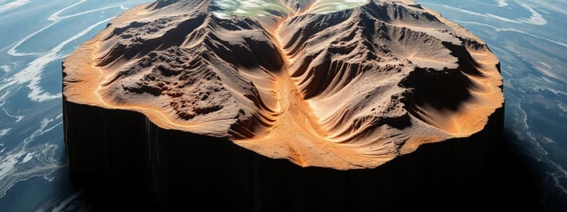
At convergent boundaries where subduction occurs, one plate slides beneath another. The subducting plate melts, creating magma that rises to form volcanoes. The collision also causes folding and uplift, forming mountains. The Andes Mountains are an example.
Contrast the landforms created by fluvial erosion in a humid climate versus an arid climate.
Contrast the landforms created by fluvial erosion in a humid climate versus an arid climate.
In humid climates, fluvial erosion creates deep, meandering river channels and broad valleys due to consistent water flow. In arid climates, it forms narrow, steep-sided canyons and alluvial fans due to infrequent but intense rainfall events.
Describe how the rainshadow effect influences precipitation patterns on either side of a mountain range.
Describe how the rainshadow effect influences precipitation patterns on either side of a mountain range.
Explain how ocean currents affect the climate of coastal regions, and provide an example of a warm and cold ocean current.
Explain how ocean currents affect the climate of coastal regions, and provide an example of a warm and cold ocean current.
How does the hydrologic cycle contribute to both weathering and erosion processes?
How does the hydrologic cycle contribute to both weathering and erosion processes?
Describe how the concept of a 'watershed' is important for managing water quality and quantity in a region.
Describe how the concept of a 'watershed' is important for managing water quality and quantity in a region.
Explain how latitude, altitude, and proximity to water bodies interact to influence local temperature ranges.
Explain how latitude, altitude, and proximity to water bodies interact to influence local temperature ranges.
Describe how human activities contribute to accelerated erosion and what measures can be taken to mitigate these effects.
Describe how human activities contribute to accelerated erosion and what measures can be taken to mitigate these effects.
Explain how climate change can affect the distribution of plant and animal species within different biomes.
Explain how climate change can affect the distribution of plant and animal species within different biomes.
Flashcards
Geography
Geography
Study of Earth's surface, features, populations, and interactions.
Physical Geography
Physical Geography
Focuses on Earth’s natural processes and features.
Absolute Location
Absolute Location
Exact coordinates of a place.
Human-Environment Interaction
Human-Environment Interaction
Signup and view all the flashcards
Divergent Plate Boundary
Divergent Plate Boundary
Signup and view all the flashcards
Weathering
Weathering
Signup and view all the flashcards
Erosion
Erosion
Signup and view all the flashcards
Climate
Climate
Signup and view all the flashcards
Hydrologic Cycle
Hydrologic Cycle
Signup and view all the flashcards
Biomes
Biomes
Signup and view all the flashcards
Study Notes
- Geography is the study of the Earth's surface, including its physical features, human populations, and the interactions between them
- Physical geography focuses on the natural processes and features of the Earth, such as landforms, climate, and ecosystems
Core Concepts
- Location: Absolute (coordinates) and relative (in relation to other places)
- Place: Physical and human characteristics of a location
- Human-Environment Interaction: How humans adapt to, modify, and depend on the environment
- Movement: The movement of people, goods, and ideas
- Region: An area with unifying characteristics (physical, human, cultural)
Earth's Structure and Plate Tectonics
- The Earth is composed of the crust, mantle, and core
- Plate tectonics: The theory that the Earth's lithosphere is divided into plates that move and interact, causing earthquakes, volcanic activity, and mountain formation
- Plate boundaries:
- Divergent: Plates move apart, creating new crust (e.g., mid-ocean ridges)
- Convergent: Plates collide, resulting in subduction or mountain building (e.g., Himalayas)
- Transform: Plates slide past each other horizontally (e.g., San Andreas Fault)
- Earthquakes: Sudden releases of energy in the Earth's crust, often occurring along plate boundaries
- Volcanoes: Formed by magma rising to the Earth's surface, often found near subduction zones or hotspots
Landforms and Processes
- Weathering: The breakdown of rocks and minerals at the Earth's surface through physical and chemical processes
- Erosion: The removal and transport of weathered material by wind, water, ice, or gravity
- Deposition: The accumulation of eroded material in a new location
- Types of Landforms:
- Mountains: Elevated landforms formed by tectonic activity, volcanism, or erosion
- Plains: Flat or gently rolling areas of low relief
- Plateaus: Elevated, flat-topped areas
- Valleys: Elongated depressions, often formed by rivers or glaciers
- Coasts: Dynamic environments shaped by waves, tides, and currents
- Fluvial processes: Actions of rivers and streams that shape the landscape through erosion, transportation, and deposition
- Glacial processes: Actions of glaciers that erode and deposit material, creating distinctive landforms like U-shaped valleys and moraines
- Aeolian processes: Actions of wind that erode, transport, and deposit sediment, particularly in arid and semi-arid regions, forming features like sand dunes
Climate and Weather
- Climate: The long-term average of weather conditions in a region
- Weather: The short-term atmospheric conditions in a specific place and time
- Factors affecting climate:
- Latitude: Affects solar radiation and temperature
- Altitude: Temperature decreases with increasing altitude
- Proximity to water: Moderates temperature due to water's high heat capacity
- Ocean currents: Distribute heat around the globe
- Prevailing winds: Influence temperature and precipitation patterns
- Atmospheric circulation: The global movement of air, driven by temperature differences and the Earth's rotation
- Precipitation: Any form of water falling from the atmosphere, including rain, snow, sleet, and hail
- Climate zones:
- Tropical: Warm and humid year-round
- Temperate: Moderate temperatures with distinct seasons
- Polar: Cold temperatures and ice cover year-round
- Arid: Dry conditions with sparse vegetation
- Climate change: Long-term changes in global or regional climate patterns, largely attributed to human activities that increase greenhouse gas concentrations in the atmosphere
Hydrology
- The study of water on Earth, including its distribution, movement, and properties
- The hydrologic cycle: The continuous movement of water between the oceans, atmosphere, and land through processes like evaporation, condensation, precipitation, and runoff
- Surface water: Water found on the Earth's surface, including rivers, lakes, and wetlands
- Groundwater: Water stored beneath the Earth's surface in aquifers
- Watershed: An area of land that drains into a common outlet, such as a river or lake
- Water resources: The availability and management of water for human use
Biogeography
- The study of the distribution of plants and animals across the Earth
- Ecosystems: Communities of interacting organisms and their physical environment
- Biomes: Large geographic areas with similar climate, vegetation, and animal life
- Factors affecting species distribution:
- Climate: Temperature, precipitation, and sunlight
- Topography: Elevation and landforms
- Soil: Nutrient content and water-holding capacity
- Biogeographic barriers: Mountains, deserts, and oceans that limit species dispersal
- Biodiversity: The variety of life on Earth, including genetic diversity, species diversity, and ecosystem diversity
- Conservation: Protecting and managing natural resources and ecosystems
Studying That Suits You
Use AI to generate personalized quizzes and flashcards to suit your learning preferences.


