Podcast
Questions and Answers
What is the boundary between land and the ocean called?
What is the boundary between land and the ocean called?
- Delta
- River
- Plateau
- Coastline (correct)
Which of these landforms is formed by the accumulation of sand, clay, and silt at the mouth of a river?
Which of these landforms is formed by the accumulation of sand, clay, and silt at the mouth of a river?
- Delta (correct)
- Plateau
- Coastline
- Dune
What is a large unit formed by long, connected chains of mountain systems and ranges?
What is a large unit formed by long, connected chains of mountain systems and ranges?
- Mountain Belt (correct)
- Plateau
- Dune
- Plain
Which of the following is NOT a characteristic of a plain?
Which of the following is NOT a characteristic of a plain?
What is the primary force that shapes dunes?
What is the primary force that shapes dunes?
Which of these landforms can be shaped by both rivers and streams?
Which of these landforms can be shaped by both rivers and streams?
Which of the following is a use of a Geographic Information System (GIS)?
Which of the following is a use of a Geographic Information System (GIS)?
What is the minimum number of satellites needed for a GPS receiver to accurately calculate its position?
What is the minimum number of satellites needed for a GPS receiver to accurately calculate its position?
What is the primary tool used in modern mapping?
What is the primary tool used in modern mapping?
What type of map shows the shape of the land, including elevation, relief, and slopes?
What type of map shows the shape of the land, including elevation, relief, and slopes?
What is the primary function of the Global Positioning System (GPS)?
What is the primary function of the Global Positioning System (GPS)?
Which of the following is NOT a data layer used in a Geographic Information System (GIS)?
Which of the following is NOT a data layer used in a Geographic Information System (GIS)?
What does GIS stand for?
What does GIS stand for?
What is topography?
What is topography?
What is the difference between a mountain range and a mountain system?
What is the difference between a mountain range and a mountain system?
What are constructive forces?
What are constructive forces?
What is an example of a constructive force?
What is an example of a constructive force?
Which of these forces can cause the formation of a mountain range?
Which of these forces can cause the formation of a mountain range?
What is the difference between elevation and relief?
What is the difference between elevation and relief?
What is NOT a landform?
What is NOT a landform?
What does the spacing of contour lines indicate?
What does the spacing of contour lines indicate?
What is the purpose of index contour lines on a topographic map?
What is the purpose of index contour lines on a topographic map?
Which feature on a topographic map represents a depression or hollow?
Which feature on a topographic map represents a depression or hollow?
How does the scale of a topographic map relate to the real world?
How does the scale of a topographic map relate to the real world?
Which of the following is NOT a feature typically found on a topographic map?
Which of the following is NOT a feature typically found on a topographic map?
What is the primary advantage of satellite imagery over aerial photography?
What is the primary advantage of satellite imagery over aerial photography?
How are satellite images created?
How are satellite images created?
Which of the following can be identified using satellite imagery?
Which of the following can be identified using satellite imagery?
Flashcards
Global Positioning System (GPS)
Global Positioning System (GPS)
A navigational system using satellites to determine the location of a receiver on Earth.
Function of GPS satellites
Function of GPS satellites
24 satellites orbit Earth to send location and time data to GPS receivers.
Minimum satellites for GPS accuracy
Minimum satellites for GPS accuracy
A GPS receiver needs data from at least 3 satellites to calculate its position accurately.
Geographic Information System (GIS)
Geographic Information System (GIS)
Signup and view all the flashcards
Uses of GIS
Uses of GIS
Signup and view all the flashcards
Mountain Belt
Mountain Belt
Signup and view all the flashcards
Plateaus
Plateaus
Signup and view all the flashcards
Plains
Plains
Signup and view all the flashcards
Coastlines
Coastlines
Signup and view all the flashcards
Dunes
Dunes
Signup and view all the flashcards
Rivers
Rivers
Signup and view all the flashcards
Delta
Delta
Signup and view all the flashcards
Topographic Maps
Topographic Maps
Signup and view all the flashcards
Contour Lines
Contour Lines
Signup and view all the flashcards
Contemporary Spacing
Contemporary Spacing
Signup and view all the flashcards
Topography
Topography
Signup and view all the flashcards
Elevation
Elevation
Signup and view all the flashcards
Contour Interval
Contour Interval
Signup and view all the flashcards
Index Contour
Index Contour
Signup and view all the flashcards
Relief
Relief
Signup and view all the flashcards
Finding Elevation
Finding Elevation
Signup and view all the flashcards
Constructive Forces
Constructive Forces
Signup and view all the flashcards
V-Shaped Lines
V-Shaped Lines
Signup and view all the flashcards
Destructive Forces
Destructive Forces
Signup and view all the flashcards
Erosion
Erosion
Signup and view all the flashcards
Aerial Photography
Aerial Photography
Signup and view all the flashcards
Satellite Imagery
Satellite Imagery
Signup and view all the flashcards
Mountain Range
Mountain Range
Signup and view all the flashcards
Landforms
Landforms
Signup and view all the flashcards
Study Notes
Introduction to Earth Systems - Surface Features in the Geosphere
- This lesson covers surface features in the geosphere, including topography, landforms and Earth-shaping forces, using mapping tools
- Objectives include understanding topography and landforms, exploring Earth-shaping forces, and utilizing mapping tools
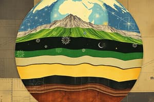
- Topography describes the shape of the land using elevation, relief, and landforms
- Elevation is the height above sea level
- Relief is the difference in elevation between the highest and lowest points in an area
- Landforms are features like mountains, plateaus, dunes, and rivers
- Different landforms have different combinations of elevations and relief
Constructive Forces
- Constructive forces create or build landforms by adding material to the Earth's surface
- Examples of these forces:
- Mountain formation like the Himalayas, formed by colliding tectonic plates
- Creation of new landmasses by volcanic activity
Destructive Forces
- Destructive forces break down or erode landforms, reducing elevation
- Examples of these forces:
- Erosion of rocks due to factors such as rain, wind, ice, and temperature changes
- Natural events like landslides, earthquakes, and volcanic eruptions. These can release ashes into the atmosphere, affecting the living organisms
Modeling Landforms
- Modern mapping uses computers, aerial photos, and satellite images to create maps showing land features
- Topographic Maps use contour lines to show elevation by connecting points at the same height
Topographic Maps
- Contour lines in a topographic map show the shape of a landform (elevation)
- Contour intervals represent the change in elevation between contour lines
- Features like ridges, valleys, and depressions can be identified using the shape of contour lines
- Hilltops are shown as closed contour loops
- Steep slopes are marked with closely spaced contour lines
- Flat areas are marked by widely spaced contour lines
Aerial Photography
- Aerial photography uses photos taken from airplanes to capture detailed images of a large area
- Photographs are pieced together to create a detailed image of a large area
Satellite Imagery
- Satellites collect and store data about the Earth's surface
- Computers process this data creating satellite images with features such as plants, land, water, snow, and ice
Global Positioning System (GPS) and Geographic Information Systems (GIS)
- Global Positioning System (GPS) uses satellites signals to determine a location
- Geographic Information System (GIS) combines data, and helps solve problems like flood risk analysis
- Both GPS and GIS are more useful than topographic maps because they provide more information about the terrain by combining multiple data sources allowing a more detailed analysis and precise locations.
Measurements and Interpretations
- Mapping tools and data help to precisely understand shapes, elevations, and landforms, assisting in critical analysis of given datasets
Studying That Suits You
Use AI to generate personalized quizzes and flashcards to suit your learning preferences.