Podcast
Questions and Answers
Which of the following best describes Earth science?
Which of the following best describes Earth science?
- The study of Earth's economic resources and their distribution.
- The branch of engineering focused on designing structures that can withstand earthquakes.
- The study of Earth's biological systems and their interactions.
- The group of sciences that studies Earth and its neighbors in space. (correct)
Earth science only focuses on the present-day processes occurring on Earth.
Earth science only focuses on the present-day processes occurring on Earth.
False (B)
Which civilization is known for keeping records of earthquakes as early as 780 BCE?
Which civilization is known for keeping records of earthquakes as early as 780 BCE?
- Ancient Greeks
- Egyptians
- Chinese (correct)
- Mayans
What two inventions during the 16th and 17th centuries significantly advanced the ability to study previously hidden aspects of Earth and the universe?
What two inventions during the 16th and 17th centuries significantly advanced the ability to study previously hidden aspects of Earth and the universe?
Which branch of Earth science is primarily concerned with the study of the origin, history, processes, and structure of the Earth?
Which branch of Earth science is primarily concerned with the study of the origin, history, processes, and structure of the Earth?
The study of the Earth's oceans, including coastal processes and seafloor topography, is known as ______.
The study of the Earth's oceans, including coastal processes and seafloor topography, is known as ______.
Paleontology is a discipline that uses the principles and methods of meteorology to reconstruct the geological history of Earth.
Paleontology is a discipline that uses the principles and methods of meteorology to reconstruct the geological history of Earth.
Which of the following best describes the focus of meteorology as a branch of Earth science?
Which of the following best describes the focus of meteorology as a branch of Earth science?
Which branch of Earth science studies the universe beyond Earth?
Which branch of Earth science studies the universe beyond Earth?
Match the following branches of Earth science with their primary focus:
Match the following branches of Earth science with their primary focus:
What is the first step in the scientific method?
What is the first step in the scientific method?
A hypothesis is a proven fact that explains a natural phenomenon.
A hypothesis is a proven fact that explains a natural phenomenon.
In the context of a scientific experiment, what is an independent variable?
In the context of a scientific experiment, what is an independent variable?
What is the purpose of a control group in a controlled experiment?
What is the purpose of a control group in a controlled experiment?
After conducting an experiment, if the results contradict the initial hypothesis, what should a scientist do?
After conducting an experiment, if the results contradict the initial hypothesis, what should a scientist do?
A group that serves as a standard of comparison with another group to which the control group is identical except for one factor is called ______.
A group that serves as a standard of comparison with another group to which the control group is identical except for one factor is called ______.
In an experiment testing the effect of liquid viscosity on flow rate, the liquid's viscosity would be the dependent variable.
In an experiment testing the effect of liquid viscosity on flow rate, the liquid's viscosity would be the dependent variable.
What should researchers do if experimental results differ from what was expected?
What should researchers do if experimental results differ from what was expected?
What does drawing a conclusion in the scientific method rely on?
What does drawing a conclusion in the scientific method rely on?
Match terms to the appropriate variable type:
Match terms to the appropriate variable type:
What is the main purpose of creating drawings of Earth's surface?
What is the main purpose of creating drawings of Earth's surface?
Longitude lines run east and west and indicate the position of north and south.
Longitude lines run east and west and indicate the position of north and south.
What is the reference point for measuring latitude?
What is the reference point for measuring latitude?
What is the angular distance east or west of the equator called?
What is the angular distance east or west of the equator called?
If you are located at 30° N latitude and 90° W longitude, which city are you closest to?
If you are located at 30° N latitude and 90° W longitude, which city are you closest to?
The ______ is an arbitrarily-chosen meridian where longitude is defined as 0°.
The ______ is an arbitrarily-chosen meridian where longitude is defined as 0°.
All locations west of the Prime Meridian have longitudes between 0° and 180°E.
All locations west of the Prime Meridian have longitudes between 0° and 180°E.
What does one minute of latitude equal?
What does one minute of latitude equal?
What is the difference between the geomagnetic and geographical poles?
What is the difference between the geomagnetic and geographical poles?
Match the following concepts with their appropriate descriptions:
Match the following concepts with their appropriate descriptions:
What system relies on a global network of satellites to transmit radio signals to Earth's surface for navigation?
What system relies on a global network of satellites to transmit radio signals to Earth's surface for navigation?
A globe is not very useful for studying smaller features, such as cities or individual buildings.
A globe is not very useful for studying smaller features, such as cities or individual buildings.
What is cartography?
What is cartography?
What is remote sensing in the context of mapping?
What is remote sensing in the context of mapping?
What does a compass rose on a map primarily indicate?
What does a compass rose on a map primarily indicate?
A ______ is a representation of map symbols and their meanings.
A ______ is a representation of map symbols and their meanings.
A verbal scale on a map is expressed as a ratio.
A verbal scale on a map is expressed as a ratio.
What do isograms on a map represent?
What do isograms on a map represent?
What information do contour lines convey on a topographic map?
What information do contour lines convey on a topographic map?
Which type of map is designed to show the distribution of geologic features, such as rock types and faults?
Which type of map is designed to show the distribution of geologic features, such as rock types and faults?
Match the following map features with their descriptions:
Match the following map features with their descriptions:
Flashcards
What is Earth Science?
What is Earth Science?
The group of sciences that studies the Earth and its neighbors in space.
What is Geology?
What is Geology?
Origin, history, processes, and structure of the Earth.
What is Physical Geology?
What is Physical Geology?
Concerned with all aspects of the Earth's structure, composition, physical properties
What is Historical Geology?
What is Historical Geology?
Signup and view all the flashcards
What is Oceanography?
What is Oceanography?
Signup and view all the flashcards
What does Oceanography study?
What does Oceanography study?
Signup and view all the flashcards
What is Meteorology?
What is Meteorology?
Signup and view all the flashcards
What is Astronomy?
What is Astronomy?
Signup and view all the flashcards
What is the Scientific Method?
What is the Scientific Method?
Signup and view all the flashcards
What is Observation in the Scientific Method?
What is Observation in the Scientific Method?
Signup and view all the flashcards
What is the Question step in the Scientific Method?
What is the Question step in the Scientific Method?
Signup and view all the flashcards
What is the Hypothesis step in the Scientific Method?
What is the Hypothesis step in the Scientific Method?
Signup and view all the flashcards
What is the Experiment step in the Scientific Method?
What is the Experiment step in the Scientific Method?
Signup and view all the flashcards
What are variables?
What are variables?
Signup and view all the flashcards
What are Independent Variables?
What are Independent Variables?
Signup and view all the flashcards
What are Dependent Variables?
What are Dependent Variables?
Signup and view all the flashcards
What is a Graphical Scale?
What is a Graphical Scale?
Signup and view all the flashcards
What is Elevation?
What is Elevation?
Signup and view all the flashcards
What is a Compass Rose?
What is a Compass Rose?
Signup and view all the flashcards
What is a Legend?
What is a Legend?
Signup and view all the flashcards
What are Subsurfaces Diagrams?
What are Subsurfaces Diagrams?
Signup and view all the flashcards
What is a Isogram?
What is a Isogram?
Signup and view all the flashcards
What are Geological Map?
What are Geological Map?
Signup and view all the flashcards
What is Cartography?
What is Cartography?
Signup and view all the flashcards
What is The Global Positioning System?
What is The Global Positioning System?
Signup and view all the flashcards
What is a Globe?
What is a Globe?
Signup and view all the flashcards
Topographic Map
Topographic Map
Signup and view all the flashcards
What is Latitude?
What is Latitude?
Signup and view all the flashcards
What is Longitude?
What is Longitude?
Signup and view all the flashcards
What is Geomagnetic Poles?
What is Geomagnetic Poles?
Signup and view all the flashcards
What is Magnetic declination?
What is Magnetic declination?
Signup and view all the flashcards
What Minute and seconds?
What Minute and seconds?
Signup and view all the flashcards
What is geological map?
What is geological map?
Signup and view all the flashcards
cartographer
cartographer
Signup and view all the flashcards
What is Conclusions?
What is Conclusions?
Signup and view all the flashcards
Study Notes
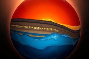
INTRODUCTION TO EARTH SCIENCE
- Earth Science is the study of the Earth and its neighbors in space.
- Study of the Earth's structure, properties, processes, and 4.5 billion years of biotic evolution.
- Focuses on the four components of the Earth system: land, water, air, and life, and their interactions.
- Scientists in China began keeping records of earthquakes around 780 BCE.
- Ancient Greeks compiled a catalog of rocks and minerals around 200 BCE.
- Mayans tracked the movement of the sun, moon, and planets.
- The first seismoscope was invented in 132 AD by Zhang Heng.
- In the 16th and 17th centuries, inventions like the microscope and telescope made seeing previously hidden worlds possible.
- Eventually, the body of knowledge about Earth became known as Earth science.
Main Branches of Earth Science
- Geology is the scientific study of the origin, history, processes, and structure of the Earth:
- Includes physical geology studying Earth's structure, composition, and properties.
- Historical geology is also known as paleontology, uses geology to reconstruct Earth's history.
- Oceanography studies the Earth's oceans, coastal processes, seafloor topography, and marine life.
- Also known as geological oceanography.
- It focuses on topography, structure, and geological processes of the ocean floor.
- Studies how the Earth and oceans formed and how ongoing processes may change them.
- Meteorology studies the atmosphere and the processes that produce weather and climate.
- Astronomy is the study of the universe beyond Earth:
- Also known as geological astronomy, astrogeology, exogeology, and planetary geology.
Scientific Method
- This is an organized and logical approached to research.
- Involves observation of a phenomenon, event, or "problem," using the senses.
- Lava from different volcanoes flows at varying speeds related to the lava's viscosity.
- Observations often lead to questions, such as "Does the viscosity of lava impact how quickly it flows?"
- A hypothesis offers a possible explanation or solution to a problem based on known facts.
- For example, lava with lower viscosity flows faster because of less resistance.
- Experiments are carried out following guidelines.
- Different liquids with varying viscosities can be tested to simulate lava flow.
- Factors that can be changed are variables; independent variables are changed by the experimenter.
- Independent variables are changed by the person performing the experiment; dependent variables change as a result.
- In most experiments, only one independent variable is tested.
- In a lava experiment, the independent variable would be the viscosity of the liquid being tested.
- The dependent variable would be the flow rate of a liquid from the varying viscosity.
- A control group is a standard of comparison identical in all factors except one.
- An experiment with a control is a controlled experiment.
- Conclusions are drawn based on the evidence or results.
- If the results differ from expectations, the hypothesis is changed or discarded.
- Expected and unexpected results can lead to new questions and further study as well as new knowledge.
- If low-viscosity liquids flow faster than high-viscosity liquids, the hypothesis is supported and vice versa.
- If results differ, analyze the possible causes such as inconsistencies in volume, ramp angle, or measurement techniques.
Models of Earth
- Drawings of the Earth's surface have been created to better understand it.
- The first known depiction of the Earth's surface was from the Babylonians in 2,300 В.С.
- Latitude is the angular distance north or south of the equator.
- Runs east to west and indicates north or south positions.
- Measured in degrees from 0° at the Equator to 90° at the poles.
- The Equator is located at 0 degrees latitude.
- One degree of latitude equals 1/360 of the Earth's circumference.
- One degree of latitude equals 111 kilometers.
- Longitude is the angular distance east or west of the equator:
- Runs north to south.
- Indicates how far east or west a place is.
- Measured in degrees from 0° at the Equator to 90° at the poles.
- The Prime Meridian is an arbitrarily chosen meridian which represents 0°.
- Locations east of the Prime Meridian have longitudes between 0° and 180°E.
- Locations west of the Prime Meridian have longitudes between 0° and 180°W.
- Minutes - 60 equal parts of each degree
- One minute of latitude equals 1.85 km.
- The distance measured by a degree of longitude decreases toward the poles.
- Geomagnetic Poles are areas where the imaginary poles of Earth’s magnets exist on the surface.
- The north end of a compass needle points in the direction of the geomagnetic north pole
- Geographical pole is where the axis of rotation intersects its surface.
- Magnetic Declination is the angle between the direction of the geographic pole and the direction a compass points.
- Magnetic North is now drifting faster than 30 miles per year.
- It has already moved back past geological north for the first time in thousands of years.
- A Global Positioning System is a satellite navigation system composed of a global network that transmits radio signals to Earth.
- NAVSTAR was the first GPS satellite which launched in February 1978.
- A globe is a familiar model of Earth that is useful for studying large surface features.
- Cartography is the science of making maps.
- Cartographers walk or drive through an area to make measurements for mapping.
- Remote sensing is the science of obtaining information about objects or areas typically from aircraft or satellites.
- Maps are often made by combining remotely gathered images with field surveys.
- A compass rose is a symbol indicating cardinal directions.
- The legend is a list of symbols and their meanings.
- Graphical Scale - a line with markings like a ruler representing units of measure on the map.
- Fractional Scale - a ratio indicating that 1 unit of distance on the map represents distance on the Earth.
- Verbal Scale - verbalizes the proportion of the map as it relates to real distance ("One centimeter is equal to one kilometer.").
- An Isogram is a line on a map representing constant or equal value.
- Used to plot data such as measurements of precipitation, temperature, gravity, magnetism, density, elevation, and chemical composition.
- Topographic Maps show the surface features, or topography, of Earth.
- Shows natural features (rivers, hills) and constructed features (buildings, roads).
- The elevation above sea level of the land.
- Elevation is measured from mean sea level.
- Contour lines show elevation by connecting points with the same elevation.
- Geologic Maps show the distribution of geologic features.
- Shows types of rocks found in a given area, locations of faults, folds, and other structures.
- Soil Maps classify, map, and describe soils.
- Based on soil surveys to record soil properties.
- Valuable for agriculture and land management.
- Diagramming the subsurface is often specialized to Earth science to envision thicknesses and orientations of materials:
- Diagrams are how earth scientists explain their understanding.
Studying That Suits You
Use AI to generate personalized quizzes and flashcards to suit your learning preferences.