Podcast
Questions and Answers
How does cartography combine different disciplines to effectively communicate spatial information?
How does cartography combine different disciplines to effectively communicate spatial information?
Cartography combines science, aesthetics, and technique to model reality in ways that effectively communicate spatial information.
How does the cartographer's work help us understand the geographic landscape?
How does the cartographer's work help us understand the geographic landscape?
The cartographer's work enables us to comprehend the geographic landscape through principles such as mathematical scale, graphical representation, and symbology.
Who was the first ancient Greek to draw a map of a known world?
Who was the first ancient Greek to draw a map of a known world?
Anaximander
How did the inventions of the sextant, telescope, and magnetic compass contribute to cartography?
How did the inventions of the sextant, telescope, and magnetic compass contribute to cartography?
Who made the oldest extant globe on Earth, and in what year was it made?
Who made the oldest extant globe on Earth, and in what year was it made?
What are the three characteristics of a map's graphical representation of an environment?
What are the three characteristics of a map's graphical representation of an environment?
In cartography, what does the term 'Mappa mundi' refer to, and what is its significance?
In cartography, what does the term 'Mappa mundi' refer to, and what is its significance?
Name at least three essential elements that should be present on a map for it to be considered complete and informative.
Name at least three essential elements that should be present on a map for it to be considered complete and informative.
According to map symbology, what real-world features are typically represented by points, lines, and areas on a map?
According to map symbology, what real-world features are typically represented by points, lines, and areas on a map?
What do brown and green colors represent on a map?
What do brown and green colors represent on a map?
How do planimetric maps differ from topographic maps in terms of the dimensions they represent?
How do planimetric maps differ from topographic maps in terms of the dimensions they represent?
What distinguishes topographic maps from planimetric maps?
What distinguishes topographic maps from planimetric maps?
What is a thematic map, and what purpose does it serve in cartography?
What is a thematic map, and what purpose does it serve in cartography?
What role do electronic computers play in modern cartography, particularly with computer-generated maps?
What role do electronic computers play in modern cartography, particularly with computer-generated maps?
What is the general use case for navigational charts?
What is the general use case for navigational charts?
Name at least three advantages of using paper maps.
Name at least three advantages of using paper maps.
What are some potential drawbacks or disadvantages associated with the use of traditional paper maps?
What are some potential drawbacks or disadvantages associated with the use of traditional paper maps?
How did exploration during the 15th to 17th centuries influence the development of cartography?
How did exploration during the 15th to 17th centuries influence the development of cartography?
Explain why the selective nature of maps is a critical aspect of their design.
Explain why the selective nature of maps is a critical aspect of their design.
Differentiate between the advantages of using paper maps in areas with limited technology access compared to regions with advanced digital infrastructure.
Differentiate between the advantages of using paper maps in areas with limited technology access compared to regions with advanced digital infrastructure.
In map design, why is the choice of color for different features (like water, vegetation, or built-up areas) more than just an aesthetic decision?
In map design, why is the choice of color for different features (like water, vegetation, or built-up areas) more than just an aesthetic decision?
How has the advent of computer-generated mapping affected the cartographer's role in map production and spatial data analysis?
How has the advent of computer-generated mapping affected the cartographer's role in map production and spatial data analysis?
Considering the blend of science and art in cartography, how might a cartographer balance accuracy with visual appeal when designing a map for public use?
Considering the blend of science and art in cartography, how might a cartographer balance accuracy with visual appeal when designing a map for public use?
How do mapmakers incorporate symbology to translate diverse real-world entities, like landmarks and ecological zones, into a two-dimensional plane?
How do mapmakers incorporate symbology to translate diverse real-world entities, like landmarks and ecological zones, into a two-dimensional plane?
How do cartographers address the challenge of representing three-dimensional landscapes on flat paper maps?
How do cartographers address the challenge of representing three-dimensional landscapes on flat paper maps?
Flashcards
What is Cartography?
What is Cartography?
The study and practice of making and using maps, combining science, aesthetics, and technique to communicate spatial information.
Who is a Cartographer?
Who is a Cartographer?
A person who draws or produces maps.
Who was Anaximander?
Who was Anaximander?
The first ancient Greek credited with drawing a map of the known world.
Origin of the word 'map'?
Origin of the word 'map'?
Signup and view all the flashcards
What defines a map?
What defines a map?
Signup and view all the flashcards
What are Planimetric Maps?
What are Planimetric Maps?
Signup and view all the flashcards
What are Topographic Maps?
What are Topographic Maps?
Signup and view all the flashcards
What are Thematic Maps?
What are Thematic Maps?
Signup and view all the flashcards
What are Computer-generated Maps?
What are Computer-generated Maps?
Signup and view all the flashcards
What are the advantages of maps?
What are the advantages of maps?
Signup and view all the flashcards
What are the distadvantages of maps?
What are the distadvantages of maps?
Signup and view all the flashcards
What does brown indicate on a map?
What does brown indicate on a map?
Signup and view all the flashcards
What does blue indicate on a map?
What does blue indicate on a map?
Signup and view all the flashcards
What does green indicate on a map?
What does green indicate on a map?
Signup and view all the flashcards
What does black indicate on a map?
What does black indicate on a map?
Signup and view all the flashcards
What does grey indicate on a map?
What does grey indicate on a map?
Signup and view all the flashcards
What does red indicate on a map?
What does red indicate on a map?
Signup and view all the flashcards
What does pink indicate on a map?
What does pink indicate on a map?
Signup and view all the flashcards
Study Notes
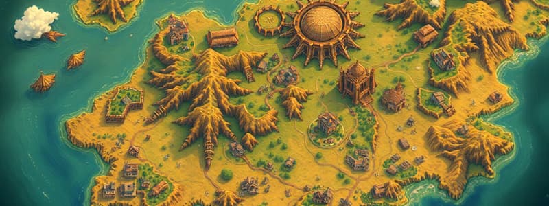
Cartography
- Cartography involves making and using maps.
- It relies on science, aesthetics, and technique.
- Cartography communicates spatial information by modeling reality.
- Cartography can be defined as the practice or study of map making.
- Cartography allows understanding the geographic landscape.
- Cartography is based on mathematical scale, graphical representation, and associated symbology.
Cartographer
- A cartographer draws or produces maps.
- Anaximander was the first ancient Greek to draw a map of the known world.
Brief History of Cartography
- From the 15th to 17th centuries, European cartographers copied and drew new maps based on new surveying techniques and observations.
- Inventions like the sextant, telescope, and magnetic compass improved map accuracy.
- Martin Behaim, a German cartographer, created the oldest extant globe on Earth in 1492.
Maps
- The word "map" comes from the medieval Latin Mappa mondi, where mappa means napkin or cloth and mundi means the world .
- "Map" is a shortened term meaning a two-dimensional representation of the world's surface.
- Maps are reduced, selective, and symbolized graphical representations of an environment.
- Maps are reduced because they should be smaller than the actual size in the ground.
- Maps are selective and may not show all information, depending on its purpose..
- Maps use visual variables like color, texture, size, and shape for symbolization.
Elements of a Map
- Title: indicates the subject of the map.
- Scale: represents the relationship between map distance and actual ground distance.
- Legend: explains the symbols and colors used on the map.
- Compass: shows the direction of north and other cardinal directions.
- Latitude and Longitude: provide a coordinate system for locating points on Earth.
Map Symbols
- Points: for buildings, dipping tanks, and trigonometrical beacons.
- Lines: for railways, roads, power lines, and telephone lines.
- Areas: for cultivation, orchards, and vineyards.
Color Usage in Maps
- Brown: represents land or earth features such as contour lines, eroded areas, rock outcrops, sand, and secondary roads.
- Blue: signifies water features like aqueducts, canals, coastlines, dams, lakes, rivers, and water towers.
- Green: indicates vegetation, including cultivated fields, golf courses, nature reserves, orchards, and woodland.
- Black: represents construction features like roads, tracks, railways, buildings, cemeteries, communication towers, and boundaries.
- Grey: construction features like built-up areas and cadastral information.
- Red: for national, arterial, and main roads, lighthouses, and marine lights.
- Pink: represent urban areas and large cities.
Classification of Maps
- Planimetric Maps: represent the earth's surface in two dimensions, showing horizontal positions of natural and man-made features.
- Topographic Maps: represent the earth's surface in three dimensions, indicating relief using contours.
- Thematic Maps: focus on a specific theme or subject against a skeletal topographic background.
- Computer-generated Maps: use electronic computers to store, process, and retrieve cartographic information in graphic form.
- Navigational Charts: specific chart type for navigation.
Advantages of Maps
- Fundamental for specific purposes.
- Degrees are available.
- Utilized for information examination.
- Paper maps provide master plan
- No confusion
- Substantial
- No web association with use.
- Modest
- The main choice in distant regions
- Ideal for use while traveling
- Clearer because of the restricted elements
- Comprehensive perspective on the area through their scales.
Disadvantages of Maps
- Tedious
- Great quality paper maps might be elusive
- Inaccuracies in Printing
- Can easily be ruined
- Restricted
- Old-fashioned
- Unfinished.
- One-sided
- Restricts highlights
- Convoluted to comprehend
- Just uses images
- Hard to show height
Studying That Suits You
Use AI to generate personalized quizzes and flashcards to suit your learning preferences.


