Podcast
Questions and Answers
Which river joins the Ganga at Allahabad?
Which river joins the Ganga at Allahabad?
- Ghaghara
- Yamuna (correct)
- Kosi
- Gandak
What is the total length of the Indus River?
What is the total length of the Indus River?
- 3,200 km
- 3,000 km
- 2,500 km
- 2,900 km (correct)
What percentage of the Indus River's water is used by India for irrigation?
What percentage of the Indus River's water is used by India for irrigation?
- 50%
- 40%
- 30%
- 20% (correct)
Which delta is formed by the Ganga River?
Which delta is formed by the Ganga River?
What is significant about the tributaries like Ghaghara, Gandak, and Kosi for agriculture?
What is significant about the tributaries like Ghaghara, Gandak, and Kosi for agriculture?
What is the significant feature of the Brahmaputra River as it flows through Assam?
What is the significant feature of the Brahmaputra River as it flows through Assam?
Which of the following rivers is known to flow westward in a rift valley?
Which of the following rivers is known to flow westward in a rift valley?
What is the length of the Godavari River?
What is the length of the Godavari River?
Majuli is recognized as what in relation to the Brahmaputra River?
Majuli is recognized as what in relation to the Brahmaputra River?
Which river is often referred to as the 'Dakshin Ganga'?
Which river is often referred to as the 'Dakshin Ganga'?
What is a notable feature of the Narmada river?
What is a notable feature of the Narmada river?
Where does the Kaveri River have its origin?
Where does the Kaveri River have its origin?
Which of the following rivers flows through Madhya Pradesh and Gujarat?
Which of the following rivers flows through Madhya Pradesh and Gujarat?
Which two rivers predominantly flow into the Bay of Bengal?
Which two rivers predominantly flow into the Bay of Bengal?
What kind of flooding is characteristic of the Brahmaputra River area?
What kind of flooding is characteristic of the Brahmaputra River area?
Flashcards are hidden until you start studying
Study Notes
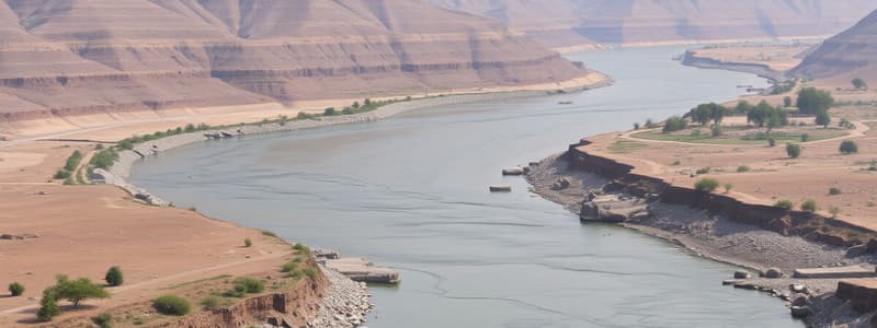
The Indus River System
- Originates in Tibet, near Lake Mansarowar.
- Flows westward through regions of Ladakh, Kashmir, Baltistan, and Gilgit, emerging at Attock.
- Major tributaries include Zaskar, Nubra, Shyok, Hunza in Kashmir; Satluj, Beas, Ravi, Chenab, and Jhelum converge near Mithankot in Pakistan.
- Total length is approximately 2,900 km.
- Under the Indus Water Treaty, India utilizes 20% of the water for irrigation across Punjab, Haryana, and parts of Rajasthan.
- Final destination is the Arabian Sea, located east of Karachi.
- The river has a very gentle slope.
The Ganga River System
- Originates from the Bhagirathi at the Gangotri Glacier, joined by the Alaknanda at Devaprayag, Uttarakhand.
- Emerges at Haridwar and flows across the northern plains.
- Himalayan tributaries include Yamuna, Ghaghara, Gandak, and Kosi; Peninsular tributaries are Chambal, Betwa, and Son.
- The Yamuna River starts from the Yamunotri Glacier and merges with the Ganga at Allahabad.
- Annual floods from tributaries like Ghaghara, Gandak, and Kosi enrich the soil, boosting agriculture.
- Key conservation program: Namami Gange Programme focuses on the Ganga's rejuvenation.
- Length exceeds 2,500 km, forming the Sundarban Delta, the largest and fastest-growing delta globally.
- Exhibits a meandering drainage pattern due to a gentle slope.
The Brahmaputra River System
- Originates in Tibet, east of Mansarowar Lake.
- Flows eastwards parallel to the Himalayas, entering India in Arunachal Pradesh as Dihang and flowing into Assam as the Brahmaputra.
- Tributaries like Dibang and Lohit join the Brahmaputra in Assam.
- Known as Tsang Po in Tibet and Jamuna in Bangladesh.
- Features a braided channel and numerous riverine islands, including Majuli, the world's largest riverine island.
- Experiences annual flooding in Assam and Bangladesh from high rainfall and silt deposition.
- Riverbed regularly shifts due to ongoing silt deposits.
Overview of Peninsular Rivers
- Water divide formed by the Western Ghats runs from north to south along the western coast.
- Major eastward-flowing rivers: Mahanadi, Godavari, Krishna, Kaveri; these drain into the Bay of Bengal and form deltas.
- Major westward-flowing rivers: Narmada and Tapi; these create estuaries.
- Generally, peninsular river drainage basins are smaller compared to those of Himalayan rivers.
The Narmada Basin
- Originates from the Amarkantak hills in Madhya Pradesh.
- Flows westward through a rift valley due to geological faulting.
- Notable features include Marble Rocks near Jabalpur and Dhuadhar Falls.
- Short tributaries join at right angles along the main river route.
- Coverage spans Madhya Pradesh and Gujarat.
- Conservation initiative: Namami Devi Narmade, aims for river conservation led by the Madhya Pradesh government.
The Tapi Basin
- Originates in the Satpura ranges of Betul district, Madhya Pradesh.
- Flows westward through a rift valley, paralleling the Narmada River.
- Shorter in length compared to the Narmada.
- Coverage includes Madhya Pradesh, Gujarat, and Maharashtra.
The Godavari Basin
- Originates on the slopes of the Western Ghats in Nasik district, Maharashtra.
- Flows eastward into the Bay of Bengal with a length of about 1,500 km.
- The largest drainage basin among peninsular rivers, encompassing Maharashtra, Madhya Pradesh, Odisha, and Andhra Pradesh.
- Major tributaries include Purna, Wardha, Pranhita, Manjra, Wainganga, and Penganga.
- Known as Dakshin Ganga due to its extensive length and coverage.
The Mahanadi Basin
- Originates from the highlands of Chhattisgarh.
- Flows eastward into the Bay of Bengal and has a length of approximately 860 km.
- Its drainage basin includes regions from Maharashtra, Chhattisgarh, Jharkhand, and Odisha.
The Krishna Basin
- Springs originate near Mahabaleshwar with a flow path eastward into the Bay of Bengal.
- Total length is about 1,400 km.
- Major tributaries consist of Tungabhadra, Koyana, Ghatprabha, Musi, and Bhima.
- The drainage basin is shared by Maharashtra, Karnataka, and Andhra Pradesh.
The Kaveri Basin
- Originates from the Brahmagri range in the Western Ghats.
- Flows eastward into the Bay of Bengal, south of Cuddalore in Tamil Nadu, with a length of approximately 760 km.
- Major tributaries include Amravati, Bhavani, Hemavati, and Kabini.
- Covers parts of Karnataka, Kerala, and Tamil Nadu.
- Notable feature: Shivasamudram Falls, the second largest waterfall in India, supplies hydroelectric power to Mysuru, Bengaluru, and Kolar Gold Field.
Studying That Suits You
Use AI to generate personalized quizzes and flashcards to suit your learning preferences.


