Podcast
Questions and Answers
What does Theme A in the introduction primarily focus on?
What does Theme A in the introduction primarily focus on?
- Modern technology in map-making
- The political history of India
- The cultural practices of ancient India
- The geographical features and their impact on civilization (correct)
Why is understanding geographical features still relevant in today's digital age?
Why is understanding geographical features still relevant in today's digital age?
- Geography has less impact on modern societies
- Maps are no longer necessary for navigation
- Because mobile maps are often inaccurate
- Geographical features shape civilizations historically and culturally (correct)
What metaphor is used in Theme B to represent the concept of history?
What metaphor is used in Theme B to represent the concept of history?
- Storybook
- Tapestry (correct)
- Canvas
- Map
What is one of the main aspects of India's unique identity according to the content?
What is one of the main aspects of India's unique identity according to the content?
Which of the following is NOT indicated as a geographical feature that shapes civilizations?
Which of the following is NOT indicated as a geographical feature that shapes civilizations?
What is the purpose of exploring the past according to Theme B?
What is the purpose of exploring the past according to Theme B?
What literary form is used to depict historical narratives in Theme B?
What literary form is used to depict historical narratives in Theme B?
How does the introductory theme characterize the relationship between geography and civilization?
How does the introductory theme characterize the relationship between geography and civilization?
What shape is the Earth most accurately described as?
What shape is the Earth most accurately described as?
Which of the following is NOT a type of road mentioned?
Which of the following is NOT a type of road mentioned?
Which symbol represents a railway line on a map?
Which symbol represents a railway line on a map?
Which of the following boundary types is NOT mentioned?
Which of the following boundary types is NOT mentioned?
What type of structure is associated with a temple according to the symbols commonly used in maps?
What type of structure is associated with a temple according to the symbols commonly used in maps?
Which of the following is a water resource symbolized on a map?
Which of the following is a water resource symbolized on a map?
Why is it challenging to represent the Earth on a flat sheet of paper?
Why is it challenging to represent the Earth on a flat sheet of paper?
Why is understanding the past important for citizens?
Why is understanding the past important for citizens?
Which of the following elements is typically included in a map as a symbol?
Which of the following elements is typically included in a map as a symbol?
What is one objective of exploring India's cultural heritage?
What is one objective of exploring India's cultural heritage?
What characteristic is mentioned about India in relation to democracy?
What characteristic is mentioned about India in relation to democracy?
What is a responsibility of citizens in a democracy?
What is a responsibility of citizens in a democracy?
How does studying social sciences benefit citizens?
How does studying social sciences benefit citizens?
Which aspect of governance does the theme explore?
Which aspect of governance does the theme explore?
What does understanding cultural heritage help individuals address?
What does understanding cultural heritage help individuals address?
What is one challenge of studying history highlighted in the content?
What is one challenge of studying history highlighted in the content?
What is the first move made by the white side in the game?
What is the first move made by the white side in the game?
What do latitudes measure?
What do latitudes measure?
What is located halfway between the North Pole and the South Pole?
What is located halfway between the North Pole and the South Pole?
Which concept is used to determine locations on a chessboard?
Which concept is used to determine locations on a chessboard?
How can you visualize a latitude line as you move from the Equator toward the poles?
How can you visualize a latitude line as you move from the Equator toward the poles?
What is the significance of the two coordinates system in maps?
What is the significance of the two coordinates system in maps?
Which of the following describes latitude?
Which of the following describes latitude?
What movement does the globe allow you to identify the North and South Poles?
What movement does the globe allow you to identify the North and South Poles?
What explains the difference in daylight between Porbandar and Tinsukia?
What explains the difference in daylight between Porbandar and Tinsukia?
Why is it not practical for a country to use multiple local times?
Why is it not practical for a country to use multiple local times?
What is the basis for Indian Standard Time (IST)?
What is the basis for Indian Standard Time (IST)?
How are standard times generally organized around the world?
How are standard times generally organized around the world?
What does the hint in the provided content suggest about the longitude difference?
What does the hint in the provided content suggest about the longitude difference?
How are international borders considered in the organization of time zones?
How are international borders considered in the organization of time zones?
What is the significance of the numbers inside some countries on a world map?
What is the significance of the numbers inside some countries on a world map?
Which statement accurately reflects the concept of local time?
Which statement accurately reflects the concept of local time?
Flashcards are hidden until you start studying
Study Notes
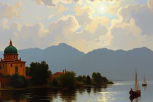
Theme A: India and the World: Land and the People
- This theme covers the basics of geography, including key features of the planet and methods of representation on maps.
- The theme emphasizes the influence of geographical features like oceans, mountains, and rivers on civilizations, particularly in India.
- Exploration of how India's natural setting shapes its unique identity is included.
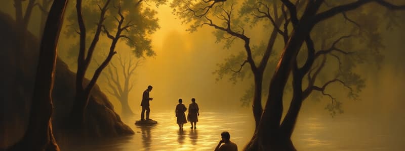
Theme B: Tapestry of the Past
- The theme draws comparisons to the historical narratives depicted on tapestries, focusing on past events in India.
- The theme acknowledges the importance of understanding history in shaping our present understanding.
- It clarifies that history, even in its unpleasant aspects, assists in comprehending the present, avoiding past mistakes.
Theme C: Our Cultural Heritage and Knowledge Traditions
- Explores the rich and ancient culture of India.
- Analyzes the guiding principles and historical manifestations of this culture.
- Examines how this heritage can be applied to address contemporary challenges, promoting cultural understanding and appreciation.
Theme D: Governance and Democracy
- This theme delves into the functioning of India's political system, being the world's largest democracy.
- It examines the characteristics and components of this system.
- The theme also discusses citizen participation in governance, rights, and duties, comparing India's system with other countries.
- The theme highlights an understanding of governance and democracy as essential to informed and responsible citizenship.
Mapping the Earth
- The text explores map symbols, their use, and how to read them.
- Common map symbols include:
- Railway lines with specific gauges and stations
- Roads differentiated as metalled and unmettled
- Boundaries defining international regions, states, or districts
- Water features like rivers, wells, tanks, canals, and bridges
- Places of worship like temples, churches, mosques, and chhatris
- Public institutions including post offices, police stations, and post and telegraph offices.
- Settlements and graveyards
- Plants and trees
- grass
Locating Places on the Earth
- The text introduces the coordinate system for locating places on maps, analogous to systems used in chess.
- The coordinate system utilizes latitudes and longitudes for precise location identification.
Latitudes
- Latitude measures distance from the Equator, which is located midway between the North and South poles.
- Latitude lines run east and west, parallel to the Equator.
Longitudes
- Longitude measures the distance east or west from the Prime Meridian, an imaginary line that runs north and south, passing through Greenwich, England.
- Longitude lines run north and south, converging at the poles.
Local Time and Standard Time
- Time zones are divided into 15° intervals.
- Local time is based on the position of the sun, with every 15° of longitude being 1 hour different.
- Standard time is a unified time system adopted by countries for simplifying timekeeping, based on a designated meridian within their territory.
- India Standard Time (IST) is 5 hours and 30 minutes ahead of Greenwich Mean Time (GMT).
- The text notes that time zone boundaries deviate from straight lines to accommodate international borders and national standard time.
Studying That Suits You
Use AI to generate personalized quizzes and flashcards to suit your learning preferences.