Podcast
Questions and Answers
What are the three major components of the GNSS system?
What are the three major components of the GNSS system?
- Satellites, Radar Systems, Control Units
- Satellites, Ground Control Stations, GNSS Receivers (correct)
- Satellites, GPS Modules, User Terminals
- Ground Stations, Global Communicators, GNSS Receivers
Which of the following statements about GPS is most accurate?
Which of the following statements about GPS is most accurate?
- GPS was developed and funded by various nations.
- GPS is only accessible to military personnel.
- GPS was developed by the Department of Defense at a cost exceeding $12 billion. (correct)
- GPS is a single unit that operates independently.
How do historical navigational tools like the sextant fail in certain conditions?
How do historical navigational tools like the sextant fail in certain conditions?
- They are ineffective in urban environments.
- They can only be used during daylight.
- They require satellite signals to operate.
- They fail to work on cloudy days. (correct)
What is the primary purpose of having accurate clocks on GNSS satellites?
What is the primary purpose of having accurate clocks on GNSS satellites?
Which limitation is associated with radionavigation systems like Lowrance?
Which limitation is associated with radionavigation systems like Lowrance?
What is one of the military applications of GNSS technology?
What is one of the military applications of GNSS technology?
What operational altitude do GNSS satellites maintain?
What operational altitude do GNSS satellites maintain?
Why might GNSS be preferred over traditional navigation methods?
Why might GNSS be preferred over traditional navigation methods?
What happens when a GPS receiver obtains signals from just one satellite?
What happens when a GPS receiver obtains signals from just one satellite?
What does GNSS stand for?
What does GNSS stand for?
How does obtaining signals from two satellites enhance the GPS accuracy?
How does obtaining signals from two satellites enhance the GPS accuracy?
What is the minimum number of satellites required for a GPS receiver to determine a precise location and elevation?
What is the minimum number of satellites required for a GPS receiver to determine a precise location and elevation?
Which of the following is NOT a component of GNSS?
Which of the following is NOT a component of GNSS?
Why does a GPS receiver need a third satellite signal?
Why does a GPS receiver need a third satellite signal?
Which statement is true regarding GPS?
Which statement is true regarding GPS?
Which of the following best describes how GPS determines location?
Which of the following best describes how GPS determines location?
What was the primary limitation of GNSS mentioned?
What was the primary limitation of GNSS mentioned?
What technical advantage do multiple satellite signals provide for GPS receivers?
What technical advantage do multiple satellite signals provide for GPS receivers?
Which system was operational in the Asia/Pacific region since 2012?
Which system was operational in the Asia/Pacific region since 2012?
How does GPS differ from other navigation systems?
How does GPS differ from other navigation systems?
How does GNSS function to provide positioning?
How does GNSS function to provide positioning?
Which historical navigation tool does GPS primarily improve upon?
Which historical navigation tool does GPS primarily improve upon?
Which navigation system was operational since 2010?
Which navigation system was operational since 2010?
What is one real-world use of GNSS?
What is one real-world use of GNSS?
Flashcards
1 satellite
1 satellite
GPS receiver location is on a sphere defined by the satellite's signal
2 satellites
2 satellites
GPS receiver location is on the intersection of two spheres, reducing possible positions.
3 satellites
3 satellites
Location of GPS receiver is at the intersection of three spheres, resulting in a maximum of two locations
4 satellites
4 satellites
Signup and view all the flashcards
GNSS
GNSS
Signup and view all the flashcards
GPS
GPS
Signup and view all the flashcards
Satellite
Satellite
Signup and view all the flashcards
Ground Control Stations
Ground Control Stations
Signup and view all the flashcards
GNSS Receiver
GNSS Receiver
Signup and view all the flashcards
Satellite Locations
Satellite Locations
Signup and view all the flashcards
Satellite Clocks
Satellite Clocks
Signup and view all the flashcards
Radio Signals
Radio Signals
Signup and view all the flashcards
GNSS
GNSS
Signup and view all the flashcards
GPS
GPS
Signup and view all the flashcards
GLONASS
GLONASS
Signup and view all the flashcards
Galileo
Galileo
Signup and view all the flashcards
Compass
Compass
Signup and view all the flashcards
Why use GNSS?
Why use GNSS?
Signup and view all the flashcards
Study Notes
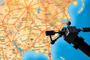
GNSS Fundamentals
- GNSS is an umbrella term encompassing all satellite navigation systems
- GPS (Global Positioning System) is a specific GNSS system, developed by the US
- GPS refers to the constellation of satellites; everything related to it (satellites, receivers, etc.) is also referred to as 'GPS'
- Other options besides GPS are developing, like GLONASS (Russia), Galileo (European Union), and Compass (China)
- GNSS systems are crucial for determining locations, especially where traditional methods like addresses/landmarks are unavailable, for example, remote areas, oceans, etc.
- Pre-GPS navigation tools, like Sextant and Lowrance, had limitations (e.g., cloudy weather)
- The military had different location-determining needs (e.g., targeting, avoiding friendly fire, using 'smart bombs')
- GNSS comprises satellites, ground control stations, and GNSS receivers/units.
- There are 24-32 satellites orbiting Earth at ~11,000 nautical miles, with precise location data maintained by the DOD
- Satellite clocks are highly accurate
- Satellites continually broadcast radio signals to Earth, which are picked up by receivers
- The GPS receiver measures the signal travel time to determine the distance from multiple satellites.
- GPS receivers require signals from at least 3 or 4 satellites to calculate accurate location data.
- The distance from a satellite is calculated by multiplying the travel time of signal by its velocity (roughly 186,355 miles/second).
- Five control stations on Earth monitor the satellites and send updates for fine-tuning and positioning accuracy.
- Without control stations, the system's accuracy would rapidly degrade.
- GPS (and GNSS) systems aren't just one device; they consist of many components working together for positioning.
- GPS development cost the US Department of Defense over $12 billion
- Funding for the public use of GPS depended on making it accessible.
Studying That Suits You
Use AI to generate personalized quizzes and flashcards to suit your learning preferences.