Podcast
Questions and Answers
What was the primary communication method for distress and safety at sea before the GMDSS?
What was the primary communication method for distress and safety at sea before the GMDSS?
- Morse code. (correct)
- Voice radio transmissions.
- Satellite communication.
- Digital Selective Calling (DSC).
What key event highlighted the need for a standardized system for maritime distress calls?
What key event highlighted the need for a standardized system for maritime distress calls?
- Increased maritime pollution incidents.
- The sinking of the Titanic. (correct)
- A major communications technology failure in the 1900s.
- World War I submarine attacks.
Which organization spearheaded the development of the Global Maritime Distress and Safety System (GMDSS)?
Which organization spearheaded the development of the Global Maritime Distress and Safety System (GMDSS)?
- The International Maritime Organization (IMO). (correct)
- The National Oceanic and Atmospheric Administration (NOAA).
- The U.S. Coast Guard (USCG).
- The International Telecommunications Union (ITU).
What fundamental change did GMDSS bring to maritime distress communications?
What fundamental change did GMDSS bring to maritime distress communications?
What is a key benefit of the GMDSS regarding distress alerting?
What is a key benefit of the GMDSS regarding distress alerting?
According to SOLAS amendments, by when were ships required to carry NAVTEX and satellite EPIRBs?
According to SOLAS amendments, by when were ships required to carry NAVTEX and satellite EPIRBs?
Which of the following is NOT a primary function of the GMDSS?
Which of the following is NOT a primary function of the GMDSS?
What determines the specific radio carriage requirements for a ship under GMDSS?
What determines the specific radio carriage requirements for a ship under GMDSS?
What technology does GMDSS use to automate ship-to-shore communication?
What technology does GMDSS use to automate ship-to-shore communication?
Which of the following is an advantage of GMDSS over the previous ship-to-ship safety system?
Which of the following is an advantage of GMDSS over the previous ship-to-ship safety system?
Which of the following statements best describes how GMDSS enhances search and rescue operations?
Which of the following statements best describes how GMDSS enhances search and rescue operations?
What is a key requirement of GMDSS regarding radio operators?
What is a key requirement of GMDSS regarding radio operators?
Which GMDSS sea area is defined as being within radiotelephone range of at least one VHF/DSC coast station?
Which GMDSS sea area is defined as being within radiotelephone range of at least one VHF/DSC coast station?
What defines Sea Area A3 under the GMDSS?
What defines Sea Area A3 under the GMDSS?
What is the primary purpose of the COSPAS-SARSAT system within the GMDSS framework?
What is the primary purpose of the COSPAS-SARSAT system within the GMDSS framework?
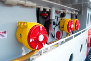
What is the main function of an EPIRB (Emergency Position-Indicating Radio Beacon)?
What is the main function of an EPIRB (Emergency Position-Indicating Radio Beacon)?
On what frequency do newer EPIRBs operate that are part of the COSPAS-SARSAT system?
On what frequency do newer EPIRBs operate that are part of the COSPAS-SARSAT system?
What information does a 406 MHz EPIRB transmit to aid in search and rescue efforts?
What information does a 406 MHz EPIRB transmit to aid in search and rescue efforts?
What is the purpose of registering a 406 MHz EPIRB, and what are the consequences of failing to comply?
What is the purpose of registering a 406 MHz EPIRB, and what are the consequences of failing to comply?
How often is re-registration required for an EPIRB, according to GMDSS regulations?
How often is re-registration required for an EPIRB, according to GMDSS regulations?
What actions should be taken regarding an EPIRB once it has been activated in a distress situation?
What actions should be taken regarding an EPIRB once it has been activated in a distress situation?
What is the primary purpose of the NAVTEX system?
What is the primary purpose of the NAVTEX system?
How does a NAVTEX receiver determine if an incoming message is relevant or new?
How does a NAVTEX receiver determine if an incoming message is relevant or new?
What is the range of NAVTEX reception?
What is the range of NAVTEX reception?
What services do Inmarsat systems provide as part of GMDSS?
What services do Inmarsat systems provide as part of GMDSS?
What is the purpose of the SafetyNET service provided by Inmarsat?
What is the purpose of the SafetyNET service provided by Inmarsat?
What is the USCG AMVER Center?
What is the USCG AMVER Center?
What capabilities do High-Frequency (HF) communications provide within the GMDSS?
What capabilities do High-Frequency (HF) communications provide within the GMDSS?
What is the purpose of a SART (Search and Rescue Radar Transponder) in the context of GMDSS?
What is the purpose of a SART (Search and Rescue Radar Transponder) in the context of GMDSS?
What factor significantly influences the detection range between a ship and a SART?
What factor significantly influences the detection range between a ship and a SART?
How did U.S. ships transition from Morse code equipment to GMDSS equipment?
How did U.S. ships transition from Morse code equipment to GMDSS equipment?
What is a Personal Locator Beacon (PLB)?
What is a Personal Locator Beacon (PLB)?
What should you consider when using a PLB on a boat, pertaining to the registration form?
What should you consider when using a PLB on a boat, pertaining to the registration form?
If signals are detected by a GEOSAR satellite, what information is provided?
If signals are detected by a GEOSAR satellite, what information is provided?
A major advantage of second-generation equipment is that each 406 EPIRB transmits which piece of information?
A major advantage of second-generation equipment is that each 406 EPIRB transmits which piece of information?
Why is it essential to your safety that the information on file for an EPIRB is correct and current?
Why is it essential to your safety that the information on file for an EPIRB is correct and current?
Other than replacing the battery, what other maintenance is required for EPIRBs?
Other than replacing the battery, what other maintenance is required for EPIRBs?
How does a NAVTEX receiver communicate incoming messages?
How does a NAVTEX receiver communicate incoming messages?
What does the voice Inmarsat C and Mini-C equipment provide?
What does the voice Inmarsat C and Mini-C equipment provide?
What is one of the Coast Guard's improvements implemented to meet the GMDSS requirements?
What is one of the Coast Guard's improvements implemented to meet the GMDSS requirements?
Flashcards
GMDSS
GMDSS
A global initiative that uses satellite and terrestrial radio services to automate distress alerting and improve search and rescue operations for ships. It shifted the focus from ship-to-ship to ship-to-shore communication.
COSPAS-SARSAT System
COSPAS-SARSAT System
An international satellite-based search and rescue system established by Canada, France, the U.S., and Russia. It utilizes 406 MHz satellite EPIRBs to transmit vessel identification and location to rescue coordination centers.
EPIRB
EPIRB
A radio beacon designed to float and automatically activate in a distress situation, transmitting a signal to alert rescue authorities. Modern EPIRBs use the 406 MHz frequency and provide vessel identification.
PLB
PLB
Signup and view all the flashcards
NAVTEX
NAVTEX
Signup and view all the flashcards
Inmarsat
Inmarsat
Signup and view all the flashcards
SART
SART
Signup and view all the flashcards
Sea Areas (GMDSS)
Sea Areas (GMDSS)
Signup and view all the flashcards
Study Notes
- The Global Maritime Distress & Safety System (GMDSS) was created after the invention of the radio at the end of the 19th century
- Ships used Morse code for distress and safety telecommunications, with the first use in 1844
- After the Titanic sank in 1912, legislation required ships to have Morse code radiotelegraph equipment and listen to a common frequency for distress calls
- The International Telecommunications Union (ITU) followed suit, requiring ships of all nations to use Morse code for distress calls
- Morse code distress calling required skilled radio operators to spend many hours listening to a specific radio frequency
- The range on the medium-frequency (MF) distress band (500 kHz) was limited, as also the amount of traffic Morse signals could carry
The Development of GMDSS
- The International Maritime Organization (IMO) started improving maritime distress and safety communications in the mid-1970s
- In 1979, the International Convention on Maritime Search and Rescue called for a global search and rescue plan
- The IMO developed the GMDSS to provide communication support for the search and rescue plan
- The GMDSS is based on satellite and terrestrial radio services and changed international distress communications from ship-to-ship to ship-to-shore
- The GMDSS replaced the mandatory requirement for Morse code communication by commercial vessels
- The GMDSS provides automatic distress alerting and locating and requires ships to receive broadcasts of maritime safety information
- In 1988, the Safety of Life at Sea Convention (SOLAS) was amended, requiring ships to fit GMDSS equipment
- Ships were required to carry NAVTEX and satellite EPIRBs by 1 August 1993, and all other GMDSS equipment by 1 February 1999
- U.S. ships were allowed to fit GMDSS in place of Morse telegraphy equipment by the Telecommunications Act of 1996
- The GMDSS consists of several systems and can reliably perform functions like alerting, search and rescue coordination, locating, maritime safety information broadcasts, general communications, and bridge-to-bridge communications
- Specific radio carriage requirements depend upon the ship's area of operation rather than its tonnage
- The system also provides redundant means of distress alerting and emergency sources of power
Features of GMDSS
- The GMDSS is the internationally recognized distress and radio communication safety system for ships
- It is an automated ship-to-shore system using satellites and digital selective calling (DSC) technology
- The GMDSS is mandated for all ships by the IMO
- The GMDSS provides worldwide ship-to-shore alerting and simplifies radio operations allowing alerts to be sent by two simple actions
- It ensures redundancy of communications, enhances search and rescue, minimizes unanticipated emergencies at sea, and eliminates reliance on a single person for communications
- It requires at least two licensed GMDSS radio operators and two maintenance methods to ensure distress communications capability at all times
Sea Areas
- GMDSS uses four coverage areas to cover the sea areas of the world for distress watchkeeping, namely A1, A2, A3, and A4
- Sea Area A1: Within radiotelephone range of at least one VHF/DSC coast station (about 20-30 NM)
- Sea Area A2: Within MF range of a coast station fitted with DSC (about 150 miles)
- Sea Area A3: Covered by the Inmarsat Satellite System (excluding A1 and A2 areas)
- Sea Area A4: Polar regions not covered by the above
GMDSS Component Systems
- The GMDSS consists of separate systems being implemented in a coordinated manner
- The COSPAS-SARSAT System is an international satellite-based search and rescue system, established by Canada, France, the U.S., and Russia
- These countries codeveloped a 406 MHz satellite emergency position-indicating radiobeacon (EPIRB), an element of the GMDSS designed to operate with the COSPAS-SARSAT system
- EPIRBs are required on SOLAS ships, commercial fishing vessels, and other ships and are designed to transmit to a rescue coordination center a vessel identification and an accurate location of the vessel from anywhere in the world
Emergency Position Indicating RadioBeacon (EPIRB)
- Every boat that goes offshore beyond reliable VHF radio range should carry an EPIRB
- Original models operated on two frequencies: 121.5 MHz (emergency channel for civilian planes) and 243.0 MHz (guard channel for military aircraft)
- Aircraft detecting these EPIRBs reported to the airway control authorities
- Equipment on orbiting satellites of the COSPAS-SARSAT system could relay EPIRB signals when the satellite could "see" both the EPIRB and a ground terminal simultaneously
- The beacon's position was determined by multiple reports from aircraft and/or orbiting satellites
- It took 4 to 6 hours (sometimes up to 12 hours) to determine a position and initiate rescue efforts, with location usually within 12 to 15 miles (22 to 28 km)
- EPIRBs were divided into Class A (floatfree, automatic activation) and Class B (manually activated)
- First-generation EPIRBs suffered from interference and had a very high incidence of false alarms
- Processing signals from Class A and B units by the COPAS-SARSAT system was discontinued on 1 February 2009
- Now, only 406 MHz signals are monitored
Second Generation EPIRBs
- Advances in technology led to the development of "406" EPIRBs, operating at 406.0 MHz
- These signals are picked up by orbiting satellites of COSPAS-SARSAT, transmitted to a ground station, and passed on to rescue authorities
- Distress signals are stored by the satellite and retransmitted when a ground station is in range
- Distress signals can also be received and relayed by GEOS weather satellites and other geostationary satellites of the GEOSAR system
- When COSPAS-SARSAT satellites are used, position is determined by the Doppler effect
- Position can be determined within 1 to 3 miles (2 to 5 km) and may take 1 to 2 hours
- If signals are detected by a GEOSAR satellite, an immediate distress alert is provided, but no position information is given
- Each 406 EPIRB transmits a unique registration number for identification
- Each unit is entered into a database that provides vital information on the vessel
- Purchasers of 406 EPIRBs are legally required to register them with penalties for failing to comply
Personal Locator Beacon (PLB)
- A Personal Locator Beacon (PLB) serves the same needs for a boater as an EPIRB but meant to be associated with an individual
- PLBs are smaller and lighter, transmitting the same 406 and 121.5 MHz signals with identification specific to that unit
- Some models may have an input for GPS position data, and never models have internal GPS included
- PLBs do not have a strobe light and will not function in that situation, with intended operation for a shorter period than an EPIRB
- The FCC authorized the sale and use of PLBs in the United States as of 1 July 2003, and these units must be registered
EPIRB Registration
- EPIRB registration is for two years only, requiring re-registration, and any changes must be reported
- No fees are required for registration
- Available in Category I (float-free, automatic activation) and Category II (manual activation); both have a 121.5 MHz beacon and strobe light
- Category II units range from $500 to $650, with Category I models $50 to $100 more expensive
- A model of a 406 EPIRB with a connection for position data from an onboard GPS receiver as well as a 406 EPIRB with an internal GPS receiver have been created
- The vessel's position is continually updated and stored in the EPIRB every 20 minutes
- Cost of an EPIRB with GPS interconnect capability is slightly than that of a standard 406 EPIRB, about $550 to $600
- A GPIRB, with integral GPS receiver, is about $750 to $800
- The distress location is clearly established to less than a half mile (1 km)
EPIRB Use and Maintenance
- An activated EPIRB must be left on
- Testing must be strictly limited to the unit's manual conditions
- The only maintenance is the battery replacement at intervals specified by the unit's manual
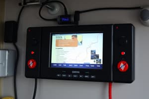
NAVTEX
- NAVTEX is an international, automated system for distributing maritime navigational warnings, weather forecasts, search and rescue notices, and safety information to ships
- A NAVTEX receiver is installed in the pilot house and checks each incoming message to see if it has been received or if not relevant
- NAVTEX receivers print messages on a roll of adding-machine-size paper
- Certain types of messages can be set to "non-print" and recent models use an LCD screen with optional printing
- A new ship receives many previously broadcast messages for the first time, while others that have already received it do not receive it again
- A person does not need to be present during a broadcast
- Transmitting stations operate at scheduled times on 518 kHz, with NAVTEX reception extending 200 to 400 nautical miles
Inmarsat
- Inmarsat satellite systems operated by the International Mobile Satellite Organization are important elements of the GMDSS
- Inmarsat A, B, M, and Fleet 77, Fleet 55, and Fleet 33 systems provide ship-shore, ship-ship, and shore-ship telephone, telex, and high-speed data services, including distress priority telephone and telex service
- Inmarsat M and Mini-M equipment is small and lighter and voiceless Inmarsat C and Mini-C provide ship-shore, shore-ship, and ship-ship store-and-forward data and telex messaging
- They also have the capability for sending preformatted distress messages to a rescue coordination center, and the SafetyNET service
- SafetyNET works similarly to NAVTEX in areas outside NAVTEX coverage
- Inmarsat C and Mini-C equipment is small and lighter than Inmarsat A, B, or Fleet F77
- Inmarsat A, B, and Fleet F77 and F55 ship earth stations require large gyrostabilized antennas, while the antenna size of the Fleet 33, Inmarsat C, and Mini-C is smaller
- Inmarsat also operates an EPIRB system, the Inmarsat E and E+, similar to that operated by COSPAS-SARSAT
- Fleet F33 provides voice, fax, and data for smaller vessels
- Combined meteorological observations and AMVER reports can be sent to both the USCG AMVER Center and NOAA, using an Inmarsat C ship-earth station, at no charge
- Inmarsat C equipment have an integral satellite navigation receiver, or be externally connected to a satellite navigation receiver
High-Frequency Communications
- The GMDSS includes HF radiotelephone and radiotelex equipment, with calls initiated by digital selective calling
- Worldwide broadcasts of maritime safety information are made on HF narrow-band direct printing channels
- The Coast Guard improved high-frequency (HF) ship-shore radio safety services to the maritime community, as well as narrow-band direct-printing broadcasts
SART
- The GMDSS installation on ships includes one or more search-and-rescue radar transponders (SART)
- They are used to locate survival craft or distressed vessels by creating a series of dots on a rescuing ship's X-band (3 cm) radar display
- The detection range depends on the height of the ship's radar mast and the height of the SART, normally about eight nautical miles
- A marine radar may not detect a SART even within this range
Studying That Suits You
Use AI to generate personalized quizzes and flashcards to suit your learning preferences.