Podcast
Questions and Answers
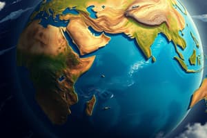
What is the significance of the Prime Meridian?
What is the significance of the Prime Meridian?
- It is an imaginary line that runs through Greenwich in England, dividing the Earth into western and eastern hemispheres. (correct)
- It determines the suitability of an area for agriculture.
- It divides the Earth into the northern and southern hemispheres.
- It marks the areas with similar human characteristics.
How does the physical geography of a region influence its human geography?
How does the physical geography of a region influence its human geography?
- It has no impact on human geography.
- It can affect the availability of resources, climate, terrain, and consequently, human activities and settlement patterns. (correct)
- It determines the languages spoken in the region.
- It only affects the types of natural disasters a region might experience.
Which of the following factors determine the suitability of an area for human habitation?
Which of the following factors determine the suitability of an area for human habitation?
- Availability of resources, climate, and terrain. (correct)
- The cultural values of the inhabitants.
- The languages spoken in the region.
- Only the climate of the area.
What is the primary purpose of using maps?
What is the primary purpose of using maps?
What type of information can be gathered from maps?
What type of information can be gathered from maps?
What is the role of the Ordnance Survey (OS)?
What is the role of the Ordnance Survey (OS)?
What is the purpose of symbols on OS maps?
What is the purpose of symbols on OS maps?
What do contour lines on a map indicate?
What do contour lines on a map indicate?
How can contour lines be used to understand the terrain?
How can contour lines be used to understand the terrain?
What is the appearance of contour lines that show a valley?
What is the appearance of contour lines that show a valley?
What is the purpose of the grid system on maps?
What is the purpose of the grid system on maps?
In grid references, what do eastings and northings represent?
In grid references, what do eastings and northings represent?
What is the correct order for stating a four-figure grid reference?
What is the correct order for stating a four-figure grid reference?
How can six-figure grid references improve the precision of location on a map?
How can six-figure grid references improve the precision of location on a map?
If a feature is halfway within a grid square, what number is added to the easting or northing to create a six-figure grid reference?
If a feature is halfway within a grid square, what number is added to the easting or northing to create a six-figure grid reference?
Flashcards
Hemispheres
Hemispheres
The major divisions of the Earth; Northern, Southern, Eastern and Western.
Prime Meridian
Prime Meridian
An imaginary line of longitude that runs through Greenwich, England, dividing the Earth into Eastern and Western hemispheres.
Contour Line
Contour Line
A line that connects points of equal elevation (height) on a map.
Terrain
Terrain
Signup and view all the flashcards
Grids on Maps
Grids on Maps
Signup and view all the flashcards
Eastings
Eastings
Signup and view all the flashcards
Northings
Northings
Signup and view all the flashcards
Four-Figure Grid Reference
Four-Figure Grid Reference
Signup and view all the flashcards
Six-Figure Grid References
Six-Figure Grid References
Signup and view all the flashcards
OS maps
OS maps
Signup and view all the flashcards
Maps for Navigation
Maps for Navigation
Signup and view all the flashcards
Study Notes
Global Areas
- Geography uses terms to describe locations.
- Earth is divided into hemispheres; northern & southern, divided by the equator, and into western & eastern, divided by the Prime Meridian, which runs through Greenwich, England.
- Regions are areas with similar physical and human geography that can affect each other.
- Factors like resource availability, climate, and terrain influence human settlement patterns.
- Similarities in climate and terrain can result in similar natural vegetation and agricultural suitability.
- Cultural characteristics of a region can be influenced by available foods and clothing adapted to the climate.
- Similar ideas and principles can shape behaviors and values within a region.
- Geographical regions often face similar challenges which can result from climate or weather patterns like storms or droughts.
- Countries in a region with similar geological conditions may have similar resources and produce similar goods.
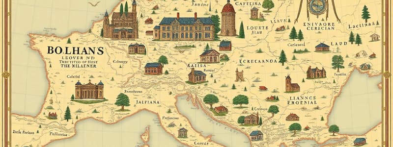
Why Use Maps
- Maps are useful tools for navigation.
- Ordinance Survey (OS) is the mapping agency for the United Kingdom, provide maps of the whole UK.
- OS maps use symbols to represent features like buildings and roads.
- OS maps include a key to explain the symbols used.
- OS maps also indicate terrain through features like hills and valleys.
- Contour lines, typically orange on OS maps, join points of equal elevation.
- Contour lines have numbers to indicate the elevation.
- Closer contour lines indicate steeper terrain.
- Contour lines show the shape of the land and presence mountain ridges.
- The closer contour lines, the steeper the slope.
- V-shaped contour patterns show a valley while circular contour lines indicate a hill.
Grids on Maps
- Maps use grids to create squares: useful for narrowing search areas.
- Grid lines are numbered to help find specific areas.
- Eastings are numbers reading left to right.
- Northings are numbers reading south to north.
- A four-figure grid reference uses two digits each of the easting and northing numbers.
- Remember to always start with the eastings first ("along the corridor and up the stairs").
- To create a four-figure grid reference, combine grid lines and grid numbers.
- Adding extra numbers to the easting and northing, references can be more precise to work out exactly where features are located.
- Features can be found within 100m on a map with the new extra number.
- A grid square divided into tenths uses the first three numbers for the easting and the last three for the northing, including tenths.
Studying That Suits You
Use AI to generate personalized quizzes and flashcards to suit your learning preferences.