Podcast
Questions and Answers
Which aspect of Ireland's physical geography is likely to influence musical practices according to the content?
Which aspect of Ireland's physical geography is likely to influence musical practices according to the content?
- The varied climates
- The coastal areas
- The bog landscapes (correct)
- The hilly terrain
What natural feature is associated with the sacred ground mentioned in the content?
What natural feature is associated with the sacred ground mentioned in the content?
- The forests
- The cliffs
- The bogs (correct)
- The mountains
Which location is mentioned as a point of interest in understanding glacial Ireland?
Which location is mentioned as a point of interest in understanding glacial Ireland?
- Gap of Dunloe (correct)
- The Burren
- Clogherhead
- The Cliffs of Moher
What characteristic of the Irish landscape is emphasized in the content?
What characteristic of the Irish landscape is emphasized in the content?
What sentiment towards Irish heritage is expressed in the content?
What sentiment towards Irish heritage is expressed in the content?
What aspect of Ireland's geography is highlighted as intriguing to one student regarding its impact on culture?
What aspect of Ireland's geography is highlighted as intriguing to one student regarding its impact on culture?
Which geographical feature is noted for its extreme landscape in Ireland?
Which geographical feature is noted for its extreme landscape in Ireland?
What issue related to human geography is of interest to students in Ireland?
What issue related to human geography is of interest to students in Ireland?
How does one student express the connection between landscape and literature?
How does one student express the connection between landscape and literature?
What theme appears to be significant in the students' interests in cultural geography?
What theme appears to be significant in the students' interests in cultural geography?
What economic issue concerning land is mentioned as an area of interest?
What economic issue concerning land is mentioned as an area of interest?
Which geographical area is highlighted for its notorious cliffs and rugged landscape?
Which geographical area is highlighted for its notorious cliffs and rugged landscape?
What aspect of geography is emphasized as shaping various cultural elements like folklore?
What aspect of geography is emphasized as shaping various cultural elements like folklore?
What term describes land shaped by the erosion and deposition of sediments through glacial meltwater?
What term describes land shaped by the erosion and deposition of sediments through glacial meltwater?
Which process involves glaciers scraping and wearing away the valley floor and sides?
Which process involves glaciers scraping and wearing away the valley floor and sides?
What are eskers primarily composed of?
What are eskers primarily composed of?
How is plucking described in glacial erosion?
How is plucking described in glacial erosion?
Which type of bog is characterized by a more uniform depth and is slowly formed over centuries?
Which type of bog is characterized by a more uniform depth and is slowly formed over centuries?
What is the main feature used to identify the gap of Dunloe and its formation during the ice age?
What is the main feature used to identify the gap of Dunloe and its formation during the ice age?
Sphagnum moss is primarily associated with which type of ecosystem?
Sphagnum moss is primarily associated with which type of ecosystem?
What is one of the impacts of damaged bogs on the environment?
What is one of the impacts of damaged bogs on the environment?
Flashcards are hidden until you start studying
Study Notes
The Making of the Irish Landscape
- Glacial Ireland: The Irish landscape was significantly shaped by ice age glaciers, creating various physical features and diverse landscapes.
- Key Terms:
- Fluvioglacial landforms: Landscapes shaped by the erosion and deposition of sediments from glacial meltwater.
- Abrasion: Erosion caused by glacial movement, scraping and wearing away the bedrock.
- Plucking: Erosion process where meltwater freezes in cracks, and the rock is then plucked and removed as the glacier moves.
- Eskers: Long, narrow ridges of sand and gravel deposited by streams that flowed under the ice, left behind after the ice melted.
- Examples of Glacial Landforms:
- Clogherhead (Co. Louth): Exhibits folding of land due to glacial activity.
- The Eglone Stone (Sligo): Example of a glacial erratic, a rock transported and deposited by a glacier.
- Curragh (County Kildare): A large, flat plain formed by glacial deposition. Its unique characteristics can be understood by listening to a podcast on Moodle: https://soundcloud.com/abartaaudioguides/002-physical-geography-the-story-of-the-curragh
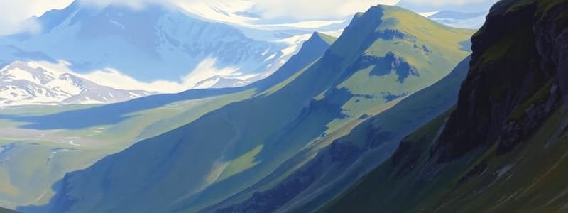
- Gap of Dunloe (County Kerry): A narrow valley sculpted by glacial erosion, featuring striking mountain scenery.
- Irish Bogs: A significant feature of the Irish landscape, formed by the accumulation of partially decayed plant matter (peat).
- Peat: Decomposed plant matter, primarily sphagnum moss, that forms bogs.
- Types of Bogs:
- Raised Bogs: Dome-shaped bogs that rise above the surrounding landscape.
- Blanket Bogs: Spread across the landscape, typically found in mountainous areas.
- Sphagnum Moss: A crucial component of bogs, playing a vital role in water retention and decomposition.
- Raised Bog Development: Bogs formed through the accumulation of sphagnum moss over time, creating a raised platform.
- Bog Bodies: Human remains found preserved in bogs, offering insights into past societies.
- Clara Bog: A large raised bog in Ireland.
- Turbary Rights & Conservation: Rights to harvest peat for fuel, while also recognizing the need for bog conservation.
- Damaged Bogs & Water Quality: The degradation of bogs can have a detrimental impact on water quality.
- Sphagnum Moss & Carbon: Sphagnum moss is an important carbon sink, contributing to climate change mitigation.
- The Making of the Irish Landscape: A course exploring the Irish landscape, incorporating physical geography, human geography, and cultural geography.
Upcoming Lecture
- The next lecture will focus on historical maps and the Ordnance Survey of Ireland.
- It will explore the development of mapping and its role in understanding Irish geography.
- Key elements include:
- Historical Maps: Exploring how maps have been used to represent Ireland throughout history.
- Ordnance Survey of Ireland: A detailed mapping project of Ireland that provides comprehensive information.
- Contemporary Irish Maps: Analyzing current mapping technologies and their applications in Ireland.
- Mapping Purposes Activity: Students will engage in an activity related to mapping and its purposes.
Studying That Suits You
Use AI to generate personalized quizzes and flashcards to suit your learning preferences.


