Podcast
Questions and Answers
What are the chief subfields of Geography Class 12?
What are the chief subfields of Geography Class 12?
- Meteorological, astronomical, biological, geological, and anthropological geography
- Historical, environmental, linguistic, technological, and urban geography
- Physical, economic, social, political, and cultural geography (correct)
- Ecological, agricultural, industrial, demographic, and psychological geography
What kind of themes do students evaluate in Geography Class 12?
What kind of themes do students evaluate in Geography Class 12?
- Chemistry experiments, literary analysis, music theory, economic principles
- Climate change, water resources, settlement patterns, governance structures (correct)
- Astronomy, organic farming, art history, political ideologies
- Oceanography, zoology, urban planning, religious practices
What skills do students acquire while studying Geography Class 12?
What skills do students acquire while studying Geography Class 12?
- Mathematical prowess, language proficiency, athletic prowess
- Dance expertise, painting techniques, automotive repair skills
- Physical strength, culinary abilities, musical talent
- Analytical capabilities, spatial reasoning, communication skills (correct)
How do students develop teamwork strategies in Geography Class 12?
How do students develop teamwork strategies in Geography Class 12?
What is one way in which students can enhance their ability to interpret real-world problems?
What is one way in which students can enhance their ability to interpret real-world problems?
How do GIS and Geography Class 12 contribute to understanding current events?
How do GIS and Geography Class 12 contribute to understanding current events?
What is one of the primary functions of GIS technology?
What is one of the primary functions of GIS technology?
How has GIS technology impacted urban planning?
How has GIS technology impacted urban planning?
Which of the following is NOT a technique utilized in GIS technology?
Which of the following is NOT a technique utilized in GIS technology?
How can GIS help predict the spread of diseases?
How can GIS help predict the spread of diseases?
In what ways do city planners use GIS technology?
In what ways do city planners use GIS technology?
What is the main purpose of digital maps with layers in GIS technology?
What is the main purpose of digital maps with layers in GIS technology?
Flashcards are hidden until you start studying
Study Notes
Exploring Geography's Tools and Concepts
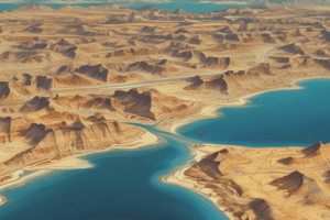
Geography is more than just identifying places on a map; it encompasses diverse subjects like human environments, ecosystems, spatial patterns, and our dynamic interactions with them. As we delve into this vast sphere of knowledge, let's examine two distinct areas – Geographic Information Systems (GIS) and Geography Class 12 – which offer unique ways to understand and engage with the world around us.
GIS: Mapping Reality
A fundamental tool in modern geography, GIS allows users to visualize, analyze, and manage spatial data. This technology has transformed how we perceive and interact with various aspects of society, including urban planning, environmental conservation, public health, transportation networks, and natural disasters management.
GIS incorporates various cutting-edge techniques such as remote sensing, global positioning system (GPS) tracking, and database design. It employs digital maps made up of layers containing different types of data, enabling geographers to discern complex relationships between features and develop accurate insights.
For instance, GIS can help predict the spread of diseases by overlaying population density, healthcare infrastructure, weather, and other relevant datasets. Similarly, city planners utilize GIS to optimize transport routes, minimize traffic congestion, and promote sustainable development.
Geography Class 12: Developing Analytical Skills
The study of geography reaches its pinnacle in high school curriculums, providing students with essential concepts, principles, and skills necessary to comprehend local, regional, national, and international issues effectively. At this level, the subject branches out into several subfields, chief among them being physical, economic, social, political, and cultural geography.
Students learn to evaluate themes ranging from climate change, water resources, landforms, demography, settlement patterns, trade networks, governance structures, religious practices, tourism trends, culture, and natural hazards prevalent across the globe. They also acquire valuable analytical capabilities while analyzing case studies, conducting fieldwork, interpreting maps and charts, and applying spatial reasoning to solve real-world problems.
Moreover, Geography Class 12 equips students with vital communication skills through debating, presenting findings, writing essays, and collaboratively solving puzzles. These abilities encourage critical thinking, foster creativity, broaden perspectives, develop teamwork strategies, and build confidence in problem-solving situations.
In conclusion, both GIS and Geography Class 12 contribute uniquely to understanding and engagement with current events, societal concerns, and future challenges related to the planet. By exploring these tools and concepts, you will gain a holistic viewpoint, enhancing your ability to interpret, communicate, and resolve pressing issues facing humanity today.
Studying That Suits You
Use AI to generate personalized quizzes and flashcards to suit your learning preferences.