Podcast
Questions and Answers
What does the geoid represent in relation to the surface of the Earth?
What does the geoid represent in relation to the surface of the Earth?
- A surface of constant potential energy (correct)
- A constant gravitational force reference
- An idealized flat plane
- A mathematically defined curve
Why is the plumb line significant in construction?
Why is the plumb line significant in construction?
- It establishes the direction for measurements and plans (correct)
- It defines the area of land to be used for construction
- It determines the maximum height of structures
- It indicates the geographical north direction
Which statement accurately describes a property of the geoid?
Which statement accurately describes a property of the geoid?
- It coincides with the average sea level only in fresh water bodies
- It can be analytically represented for calculation purposes
- It is not suitable for spatial coordinates calculations (correct)
- It is characterized by regular fluctuations in height
How is orthometric height defined?
How is orthometric height defined?
What forces determine the orientation of the plumb line?
What forces determine the orientation of the plumb line?
Welche Aussage beschreibt die Funktion des Geoids am besten?
Welche Aussage beschreibt die Funktion des Geoids am besten?
Worin unterscheidet sich das Geoid von einem Ellipsoid?
Worin unterscheidet sich das Geoid von einem Ellipsoid?
Warum fließt kein Wasser zwischen Punkten auf der Oberfläche des Geoids?
Warum fließt kein Wasser zwischen Punkten auf der Oberfläche des Geoids?
Wie wird die orthometrische Höhe eines Punktes definiert?
Wie wird die orthometrische Höhe eines Punktes definiert?
Was bestimmt die Richtung der plumb line?
Was bestimmt die Richtung der plumb line?
Flashcards
Geoid
Geoid
A dynamic Earth surface determined by gravity and centrifugal forces, following equipotential lines where water would settle.
Plumb line direction
Plumb line direction
Direction determined by gravity, crucial for construction and measurements
Equipotential surface
Equipotential surface
Surface with constant gravitational potential energy, preventing water flow.
Orthometric height
Orthometric height
Signup and view all the flashcards
Geoid and sea level
Geoid and sea level
Signup and view all the flashcards
Lotrichtung
Lotrichtung
Signup and view all the flashcards
Äquipotenzialfläche
Äquipotenzialfläche
Signup and view all the flashcards
Orthometrische Höhe
Orthometrische Höhe
Signup and view all the flashcards
Geoid und Meeresspiegel
Geoid und Meeresspiegel
Signup and view all the flashcards
Study Notes
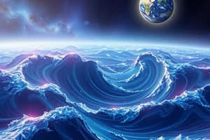
Geoid
- Geoid is a physical, dynamic replacement surface for the Earth's body
- It reflects the natural direction that dominates our lives, especially evident in construction
- Plans and measurements are based on this direction, or the normal direction (horizontal)
- This direction is determined by gravity and centripetal force
- A liquid conforms to these forces, creating a surface with equal potential (equal energy state)
- The surface of the ocean, extending beneath continents, describes this surface
- The geoid is a surface of equal potential, indicating that there's no water flow between points on the geoid (lack of energy gradient)
- The geoid is identical to the average ocean surface over water bodies
- The geoid coincides with the ellipsoid
- The geoid is not an analytically definable surface, and is not ideal for calculations
- However, it is the standard for altitude and gravity measurements
- Height measurements referencing the geoid are physically defined
- Orthometric height of a point is the distance from the geoid, measured along the plumb line
Studying That Suits You
Use AI to generate personalized quizzes and flashcards to suit your learning preferences.
Description
Explore the concept of the geoid as a physical and dynamic surface that influences various aspects of life, particularly in construction and geographical measurements. This quiz delves into how gravity and other forces shape this surface, and its significance in determining vertical measurements and altitudes. Understand the relationship between the geoid, ocean surfaces, and the ellipsoid.