Podcast
Questions and Answers
What are the three major landscape regions classified based on?
What are the three major landscape regions classified based on?
- Bedrock and elevation (correct)
- Climate and soil
- Plant life and animal life
- Latitude and longitude
A landscape region is defined by landforms with a common origin.
A landscape region is defined by landforms with a common origin.
True (A)
The change in elevation of a landscape is called ______.
The change in elevation of a landscape is called ______.
relief
What are the two main factors that influence how landscapes are shaped?
What are the two main factors that influence how landscapes are shaped?
Which of the following is NOT a characteristic of a mountain landscape region?
Which of the following is NOT a characteristic of a mountain landscape region?
Match the landscape region with its defining characteristic:
Match the landscape region with its defining characteristic:
How do arid climates influence landscape characteristics?
How do arid climates influence landscape characteristics?
Thick, rich soil is a characteristic of landscapes in arid climates.
Thick, rich soil is a characteristic of landscapes in arid climates.
Flashcards
Landscape Region
Landscape Region
A region on Earth's surface where landforms have a common origin.
Topography
Topography
The arrangement of the natural and artificial physical features of an area.
Relief
Relief
The change in elevation across a landscape.
Mountain
Mountain
Signup and view all the flashcards
Plateau
Plateau
Signup and view all the flashcards
ARID Climate
ARID Climate
Signup and view all the flashcards
HUMID Climate
HUMID Climate
Signup and view all the flashcards
Drainage Patterns
Drainage Patterns
Signup and view all the flashcards
Study Notes
Unit 5: Where Does All The Water Go?
- Unit 4 materials should be put aside for the midterm on Feb 5, 2025.
Today's Objective: What is a Landscape Region?
- A landscape region is a section of Earth's surface where landforms share a common origin.
Topography
- Topography displays the shape of the land, highlighting different landscape regions.
Relief
- Relief is the change in elevation.
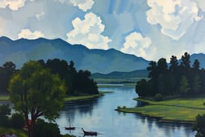
Major Landscape Regions
- Three major landscape regions are plains, plateaus, and mountains.
- These are categorized by bedrock and elevation.
Mountains
- Mountains have the greatest relief.
- They are characterized by peaks and valleys.
- Bedrock is not horizontal.
- They are typically made up of metamorphic rock.
Plateaus
-
Plateaus have medium relief.
-
They have several stream valleys.
-
Bedrock is flat.
-
They are mostly made of sedimentary rock.
-
Example Differences:
- Catskills: Dissected plateau, sedimentary bedrock
- Adirondacks: True mountains, metamorphic bedrock
Plains
- Plains have little relief.
- They have a low elevation.
- They are flat.
Climate Influence on Landscapes
- Precipitation affects measurable landscape characteristics.
- Wet climates lead to thick, rich soils and smooth, rounded landscapes.
- Dry climates result in thin soils, little humus, and sharp angles/steep slopes.
Factors Affecting Landscapes
- Softer rock erodes more quickly than harder rock.
- Durable rock forms higher portions of landscapes such as plateaus, mountains, and cliffs.
Drainage Patterns
- Water flow patterns depend on bedrock structure.
- Drainage patterns are determined by how small streams (tributaries) join larger streams.
Drainage Pattern Examples
- Radial: Water flows in all directions from mountainous areas.
- Dendritic (branching): Water branches together, typical of flat plains.
- Trellis (rectangular): Water flows in rectangular patterns, common in plateaus with folded or faulted bedrock.
- Annular: Water flows in circular patterns around an igneous intrusion.
Drainage Basin (Watershed)
- A drainage basin is the area where water flows off a landscape region into a body of water (ocean or stream).
Studying That Suits You
Use AI to generate personalized quizzes and flashcards to suit your learning preferences.