Podcast
Questions and Answers
Which place name's meaning directly refers to a type of plant?
Which place name's meaning directly refers to a type of plant?
- Bow River (correct)
- Amisk
- Athabasca
- Saskatchewan
Which place name's meaning is related to a spiritual or supernatural concept?
Which place name's meaning is related to a spiritual or supernatural concept?
- Manitoba (correct)
- Nanaimo
- Kitchener
- Tuktoyaktuk
Which two place names share the same language of origin?
Which two place names share the same language of origin?
- Athabasca and Saskatchewan (correct)
- Nanaimo and Kitchener
- Canada and Manitoba
- Amisk and Bow River
What is the meaning of the place name "Tuktoyaktuk" in Inuvialuktun?
What is the meaning of the place name "Tuktoyaktuk" in Inuvialuktun?
Which place name's origin is not related to the geographical location it is associated with?
Which place name's origin is not related to the geographical location it is associated with?
Which of the following best describes the term 'absolute location'?
Which of the following best describes the term 'absolute location'?
Which of the following is NOT a major theme of geography?
Which of the following is NOT a major theme of geography?
What is the primary reason why towns often develop along geographic features like rivers or coastlines?
What is the primary reason why towns often develop along geographic features like rivers or coastlines?
Which of the following is an example of how human-environment interaction can negatively impact the environment?
Which of the following is an example of how human-environment interaction can negatively impact the environment?
The concept of 'region' in geography refers to:
The concept of 'region' in geography refers to:
Why is a location near forests, labor, and transportation ideal for a paper mill?
Why is a location near forests, labor, and transportation ideal for a paper mill?
Which of the following is NOT a factor to consider when choosing the best place for a temporary settlement?
Which of the following is NOT a factor to consider when choosing the best place for a temporary settlement?
What is the primary implication of "the geographic inquiry process"?
What is the primary implication of "the geographic inquiry process"?
What is one benefit of tall buildings?
What is one benefit of tall buildings?
Which of these is a characteristic of thematic maps?
Which of these is a characteristic of thematic maps?
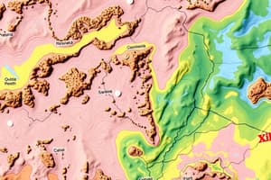
What does a topographic map display?
What does a topographic map display?
What was the main reason the PATH system in Toronto was created?
What was the main reason the PATH system in Toronto was created?
Which of the following is a common problem caused by human-made changes in nature?
Which of the following is a common problem caused by human-made changes in nature?
Flashcards
What is a general-purpose map?
What is a general-purpose map?
Shows roads, water, parks, and cities - it's a general overview of the area.
What is a thematic map?
What is a thematic map?
Focuses on one specific topic or theme, like showing how much rain falls in different parts of the world.
What is a choropleth map?
What is a choropleth map?
Uses different shades of color to show amounts of something, like showing population density.
What is a topographic map?
What is a topographic map?
Signup and view all the flashcards
What is a "PATH" map?
What is a "PATH" map?
Signup and view all the flashcards
What is Geography?
What is Geography?
Signup and view all the flashcards
What is the Geographic Inquiry Process?
What is the Geographic Inquiry Process?
Signup and view all the flashcards
How does GPS work?
How does GPS work?
Signup and view all the flashcards
What are Thematic Maps?
What are Thematic Maps?
Signup and view all the flashcards
What is Human-Environment Interaction?
What is Human-Environment Interaction?
Signup and view all the flashcards
What are Regions?
What are Regions?
Signup and view all the flashcards
What is Climate in Relation to Location?
What is Climate in Relation to Location?
Signup and view all the flashcards
What does the word "Canada" mean?
What does the word "Canada" mean?
Signup and view all the flashcards
What does the name "Amisk" mean in Cree?
What does the name "Amisk" mean in Cree?
Signup and view all the flashcards
What does "Athabasca" mean in Cree?
What does "Athabasca" mean in Cree?
Signup and view all the flashcards
What does the word "Saskatchewan" mean in Cree?
What does the word "Saskatchewan" mean in Cree?
Signup and view all the flashcards
What does the name "Tuktoyaktuk" mean in Inuvialuktun?
What does the name "Tuktoyaktuk" mean in Inuvialuktun?
Signup and view all the flashcards
Study Notes
Unit 1: Geographic Inquiry & Skill Development
- Geographic thinking involves analyzing places and connections
- Geographic inquiry process involves asking questions and gathering information
- Maps are important for showing places
Different Types of Maps
- General reference maps
- Thematic maps
- Topographic maps
GPS (Global Positioning System)
- GPS tracks locations
- GPS stands for Global Positioning System
Who Came Up With Geography?
- Eratosthenes is considered the father of Geography
- Geography is the study of Earth and everything on it
Why Study Geography?
- Sense of Place: Climate depends on location
- Sustainability: Human impact on the environment
- Connections: Understanding links between systems
Five Themes of Geography
- Location: Where is it? Why there?
- Place: What is it like? What are its features?
- Human-Environment Interaction: How humans affect and are affected by their environment (e.g., air conditioning)
- Movement: Movement of goods and people
- Region: Areas with similar features
Questions on Locations
- Absolute location of Monarch Park: 1 Hanson Street, Toronto
- Relative location of Monarch Park: near Toronto landmarks
- Best place for a paper mill: near forests, labor, and transport
- Best place for a store: near areas with high demand
- Best place for farming: fertile soil and water access
- Best spot for temporary settlement: accessible, defensible, and resource-rich
- Why are towns located along geographic features?: Access to water and transport
- Ideal relocation location for safety: near resources and defensible areas
The 5 Themes and Their Effects on You
- Location: Provides a sense of direction
- Place: Unique features make life enjoyable
Human Impact on Geography
- Humans have transformed villages into cities through growth of roads and businesses.
- Challenges of urbanization include overcrowding and pollution.
- Dams are built to store water and generate electricity. However, this disrupts wildlife habitats and floods land.
- Tall buildings provide more space for homes and work but create traffic and block sunlight.
- Technology has advanced communication and travel but raises privacy concerns and creates too much data.
- Human-made changes to nature often cause harm and habitat destruction, the solution includes recycling and use of clean energy.
Maps and Their Uses
- Maps show Earth's surface
- Maps are used by numerous professions (Doctor, Engineer, Pilot, Urban Planner, and Cartographers).
- General Purpose Maps: Show roads, water, parks, and cities.
- Thematic Maps: Focus on one particular topic or theme, often represented by shading or colors.
- Choropleth Maps: Use shades to show data/information
- Topographic Maps: Display land, buildings, roads, and height (elevation).
Maps for Everyday Use
- Maps help people find locations
- PATH map in Toronto is special because it connects several locations underground.
Investigation of Indigenous Places
- Research was done on place names, meanings, and languages of origin. Different locations are referenced (Canada, Amisk, Athabasca, Bow River, Manitoba)
Studying That Suits You
Use AI to generate personalized quizzes and flashcards to suit your learning preferences.