Podcast
Questions and Answers
Which of the following is NOT a step in the water cycle?
Which of the following is NOT a step in the water cycle?
- Evaporation
- Transpiration
- Condensation
- Infiltration (correct)
Tropical climates have low temperatures year-round.
Tropical climates have low temperatures year-round.
False (B)
What are the two main factors that determine climate regions?
What are the two main factors that determine climate regions?
Temperature and precipitation
The push and pull factors influence _______ distribution.
The push and pull factors influence _______ distribution.
Match the climate region to its typical characteristics:
Match the climate region to its typical characteristics:
Which climate region is typically characterized by low temperatures and ice cover?
Which climate region is typically characterized by low temperatures and ice cover?
Transpiration is the process of water vapor being released by plants into the atmosphere.
Transpiration is the process of water vapor being released by plants into the atmosphere.
Name one economic push factor that can influence migration.
Name one economic push factor that can influence migration.
Which of the following factors generally leads to higher population density?
Which of the following factors generally leads to higher population density?
Name one human factor that can increase population density.
Name one human factor that can increase population density.
Areas with larger amounts of ______ tend to have higher population density.
Areas with larger amounts of ______ tend to have higher population density.
Match each factor with its effect on population density:
Match each factor with its effect on population density:
Migration can lead to an imbalance in the population structure of a country.
Migration can lead to an imbalance in the population structure of a country.
What is the main reason for male overpopulation in the UAE?
What is the main reason for male overpopulation in the UAE?
Resources that can be replenished naturally over time are referred to as __________ resources.
Resources that can be replenished naturally over time are referred to as __________ resources.
Match the terms with their definitions:
Match the terms with their definitions:
Which of the following is a potential consequence of rapid population growth due to migration?
Which of the following is a potential consequence of rapid population growth due to migration?
All economies are classified under the same common terms regardless of their characteristics.
All economies are classified under the same common terms regardless of their characteristics.
What are the two main categories of resources discussed in economic geography?
What are the two main categories of resources discussed in economic geography?
Which branch of geography focuses on natural features like mountains and rivers?
Which branch of geography focuses on natural features like mountains and rivers?
Absolute location is expressed in terms of relative position to other locations.
Absolute location is expressed in terms of relative position to other locations.
What is the term used to describe how people adapt to their environment?
What is the term used to describe how people adapt to their environment?
The _____ refers to the movement of people, goods, and ideas across Earth's surface.
The _____ refers to the movement of people, goods, and ideas across Earth's surface.
Match the geographic themes with their definitions:
Match the geographic themes with their definitions:
Which of the following best describes Geographic Information Systems (GIS)?
Which of the following best describes Geographic Information Systems (GIS)?
Human geography only studies the physical features of the Earth.
Human geography only studies the physical features of the Earth.
What type of map shows Earth's surface features such as mountains and valleys?
What type of map shows Earth's surface features such as mountains and valleys?
The theme of _____ explores how people interact with their environment.
The theme of _____ explores how people interact with their environment.
What is an example of a human characteristic as defined in geography?
What is an example of a human characteristic as defined in geography?
What is the primary goal of mitigation in relation to climate change?
What is the primary goal of mitigation in relation to climate change?
Adaptation refers to efforts aimed solely at reducing greenhouse gas emissions.
Adaptation refers to efforts aimed solely at reducing greenhouse gas emissions.
What does population density measure?
What does population density measure?
The process of adjusting to expected future climate is called ______.
The process of adjusting to expected future climate is called ______.
Match the following terms with their correct definitions:
Match the following terms with their correct definitions:
Which of the following factors does NOT affect population density?
Which of the following factors does NOT affect population density?
Reforestation is a method used for adaptation in climate change.
Reforestation is a method used for adaptation in climate change.
Name one potential beneficial opportunity associated with climate change.
Name one potential beneficial opportunity associated with climate change.
Population geography involves the study of the ______ distribution of the human population.
Population geography involves the study of the ______ distribution of the human population.
What is a primary focus of population geography?
What is a primary focus of population geography?
What type of map shows the boundaries of countries and their major cities?
What type of map shows the boundaries of countries and their major cities?
Climate maps display economic activity across different regions.
Climate maps display economic activity across different regions.
What do longitude lines represent?
What do longitude lines represent?
A ________ is a type of map that uses colors to show specific information such as population density.
A ________ is a type of map that uses colors to show specific information such as population density.
Match each mapping tool with its primary function:
Match each mapping tool with its primary function:
Which type of map would be least useful for maritime navigation?
Which type of map would be least useful for maritime navigation?
Latitude is measured from the Equator to the North Pole.
Latitude is measured from the Equator to the North Pole.
What is the purpose of a digital map?
What is the purpose of a digital map?
The lines of latitude are referred to as __________.
The lines of latitude are referred to as __________.
What is the range of degrees for longitude?
What is the range of degrees for longitude?
Flashcards
Evaporation
Evaporation
The process by which water changes from a liquid state to a gaseous state, rising into the atmosphere.
Condensation
Condensation
The process where water vapor in the atmosphere cools and changes back into liquid water, forming clouds.
Precipitation
Precipitation
Any form of water that falls from the atmosphere to the Earth’s surface, such as rain, snow, sleet, or hail.
Transpiration
Transpiration
Signup and view all the flashcards
Tropical Climate
Tropical Climate
Signup and view all the flashcards
Temperate Climate
Temperate Climate
Signup and view all the flashcards
Polar Climate
Polar Climate
Signup and view all the flashcards
Arid Climate
Arid Climate
Signup and view all the flashcards
Supply
Supply
Signup and view all the flashcards
Demand
Demand
Signup and view all the flashcards
Renewable Resources
Renewable Resources
Signup and view all the flashcards
Non-Renewable Resources
Non-Renewable Resources
Signup and view all the flashcards
Needs
Needs
Signup and view all the flashcards
Wants
Wants
Signup and view all the flashcards
Economic Principles
Economic Principles
Signup and view all the flashcards
What is Geography?
What is Geography?
Signup and view all the flashcards
Physical Geography
Physical Geography
Signup and view all the flashcards
Human Geography
Human Geography
Signup and view all the flashcards
Geographic Information Systems (GIS)
Geographic Information Systems (GIS)
Signup and view all the flashcards
Absolute Location
Absolute Location
Signup and view all the flashcards
Relative Location
Relative Location
Signup and view all the flashcards
Place
Place
Signup and view all the flashcards
Human-Environment Interaction
Human-Environment Interaction
Signup and view all the flashcards
Movement
Movement
Signup and view all the flashcards
Region
Region
Signup and view all the flashcards
Adaptation
Adaptation
Signup and view all the flashcards
Mitigation
Mitigation
Signup and view all the flashcards
Population geography
Population geography
Signup and view all the flashcards
Population Density
Population Density
Signup and view all the flashcards
Population distribution
Population distribution
Signup and view all the flashcards
Sink
Sink
Signup and view all the flashcards
Sink Enhancement
Sink Enhancement
Signup and view all the flashcards
Source Reduction
Source Reduction
Signup and view all the flashcards
Aforestation
Aforestation
Signup and view all the flashcards
Reforestation
Reforestation
Signup and view all the flashcards
Political Maps
Political Maps
Signup and view all the flashcards
Thematic/Choropleth Maps
Thematic/Choropleth Maps
Signup and view all the flashcards
Climate Maps
Climate Maps
Signup and view all the flashcards
Nautical Charts
Nautical Charts
Signup and view all the flashcards
Digital Maps
Digital Maps
Signup and view all the flashcards
Longitude
Longitude
Signup and view all the flashcards
Latitude
Latitude
Signup and view all the flashcards
Global Positioning Systems (GPS)
Global Positioning Systems (GPS)
Signup and view all the flashcards
Coordinate System
Coordinate System
Signup and view all the flashcards
Migration
Migration
Signup and view all the flashcards
Rural-Urban Migration
Rural-Urban Migration
Signup and view all the flashcards
Impacts of High Population Density
Impacts of High Population Density
Signup and view all the flashcards
Impacts of Low Population Density
Impacts of Low Population Density
Signup and view all the flashcards
Study Notes
Geography Test - November 3, 2024 (Grade 8)
- Test Date: November 3, 2024
- Grade Level: 8
- Subject: Geography
Key Concepts (Physical Geography)
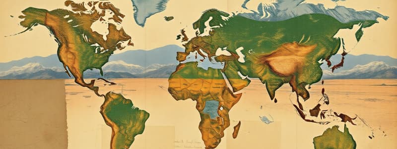
- Earth's Physical Features: Review river systems.
- Water Cycle: Understand precipitation, condensation, evaporation, and transpiration.
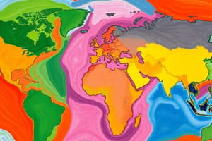
- Climate Regions: Study tropical, temperate, polar, arid, and continental climates. Note the geographic areas these climates cover, the typical temperatures, and precipitation levels. Review climate change mitigation and adaptation. Find summary notes on Google Classroom.
Key Concepts (Human Geography)
- Population and Settlement: Focus on population distribution, density, push and pull factors (economic, environmental, social and political).
Study Tips
- Note Taking: Write down key terms, definitions, and examples.
- Flashcards: Create flashcards for review.
- Maps and Diagrams: Label continents, countries, major cities on maps and diagrams. Visualize water cycles and plate tectonics.
- Ask Questions: Don't hesitate to ask your teacher for clarification.
- Study Groups: Collaborate with classmates to review material.
- Test Format: The test includes multiple-choice questions and some long-answer questions. Use class notes and the textbook (chapters 2 & 3), focusing on Earth's physical geography and its people.
Studying That Suits You
Use AI to generate personalized quizzes and flashcards to suit your learning preferences.