Podcast
Questions and Answers
Which geographical feature primarily separates the British Isles from the mainland of Europe?
Which geographical feature primarily separates the British Isles from the mainland of Europe?
- The Irish Sea
- The Bay of Biscay
- The Gulf Stream
- The English Channel and the Strait of Dover (correct)
Historically, into how many parts is the territory of the United Kingdom divided?
Historically, into how many parts is the territory of the United Kingdom divided?
- Three
- Two
- Five
- Four (correct)
Which natural factor most significantly influences Great Britain's climate and natural environment?
Which natural factor most significantly influences Great Britain's climate and natural environment?
- Its mountainous terrain
- Its dense forests
- Its proximity to the sea (correct)
- Its extensive river systems
How does the coastline of Great Britain generally differ between its eastern and western sides?
How does the coastline of Great Britain generally differ between its eastern and western sides?
Which of the following best describes the general slope of the land in Great Britain?
Which of the following best describes the general slope of the land in Great Britain?
What is the highest mountain in the British Isles?
What is the highest mountain in the British Isles?
Which of the following factors contributes most to Great Britain's mild winters compared to other regions at the same latitude?
Which of the following factors contributes most to Great Britain's mild winters compared to other regions at the same latitude?
Why are rivers in Britain typically short and have consistently high water levels?
Why are rivers in Britain typically short and have consistently high water levels?
Why are most large ports in Great Britain located in estuaries?
Why are most large ports in Great Britain located in estuaries?
How have human activities historically impacted the natural vegetation of Great Britain?
How have human activities historically impacted the natural vegetation of Great Britain?
Which of the following animals has NOT become practically extinct in the British Isles due to deforestation?
Which of the following animals has NOT become practically extinct in the British Isles due to deforestation?
In which regions of Great Britain are the most significant coal deposits found?
In which regions of Great Britain are the most significant coal deposits found?
What was a key factor that facilitated the rapid industrialization of the United Kingdom in the 19th century?
What was a key factor that facilitated the rapid industrialization of the United Kingdom in the 19th century?
Which sector is NOT mentioned as an important branch of Great Britain’s economy?
Which sector is NOT mentioned as an important branch of Great Britain’s economy?
Which geographical area is often referred to as the 'Garden of England'?
Which geographical area is often referred to as the 'Garden of England'?
What role do hedges play in the landscape of Midland Britain?
What role do hedges play in the landscape of Midland Britain?
Why are British rivers, despite their short length, significant for transportation?
Why are British rivers, despite their short length, significant for transportation?
Why are lakes in the English Lake District particularly noted for their beauty?
Why are lakes in the English Lake District particularly noted for their beauty?
Why is the eastern part of Britain considered to be in a 'rain-shadow'?
Why is the eastern part of Britain considered to be in a 'rain-shadow'?
Which industry has historically concentrated in areas such as Birmingham, Coventry, and Sheffield?
Which industry has historically concentrated in areas such as Birmingham, Coventry, and Sheffield?
How does the text describe the economic role of seaports in Great Britain?
How does the text describe the economic role of seaports in Great Britain?
What limits the economic potential of British lakes as navigable waterways?
What limits the economic potential of British lakes as navigable waterways?
The Caledonian Canal separates which two parts of the Highlands?
The Caledonian Canal separates which two parts of the Highlands?
Where are tin and copper mines primarily located in Great Britain?
Where are tin and copper mines primarily located in Great Britain?
Hedges and stone walls divide the farming land into fields. What percentage accounts for pasture and meadow?
Hedges and stone walls divide the farming land into fields. What percentage accounts for pasture and meadow?
Which of the following statements accurately describes the climate of Wales, based on the information provided?
Which of the following statements accurately describes the climate of Wales, based on the information provided?
How have industries developed in the 20th century?
How have industries developed in the 20th century?
Which of the following is NOT a correct description for the natural regions?
Which of the following is NOT a correct description for the natural regions?
Which of the following activities contributes the most to chicken and egg production for the population?
Which of the following activities contributes the most to chicken and egg production for the population?
Flashcards
The British Isles
The British Isles
A group of islands off the north-western coast of Europe, separated from the continent by the English Channel and the North Sea.
Islands of the British Isles
Islands of the British Isles
Two primary islands, Great Britain and Ireland, alongside smaller islands like the Isle of Wight, Anglesea, and the Isle of Man.
Divisions of the UK
Divisions of the UK
England, Scotland, Wales, and Northern Ireland.
Influence of the Sea
Influence of the Sea
Signup and view all the flashcards
Natural Regions of Great Britain
Natural Regions of Great Britain
Signup and view all the flashcards
Indented Coastline
Indented Coastline
Signup and view all the flashcards
Southern and Eastern Coasts
Southern and Eastern Coasts
Signup and view all the flashcards
General Land Slope
General Land Slope
Signup and view all the flashcards
Highlands of Scotland
Highlands of Scotland
Signup and view all the flashcards
Ben Nevis
Ben Nevis
Signup and view all the flashcards
The Pennines
The Pennines
Signup and view all the flashcards
Snowdon
Snowdon
Signup and view all the flashcards
British Climate
British Climate
Signup and view all the flashcards
Wettest Areas of Britain
Wettest Areas of Britain
Signup and view all the flashcards
Gulf Stream's Impact
Gulf Stream's Impact
Signup and view all the flashcards
British Rivers
British Rivers
Signup and view all the flashcards
Important Rivers
Important Rivers
Signup and view all the flashcards
Famous Lake District
Famous Lake District
Signup and view all the flashcards
Mountainous Vegetation
Mountainous Vegetation
Signup and view all the flashcards
Field Divisions
Field Divisions
Signup and view all the flashcards
British Animal Life
British Animal Life
Signup and view all the flashcards
Coal Basins
Coal Basins
Signup and view all the flashcards
Tin and Copper Mines
Tin and Copper Mines
Signup and view all the flashcards
British Products
British Products
Signup and view all the flashcards
Ship-building Centers
Ship-building Centers
Signup and view all the flashcards
Biggest English Ports
Biggest English Ports
Signup and view all the flashcards
Garden of England Produce
Garden of England Produce
Signup and view all the flashcards
Study Notes
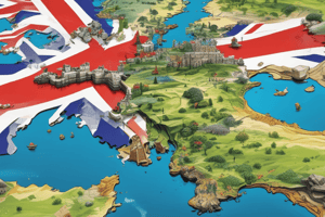
- The United Kingdom of Great Britain and Northern Ireland is located on the British Isles off the north-western coast of Europe.
- The English Channel, the Strait of Dover, and the North Sea separate the British Isles from the continent.
- The British Isles consist of Great Britain, Ireland, and numerous smaller islands.
- Key smaller islands include the Isle of Wight, Anglesea, the Isle of Man, the Hebrides, the Orkney Islands, and the Shetland Islands.
- Historically, the UK is divided into England, Scotland, Wales, and Northern Ireland.
- The total area of the UK is 244,000 square kilometers.
Nature
- Great Britain is in Europe's temperate zone.
- The sea significantly impacts Great Britain's nature, with no location more than 100-120 km from the seashore (40-60 km in the north).
- Great Britain's three natural regions:
- Scotland: highland and upland relief with coniferous and mixed forests.
- Wales and mountainous England: upland cut by ravines and valleys, covered with meadows, moorland, cultivated farmland, and broadleaf forests.
- South-east England: plain landscape, fertile soils, cultivated farmland, and broadleaf forests.
Coasts
- Great Britain's coastline is heavily indented, especially in the west and north-west with mountains close to the coast.
- Scotland's coasts, along with the Hebrides, Orkney Islands, and Shetland Islands, feature numerous fiords.
- The south and east coasts slope gently with sandy shores, occasionally interrupted by low cliffs.
Relief
- The general slope of the land descends from north-west to south-east.
- Mountains cover most of northern, western, and middle Great Britain and are divided into groups:
- The Highlands of Scotland: occupy most of the land north-west of a line from Glasgow to Aberdeen.
- The North-western Highlands and the Grampians are separated by the Caledonian Canal.
- Ben Nevis (1343 m) is the highest mountain in the British Isles.
- The Central Plain of Scotland separates the Highlands from the Southern Uplands of Scotland.
- The Southern Uplands and the Pennines: stretch north-south across northern and middle England.
- Wales is occupied by the Cumbrians, with Snowdon (1085 m) as the highest peak.
- The Highlands of Scotland: occupy most of the land north-west of a line from Glasgow to Aberdeen.
- South-eastern England is lowland, interrupted by low chalk ridges.
Climate
- The climate is humid and mild marine West-Coast, featuring warm winters, cool summers, and plenty of rain throughout the year.
- Prevailing winds come from the south-west.
- Winds from the ocean are mild and carry moisture.
- Mountainous areas near the west coast experience rainfall as temperatures drop, causing condensation.
- The wettest regions are the Highlands of Scotland, the Lake District, and North Wales.
- The eastern part of Britain is in a rain-shadow due to moisture loss over the western highlands.
- Rain occurs throughout the year, with autumn and winter being the wettest seasons.
- The Thames district receives the most rain in the summer.
- Great Britain's winters are warmer than other regions at the same latitude, due to south-west winds and the Gulf Stream.
Inland Waters
- British rivers are short, with their direction determined by the mountains.
- Most rivers flow eastward due to the mountainous west coast.
- High rainfall ensures consistently high water levels in rivers.
- Rivers rarely freeze in winter.
- A canal system connects many rivers, providing inland water transport.
- British rivers are non-navigable for ocean ships but feature deep estuaries with strong tides.
- Most major British ports are located in estuaries.
- Important rivers are the Severn, the Thames, the Tyne, the Trent, the Mersey, and the Clyde.
- British lakes are small and without outlets, limiting their economic use in waterways.
- The English Lake District is known for beauty and picturesque surroundings.
Vegetation
- Mountainous regions feature coniferous and mixed forests with pine, oak, and birch.
- Thin, poor soils lead to moorland in the Highlands of Scotland, the Pennines, the Lake District, mountains of Wales, and parts of England.
- Farmers cultivate valley lands and plains where soils are deep and rich.
- Britain has rich natural vegetation due to its mild climate and varied soils.
- Originally, oak forests covered most of the lowland.
- Woodlands now cover about 7% of the country's surface due to deforestation.
- The greatest density of woodland is in northern and eastern Scotland, parts of south-east England, and the Welsh border.
- Common trees include oak, beech, ash, elm, pine, and birch.
- Midland Britain appears well-wooded due to hedges and isolated trees.
- Hedges and stone walls divide farmland into fields, a typical English countryside feature.
- Most of countryside England is agricultural land, about a third of which is arable, and the rest is pasture and meadow.
Animal Life
- The animal life is poorer than centuries ago.
- Forest animals like wolves, bears, boars, deer, and the Irish elk are practically extinct due to deforestation.
- Foxes are common in rural areas, and otters along rivers and streams.
- Smaller animals include mice, rats, hedgehogs, moles, squirrels, hares, rabbits, and weasels.
- Many birds exist, including songbirds (blackbirds, sparrows, starlings) .
- Sea-birds nest along the coasts and venture inland in search of food.
Mineral Resources
- Great Britain is rich in coal.
- Coal basins are in Northumberland, Lancashire, Yorkshire, Nottinghamshire, South Wales, North Wales, and near Glasgow.
- Iron ores are found alongside coal layers, but their iron content is low.
- Tin and copper mines are in Cornwall and Devonshire.
- Copper and lead mines are in England.
- Lead and silver ores are mined in Derbyshire, Cumberland, and Lancashire.
Economy
- The UK was the first country to become highly industrialized.
- Easy coal mining was important during industrialization.
- Coal mining is one of the most developed industries.
- The biggest coal and iron mines are in north-east England, Lancashire, Yorkshire, Scotland, and Wales.
- Heavy industry was in central England and the London region but new industries like electronics, radio, and chemical industry have appeared since.
- Shipbuilding is concentrated in London, Glasgow, Newcastle, Liverpool, and Belfast.
- Woolen industry is developed in Yorkshire, with products exported.
- Sea-ports are important, with London, Liverpool, and Glasgow being the biggest.
- Great Britain exports industrial products and imports food.
- Sheep, cattle, and dairy farming are important.
- Chicken farms are important.
- The south of England, known as the "Garden of England," grows apples, pears, cherries, plums, and berries.
Studying That Suits You
Use AI to generate personalized quizzes and flashcards to suit your learning preferences.