Podcast
Questions and Answers
What is the largest island in the Philippines, encompassing 95% of the total land area?
What is the largest island in the Philippines, encompassing 95% of the total land area?
- Visayas
- Luzon (correct)
- Mindanao
- Negros
Which mountain range in Luzon is known for being the longest continuous mountain range in the Philippines?
Which mountain range in Luzon is known for being the longest continuous mountain range in the Philippines?
- Caraballo del Sur
- Tagaytay Range
- Zambales Range
- Sierra Madre (correct)
Which of the following volcanoes is located in the Caraballo de Baler mountain range?
Which of the following volcanoes is located in the Caraballo de Baler mountain range?
- Taal Volcano
- Mayon Volcano (correct)
- Bulusan Volcano (correct)
- Kanlaon Volcano
Which island group does the Zambales Range belong to?
Which island group does the Zambales Range belong to?
What notable feature divides Negros Island from northwest to southeast?
What notable feature divides Negros Island from northwest to southeast?
The Philippines consists of 7,641 islands.
The Philippines consists of 7,641 islands.
Mayon Volcano is located in the Sierra Madre mountain range.
Mayon Volcano is located in the Sierra Madre mountain range.
The Zambales Range extends from the coast of the China Sea to the province of Bulacan.
The Zambales Range extends from the coast of the China Sea to the province of Bulacan.
Mount Makiling is part of the Tagaytay Range.
Mount Makiling is part of the Tagaytay Range.
Kanlaon Volcano is located on Negros Island and is divided by a range from northwest to southeast.
Kanlaon Volcano is located on Negros Island and is divided by a range from northwest to southeast.
Flashcards are hidden until you start studying
Study Notes
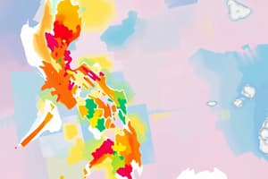
Geography of the Philippines
- The Philippines is an archipelago consisting of 7,641 islands.
- The islands are categorized into three main groups: Luzon, Visayas, and Mindanao.
Luzon
- Luzon is the largest island, comprising 95% of the country's total land area.
- Major mountain ranges in Luzon include:
- Caraballo del Sur:
- Extends north to south, features the Central and Northern Cordilleras.
- The highest peak is located at the intersection of Abra, Ilocos Norte, and Cagayan.
- Caraballo de Baler:
- Begins at Baler, Aurora, stretching to San Bernardino Strait.
- Home to significant volcanoes including Mayon Volcano in Albay and Bulusan Volcano in Sorsogon.
- Sierra Madre:
- The longest continuous mountain range in the Philippines.
- Starts in Baler and traverses provinces like Cagayan, Isabela, Nueva Vizcaya, and Quirino.
- Caraballo del Sur:
Other Notable Landforms
- Zambales Range:
- Begins at Cape Bolinao, Pangasinan and runs southward along the China Sea coast, ending in Cavite and Batangas.
- Tagaytay Range:
- Features Mount Makiling in Laguna and Taal Volcano in Batangas.
- Negros Island:
- Characterized by a range dividing it from northwest to southeast, with Kanlaon Volcano being the prominent feature.
Studying That Suits You
Use AI to generate personalized quizzes and flashcards to suit your learning preferences.