Podcast
Questions and Answers
What are the main coastal plains of Palestine mentioned in the text?
What are the main coastal plains of Palestine mentioned in the text?
The main coastal plains of Palestine are Saruunah plain, Mount Carmel plain, and the Acre plain.
Describe the significance of the Sahil Plain of Tunisia.
Describe the significance of the Sahil Plain of Tunisia.
The Sahil Plain of Tunisia is significant for its olive monoculture.
What defines a flood plain, according to the content?
What defines a flood plain, according to the content?
A flood plain is the floor of a river valley beyond the riverbed, formed from mud, sand, and silt left when the river overflows.
What are the two major tributaries of the Nile River?
What are the two major tributaries of the Nile River?
How long is the Nile River as it flows through Egypt?
How long is the Nile River as it flows through Egypt?
What is the dominant feature of the Nile Delta?
What is the dominant feature of the Nile Delta?
Where does the Nile River end?
Where does the Nile River end?
What geographic region does the content mainly focus on?
What geographic region does the content mainly focus on?
What are the two main geographical regions of the Arab League?
What are the two main geographical regions of the Arab League?
What is the length of the Tell Atlas mountain chain?
What is the length of the Tell Atlas mountain chain?
Which countries are included in West Asia according to the United Nations regional divisions?
Which countries are included in West Asia according to the United Nations regional divisions?
Name one animal species endemic to the Tell Atlas.
Name one animal species endemic to the Tell Atlas.
What are the three types of plains found in the Arab World?
What are the three types of plains found in the Arab World?
Name two deserts that span the Arab League.
Name two deserts that span the Arab League.
Define a coastal plain.
Define a coastal plain.
What is the highest point in the Arab League and where is it located?
What is the highest point in the Arab League and where is it located?
What natural forces contribute to the creation of landforms?
What natural forces contribute to the creation of landforms?
How wide is the Coastal Plain of Syria?
How wide is the Coastal Plain of Syria?
What distinguishes plains from other types of landforms?
What distinguishes plains from other types of landforms?
Which mountain ranges are noted as high mountains in the Arab World?
Which mountain ranges are noted as high mountains in the Arab World?
What are landscapes, and how are they related to landforms?
What are landscapes, and how are they related to landforms?
Which Mediterranean Coastal Plain runs from the Turkish border to Lebanon?
Which Mediterranean Coastal Plain runs from the Turkish border to Lebanon?
What is the height threshold that defines a plain?
What is the height threshold that defines a plain?
What is the lowest point in the Arab League and where is it found?
What is the lowest point in the Arab League and where is it found?
What is the approximate width of the desert at its base?
What is the approximate width of the desert at its base?
Describe the climate conditions of the Badia region.
Describe the climate conditions of the Badia region.
What is an oasis in geographical terms?
What is an oasis in geographical terms?
What is the historical significance of Palmyra?
What is the historical significance of Palmyra?
What makes Azraq Oasis unique compared to other areas in the Jordanian desert?
What makes Azraq Oasis unique compared to other areas in the Jordanian desert?
How does Azraq Oasis contribute to groundwater resources in Jordan?
How does Azraq Oasis contribute to groundwater resources in Jordan?
What type of vegetation is primarily found in the Badia desert?
What type of vegetation is primarily found in the Badia desert?
Why are the locations of Badiyat Al-Sham's major oases critical for trade?
Why are the locations of Badiyat Al-Sham's major oases critical for trade?
What is the primary reason for the decrease in size of the Ghouta Oasis?
What is the primary reason for the decrease in size of the Ghouta Oasis?
Name two animal species that have been re-introduced to Badiyat Al-Sham preserves.
Name two animal species that have been re-introduced to Badiyat Al-Sham preserves.
What role do rivers play in the formation of valleys?
What role do rivers play in the formation of valleys?
Describe the climate conditions that allow certain plants and animals to survive in Badiyat Al-Sham.
Describe the climate conditions that allow certain plants and animals to survive in Badiyat Al-Sham.
What is a valley and how is it typically created?
What is a valley and how is it typically created?
How do human activities affect wildlife in Badiyat Al-Sham?
How do human activities affect wildlife in Badiyat Al-Sham?
What types of crops have traditionally been grown in Ghouta Oasis?
What types of crops have traditionally been grown in Ghouta Oasis?
Identify one reason why valleys have been important for human development.
Identify one reason why valleys have been important for human development.
What are the two sub-climates of the Sahara Desert?
What are the two sub-climates of the Sahara Desert?
What record high temperature is held by Azizia, Libya?
What record high temperature is held by Azizia, Libya?
Name two types of vegetation found in the Sahara Desert.
Name two types of vegetation found in the Sahara Desert.
What types of mammals can be found in the Sahara Desert?
What types of mammals can be found in the Sahara Desert?
How has the Sahara Desert's climate changed over the past 8,000 years?
How has the Sahara Desert's climate changed over the past 8,000 years?
What is Badiyat Al-Sham, and where is it located?
What is Badiyat Al-Sham, and where is it located?
What geological feature primarily covers Badiyat Al-Sham?
What geological feature primarily covers Badiyat Al-Sham?
What area does Badiyat Al-Sham extend between?
What area does Badiyat Al-Sham extend between?
Flashcards
Arabian World Regions
Arabian World Regions
The Arabian world geographically includes 22 countries, divided into the larger African region and the smaller Asian region.
Arab World Regional Divisions
Arab World Regional Divisions
The Arabian world, based on UN regional divisions, belongs to four main regions: West Asia, North Africa, Western Africa, and Eastern Africa.
Landforms
Landforms
Landforms are natural physical features on Earth's surface. Examples include plateaus, mountains, valleys, and plains.
Landform Creation
Landform Creation
Signup and view all the flashcards
Landscapes
Landscapes
Signup and view all the flashcards
Arab World Deserts
Arab World Deserts
Signup and view all the flashcards
Arabian Climate Zones
Arabian Climate Zones
Signup and view all the flashcards
Geographical Extremities in the Arab World
Geographical Extremities in the Arab World
Signup and view all the flashcards
What is the Sahara Desert?
What is the Sahara Desert?
Signup and view all the flashcards
What are the two main climates of the Sahara Desert?
What are the two main climates of the Sahara Desert?
Signup and view all the flashcards
What types of plants can be found in the Sahara Desert?
What types of plants can be found in the Sahara Desert?
Signup and view all the flashcards
What are some mammals that live in the Sahara Desert?
What are some mammals that live in the Sahara Desert?
Signup and view all the flashcards
What types of birds can be found in the Sahara Desert?
What types of birds can be found in the Sahara Desert?
Signup and view all the flashcards
What is Badiyat Al-Sham?
What is Badiyat Al-Sham?
Signup and view all the flashcards
Where is Badiyat Al-Sham located?
Where is Badiyat Al-Sham located?
Signup and view all the flashcards
Why is Badiyat Al-Sham sometimes called the Greater Badiyat al-Sham?
Why is Badiyat Al-Sham sometimes called the Greater Badiyat al-Sham?
Signup and view all the flashcards
Badiyat Al-Sham
Badiyat Al-Sham
Signup and view all the flashcards
Climate of Badiyat Al-Sham
Climate of Badiyat Al-Sham
Signup and view all the flashcards
Oasis
Oasis
Signup and view all the flashcards
Palmyra (Tadmur)
Palmyra (Tadmur)
Signup and view all the flashcards
Azraq Oasis
Azraq Oasis
Signup and view all the flashcards
Importance of Palmyra
Importance of Palmyra
Signup and view all the flashcards
Caravan City
Caravan City
Signup and view all the flashcards
Al-Sham
Al-Sham
Signup and view all the flashcards
What is the Ghouta Oasis?
What is the Ghouta Oasis?
Signup and view all the flashcards
Why is the Ghouta Oasis shrinking?
Why is the Ghouta Oasis shrinking?
Signup and view all the flashcards
What is a valley?
What is a valley?
Signup and view all the flashcards
How are valleys formed?
How are valleys formed?
Signup and view all the flashcards
Why are valleys important for humans?
Why are valleys important for humans?
Signup and view all the flashcards
What is special about Badiyat Al-Sham?
What is special about Badiyat Al-Sham?
Signup and view all the flashcards
What is the main threat to Badiyat Al-Sham's animals?
What is the main threat to Badiyat Al-Sham's animals?
Signup and view all the flashcards
What are some conservation efforts in Badiyat Al-Sham?
What are some conservation efforts in Badiyat Al-Sham?
Signup and view all the flashcards
Tell Atlas Mountains
Tell Atlas Mountains
Signup and view all the flashcards
Plain
Plain
Signup and view all the flashcards
Mediterranean Coastal Plains
Mediterranean Coastal Plains
Signup and view all the flashcards
Flood Plain
Flood Plain
Signup and view all the flashcards
Inland Plains
Inland Plains
Signup and view all the flashcards
Coastal Plain of Syria
Coastal Plain of Syria
Signup and view all the flashcards
Volcanic Plains
Volcanic Plains
Signup and view all the flashcards
Desert Plains
Desert Plains
Signup and view all the flashcards
Coastal Plains
Coastal Plains
Signup and view all the flashcards
Egypt Flood Plain
Egypt Flood Plain
Signup and view all the flashcards
Blue Nile
Blue Nile
Signup and view all the flashcards
River Delta
River Delta
Signup and view all the flashcards
Nile in Egypt
Nile in Egypt
Signup and view all the flashcards
Nile Valley
Nile Valley
Signup and view all the flashcards
Nile Delta
Nile Delta
Signup and view all the flashcards
Study Notes
Geographical Terrains in the Arab World
- Terrain is a type of land
- The Arab world has various terrains
- Terrains can be divided into three types: Huge Arid Desert, fertile south and north, and High Mountains
- This chapter focuses on the main geographical terrains in the Arab World along with some examples of each.
Geography of the Arab League
-
The Arab world comprises 22 states and territories of the Arab League
-
Stretching from the Atlantic Ocean to the Arabian Sea
-
Extending from the Mediterranean Sea to the Horn of Africa and the Indian Ocean
-
The Arab League is a regional organization with 22 countries in western Asia and northern Africa
-
Its members are primarily Arabic speakers
-
The headquarters is in Cairo, Egypt
Regions
- The Arab League can be divided into two main geographical regions: the Asian part (12 states) and the larger African part (10 states)
- These states are further divided into four regions by the UN:
- West Asia: Bahrain, Iraq, Jordan, Kuwait, Lebanon, Oman, Palestine, Qatar, Saudi Arabia, Syria, the UAE, and Yemen.
- Northern Africa: Algeria, Egypt, Libya, Morocco, Sudan (North Sudan & South Sudan), and Tunisia.
- Western Africa: Mauritania
- Eastern Africa: Comoros, Djibouti, and Somalia
Landforms
- Landforms are natural physical features on Earth's surface: Mountains, valleys, plateaus, and plains.
- Generated by forces like wind, water, and ice, or Earth's plate movement.
- 80% of the Arab world is covered in desert
Climate
- The Arab League has several climate regions:
- Arid: high evaporation, excessive heat, low rainfall and low precipitation. (covers roughly 80% of the region)
- Semi-arid: intermediate between arid and humid climates.
- Moderate Mediterranean: rainy season during autumn and winter, mild winters and hot summers
- Tropical Wet: Rainfall during summer, dry winters.
The Sahara Desert
-
One of the world's largest deserts
-
Covering roughly 9 million square kilometers
-
Located in Northern Africa
-
Main Characteristics: -receives very little precipitation throughout the year -Climate is very hot and dry
- Little evaporation in the atmosphere to block sunlight
-
The area contains diverse vegetation and animals adapted for the harsh environment
Badiyat Al-Sham
- Also known as The Greater Badiyat al-Sham (Badiyat al-Sham al-Kubra)
- A combination of desert and steppe
- Mostly covered by basalt rocks from lava flows
- Located between the desert of Al-Nufud on the Arabian Peninsula and the Euphrates River.
Palmyra (Tadmur)
- An oasis in the Syrian Desert
- Located near a hot spring (Afqa)
- Crucial caravan city for travelers traversing the Syrian Desert
Azraq Oasis
- A unique wetland oasis in northeastern Jordan
- Only permanent natural wetland in Jordanian desert
- Four main springs providing water
- Diverse biodiversity, flocks of birds visit during migration
Al-Ghouta Oasis
- Located in a green agricultural belt surrounding Damascus
- Long history of providing food for the city
- Facing challenges of expansion of housing and industry
Major Valleys
- Valleys are depressions in Earth's surface often occupied by river or streams
- Formed by erosion
- Jordan rift valley: linear shaped lowland, largest rift valley worldwide, situated in East Africa
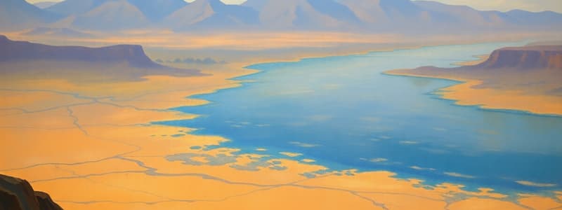
- The Nile Valley: V-shaped canyon running 660 miles with 4,250 square miles floodplain
- Rich in silt from flood waters, which makes land in the valley fertile for agriculture.
The Importance of Mountains
- Mountains are elevated landforms with steep sides and ridges
- Mountain ranges are long chains of mountains
- Mountains are ecosystem centers—unique biodiversity
- Source of rivers; crucial for water supply as they collect and store rainwater/snow
- Important for settlements, agriculture, and industries
- Important economic use; wood, charcoal, timber, export.
The Atlas Mountains
-
Mountain range in Africa
-
Running through Morocco, Algeria, and Tunisia, rich in minerals, lead, zinc, iron, manganese, gold
-
The Atlas Mountains contain various elevations and three regions
-
The Moroccan area includes the Middle Atlas, High Atlas, and Anti-Atlas regions
-
Further divided into the Saharan and Tell Atlas regions.
Major Plains
- Plains are broad, flat surfaces
- Types of plains include:
- Mediterranean Coastal Plains (located along the Mediterranean Sea): fertile coastal areas
- Floodplains (formed by rivers): deposited by floodwaters; e.g., The Nile Valley and Delta.
- Egypt Floodplain, or The Nile Valley and Delta: One of the largest and most fertile floodplains in the world.
Studying That Suits You
Use AI to generate personalized quizzes and flashcards to suit your learning preferences.