Podcast
Questions and Answers
What is Palawan known as in the Spanish language?
What is Palawan known as in the Spanish language?
- Territory
- Native Plant
- Umbrella-shaped (correct)
- Land of safe and beautiful harbor
How is the topography of Palawan best described?
How is the topography of Palawan best described?
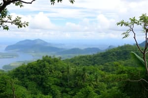
- Covered with dense forests (correct)
- Volcanic
- Sandy beaches
- Mangrove swamps
Which province is closer to Malaysia than to other provinces in the Philippines?
Which province is closer to Malaysia than to other provinces in the Philippines?
- Visayas
- Palawan (correct)
- Luzon
- Mindanao
What geological formations predominate in Palawan?
What geological formations predominate in Palawan?
Which river is said to be the boundary of the Philippines' national territory?
Which river is said to be the boundary of the Philippines' national territory?
What is the total land area of Palawan?
What is the total land area of Palawan?
What is the highest point in Palawan?
What is the highest point in Palawan?
Which type of trees are known to exist on the island of Palawan?
Which type of trees are known to exist on the island of Palawan?
'Palwa' in the native language refers to what?
'Palwa' in the native language refers to what?
Why is the geographical position of Palawan crucial?
Why is the geographical position of Palawan crucial?
Flashcards are hidden until you start studying
Study Notes
Palawan in Spanish
- Palawan is known as "Paragua" in Spanish.
Topography of Palawan
- Palawan is considered a karst landscape—characterized by unique limestone formations.
Closest to Malaysia
- Palawan is the closest province to Malaysia, compared to other provinces within the Philippines.
Predominant Geological Formations
- Limestone formations are prominent in Palawan's landscape.
Boundary River
- The Batan River is considered the boundary line of the Philippines' national territory.
Total Land Area of Palawan
- Palawan's total land area spans 14,896.82 square kilometers.
Highest Point
- The highest point in Palawan is Mount Mantalingajan, reaching an elevation of 2,085 meters.
Tree Types in Palawan
- Palawan is home to a variety of trees, including dipterocarps, ipil, and narra.
Meaning Of 'Palwa'
- “Palwa” in the native language refers to “a long, narrow, and forested land”.
Importance Of Palawan's Location
- Palawan's location allows for the protection of both marine and terrestrial biodiversity, as well as acting as a natural barrier against external influences. It also serves as a gateway to other regions in Southeast Asia.
Studying That Suits You
Use AI to generate personalized quizzes and flashcards to suit your learning preferences.


