Podcast
Questions and Answers
What type of landscape is found in the Central Highlands of Central America?
What type of landscape is found in the Central Highlands of Central America?
- Lowlands
- Deserts
- Swamps
- Volcanic (correct)
What two continents does the Isthmus of Panama connect?
What two continents does the Isthmus of Panama connect?
- South America and Europe
- North America and South America (correct)
- Africa and Asia
- North America and Europe
What does the term 'megacity' refer to?
What does the term 'megacity' refer to?
- A city made up of several generations of family members
- A city that dominates a country's economy, culture and government
- A great city made of several large cities (correct)
- A city with a higher standard of living than other cities
What is the name of the agreement that eliminated most trade restrictions between Canada, the United States, and Mexico?
What is the name of the agreement that eliminated most trade restrictions between Canada, the United States, and Mexico?
Which of these is a factor that causes water shortages in Central America?
Which of these is a factor that causes water shortages in Central America?
What is the term for planting young trees or seeds on land where trees have been cut or destroyed?
What is the term for planting young trees or seeds on land where trees have been cut or destroyed?
What is the name of the region in Peru and Bolivia that is encircled by the Andes?
What is the name of the region in Peru and Bolivia that is encircled by the Andes?
The Atacama Desert is located in South America and is considered the driest place on Earth.
The Atacama Desert is located in South America and is considered the driest place on Earth.
The ____ system is the knotted cords of various lengths and colors used by the Inca to keep financial records.
The ____ system is the knotted cords of various lengths and colors used by the Inca to keep financial records.
What term describes the condition where some places do not benefit as much as others from social and economic advancement?
What term describes the condition where some places do not benefit as much as others from social and economic advancement?
Which of these terms refers to the practice of recreational travel based on concern for the environment?
Which of these terms refers to the practice of recreational travel based on concern for the environment?
Which of these is NOT a natural resource typically found in South America?
Which of these is NOT a natural resource typically found in South America?
Flashcards
Land Bridge
Land Bridge
A strip of land connecting two larger landmasses, allowing plant and animal migration.
Pacific Ring of Fire
Pacific Ring of Fire
A zone of high seismic activity around the Pacific Ocean.
Seismic
Seismic
Related to or caused by earthquakes.
Mesa Central
Mesa Central
Signup and view all the flashcards
Vertical Climate Zones
Vertical Climate Zones
Signup and view all the flashcards
Gulf of Mexico
Gulf of Mexico
Signup and view all the flashcards
Northeast Trade Winds
Northeast Trade Winds
Signup and view all the flashcards
Chaparral Biome
Chaparral Biome
Signup and view all the flashcards
Rainforest Biome
Rainforest Biome
Signup and view all the flashcards
Silver Production
Silver Production
Signup and view all the flashcards
Petroleum Production
Petroleum Production
Signup and view all the flashcards
Mayan Civilization
Mayan Civilization
Signup and view all the flashcards
Aztec Empire
Aztec Empire
Signup and view all the flashcards
Hernán Cortés
Hernán Cortés
Signup and view all the flashcards
Mestizo
Mestizo
Signup and view all the flashcards
Indigenous
Indigenous
Signup and view all the flashcards
Conquistador
Conquistador
Signup and view all the flashcards
Cash Crop
Cash Crop
Signup and view all the flashcards
Columbian Exchange
Columbian Exchange
Signup and view all the flashcards
Caudillo
Caudillo
Signup and view all the flashcards
Benito Juárez
Benito Juárez
Signup and view all the flashcards
Mexican Revolution
Mexican Revolution
Signup and view all the flashcards
Megacity
Megacity
Signup and view all the flashcards
Primate City
Primate City
Signup and view all the flashcards
Extended Family
Extended Family
Signup and view all the flashcards
Gross Domestic Product (GDP)
Gross Domestic Product (GDP)
Signup and view all the flashcards
NAFTA
NAFTA
Signup and view all the flashcards
Outsourcing
Outsourcing
Signup and view all the flashcards
Maquiladora
Maquiladora
Signup and view all the flashcards
Free Trade Zone
Free Trade Zone
Signup and view all the flashcards
Study Notes
Physical Geography of Mexico
- Mexico and Central America are joined by a land bridge, enabling plant and animal migration.
- Latin America is part of the Pacific Ring of Fire, prone to seismic activity.
- Mexico, Central America, and the Caribbean have few river systems.
- The Mesa Central is a major grain-producing region.
- Vertical climate zones exist, varying in elevation; each has its own unique vegetation and crops.
- The Gulf of Mexico supports the fishing industry in both Mexico and the US.
- Northeast trade winds influence Mexico's climate; arid/semi-arid conditions in the north and rainforest biomes in coastal areas.
- Mexico is a major silver producer.
- Mexico's petroleum industry is significant.
Human Geography of Mexico
- Mexico's human geography reflects influences from Maya, Aztec, and Spanish cultures.
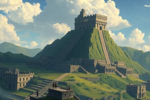
- Mayan civilization originated in the Yucatán Peninsula.
- The Aztec Empire developed in central Mexico, with Tenochtitlan (present-day Mexico City) as its capital.
- Hernán Cortés conquered the Aztec in 1519, claiming Mexico for Spain.
- Mestizo people are of mixed indigenous and European descent.
- Indigenous people are native to a region.
- Conquistadors were Spanish soldiers who participated in the conquest of Latin America.
- Spain acquired gold and silver resources from Mexico.
- Cash crops were grown for trade and sale.
Physical Geography of Central America and the Caribbean
- Central America is primarily hilly and mountainous, with some coastal swamps and lowlands.
- Volcanic activity and earthquakes are common in the region.
- Fertile volcanic soil supports agriculture.
- The Isthmus of Panama connects North and South America.
- Many islands in the Caribbean are volcanic peaks.
- The region has a variety of climates, depending on elevation, proximity to the sea, and other factors.
- Tropical rainforests are prevalent in many parts of Central America.
- Biodiversity is high in the region's ecosystems.
- Climates vary with elevation and altitude.
- Natural resources include minerals such as nickel and iron, as well as timber and petroleum.
Human Geography of Central America and the Caribbean
- Spain founded the first permanent European settlement in Hispaniola (1493).
- Other European countries also established colonies throughout the region.
- Indigenous populations suffered severely from forced labor, disease, and starvation.
- The 1800s saw independence movements in Central America, often sparked by political and socioeconomic turmoil.
- The majority of Central Americans are Roman Catholic.
- A blend of indigenous, European, African, and Asian populations is prominent in the region.
- Population pressure frequently results in migration.
- Languages in the region are diverse, with many dialects.
Physical Geography of South America
- The Andes are the world's longest mountain range.
- The Andes are characterized by parallel mountain chains and high plateaus.
- The Andes are part of the Ring of Fire, with significant tectonic activity.
- Patagonia is a dry, barren region of South America.
- The Amazon River drains a massive area into the Atlantic Ocean.
- Important waterways in the region include the Paraná, Uruguay, and Paraguay rivers, which flow into the Río de la Plata.
- Lake Maracaibo is the largest lake in South America.
- South America experiences a range of climates, from tropical wet/dry to Highland regions.
- Altitude differences result in different ecological and climate zones.
Human Geography of South America
- South America's diverse population is a result of indigenous, European, African, and Asian influences.
- The Inca Empire built an extensive network of roads and irrigation systems in the Andes Mountain range.
- European colonization brought significant population decline due to disease and harsh labor conditions.
- Independence movements occurred throughout the 1800s, with leaders such as Bolívar and San Martín.
- The region's diverse populations often experience inequality and struggles with political corruption.
- Many people live in urban areas, often experiencing high population density and urbanization issues.
People and Their Environment in Latin America
- Water shortages are a widespread concern for many countries.
- Timber extraction, slash-and-burn agriculture, and soil erosion lead to environmental problems.
- Deforestation and unsustainable practices threaten environmental stability.
- Reforestation efforts are being put in place to combat environmental issues.
- Natural resource exploitation has significant environmental impacts.
- Strategies for sustainable development are needed.
Studying That Suits You
Use AI to generate personalized quizzes and flashcards to suit your learning preferences.