Podcast
Questions and Answers
What is Cartography?
What is Cartography?
- The measurement of land areas.
- The art, science, and technology of making maps. (correct)
- The analysis of geographical information.
- The study of climate patterns.
What does the geographic grid refer to?
What does the geographic grid refer to?
A set of imaginary lines that intersect at right angles to form a system of reference for locating points on the surface of the earth.
Define Latitude.
Define Latitude.
The angular distance north or south of the equator, measured in degrees ranging from 0 degrees to 90 degrees.
What is the Prime Meridian?
What is the Prime Meridian?
What does Longitude measure?
What does Longitude measure?
The _____ is where each new day begins.
The _____ is where each new day begins.
What defines Globe Properties?
What defines Globe Properties?
What is a Map Projection?
What is a Map Projection?
What is an Equal Areas, Equivalent Projection?
What is an Equal Areas, Equivalent Projection?
Describe Conformal Projections.
Describe Conformal Projections.
What are Equidistant Projections?
What are Equidistant Projections?
What do Azimuthal Projections show?
What do Azimuthal Projections show?
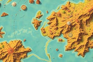
What are Topographic Maps?
What are Topographic Maps?
Define Contour Interval.
Define Contour Interval.
What are Choropleth Maps?
What are Choropleth Maps?
What is an Area Cartogram?
What is an Area Cartogram?
What is an Isoline?
What is an Isoline?
What are Flow Line Maps used for?
What are Flow Line Maps used for?
Define Remote Sensing.
Define Remote Sensing.
What are Landsat Satellites?
What are Landsat Satellites?
What is the Global Positioning System (GPS)?
What is the Global Positioning System (GPS)?
Define Geographic Information System (GIS).
Define Geographic Information System (GIS).
What is a Geographic Database?
What is a Geographic Database?
What is Scale in map-making?
What is Scale in map-making?
Flashcards are hidden until you start studying
Study Notes
Cartography and Geographic Concepts
- Cartography: The art, science, and technology involved in making maps.
- Geographic Grid: A system formed by imaginary intersecting lines, aiding in locating points on Earth's surface.
Latitude and Longitude
- Latitude: Measured in degrees from the equator (0°) to the poles (90° north or south).
- Longitude: Measures angular distance east or west from the Prime Meridian, ranging from 0° to 180°.
- Prime Meridian: The 0° longitude line, located at the Royal Observatory in Greenwich, England.
- International Date Line: Generally follows the 180° meridian; marks where each new day begins.
Globe Properties
- Meridians are equal in length and meet at the poles; they are true north-south lines.
- Parallels of latitude are parallel to the equator and shorten as they approach the poles.
- Meridians and parallels intersect at right angles, maintaining consistent scale in all directions.
Map Projections and Types
- Map Projection: Techniques to represent the Earth’s curved surface on flat maps.
- Equal Areas Projection: Maintains area proportions; shapes may be distorted.
- Conformal Projections: Preserve shape for small areas, keeping angular relationships accurate.
- Equidistant Projections: Show true distances from one or two central points but distort distances elsewhere.
- Azimuthal Projections: Display true directions from a central point to other locations.
Types of Thematic Maps
- Topographic Maps: Illustrate terrain shape and elevation, utilizing contour lines.
- Contour Interval: Vertical spacing between contour lines, indicated on the map.
- Choropleth Maps: Represent variation in a phenomenon across areas.
- Area Cartogram: Area sizes adjusted to reflect specific variables (e.g., population, income).
- Isoline: Lines connecting points of equal elevation on maps.
Movement and Remote Sensing
- Flow Line Maps: Show linear movement between locations, can be qualitative or quantitative.
- Remote Sensing: Method to gather information about an object or area without direct ground contact.
- Landsat Satellites: Known remote sensing spacecraft that monitor various Earth features like deforestation and water quality.
Geographic Systems
- Global Positioning System (GPS): Determines exact locations using signals from satellites.
- Geographic Information System (GIS): A computer-based system for managing and analyzing geographically referenced data.
- Geographic Database: A digital collection of geographic information from various sources.
Scale and Contours
- Scale: The ratio relating measurements on a map to actual measurements on Earth.
- Contour Line: Primary symbol on topographic maps representing elevation changes.
Studying That Suits You
Use AI to generate personalized quizzes and flashcards to suit your learning preferences.