Podcast
Questions and Answers
What is the typical diameter range of a mid-latitude cyclone?
What is the typical diameter range of a mid-latitude cyclone?
- 1500-5000 km (correct)
- 200-1000 km
- 1000-2000 km
- 3000-6000 km
Which of the following statements is true about the mid-latitude cyclone?
Which of the following statements is true about the mid-latitude cyclone?
- They have a clockwise flow in the northern hemisphere.
- They are primarily found in the tropics.
- They are a low pressure system in the middle latitudes. (correct)
- They are a type of tropical storm.
Which method of energy transfer involves mass exchange?
Which method of energy transfer involves mass exchange?
- Thermal radiation
- Radiation
- Convection (correct)
- Conduction
What principle states that energy is conserved in a closed system?
What principle states that energy is conserved in a closed system?
What is the primary source of energy for the Earth system?
What is the primary source of energy for the Earth system?
How is energy from the sun primarily transferred to the Earth?
How is energy from the sun primarily transferred to the Earth?
What relationship does the equation $dQ = dU + dW$ express?
What relationship does the equation $dQ = dU + dW$ express?
What is the size range of a hurricane or tropical storm typically?
What is the size range of a hurricane or tropical storm typically?
What does Rs represent in the surface energy budget equation?
What does Rs represent in the surface energy budget equation?
Which of the following terms is typically negligible compared to other energy components in the energy budget?
Which of the following terms is typically negligible compared to other energy components in the energy budget?
In the context of energy balance, what does the term 'latent heat' specifically refer to?
In the context of energy balance, what does the term 'latent heat' specifically refer to?
Which equation describes the surface energy budget for the ocean under steady state conditions?
Which equation describes the surface energy budget for the ocean under steady state conditions?
Which component of the energy budget is represented by the term 'gz'?
Which component of the energy budget is represented by the term 'gz'?
What does the term 'Δf' signify in the energy budget equations?
What does the term 'Δf' signify in the energy budget equations?
What factor contributes to the energy balance but is often omitted from the main equations?
What factor contributes to the energy balance but is often omitted from the main equations?
Which of the following components does NOT appear in the reduced form of the energy budget for land?
Which of the following components does NOT appear in the reduced form of the energy budget for land?
What is the characteristic temperature range at low latitude stations like Pontianak?
What is the characteristic temperature range at low latitude stations like Pontianak?
How does the temperature during the summer in higher latitudes compare to that in equatorial stations?
How does the temperature during the summer in higher latitudes compare to that in equatorial stations?
In which season do meridional temperature gradients tend to be larger?
In which season do meridional temperature gradients tend to be larger?
What influences the temperature patterns along the eastern and western ocean basins?
What influences the temperature patterns along the eastern and western ocean basins?
Which region has the highest annual temperature range within the subtropics?
Which region has the highest annual temperature range within the subtropics?
What is a significant characteristic of the annual temperature range in the tropics?
What is a significant characteristic of the annual temperature range in the tropics?
What general trend is observed regarding ocean and continental temperatures during winter?
What general trend is observed regarding ocean and continental temperatures during winter?
What is the typical longitudinal temperature contrast relative to oceans?
What is the typical longitudinal temperature contrast relative to oceans?
What was the primary focus of Riehl's work in 1979?
What was the primary focus of Riehl's work in 1979?
Which publication introduced a model for the relationship between tropical precipitation and column water vapor?
Which publication introduced a model for the relationship between tropical precipitation and column water vapor?
What type of data was primarily covered in the NCEP-NCAR 50-Year Reanalysis?
What type of data was primarily covered in the NCEP-NCAR 50-Year Reanalysis?
In what year did Fasullo and Trenberth analyze the annual cycle of the energy budget?
In what year did Fasullo and Trenberth analyze the annual cycle of the energy budget?
Which of the following studies was focused on the impact of the Saharan Air Layer?
Which of the following studies was focused on the impact of the Saharan Air Layer?
What primarily heats the troposphere?
What primarily heats the troposphere?
How does the height of the tropical tropopause compare to that at the poles?
How does the height of the tropical tropopause compare to that at the poles?
What is the planetary boundary layer (PBL)?
What is the planetary boundary layer (PBL)?
What characterizes motion in the boundary layer?
What characterizes motion in the boundary layer?
What is the effect of subtropical ridges on the marine boundary layer in the eastern tropical oceans?
What is the effect of subtropical ridges on the marine boundary layer in the eastern tropical oceans?
What occurs as a result of a strong inversion and cool sea surface temperatures (SSTs) in the eastern tropical oceans?
What occurs as a result of a strong inversion and cool sea surface temperatures (SSTs) in the eastern tropical oceans?
What type of clouds are typically formed over the cooler areas near the coast in the eastern tropical oceans?
What type of clouds are typically formed over the cooler areas near the coast in the eastern tropical oceans?
How does the depth of the planetary boundary layer vary?
How does the depth of the planetary boundary layer vary?
Flashcards are hidden until you start studying
Study Notes
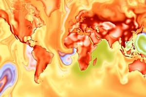
Seasonal and Geographic Distribution of Temperature
- Low latitude stations like Pontianak maintain monthly mean temperatures above 25°C with less than 2°C variation between minimum and maximum monthly means.
- Northern hemisphere experiences warmer summers and cooler winters compared to the southern hemisphere, influenced by its larger landmass.
- Tropical Latitudes: Temperature minima occur at high elevations, such as the Andes and East Africa.
- Maxima Locations: Found mainly over the continental tropics; oceans exhibit a zonal temperature pattern.
- Temperature Range: Tropics have the lowest annual temperature range (< 1.5°C), while mid-continental regions of Africa and Australia exhibit the highest ranges.
- Mid-Latitude Cyclone: A low-pressure system occurring at latitudes 30° N to 55° N, significantly larger than hurricanes (1500-5000 km vs. 200-1000 km in diameter).
Energy and the Global Climate
- The sun is the primary energy source driving atmospheric, hydrospheric, biospheric, cryospheric, and lithospheric processes.
- Energy in the earth system is conserved, aligned with the first law of thermodynamics: (dQ = dU + dW).
- Energy transfer methods include:
- Radiation: No mass exchange; energy travels at light speed.
- Conduction: Heat transfer via atomic vibration without mass exchange.
- Convection: Mass exchange occurs, allowing energy transfer through fluid movement.
- Solar radiation primarily drives energy transfer to Earth.
Energy Balance and the Role of the Tropics
- Surface energy budget links net radiation to various forms of energy (sensible, latent, etc.).
- For oceans: (R_s = cp T + Lq + Δf)
- For land: (R_s = cp T + Lq)
- In the northern hemisphere, latent heat contributes significantly (0.931 x (10^{21}) Joules) compared to sensible heat (33.94 x (10^{21}) Joules).
- Kinetic energy: Often negligible in these calculations.
Atmospheric Structure (Temperature Profile)
- The troposphere is heated from below, with the tropical tropopause being significantly higher than in polar regions.
- Planetary Boundary Layer (PBL): The lowest troposphere layer interacting with the surface; experiences turbulence.
- Diurnal changes in temperature and wind are prominent in the PBL, varying from a few hundred meters over tropical oceans to several kilometers in desert regions.
The Trade Wind Inversion
- A dominant feature in the tropical boundary layer, particularly over eastern tropical oceans.
- Associated with upwelling of cooler water and cool sea surface temperatures (SSTs), creates a strong inversion.
- Results in increased moisture and cloud formation near coastlines, primarily as stratus and stratocumulus clouds.
Studying That Suits You
Use AI to generate personalized quizzes and flashcards to suit your learning preferences.