Podcast
Questions and Answers
What is the main purpose of geo-referencing?
What is the main purpose of geo-referencing?
- To reduce the time required for data collection.
- To automate the mapping process.
- To enhance the aesthetic quality of maps.
- To align maps and models to a coordinate system for accurate positioning. (correct)
Which of the following statements is true regarding accuracy and precision in geo-referencing?
Which of the following statements is true regarding accuracy and precision in geo-referencing?
- Accuracy and precision are synonymous in geo-referencing.
- Precision and relative accuracy should be discussed instead of specific accuracy levels. (correct)
- GCPs are irrelevant for improving accuracy.
- Specific accuracy levels should always be asserted.
What role do scale constraints play in geo-referencing?
What role do scale constraints play in geo-referencing?
- They are unnecessary for accurate measurements.
- They limit the type of data that can be collected.
- They automatically correct for misalignment in images.
- They help in verifying accuracy without using GCPs. (correct)
Which coordinate systems are commonly used in the US compared to other regions?
Which coordinate systems are commonly used in the US compared to other regions?
How does ground sampling distance (GSD) affect overall accuracy?
How does ground sampling distance (GSD) affect overall accuracy?
Ground Control Points (GCPs) are essential for achieving high accuracy in commercial roofing inspections.
Ground Control Points (GCPs) are essential for achieving high accuracy in commercial roofing inspections.
Geo-referencing involves aligning maps and models to a coordinate system.
Geo-referencing involves aligning maps and models to a coordinate system.
Scale constraints can enhance both orientation and geolocation accuracy without using GCPs.
Scale constraints can enhance both orientation and geolocation accuracy without using GCPs.
The United States uses a YXZ coordinate system, while other countries often use XY reverse positioning.
The United States uses a YXZ coordinate system, while other countries often use XY reverse positioning.
With a ground sampling distance of 1 inch, the absolute accuracy can be less than 1 inch.
With a ground sampling distance of 1 inch, the absolute accuracy can be less than 1 inch.
Study Notes
Overview of Geo-Referencing and Ground Control Points (GCPs)
- Understanding geo-referencing is crucial for accuracy in geospatial tasks, even though GCPs are not required for commercial roofing inspections.
- Misrepresentation of accuracy can lead to embarrassment when interacting with professionals in geospatial fields.
Key Concepts in Geo-Referencing
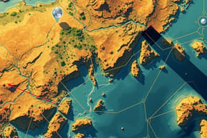
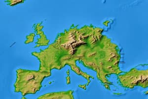
- Geo-referencing is the process of aligning maps and models to a coordinate system for accurate positioning.
- Calibration of the compass is necessary before missions, especially after traveling over 20 miles from the previous launch site.
- Scale constraints can aid in verifying the accuracy of measurements without requiring GCPs.
Importance of Scale Constraints
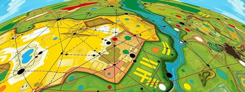
- Scale constraints help rebuild maps/models accurately through known measurements taken by inspectors.
- At least three scale constraints are recommended: lateral, opposing lateral, and vertical.
Accuracy vs. Precision
- Never assert a specific accuracy level; instead, discuss precision and relative accuracy.
- Use of GCPs enhances position, orientation, and scale accuracy, while scale constraints improve orientation and scale without enhancing geolocation.
Coordinate Systems and Their Differences
- Geographic coordinate systems specify locations using numbers, letters, or symbols (e.g., latitude, longitude, elevation).
- Be aware that coordinate systems differ internationally; the US uses YXZ while others may invert axis positioning.
Image Geotags and Data Collection
- Maps/models are often geolocated based on image geotags, which contain EXIF data sourced from drone GPS sensors.
- Proper positioning, orientation, and scale depend on the use of GCPs, thus improving overall accuracy.
Ground Sampling Distance and Accuracy
- Ground sampling distance influences overall absolute accuracy; for example, with a 1-inch GSD, absolute accuracy can only be a multiple of that distance.
- Claiming precision beyond the capabilities of your images (e.g., 1 millimeter accuracy from 20 megapixel images) can damage credibility.
Ground Control Points (GCPs) Basics
- GCPs consist of a visible target and a measurement method, typically combining both into all-in-one systems called Arrow points.
- Two main types of GPS for marking GCPs are PPK (Post-Processed Kinematic) and RTK (Real-Time Kinematic), with Arrow points commonly utilizing PPK.
Final Notes
- This knowledge is presented to help avoid misinformation within geospatial dialogues, particularly in professional settings.
Overview of Geo-Referencing and Ground Control Points (GCPs)
- Geo-referencing ensures accuracy in geospatial tasks and is essential even if GCPs are not mandatory for commercial roofing inspections.
- Misrepresenting accuracy can lead to potential embarrassment in professional geospatial interactions.
Key Concepts in Geo-Referencing
- Geo-referencing involves aligning maps and models to a specific coordinate system for precise positioning.
- Calibration of the compass is critical before missions, particularly if the launch site is over 20 miles away.
- Scale constraints can validate measurement accuracy without the need for GCPs.
Importance of Scale Constraints
- Scale constraints enable accurate reconstruction of maps/models using known measurements taken by inspectors.
- Recommended scale constraints include lateral, opposing lateral, and vertical to ensure comprehensive coverage.
Accuracy vs. Precision
- Discussions should focus on precision and relative accuracy rather than claiming specific accuracy levels.
- GCPs improve position, orientation, and scale accuracy; scale constraints enhance orientation and scale but do not affect geolocation.
Coordinate Systems and Their Differences
- Geographic coordinate systems define locations with numerical or alphabetical representations (e.g., latitude, longitude, elevation).
- Awareness of international coordinate system differences is important, as the US uses YXZ orientation, while others may invert axes.
Image Geotags and Data Collection
- Maps/models are geolocated via image geotags, which contain EXIF data obtained from drone GPS sensors.
- Accurate positioning, orientation, and scale rely on GCP utilization to enhance overall accuracy.
Ground Sampling Distance and Accuracy
- Ground sampling distance (GSD) affects absolute accuracy; a 1-inch GSD limits absolute accuracy to multiples of that distance.
- Claiming precision beyond image capabilities (e.g., asserting 1 millimeter accuracy from 20 megapixel images) can undermine credibility.
Ground Control Points (GCPs) Basics
- GCPs consist of a visible target paired with a measurement approach, often integrated into systems known as Arrow points.
- Two primary GPS methods for marking GCPs are PPK (Post-Processed Kinematic) and RTK (Real-Time Kinematic), with Arrow points largely utilizing PPK.
Final Notes
- This information aims to prevent misinformation in geospatial discussions, particularly within professional environments.
Studying That Suits You
Use AI to generate personalized quizzes and flashcards to suit your learning preferences.
Description
This quiz explores the fundamentals of geo-referencing and the role of Ground Control Points (GCPs) in geospatial tasks. Understand key concepts such as calibration, scale constraints, and the distinction between accuracy and precision. Ideal for those looking to improve their skills in geospatial accuracy and relevance.