Podcast
Questions and Answers
A heat map uses tiny dots to represent data density.
A heat map uses tiny dots to represent data density.
False (B)
Longitude measures how far east or west you are from the prime meridian.
Longitude measures how far east or west you are from the prime meridian.
True (A)
A coordinate system that considers the Earth's curvature is the Cartesian coordinate system.
A coordinate system that considers the Earth's curvature is the Cartesian coordinate system.
False (B)
Scale map ratios are unit-less and allow measurements in any unit.
Scale map ratios are unit-less and allow measurements in any unit.
All planets in Earth's solar system have a solid surface.
All planets in Earth's solar system have a solid surface.
Comets, like planets, orbit the Sun in an elliptical path.
Comets, like planets, orbit the Sun in an elliptical path.
A meteorite is a meteoroid that has successfully passed through Earth's atmosphere and struck the ground.
A meteorite is a meteoroid that has successfully passed through Earth's atmosphere and struck the ground.
The Five Themes of Geography were developed in 1984 to enhance the study of geospatial technology.
The Five Themes of Geography were developed in 1984 to enhance the study of geospatial technology.
One of the themes of geography, 'Place,' focuses on both physical and human characteristics.
One of the themes of geography, 'Place,' focuses on both physical and human characteristics.
Human Environment Interaction studies how humans solely adapt the environment according to their needs.
Human Environment Interaction studies how humans solely adapt the environment according to their needs.
Metageography considers notions of East and West to be strictly based on longitude.
Metageography considers notions of East and West to be strictly based on longitude.
A cartogram map accurately represents physical space to provide precise geographic information.
A cartogram map accurately represents physical space to provide precise geographic information.
According to metageography, the concept of which continent is East or West is determined by cultural perspective.
According to metageography, the concept of which continent is East or West is determined by cultural perspective.
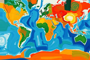
Choropleth maps use color and shade to express data amounts like political affiliation.
Choropleth maps use color and shade to express data amounts like political affiliation.
Graduated symbol maps use symbols of varying size to represent different data amounts.
Graduated symbol maps use symbols of varying size to represent different data amounts.
Flashcards
Heat map
Heat map
A map that uses shaded areas to represent data density, such as a weather map displaying temperature variations.
Dot distribution map
Dot distribution map
A map that uses tiny dots to represent individual data points, such as disease cases on a neighborhood map.
Flow-line map
Flow-line map
A map that uses lines with arrows to show the movement of data, such as the shipment of goods from one city to another.
Map scale
Map scale
Signup and view all the flashcards
Latitude
Latitude
Signup and view all the flashcards
Longitude
Longitude
Signup and view all the flashcards
Moon
Moon
Signup and view all the flashcards
Five Themes of Geography
Five Themes of Geography
Signup and view all the flashcards
Location
Location
Signup and view all the flashcards
Place
Place
Signup and view all the flashcards
Human-Environment Interaction
Human-Environment Interaction
Signup and view all the flashcards
Movement
Movement
Signup and view all the flashcards
Region
Region
Signup and view all the flashcards
Metageography
Metageography
Signup and view all the flashcards
Cartography
Cartography
Signup and view all the flashcards
Study Notes
Five Themes of Geography
- Developed in 1984 to improve geography learning.
- Focuses on Location (absolute and relative), Place (physical and human characteristics), Human-Environment Interaction, Movement, and Region (formal, functional, vernacular).
- Themes work best when used together to understand the world.
Metageography
- Study of how individuals perceive geographical concepts (e.g., East/West).
- Influenced more by culture and personal experiences than pure geography.
- Coined by Martin Lewis in 1997.
- Perceptions of East and West differ based on perspective.
Thematic Maps
- Used to display data in specific locations.
- Cartography is the art of map-making, including thematic maps.
- Uses geospatial data to illustrate relationships.
- Seven common types:
- Isoline maps: Use lines to represent continuous data (e.g., elevation).
- Cartogram maps: Distort space to show data (e.g., larger countries with denser populations).
- Choropleth maps: Use color/shade to show amounts of data (e.g., political affiliation).
- Graduated symbol maps: Use symbol sizes to show data (e.g., larger cities represented by larger circles).
- Heat maps: Use shaded areas to represent density (e.g., weather patterns).
- Dot distribution maps: Use dots to represent data (e.g., disease incidence).
- Flow-line maps: Use directional lines to show movement and quantities (e.g., goods shipments).
Locating Places on a World Map
- Continents are large landmasses separated by oceans.
- Countries are sovereign nations.
- States/counties are political regions within a country.
- Locating a place involves determining the continent, country, state/county, and then the specific location.
Geographic Coordinate System
- Locates points on a three-dimensional sphere.
- Uses latitude (north/south from the equator) and longitude (east/west from the prime meridian).
- Measured in degrees, minutes, and seconds.
- Latitude & Longitude can be converted to decimals for plotting on a Cartesian coordinate plane.
Scale Maps
- Use a ratio (e.g., 1:50,000) to represent distances.
- The ratio relates map distance to real-world distance.
- Scale is unit-less; you can use any unit of measure.
- Creating a scale map involves measuring distances on and off the map and finding a ratio.
Earth's Solar System
- Composed of the sun, eight planets, and other celestial bodies.
- Planets:
- Must have enough gravity to form a sphere and clear their orbital path.
- Orbit the sun.
- Moons: Orbit planets.
- Asteroids: Composed of metal, rock, or both; sometimes called planetoids.
- Comets: Small icy bodies with gas tails.
- Meteoroids: Float in space.
- Meteors: Meteoroids entering Earth's atmosphere.
- Meteorites: Meteors that strike Earth's surface.
- Two planet categories:
- Terrestrial (solid surface, smaller, metal core): Mercury, Venus, Earth, Mars.
- Jovian (no solid surface, primarily gas): Jupiter, Saturn, Uranus, Neptune.
Studying That Suits You
Use AI to generate personalized quizzes and flashcards to suit your learning preferences.